Hiking Around Las Vegas, Spring Mountains (Mt. Charleston)
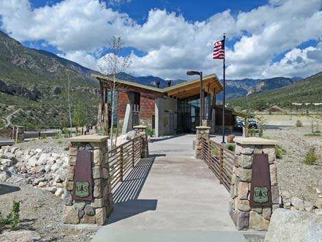
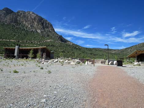
 Spring Mountains Visitor Center walkway entrance (view SW) |
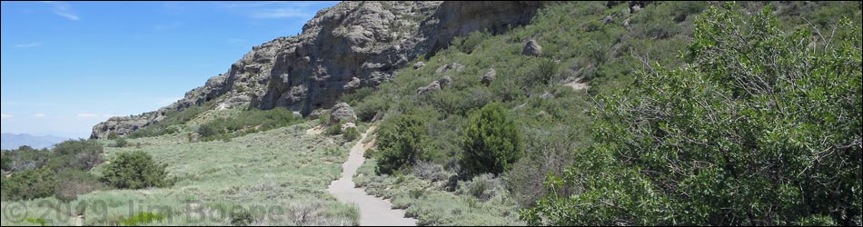
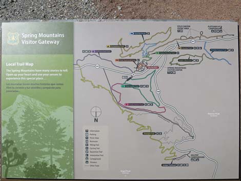
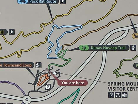
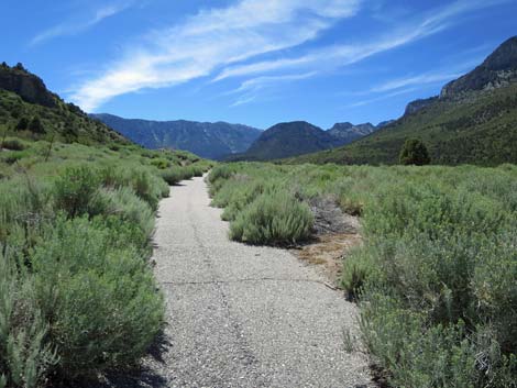
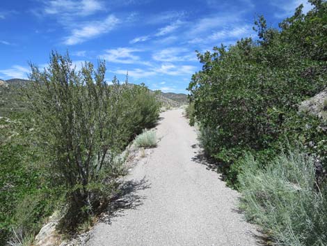
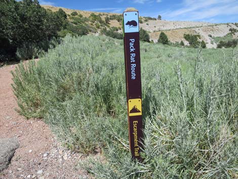
Overview The Pack Rat Trail is a loop trail (1.4 miles total) behind the Spring Mountains (Mount Charleston) Visitor Center. The trail descends gradually into Kyle Canyon Wash, goes out across the bottom of the wash, climbs steeply to run beneath the cliffs that can be seen across the canyon, drops steeply, and returns to the visitor center. Of course, as a loop, hikers can walk the trail in the other direction. The area is quite scenic with grand views up and down the canyon, a little bit of shade, and benches conveniently placed to encourage visitors to stop, sit and smell the roses, and listen to the birds and the breeze rippling across the landscape. In addition, high under the cliffs, the trail passes rare plants, a Cold War Heroes exhibit, and an enormous packrat midden. Packrat middens are a collection of everything that Desert Woodrats (aka packrats) brought to their nests over the centuries that are now cemented together by their thick and sticky urine. While unappetizing, the efforts of these creatures provide us with long records of plants that grew in this location over the past several thousand years. Link to map. |
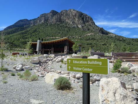
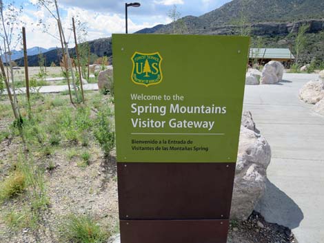 Entrance sign (view S) |
Watch Out Other than the standard warnings about hiking in the desert, ... this is a fairly safe hike without unusual hazards. However, the old-road trail on the hillside below the Visitor Center is washing away, so hikers need to be careful going around the bad spots. The trail is totally washed away in the wash bottom, but the rocky bypass is easy. Parts of the paved trail on the far hillsides are extremely steep and might cause problems for people with arthritic knees. Also, for those of us living at lower elevations, take it easy if you've just come up from the lowlands. While hiking, please respect the land and the other people out there, and try to Leave No Trace of your passage. Also, this hike isn't too long, so just bring what you need of the 10 Essentials. |
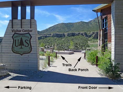
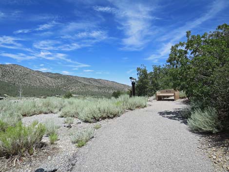
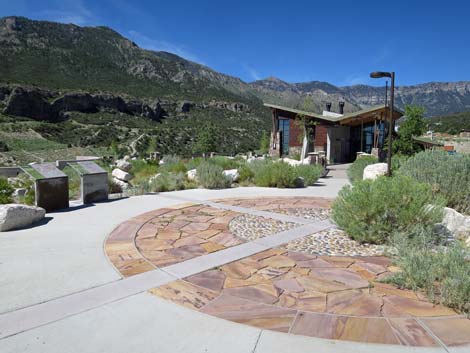 Walkway to the Visitor Center (view W) |
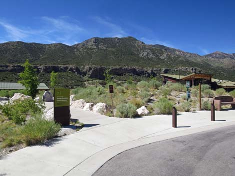
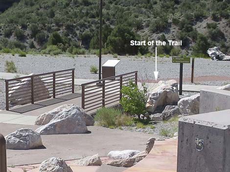
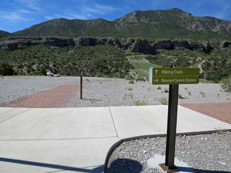
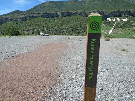
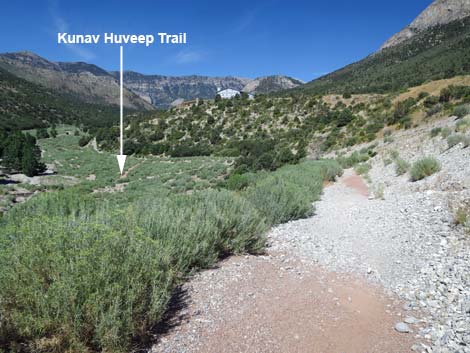
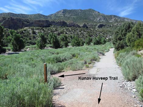
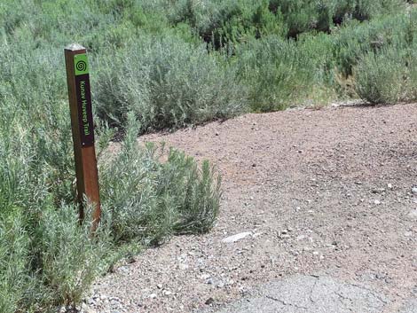
Getting to the Spring Mountains Visitor Center The Visitor Center is located in Kyle Canyon up in the Spring Mountains National Recreation Area, about 45 minutes northwest of Las Vegas. From downtown, drive north on Highway 95 for 17.0 miles towards Reno. Just beyond the edge of urban Las Vegas, turn left onto Highway 157 (Kyle Canyon Road) towards Kyle Canyon. Drive west on Kyle Canyon Road and head up the hill for 16.3 miles to a "round-about." Drive 3/4ths of the way around the loop and exit right under the ranch gate, which leads into the large visitor center parking lot. Continue towards the taller building ahead in the distance and find a convenient place to park. From the parking lot, walk to the Visitor Center building, but turn left under the arch just before the front door. Walk down through the amphitheater and out the bottom. The trailhead sign for the Kunav Huveep Trail is just ahead. The Pack Rat Trail begins by following the Kunav Huveep Trail (Kunav Huveep is Paiute for Kyle Canyon). |
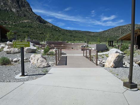
 Bridge to the Visitor Center (view W) |
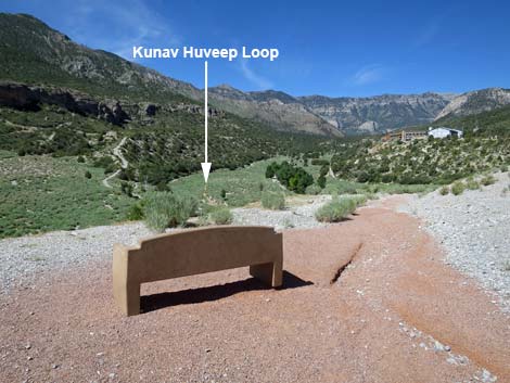
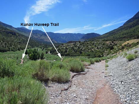
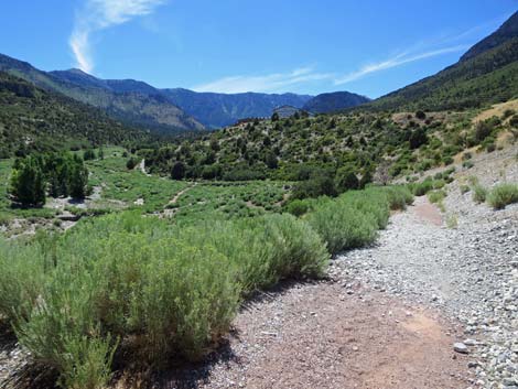
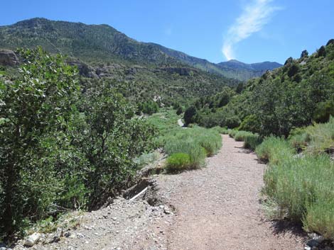
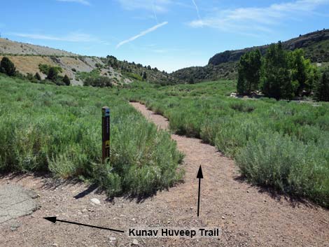
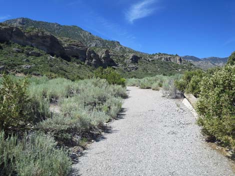
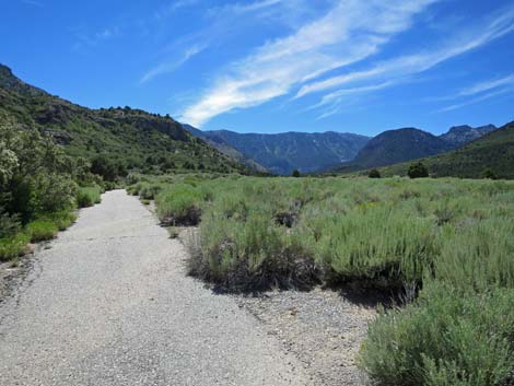
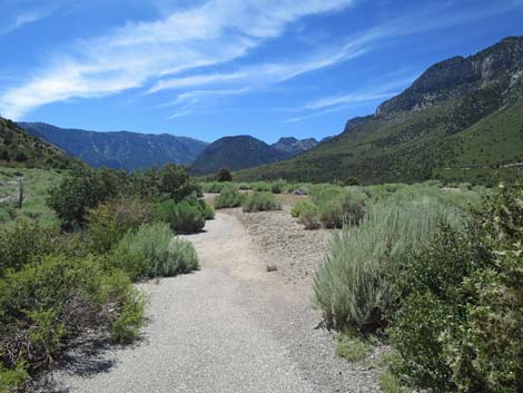
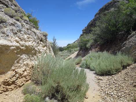
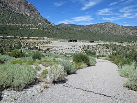
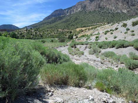
The Hike From the Kunav Huveep trailhead sign post on the south side of the amphitheater (Table 1, Waypoint 01), the trail departs the cement walkway and heads south on a red-gravel trail towards the edge of the deep canyon ahead, which is Kyle Canyon. A bench (Wpt. 02) at the edge of Kyle Canyon provides a nice place to stop, look over the area, and survey the route ahead. From the bench (Wpt. 02), the trail bends right and begins to descend westward into the canyon. While the immediate surroundings are post-industrial, the views into the canyon and off to the mountains are grand. A bit farther down the trail, hikers pass through a nice mix of desert and mountain plant species. From the desert are species such as Banana Yucca and Tulip Pricklypear, and from the mountains come Gambel Oak, Rubber Rabbitbrush, and Singleleaf Pinyon Pine. In the wash below, hikers can see a nice stand of Fremont Cottonwood Trees where taproots reach deep for sub-surface water. |
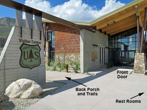 Approaching the Visitor Center front doors (view SW) |
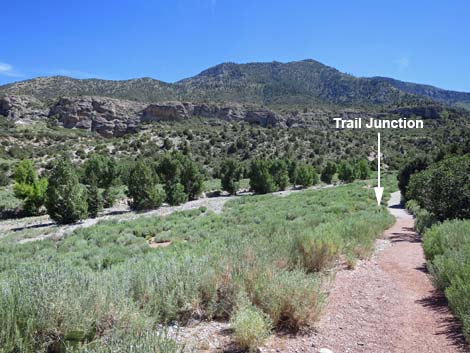
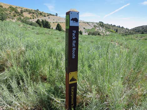
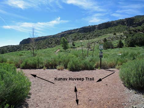
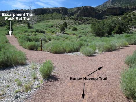
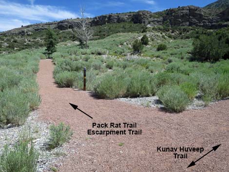
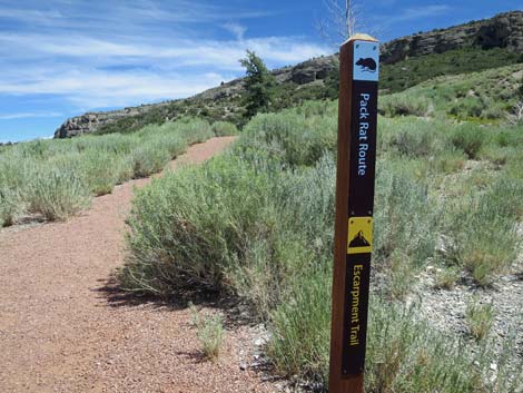
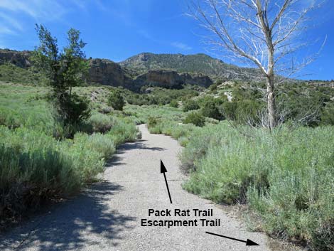
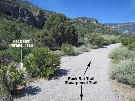
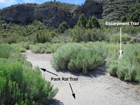
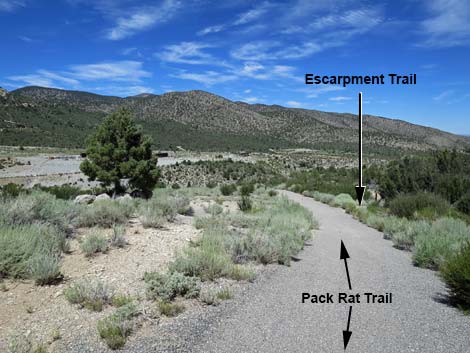
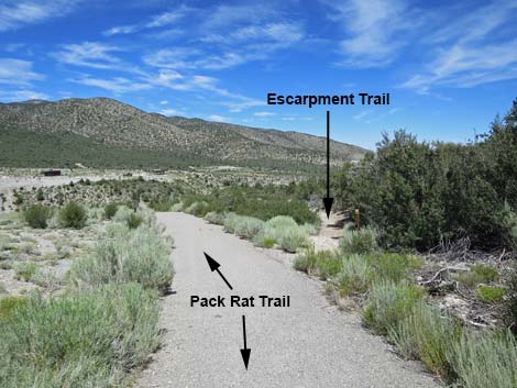
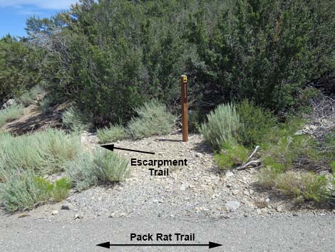
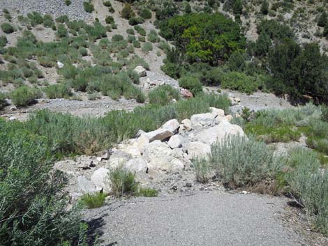
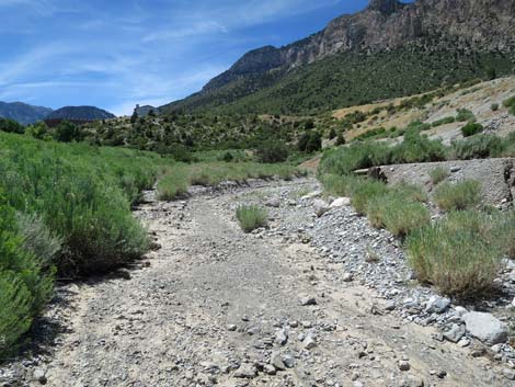
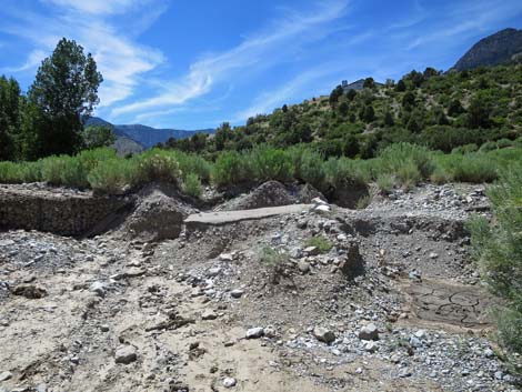
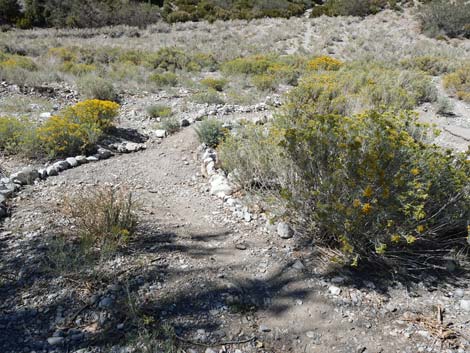
As the Kunav Huveep Trail descends off the hillside, it arrives at a trail junction (Wpt. 03) with a trail marker post. Also at this point, the red-gravel trail becomes paved. Here, the Pack Rat Trail, along with the Kunav Huveep Trail and the Escarpment Trail, takes a hard left to stay on the red-gravel trail. The trail runs east across Rubber Rabbitbrush-covered hillside above the wash bottom. The trail bends right and arrives at Kyle Canyon Wash where the trail is completely washed out, but hikers can cross the wash a few yards upstream from the original trail. Across the wash and back on the red-gravel trail, hikers quickly encounter a T-intersection (Wpt. 05) with a sign and a pet-waste-bag dispenser. This is the beginning of the Kunav Huveep Trail loop. The Pack Rat Trail stays to the left. The trail begins by heading northeast, but quickly bends right to the south and arrives at yet another trail junction (Wpt. 06). Here, at a trail marker post, the Pack Rat Trail and the Escarpment Trail turn left to head up the hillside where they quickly encounter the end of a paved trail (Wpt. 08). |
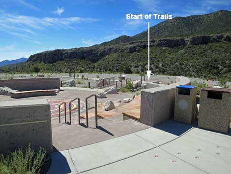
 Walkway to the trails and back porch (view S) |
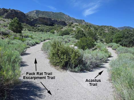
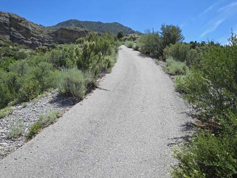
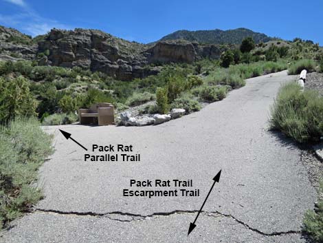
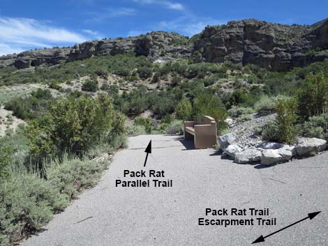
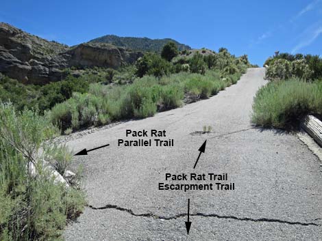
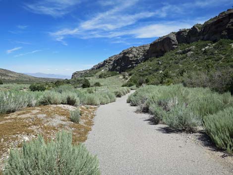
On the pavement (Wpt. 08), the Pack Rat Trail begins a gentle climb southward towards the Escarpment Cliffs. Shortly, the paved trail forks (Wpt. 09). Here, the Acastus Trail goes right and heads up Kyle Canyon, while the Pack Rat Trail continues straight and begins to climb more steeply. By the time hikers get winded on the steep trail, the trail forks again (Wpt. 10), and a bench to the left invites hikers to stop and sit a few minutes. The trail left is an alternate to the Pack Rat Trail that parallels the main trail for about 250 yards. Either way is fine: but while the alternate runs in a gully, the main trail has big views. Continuing up the main trail only a few steps, hikers find that this intersection is actually a triangular intersection. The main Pack Rat Trail continues quite steeply until reaching open flats on the crest of the ridge. Starting west across these flats, hikers soon pass the other end of the Pack Rat Parallel Trail (Wpt. 11). |
 Overlooking the outdoor amphitheater (view SE) |
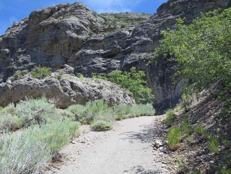
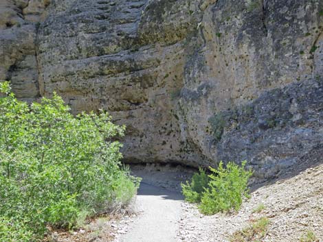
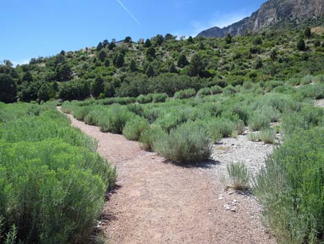
Continuing westward on gentle flats covered with Big Sagebrush mixed with a few Cliffrose and Mountain Mahogany, the trail winds a bit then makes a 180-degree bend to the left. At the top of the bend, the west end of the Escarpment Trail (Wpt. 12) cuts hard to the right to continue westward and eventually climbs to the top of the Escarpment Cliffs. The Pack Rat Trail, however, turns east across gentle grades. In this flattish, open area, the trail angles towards the base of the cliffs and eventually heads up into a bit of a rock pile to run between the boulders and the cliffs. Passing the boulders, the trail reaches the back of a shallow cleft in the Escarpment Cliffs (Wpt. 13). Here, in the shade of the cliffs where the sun never shines, hikers encounter some interesting bits of natural history. First, the cliff wall is festooned with small green plants that are only found in these shady, cliffside habitats: these are Jaeger's Mousetail, one of our rare plants known only from the Spring and Clark mountains. This wall has the most plants I've ever seen in one place, so take note and enjoy the moment. |
 Exit from the outdoor amphitheater (view SE) |
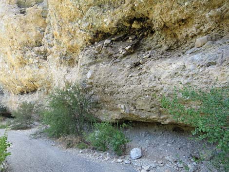
Also under the cliffs, a few steps farther down the trail, is the Desert Packrat midden from which the trail name is derived. On the eroded cliff face, there must be some holes that go back into the rock where Desert Woodrats set up home, perhaps hundreds or thousands of years ago. Over the years, they come and go across the ledges carrying food and other plant material into their nests. Some of the bits and pieces of the plants drop along the way and build up on the ledges. Woodrats also poop and pee on the ledges, and they have a very viscous, sticky urine that tends to bind everything together. The result is the dark masses of material on the ledges that we see today. While a packrat midden might seem unsavory, middens are quite important to scientists studying changes in ecosystems over time. As the environment changes, the plants change, but the woodrats continue to come and go carrying food to their nests, laying down layer upon layer in the book of history. Scientists can carefully dissect the midden layers to determine what plants were growing here over the years and learn about past ecosystems. Some packrat middens in Nevada provide a 40,000-year record of changing ecosystems. |
 Sign: Hiking Trails straight ahead (view S) |
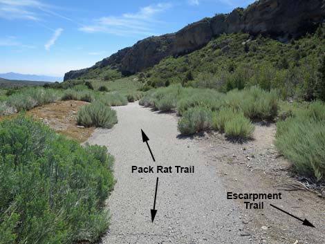
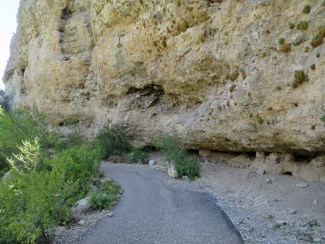
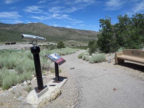
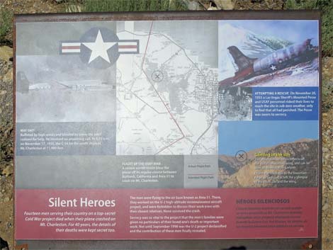
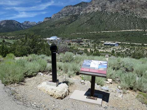
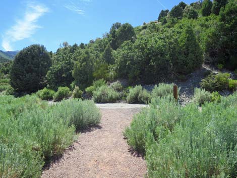
Continuing back out into the sun, the Pack Rat Trail traverses across the face of the mountain and arrives at a trail-side exhibit (Wpt. 14) with a sign, a telescope, and a bench to sit and rest. The sign, Silent Heroes, tells the story of a Cold-War plane wreck where, because of secrecy, the families of the fallen were not told the circumstances of the wreck or the nature of the men's work. The sign here, and the larger exhibit at the Visitor Center, try to rectify that error and bring honor to their memory. The telescope can be trained on the site of the crash and some of the debris that remain. Continuing down the paved Pack Rat Trail, another trail junction (Wpt 15) is soon reached. This is the east end of the Escarpment Trail. From this trail junction (Wpt 15), the Pack Rat Trail begins a very steep downhill run all the way to the bottom of the canyon. A bench about halfway down invites tired knees to stop and rest for a moment or two, but hikers eventually slip and slide all the way to the bottom where the paved trail suddenly ends (Wpt. 16) without fanfare. |
 Trail marker: Kunav Huveep Trail with red gravel |
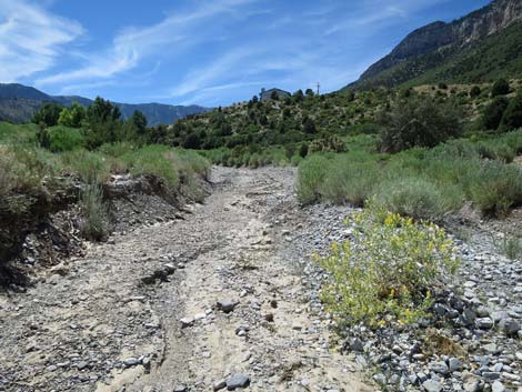
Hikers are left to push through the bushes into the wash bottom and head upstream. Following the wash up, hikers eventually arrive at the washed-out trail where it crosses the wash (Wpt. 04), as seen on the way down, thus closing the loop portion of the Pack Rat Trail. Back on the red-gravel of the Kunav Huveep Trail and heading north for the return, the trail bends to the left to reconnect with the paved trail (Wpt. 03), and then follows the red-gravel trail back up the hillside. Heading back up, the views down into the canyon seem more precious as hikers stop more frequently to admire the scenery and linger a bit longer too. Before long, the bench (Wpt. 02) at the top of the hill comes into view, as does the visitor center building and the trailhead (Wpt. 01). The shorter route to the parking lot passes by the visitor center, but the maze of paved trails in this area provides several routes to the parking lot. The building on the right is a classroom, and the picnic area is even farther right. |
 Sign: Trails in the Visitor Center area (note: North is at the bottom) |
 Sign: Kunav Huveep Trail (edited to reflect reality) |
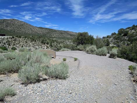
 First bench overlooking Kyle Canyon Wash (view W) |
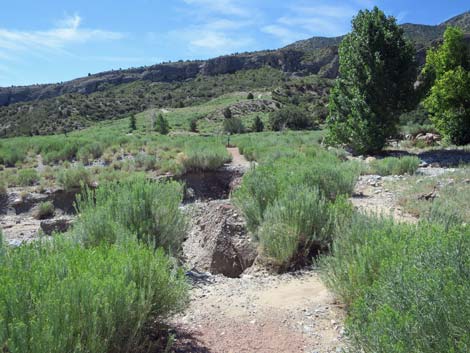
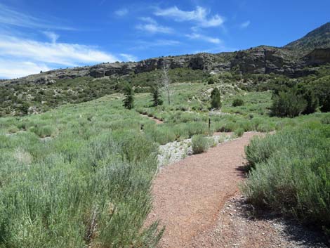
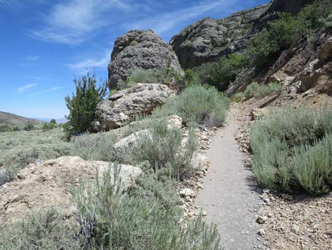
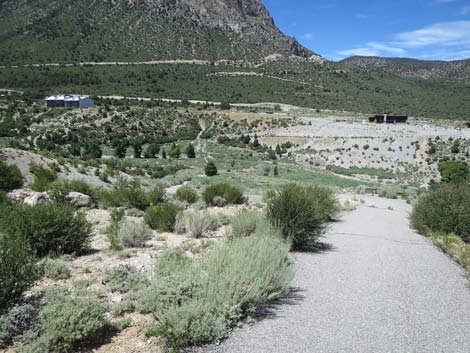
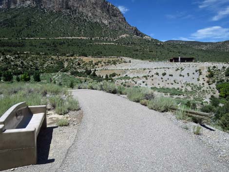
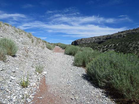
 Trail descends into Kyle Canyon Wash (view W) |
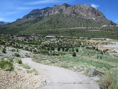
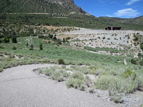
 Descending into Kyle Canyon Wash (view W) |
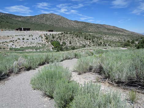
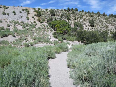
 Descending into Kyle Canyon Wash (view W) |
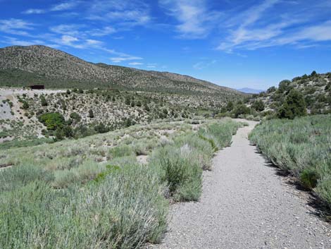
 Trail descends into Kyle Canyon Wash (view SW) |
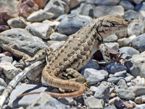 Northern Sagebrush Lizard along the trail |
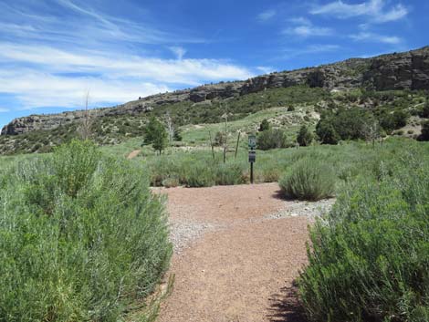
 The Kunav Huveep Trail turns left ahead (view SW) |
 The Kunav Huveep Trail turns left (view SW) |
 Trail marker: The Kunav Huveep Trail (view S) |
 Other side of trail marker: Pack Rat, Escarpment trails (view E) |
 The Kunav Huveep Trail head east on red gravel (view E) |
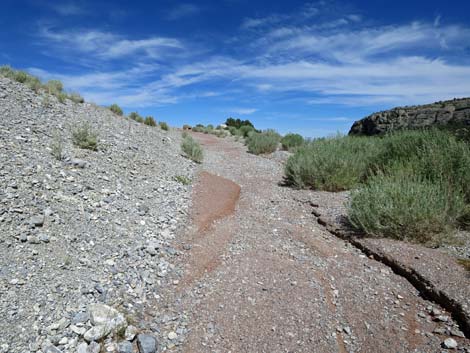
 In July 2019, the trail is washed out; go around on right (view SE) |
 Kunav Huveep Trail (view SE) |
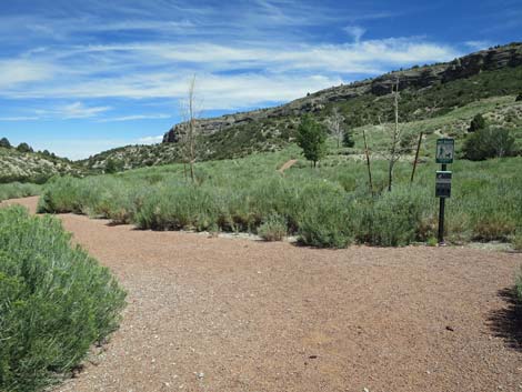
 Start of the Kunav Huveep loop (view SE) |
 Staying left on the Kunav Huveep loop (view SE) |
 Kunav Huveep loop bends to the right (view SE) |
 Trail junction: Escarpment, Pack Rat trails turn left (view SE) |
 Trail junction: Escarpment and Pack Rat trails turn up hill (view SE) |
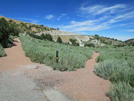
 Trail marker post: Escarpment and Pack Rat trails (view SE) |
 Red-gravel trail ends at start of pavement (view SE) |
 Trail starts up the paved trail (view SW) |
 Acastus Trail forks to the right (view SW) |
 The paved trail begins to steepen (view SW) |
 Trail junction: Pack Rat Parallel Trail forks left (view SW) |
 Trail junction: north end of the Pack Rat Parallel Trail (view SW) |
 Trail junction: Pack Rat Parallel Trail forks back to the left (view SW) |
 The paved trail is very steep (view SW) |
 The grade of the paved trail begins to lessen (view SW) The grade of the paved trail begins to lessen (view SW) |
 The paved trail runs out onto gentle flats (view SW) |
 Trail junction: south end of the Pack Rat Parallel Trail (view W) |
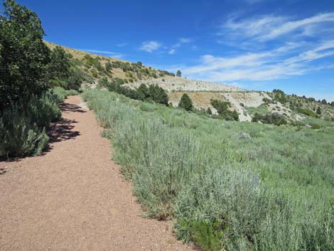
 Trail runs across gentle flats (view SW) |
 Lots of big sagebrush on these open flats (view W) |
 Pack Rat Trail bends around a hairpin turn to trail junction (view SE) |
 Pack Rat Trail runs east; Escarpment Trail runs west (view E) |
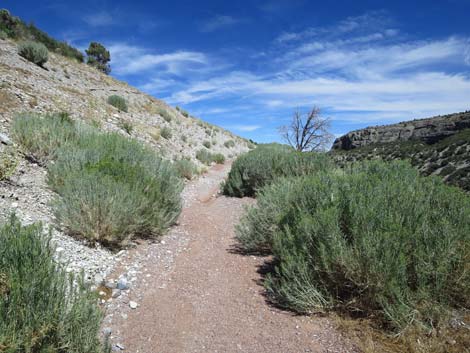
 Pack Rat Trail runs across open flats (view E) |
 Pack Rat Trail runs up to the Escarpment Cliffs (view E) |
 Pack Rat Trail climbs into the boulders (view E) |
 Pack Rat Trail in the Escarpment Cliffs (view E) |
 Pack Rat Trail runs up under the Escarpment Cliffs (view SE) |
 Going into the shade on a summer day (view SE) |
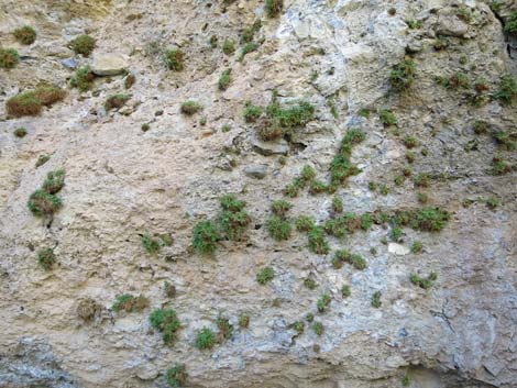 Interesting cliff-loving plant community (view S) |
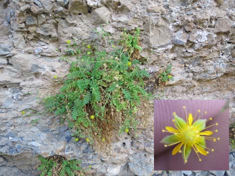 A fairly rare plant with interesting flowers: Jaeger's Mousetail |
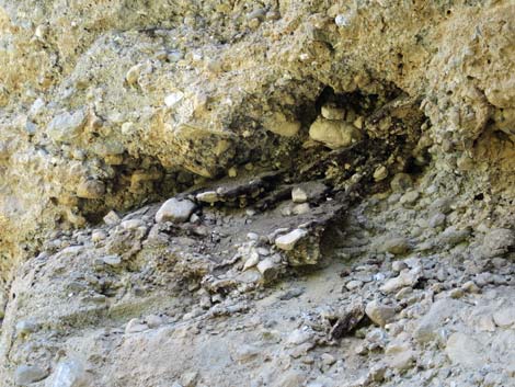
 Approaching the Pack Rat nest (view E) |
 Pack Rat nest and midden above the trail (view SE) Pack Rat nest and midden above the trail (view SE) |
 Pack Rat midden (view SE) |
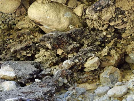 Pack Rat midden (view SE) |
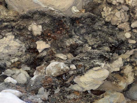 Pack Rat (Desert Woodrat) midden (view SE) |
 Pack Rat Trail emerges from the shade (view NE) |
 Approaching a trail-side exhibit (view NE) |
 Trail-side exhibit (view NE) |
 Sign: Silent Heroes of the Cold War |
 Telescope to see the plane crash site atop Mt. Charleston (view NW) |
 The trail begins descending towards the wash (view NE) |
 Pack Rat Trail approaching east end of Escarpment Trail (view NE) |
 Escarpment Trail (view E from Pack Rat Trail) |
 The trail begins the steep descent towards the wash (view NE) |
 The Pack Rat Trail gets very steep (view N) |
 Very steep Pack Rat Trail (view N) |
 Pack Rat Trail bends to wind across the hillside (view NE) |
 Not so steep (view E) |
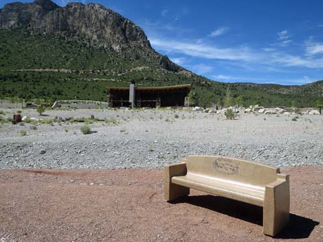
 Approaching a bench on a hairpin turn (view E) |
 The turn at the bench (view W) |
 Descending past the bench (view N) |
 The Pack Rat Trail gets very steep again (view N) The Pack Rat Trail gets very steep again (view N) |
 Pack Rat Trail approaching Kyle Canyon Wash (view NE) |
 The Pack Rat Trail at the end of the pavement (view NE) |
 The trail just ends; hikers wind down through the bushes (view W) |
 Pack Rat Trail seems to just follow the wash (view W) |
 Blazing Star with big flowers along the wash (view W) |
 Pack Rat Trail returning to the washed-out trail crossing |
 Returning to Kunav Huveep Trail at the washout (view N) |
 Kunav Huveep Trail continues (view NW) |
 Kunav Huveep Trail approaching a trail junction (view W) |
 Trail marker seen before (view N) |
 Kunav Huveep Trail turns at trail junction and goes uphill (view NE) |
 Kunav Huveep Trail climbing out of the canyon (view NE) |
 Kunav Huveep Trail climbing the hillside (view E) |
 Kunav Huveep Trail climbing the hillside (view E) |
 The bench at the top comes into view (view E) |
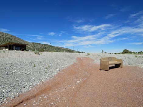 Returning to the bench (view NE) |
 The Visitor Center building is visible from the bench (view N) |
 Returning towards the Visitor Center (view N) |
 In case you missed it: that's the Visitor Center (view NW) |
 Returning to the outdoor amphitheater (view N) |
Table 1. Hiking Coordinates Based on GPS Data (NAD27; UTM Zone 11S). Download Hiking GPS Waypoints (*.gpx) file.
| Wpt. | Location | UTM Easting | UTM Northing | Elevation (ft) | Point-to-Point Distance (mi) | Cumulative Distance (mi) |
|---|---|---|---|---|---|---|
| 01 | Trailhead | 626915 | 4014658 | 6,470 | 0.00 | 0.00 |
| 02 | Top of Hillside | 626911 | 4014631 | 6,467 | 0.02 | 0.02 |
| 03 | Trail Junction | 626683 | 4014565 | 6,445 | 0.16 | 0.18 |
| 04 | Trail Crosses Wash | 626739 | 4014556 | 6,438 | 0.04 | 0.22 |
| 05 | Trail Junction | 626757 | 4014537 | 6,440 | 0.02 | 0.24 |
| 06 | Trail Junction, Pack Rat | 626790 | 4014522 | 6,450 | 0.03 | 0.27 |
| 08 | Start of Paved Trail | 626812 | 4014506 | 6,458 | 0.02 | 0.29 |
| 09 | Trail Junction | 626808 | 4014486 | 6,469 | 0.01 | 0.30 |
| 10 | Trail Junction | 626767 | 4014418 | 6,537 | 0.06 | 0.36 |
| 11 | Trail Junction | 626644 | 4014292 | 6,620 | 0.11 | 0.47 |
| 12 | Trail Junction | 626517 | 4014247 | 6,657 | 0.10 | 0.57 |
| 13 | Shady Cliff | 626773 | 4014211 | 6,759 | 0.19 | 0.76 |
| 14 | Sign and Telescope | 626817 | 4014263 | 6,760 | 0.05 | 0.81 |
| 15 | Trail Junction | 626857 | 4014305 | 6,738 | 0.03 | 0.84 |
| 16 | End of Paved Trail | 626886 | 4014550 | 6,578 | 0.21 | 1.05 |
| 04 | Trail Crosses Wash | 626739 | 4014556 | 6,438 | 0.10 | 1.15 |
| 03 | Trail Junction | 626683 | 4014565 | 6,445 | 0.07 | 1.22 |
| 02 | Top of Hillside | 626911 | 4014631 | 6,467 | 0.16 | 1.38 |
| 01 | Trailhead | 626915 | 4014658 | 6,470 | 0.02 | 1.40 |
Happy Hiking! All distances, elevations, and other facts are approximate.
![]() ; Last updated 240329
; Last updated 240329
| Hiking Around Mt Charleston | Hiking Around Las Vegas | Glossary | Copyright, Conditions, Disclaimer | Home |