Hiking Around Las Vegas, Mount Charleston Area
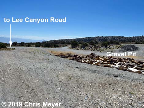 |
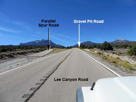
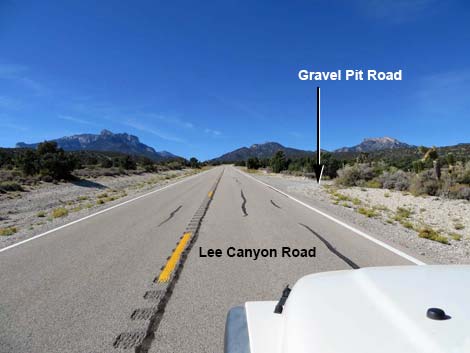
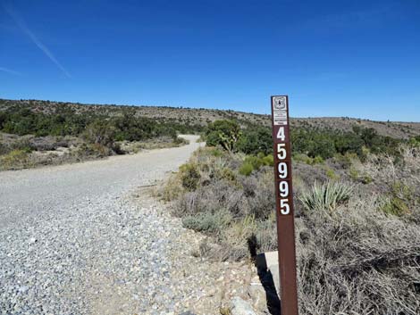
Sawmill Gravel Pit Trailhead is located up in the Spring Mountains National Recreation Area (also known as Mt. Charleston), about 45 minutes northwest of Las Vegas. The trailhead can be reached from Kyle Canyon Road (via Deer Creek Road) or directly from Lee Canyon Road. Travel via Kyle Canyon and Deer Creek roads would be more scenic, but longer than using Lee Canyon Road. Using Lee Canyon Road, from town, drive north on Highway 95 to Lee Canyon Road. Turn left onto Lee Canyon Road and drive southwest for 10.4 miles to Gravel Pit Road (Table 1, Site 1907). Watch for a carsonite sign with the road number (45995) and a gravel road leading away from the highway. Turn right and drive north into the trailhead parking area (Site 1908), which is to the right of the main gravel pit work area. Link to Trailhead Map. |
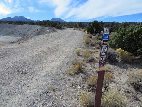 |
Using Kyle Canyon Road, from town, drive north on Highway 95 to Kyle Canyon Road. Turn left onto Kyle Canyon Road and drive southwest for 17.1 miles to Deer Creek Road, which is a bit past the Mt. Charleston Resort. Turn right onto Deer Creek Road and drive north to a T-intersection with Lee Canyon Road. Turn right onto Lee Canyon Road and drive northeast (downhill) for 3.8 miles to Sawmill Gravel Pit Trailhead Road (Site 1907). Watch for a carsonite sign with the road number (45995) and a gravel road leading away from the highway. Turn left and drive north into the trailhead parking area (Site 1908), which is to the right of the main gravel pit work area. Sawmill Gravel Pit Trailhead provides access to several new USFS trails, including Blue Tree Loop, Rocky Gorge Loop, and Deer Creek - Catch Pen Loop. If workers are in the gravel pit, consider parking on the south side of Lee Canyon Road using the paved spur road that runs parallel to the main road. |
 |
 |
 |
|
 |
 |
Table 1. Highway Coordinates (NAD27; UTM Zone 11S). Download Highway GPS Waypoints (*.gpx) file.
| Site | Location | UTM Easting | UTM Northing | Latitude (N) | Longitude (W) | Elevation (ft) |
|---|---|---|---|---|---|---|
| 1907 | Lee Canyon Road at Gravel Pit Road | 624754 | 4026938 | 36.38130 | 115.60916 | 6,581 |
| 1908 | Gravel Pit Parking Area | 624653 | 4027029 | 36.38213 | 115.61026 | 6,529 |
Happy Hiking! All distances, elevations, and other facts are approximate.
![]() ; Last updated 240329
; Last updated 240329
| Hiking Around Mt Charleston | Hiking Around Las Vegas | Glossary | Copyright, Conditions, Disclaimer | Home |