Hiking Around Las Vegas, Red Rock Canyon National Conservation Area
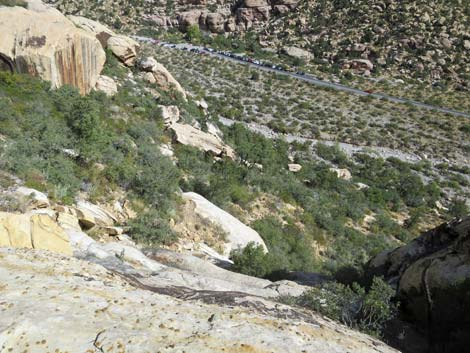
 Route overview (view NW from Children's Discovery Trailhead) |
Overview The route to Upper Lost Creek Falls starts on the Willow Springs Loop Trail, ascends a steep hillside, crosses exposed rocky ledges, and ends in a narrow box canyon above Lost Creek Falls inside the Rainbow Mountain Wilderness Area. There are several seasonal pools in Lost Creek Canyon, and the rocks are water-polished and highly sculpted. There is a willow thicket with a spring at the base of Lost Creek Canyon, so there is water here, but the waterfall often is dry late in the year. During wet years, however, the waterfall and the stream are spectacular. This route has some serious exposure and is not appropriate for the inexperienced or faint of heart; it is not appropriate for young children, and I would not take a dog up there. Link to map. |
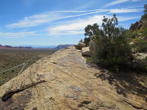
 Ragged Edges Crack (view W from Willow Springs Trail) |
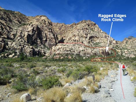
Watch Out Other than the standard warnings about hiking in the desert, ...this route has some serious exposure. Falls from a couple of spots surely would lead to sudden death. The route up the hillside is steep and rocky, and at the top of the cliff, you have to find a route across exposed ledges. Extra care should always be taken on wet or icy rocks. Stay well back from the edge at the top of the falls. While hiking, please respect the land and the other people out there, and try to Leave No Trace of your passage. Also, even though this is a short hike, be sure to bring what you need of the 10 Essentials. Getting to the Trailhead This hike is located along the Scenic Loop Road in Red Rock Canyon National Conservation Area, about 1 hour west of Las Vegas. Drive out to Red Rocks, pay the fee, and then drive about half-way around the Scenic Loop Road to Willow Springs Road. Turn right and drive north 0.2 miles to the Lost Creek Trailhead. Park here; this is the trailhead. |
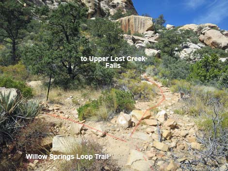
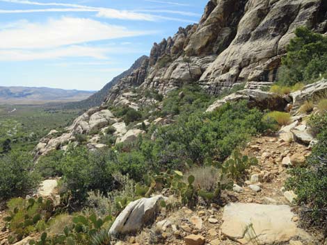
 Willow Springs Loop Trail at Upper Lost Creek Route (view NW) |
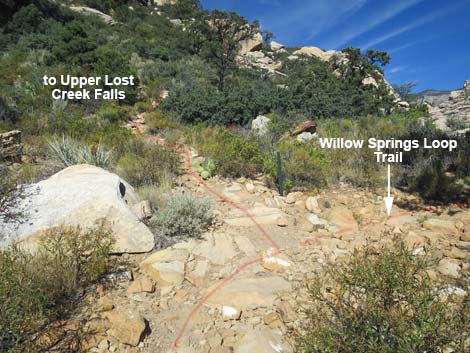
The Hike Before leaving the parking area, look across Red Rock Wash and locate Lost Creek Canyon beyond the willow thicket. The goal of this hike is to get onto the wide bench on the north (right) side of the canyon, about 100 feet above the bottom of the canyon. From the Children’s Discovery trailhead (Table 2, Waypoint 01), the route starts on the well-defined Children’s Discovery Trail and heads upstream and across Red Rock Wash towards the cliffs north of Lost Creek Canyon. The route follows the Children’s Discovery Trail across the wash and up the hillside to the signed junction with the Willow Springs Loop Trail (Wpt. 02). |
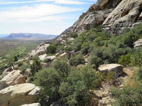
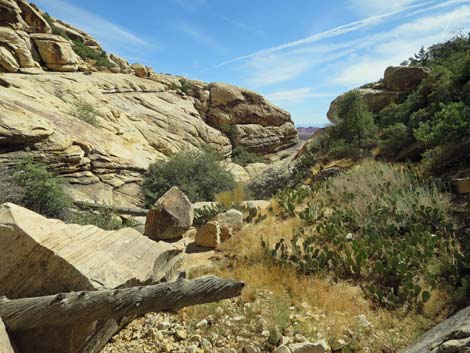
 Willow Springs Loop Trail at another Upper Lost Creek Route |
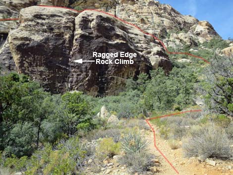
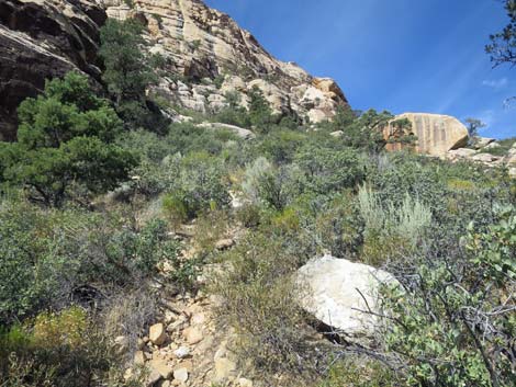
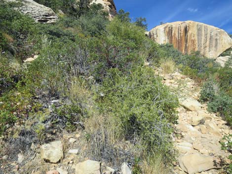
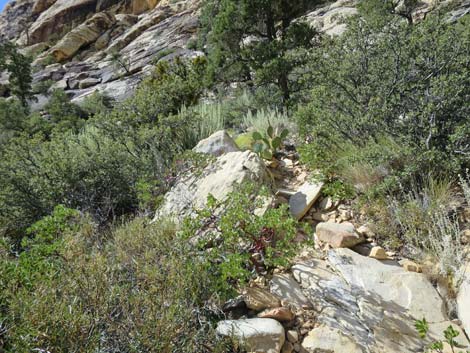
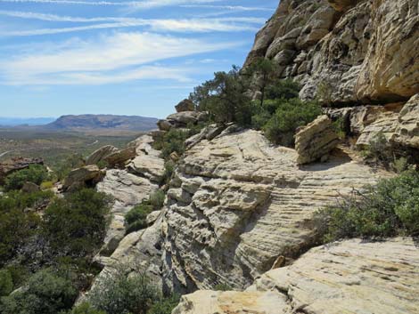
At the junction, the route turns right (north) onto the Willow Springs Loop Trail and climbs through a slot between two huge boulders. The trail winds along beneath broken cliffs and ledges, but eventually gets to the base of a large, smooth cliff face with a single vertical crack from the bottom all the way to the top. The crack is narrow at the bottom and wide at the top (and is the popular Ragged Edges rock-climbing route). Just north of this cliff face, hikers reach the high point on the Willow Springs Loop Trail (Wpt. 03). Hikers who go too far on the main trail will quickly start to drop back into Red Rock Wash; just head back to the high point. From the high point, several use-trails turn up the rocky hillside to climb through lots of shrubs and a few trees. Pick one of the use-trails and scramble up the rocky hillside for about 100 vertical feet until forced to the south (left) by cliffs. Heading south, the route traverses exposed sandstone and climbs onto the broad ledge at the top of the Ragged Edges cliff. This is about as high as the route go. |
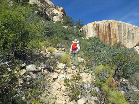
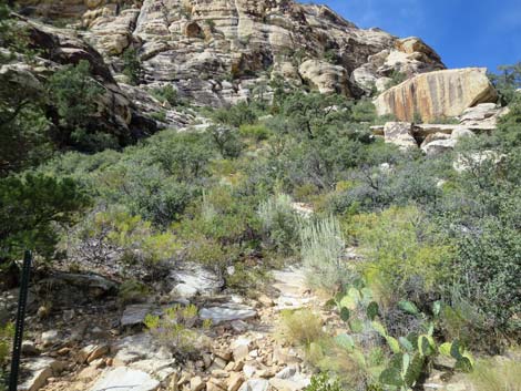 Use-trail heads up steep hillside (view NW) |
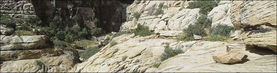
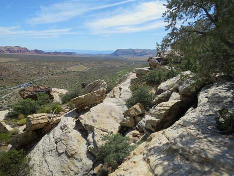
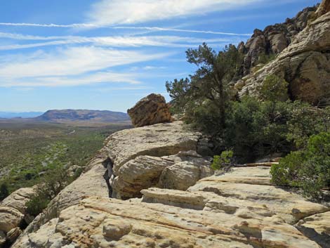
The route runs southward through bushes and across the generally wide, but sometimes narrow and exposed, ledges until reaching the mouth of Lost Creek Canyon. The route turns west (right) into the canyon and continues across generally broad ledges staying more or less at the same elevation. The route leads to the back of the canyon and ends below a waterfall (Wpt. 04). Without ropes for getting back down, I wouldn't climb any higher than this. Climbing up doesn't look bad, but the downclimb could be challenging. From the base of the waterfall, hikers can scramble downstream across the slick walls of the canyon to the top of the Lost Creek Falls (a distance of about 100 yards). Be careful on the water-polished rocks, and especially be careful at the top of Lower Lost Creek Falls. Use your own good judgment about the route and your safety: it is always better to turn back than to get hurt. It's just not worth it. You can always get more experience and come back again. To get down, carefully retrace your steps. For photos of the return, see Return from Upper Lost Creek Falls. |
 Use-trail heads up steep, rocky hillside (view NW) |
 Use-trail heads up steep, rocky hillside (view NW) |
 Hiker on steep, rocky hillside (view NW) |
 Traversing steep, rocky hillside (view S) |
 Traversing steep, rocky hillside (view S) |
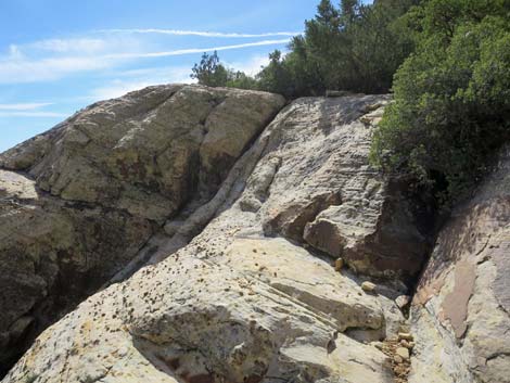 Approaching steep, exposed slickrock traverse (view S) |
 Exposure |
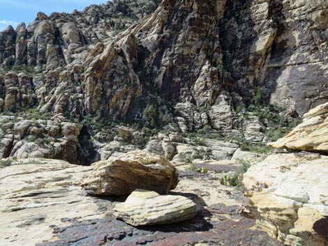
 Big ledge above Ragged Edges crack (view S) |
 Departing the ledge above Ragged Edges crack (view S) |
 Rocky hillside (view S) |
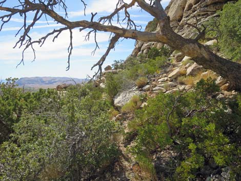 Route passes under a dead tree (view S) |
 Approaching a tricky spot (view S) |
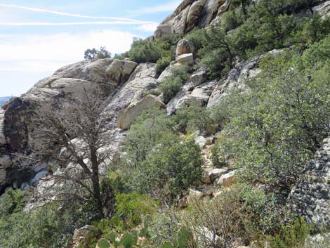
 The route traverses broken ledges (view S) |
 Traversing broken ledges (view S) |
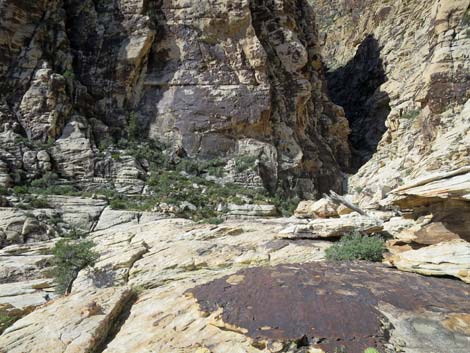
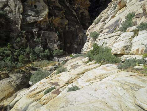
 Approaching the turn into Lost Creek Canyon (view S) |
 Turning into Lost Creek Canyon (view SW) |
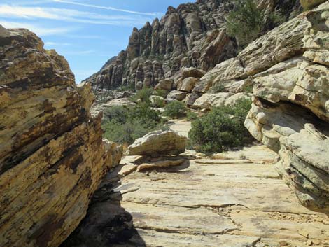
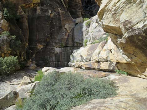
 Broad ledges lead back into Lost Creek Canyon (view W) |
 Broad ledges lead back into Lost Creek Canyon (view W) |
 Broad ledges with some tricky spots (view W) |
 Broad ledges with some tricky spots (view W) |
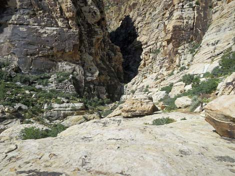
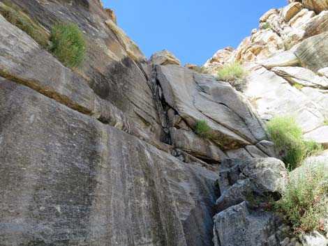
 Approaching the upper falls (view W) |
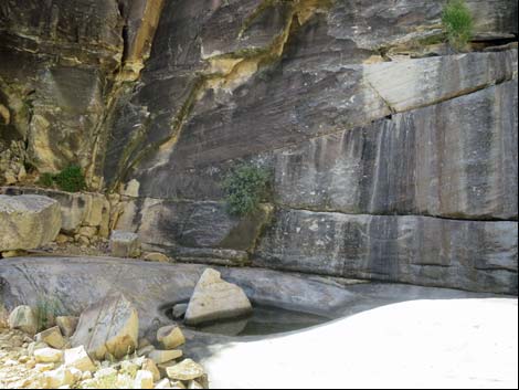
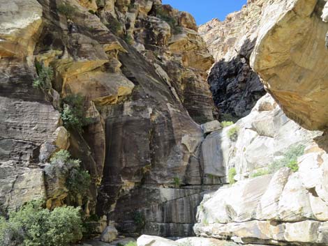 Upper Lost Creek Falls (view W) |
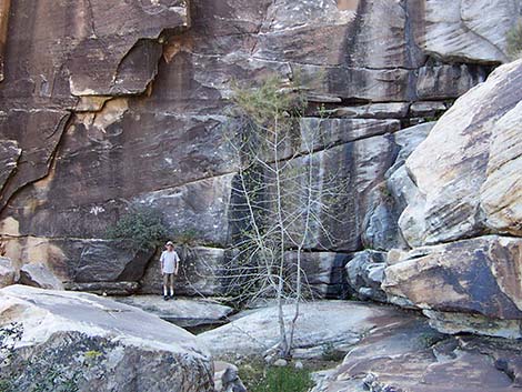 Hiker below waterfall; the tree washed away in a flood (view west) |
 Arriving at the base of the pour-over (view W) |
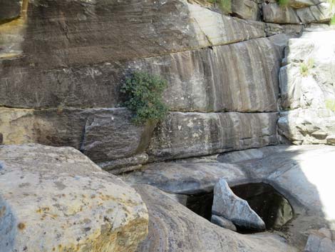 Plunge pool below the waterfall (view NW) |
 Upper Lost Creek Falls (view W) |
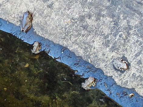 Adult and juvenile Baja California Treefrogs |
 Down canyon (view E from base of the falls) |
Seasonal pools and sculpted rock (view W; upstream) |
People below Lost Creek Falls (view E; downstream) |
Table 2. Hiking Coordinates Based on GPS Data (NAD27; UTM Zone 11S). Download Hiking GPS Waypoints (*.gpx) file.
| Wpt. | Location | Easting | Northing | Elevation (ft) | Verified |
|---|---|---|---|---|---|
| 01 | Children's Discovery Trailhead | 635547 | 4002269 | 4,473 | GPS |
| 02 | Willow Springs Loop Trail Junction | 635234 | 4002262 | 4,532 | GPS |
| 03 | Highpoint on Willow Springs Loop Trail | 635123 | 4002394 | 4,596 | GPS |
| 04 | Upper Lost Creek Falls | 635053 | 4002100 | 4,700 | Map |
Happy Hiking! All distances, elevations, and other facts are approximate.
![]() ; Last updated 240330
; Last updated 240330
| Hiking Around Red Rocks | Hiking Around Las Vegas | Glossary | Copyright, Conditions, Disclaimer | Home |