Hiking Around Las Vegas, Red Rock Canyon National Conservation Area
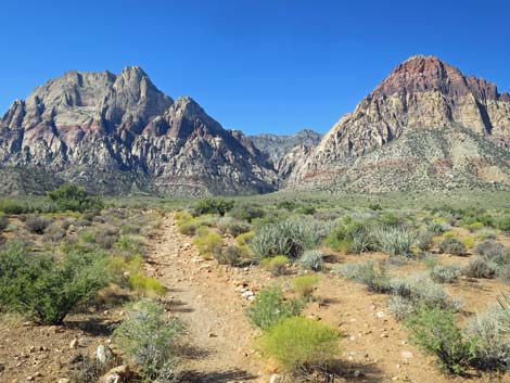
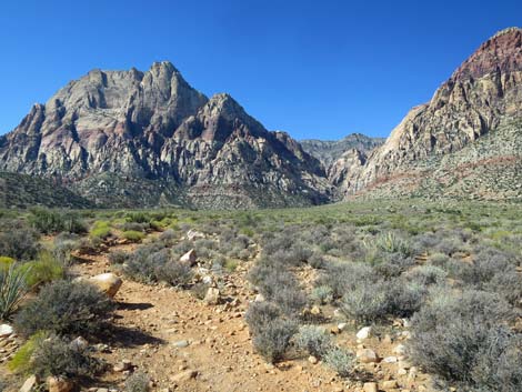
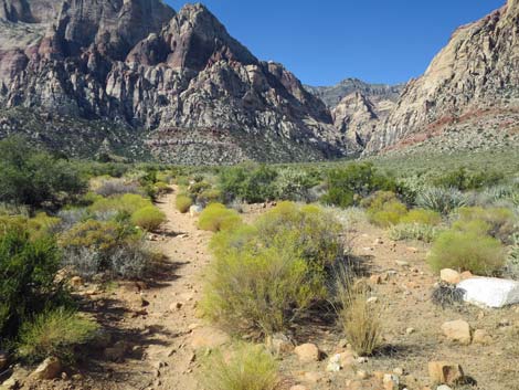
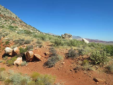
 Oak Creek Trailhead (view SW) |
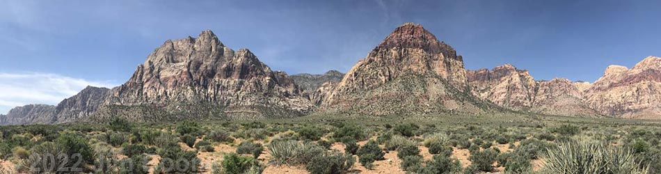
Overview The Oak Creek Canyon Trail is a delightful hike that leads into one of the narrow canyons that slices into the Red Rocks (Wilson) Cliffs. This hike has two parts: (1) an official trail and (2) a scramble up the canyon. The official trail makes for a good, easy hike that leads to an overlook at the mouth of the canyon in about 1.1 miles with an elevation gain of less than 300 ft. From there, the official trail contours across unpleasant hillsides for about 0.36 miles to end where the trail drops into Oak Creek Canyon Wash. A better option is to drop into Oak Creek Wash sooner and get a good all-body workout in the boulder-choked canyon. Either way, hikers can scramble and boulder-hop up the canyon almost forever, but this is an in-and-out or partial-loop hike. During late winter and spring, the stream flows and the canyon can be harder to navigate, at least if trying to keep the hiking boots dry. The canyon gets some full sun, but generally this is a cool place to hike. Link to map. Link to BLM Georeference PDF map file. |
 Oak Creek Trailhead (view SW) |
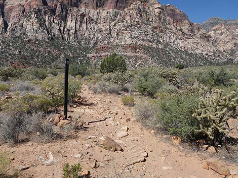
Watch Out Other than the standard warnings about hiking in the desert, ... this is an easy hike to the end of the official trail, but the trail is rocky, and hikers will need to watch their step to avoid twisting an ankle. Past the end of the official trail, the hike is a moderately strenuous scramble up the canyon that requires climbing over and around boulders. Be careful when high enough to fall and hurt yourself, watch for wet rocks, and watch for ice during winter. The main trail is fairly easy to follow, but watch for trail junctions with signed and unsigned trails. While hiking, please respect the land and the other people out there, and try to Leave No Trace of your passage. Also, even though this is a short hike, be sure to bring what you need of the 10 Essentials. |
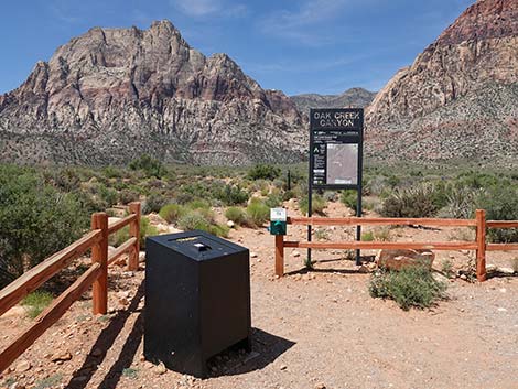
 Historical Oak Creek Trailhead sign (view SW) |
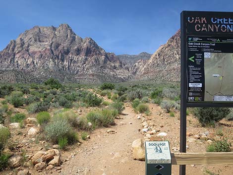
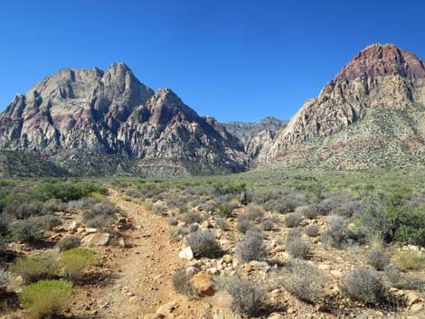
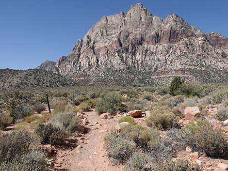
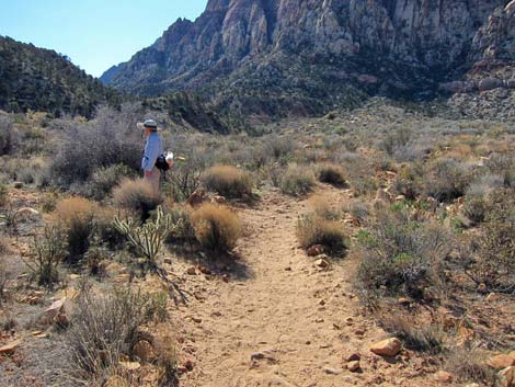
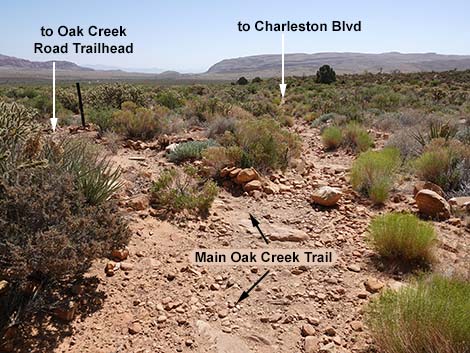
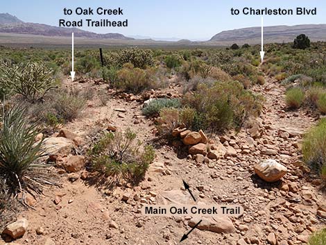
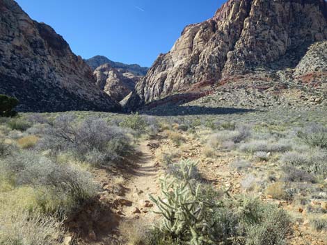
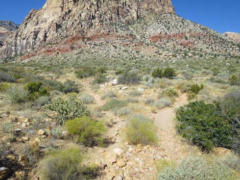
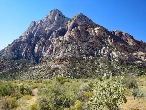
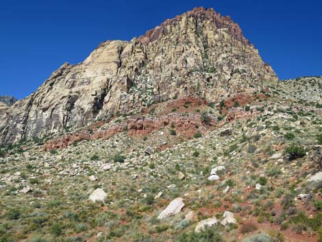
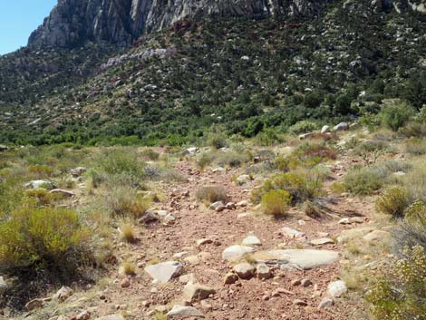
Getting to the Trailhead This hike is located along the Scenic Loop Road in Red Rock Canyon National Conservation Area, about 1 hour west of Las Vegas. Drive out to Red Rocks, pay the fee, and then drive most of the way around the Scenic Loop Road to the Oak Creek Canyon Trailhead, located at the end of Oak Creek Canyon Road. The Hike From the trailhead (Table 1, Waypoint 01), the trail runs more-or-less directly towards the mouth of Oak Creek Canyon, heading southwest and up the bajada at a gentle grade. The walking is easy, but the trail is rocky, and hikers need to watch their step to avoid twisting an ankle. Watching your step, however, is difficult because the Wilson Cliffs, and Mt. Wilson in particular, just seem to get taller, more vertical, and more spectacular the closer you get to the cliffs, and hikers will want to watch the scenery rather than the trail. |
 Start of the Oak Creek Trail (view SW) |
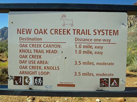
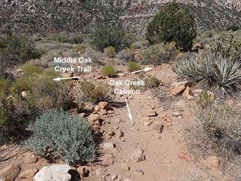
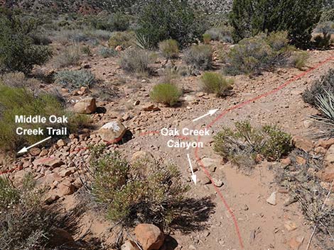
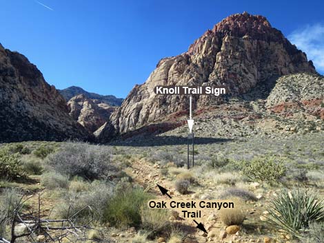
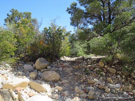
Along this lower part of the trail, the habitat type is Mojave Desert Scrub with lots of low-growing shrubs dominated by blackbrush, Mojave yucca, buckhorn cholla, and other things mixed in. At about 0.7 miles out, the Oak Creek Canyon Trail reaches an unsigned junction with the Middle Oak Creek Canyon Trail (Wpt. 02), an unofficial use-trail. Middle Oak Creek Canyon Trail comes up a braided wash where the location of the trail keeps changing, and it seems that this intersection keeps changing too, so keep a keen eye out (especially on the return) for this junction. Continuing onward, the Oak Creek Canyon Trail soon reaches another trail junction (Wpt. 03), this time with trail signs. Here, the Knoll Trail branches to the right (north) and runs out to connect with the Arnight Trail. Hikers can make a nice 3.2-mile loop (total distance) back to the trailhead by walking the Rainbow Loop Trail. |
 |
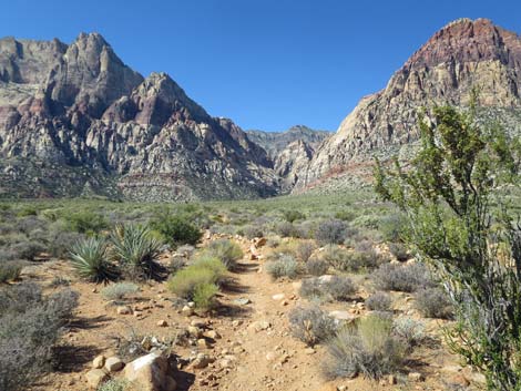
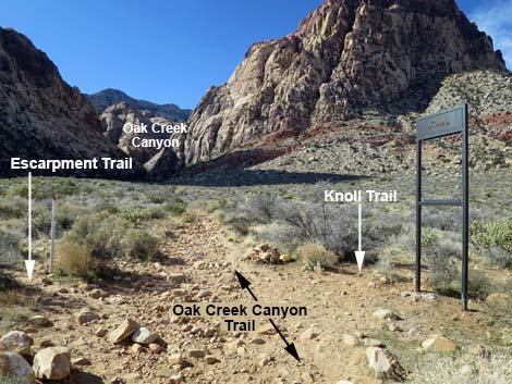
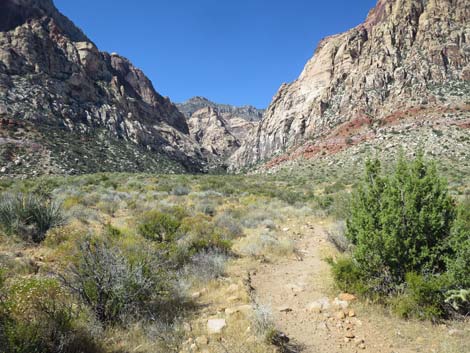
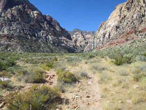
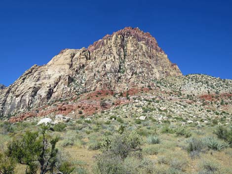
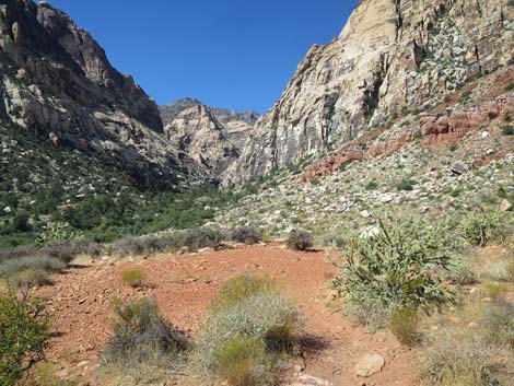
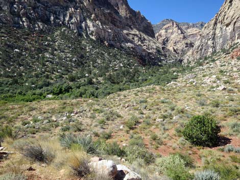
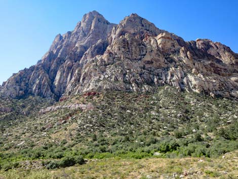
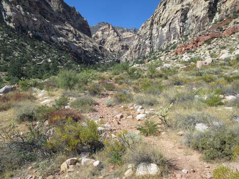
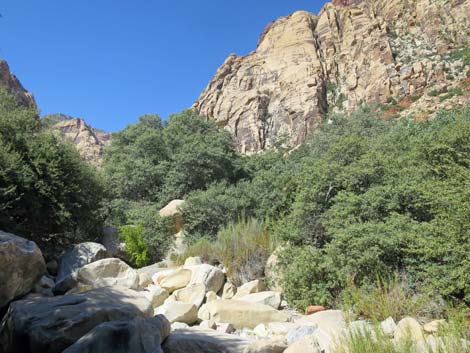
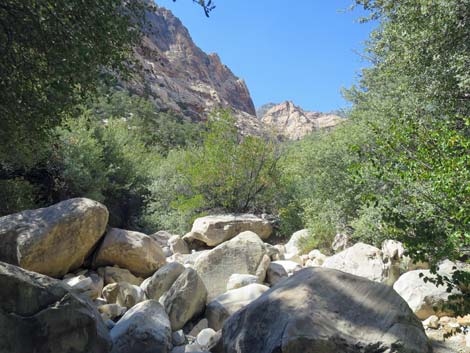
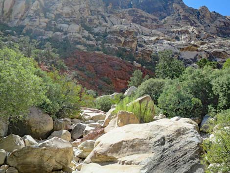
From the trail junction (Wpt. 03), the Escarpment Trail branches to the left (south), crosses Oak Creek Wash, and connects with the South Oak Creek Trail system. Continuing onward, the Oak Creek Canyon Trail soon reaches the mouth of Oak Creek Canyon where the faces of Mt. Wilson (south side) and Rainbow Mountain (north side) tower above the desert flats. At about 1.1 miles out, the trail arrives at a nice overlook (Wpt. 04) on a red-dirt bench above Oak Creek Wash with views up the canyon (spectacular cliffs) and down into the wash (heavily vegetated). Hikers can recognize the overlook by the bright-red dirt and because just past the viewpoint, an old road passes through a cut-bank of bright-red dirt, bends sharply to the south (left), and drops steeply towards the wash. For hikers who don't intend to boulder-hop up the canyon, this viewpoint is a good place to stop, relax, enjoy the scenery, eat lunch, and head back down. |
 Oak Creek Trail (view SW) Oak Creek Trail (view SW) |
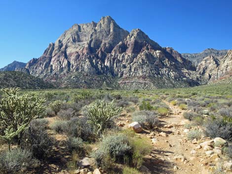
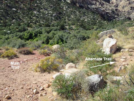
Along this upper part of the trail (closer to the cliffs) the vegetation is more robust and more diverse, with cliffrose, buckwheat, bunchgrass, yerba santa, Utah juniper, and Ephedra joining the mix of common species. In addition, from the viewpoint, you can look into the canyon and see shrub live oak, ashy silktassel, pinyon pine, and desert willow. Also watch or listen for white-tailed antelope squirrels and various species of birds near the water (e.g., Juniper Titmouse, Western Bluebird, Woodhouse's Scrub-Jay, Common Raven, and House Finch). Continuing past the overlook (Wpt. 04), the old road curves to the northwest (right) and then loops back to the south (left). Crossing out of the red dirt, the first of four use-trails forks off to the right and traverses the rocky hillside heading towards rock climbing routes. This use-trail fans out into more use-trails which are just routes across a rocky hillside with scattered cairns to guide the way (the way to where?). |
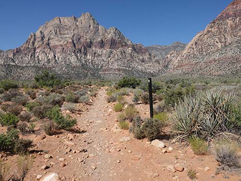
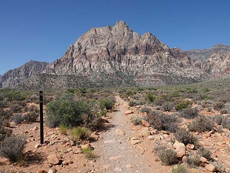 Oak Creek Trail with trail marker (view SW) |
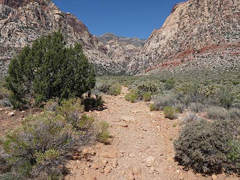
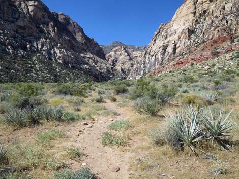
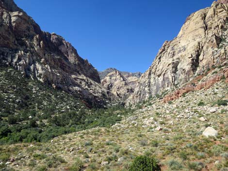
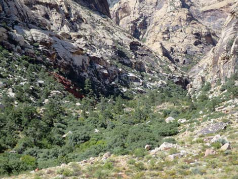
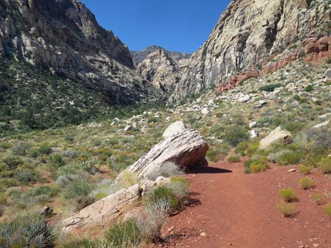
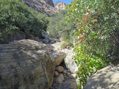
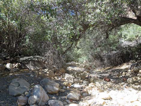
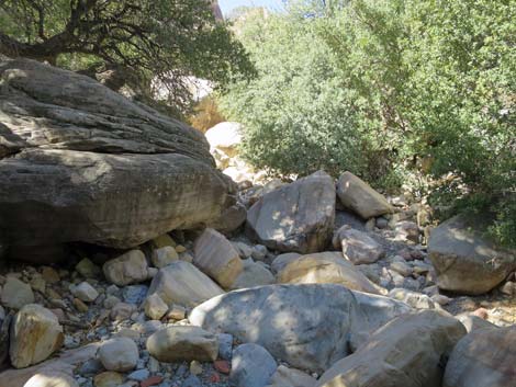
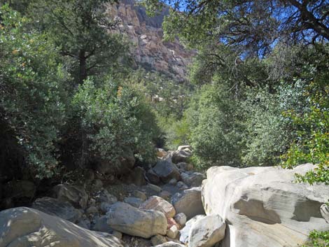
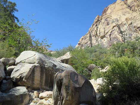
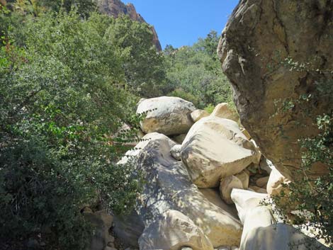
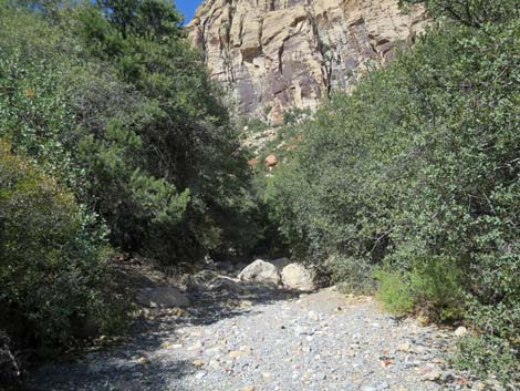
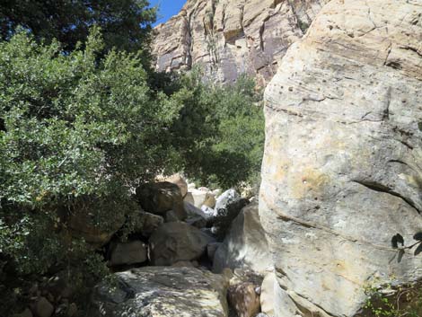
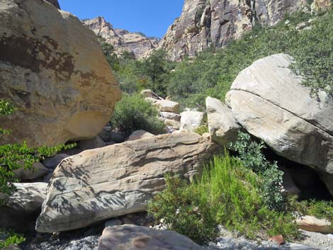
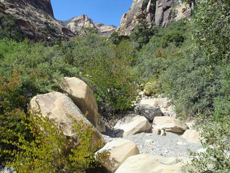
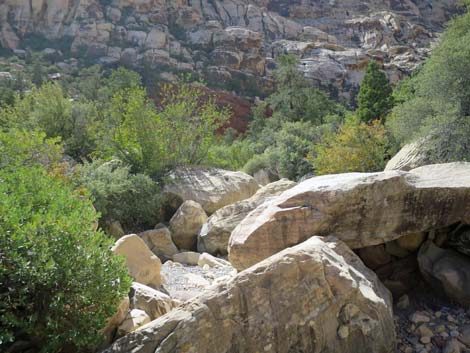
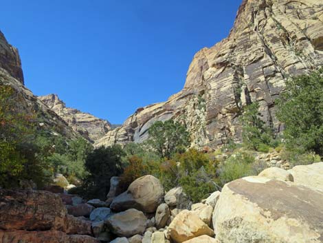
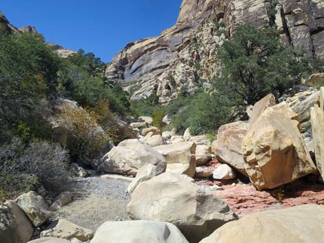
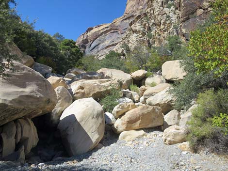
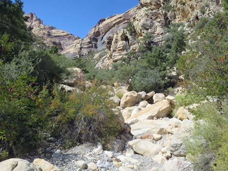
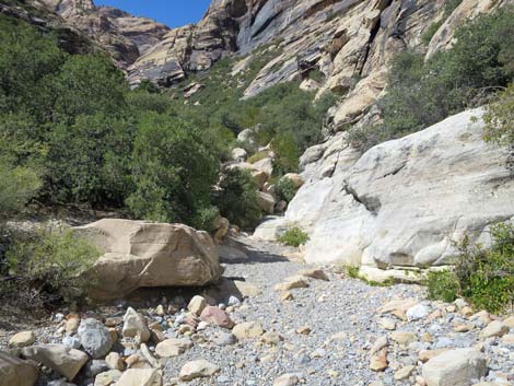
Continuing on the main trail down the hillside, hikers pass two more use-trails to the right. These use-trails connect before long and traverse out across the rocky hillside staying above the wash. The combined trail runs out to other rock climbs, but it also parallels the wash until forced into the wash by cliffs. For hikers wanting to head up the canyon more quickly, this lower trail bypasses about 0.3 miles of boulder-hopping in the wash bottom. For a more interesting route, the fourth use-trail (Wpt. 05) drops directly into the bottom of Oak Creek Canyon Wash (Wpt. 06). In the wash, hikers are left to find good ways to boulder-hop up the canyon finding ways around pour-overs and around boulders. A seasonal stream flows through the canyon forming a series of pools and little waterfalls. In the wash, hikers can boulder-hop up the canyon for forever, or so it seems. Higher up, the canyon is narrow and deep, and travel is more difficult, but the surrounding cliffs are spectacular. |
 Oak Creek Trail (view SW) Oak Creek Trail (view SW) |
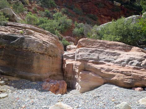
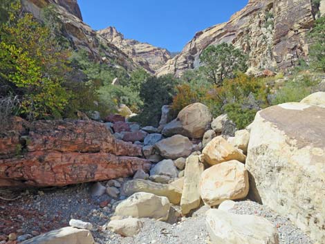
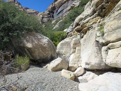
By about 1.4 miles out, the wash is running along the north edge of the canyon, but then curves abruptly to the left (south) and crosses towards the south side of the canyon. At this point, the south side of the canyon includes a layer of dark red sandstone. Approaching the red sandstone wall, hikers encounter a 10-ft high pour-over of red sandstone. At the base of the pour-over, immediately to the left, a use-trail (Wpt. 07) can be seen exiting the wash. Hikers can boulder-hop up the canyon as far as they'd like, but on the return, this use-trail parallels the wash on the south side of the canyon and makes an easier way to return down the canyon, except of course, that the Escarpment Trail was never finished and hikers will have to find a way back across Oak Creek Wash and back onto the main part of the Oak Creek Canyon Trail. For photos of the return, see Knoll-Escarpment to Oak Creek Trailhead. |
 Oak Creek Trail with trail marker (view SW) |
 Oak Creek Trail (view SW) |
 Oak Creek Trail (view SW) |
 Oak Creek Trail (view SW) |
 Hiker looking at a lizard (view SW) |
 Oak Creek Canyon Trail (view SW) |
 Oak Creek Canyon Trail at Middle Oak Creek Trail (view SW) |
 Oak Creek Canyon Trail at Middle Oak Creek Trail (view SW) |
 Oak Creek Canyon Trail past Middle Oak Creek Trail (view SW) |
 Looking back: Oak Creek Trail at Middle Oak Creek Trail (view E) |
 Looking back: Oak Creek Trail at Middle Oak Creek Trail (view SE) |
 Oak Creek Trail (view SW) |
 Oak Creek Trail approaching Knoll Trail junction (view SW) |
 Oak Creek Trail at Knoll-Escarpment trail junction (view SW) |
 Oak Creek Canyon Trail continues (view SW) |
 The trail splits, but quickly rejoins (view W) |
 Oak Creek Canyon Trail continues (view SW) |
 Oak Creek Canyon Trail nearing the mouth of the canyon (view SW) |
 Rainbow Mountain is getting close (view NW) |
 Mt Wilson is getting close (view S) |
 Approaching the mouth of Oak Creek Canyon (view SW) |
 Arriving at red-dirt Oak Creek Canyon Overlook (view SW) |
The Overlook
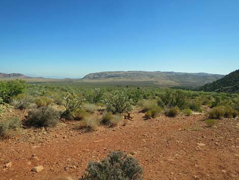
 Looking up Oak Creek Canyon (view SW) |
 Looking down into Oak Creek Wash (view SW) |
 Looking up at Rainbow Mountain (view NW) |
 Looking up at Mt. Wilson (view S) |
 Looking down into Oak Creek Canyon (view SW) |
 Looking at boulder that can be seen from the trailhead (view NE) |
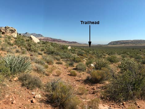 Looking back to the trailhead (view NE) |
 Looking back to the east |
Scrambling Up the Wash
 Trail departing the Overlook (view NW) |
 Looping down across the hillside (view SW) |
 The trail bends left to run south; use-trail branch off (view S) |
 First use-trail (view SW) |
 Another use-trail branches off (view SSW) |
 Second use-trail stays on bench above canyon bottom (view SW) |
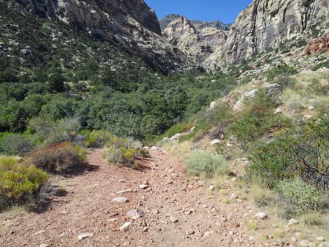 The main trail angles down towards the wash (view SW) |
 The main trail drops towards the wash (view SW) |
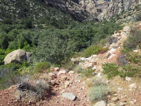
 The main trail drops steeply into the wash (view SW) |
 Oak Creek Wash is dry in late summer (view SW) |
 |
 |
 |
 |
 |
 |
 |
 |
 |
 |
 |
 |
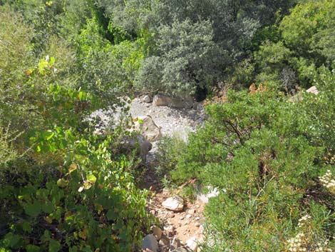
 The wash bends to run more southerly (view SSW) |
 Approaching a wall of deep-red sandstone (view SSW) |
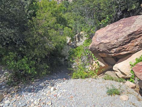
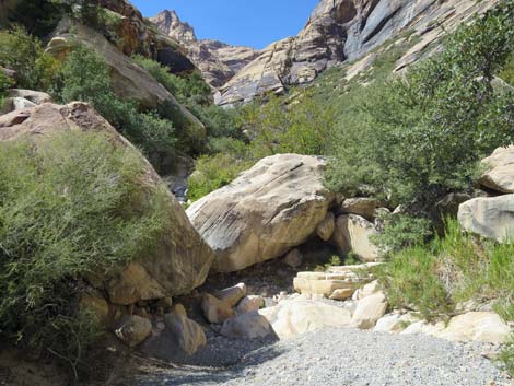
 Pour-over just before the wall of deep-red sandstone (view SSW) |
 Use-trail to the left leads back down the side of the canyon (view E) |
Continuing Up the Canyon
 Passing below the wall of deep-red sandstone (view SW) |
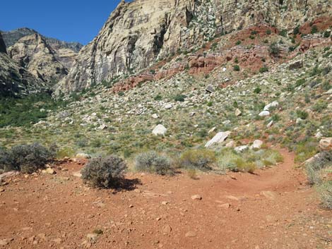
 The canyon walls are high (view SW) The canyon walls are high (view SW) |
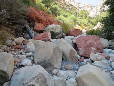 The wall of deep-red sandstone is unstable (view SW) |
 Continuing up the boulder-filled wash (view SW) |
 |
 |
 |
 |
 The end of my day (view SW) |
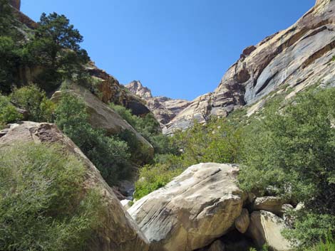 The canyon seems to go on forever (view W) |
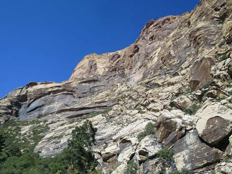 Cliffs tower above the canyon floor (view NW) |
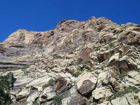 Cliffs tower above the canyon floor (view N) |
Table 1. Hiking Coordinates Based on GPS Data (NAD27; UTM Zone 11S). Download Hiking GPS Waypoints (*.gpx) file.
| Wpt. | Location | UTM Easting | UTM Northing | Elevation (ft) | Point-to-Point Distance (mi) | Cumulative Distance (mi) |
|---|---|---|---|---|---|---|
| 01 | Oak Creek Canyon Trailhead | 638117 | 3997117 | 3,895 | 0.00 | 0.00 |
| 02 | Oak Creek Trail | 637340 | 3996372 | 4,021 | 0.69 | 0.69 |
| 03 | Knoll Trail Jct | 637157 | 3996333 | 4,104 | 0.12 | 0.81 |
| 04 | Red Rock Canyon Overlook | 636774 | 3996263 | 4,168 | 0.26 | 1.07 |
| 05 | Drop into Wash | 636709 | 3996207 | 4,152 | 0.08 | 1.15 |
| 06 | Oak Creek Wash | 636680 | 3996190 | 4,137 | 0.02 | 1.17 |
| 07 | Use-Trail on Bench | 636370 | 3996096 | 4,282 | 0.28 | 1.45 |
| 01 | Oak Creek Canyon Trailhead | 638117 | 3997117 | 3,895 | 1.68 | 3.13 |
Happy Hiking! All distances, elevations, and other facts are approximate.
![]() ; Last updated 240330
; Last updated 240330
| Hiking Around Red Rocks | Hiking Around Las Vegas | Glossary | Copyright, Conditions, Disclaimer | Home |