Hiking Around Las Vegas, Muddy Mountains Wilderness Area
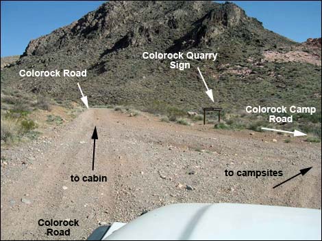 Colorock Road at Colorock Camp Road (view E) |
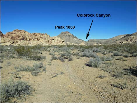
Overview Colorock is a historic sandstone quarry, and the Colorock Canyon Loop Route runs through this area and up a deep, narrow canyon into Hidden Valley in the Muddy Mountains Wilderness Area. After various options, the route loops out of Hidden Valley over a sandstone ridge and down into another part of the quarry area. Dirt roads are then used to close the loop and return to the trailhead. This hike combines the historic Colorock cabin and quarry sites, a deep narrow limestone canyon, the scenic Hidden Valley, and a climb over a high sandstone ridge with stunning views to make a delightful 3-mile day in the desert. For those who can find them, petroglyphs and pictographs add a bit of spice to the hike. Link to map. |
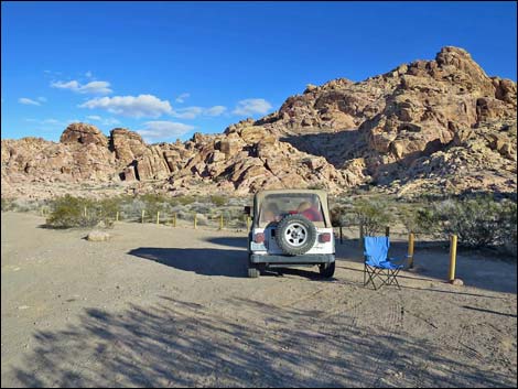
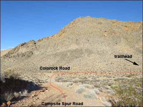
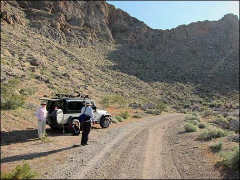 Colorock Canyon Trailhead (view E) |
Watch Out Other than the standard warnings about hiking in the desert, ... this is a fairly safe hike with no unusual hazards, although hikers will find a few Class-2 or maybe Class 3 rock scrambling moves in the narrow canyon. There are, however, some rocky edges where a careless step could send one over the edge; be extra careful around edges. While hiking, please respect the land and the other people out there, and try to Leave No Trace of your passage. This hike goes into designated Wilderness, so pay particular attention to respecting the land. This area is little used so nobody will find you if you need help, so be sure to bring the 10 Essentials. Cell phones don't work. |
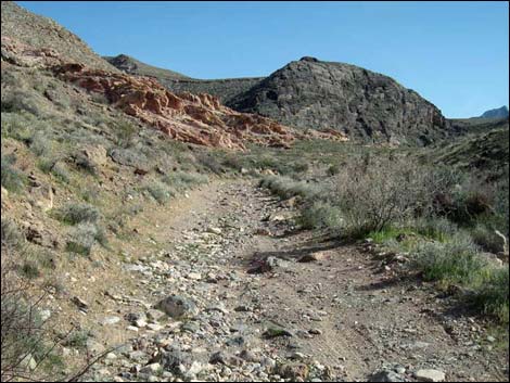
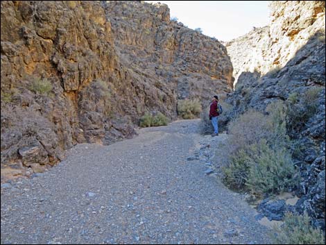
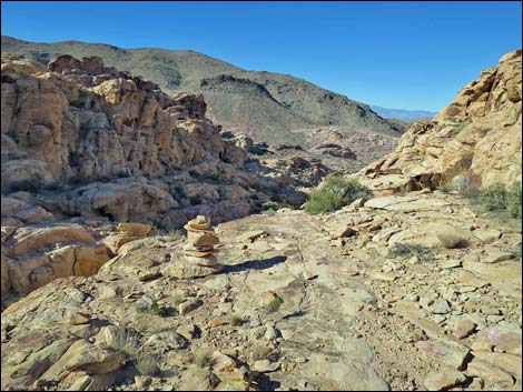
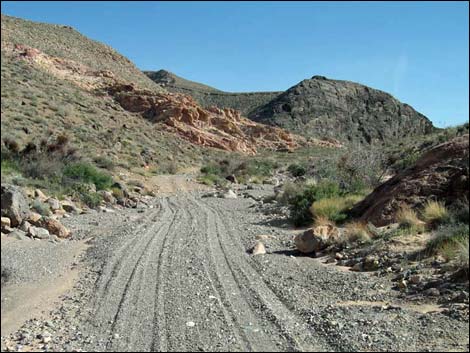 Colorock Road (view SE) |
Getting to the Trailhead This hike is located on the west edge of the Muddy Mountains Wilderness Area, about 1.5 hours north of Las Vegas near Valley of Fire State Park. From Las Vegas, drive northbound Interstate-15 for 33 miles to Exit 75E. Turn right onto Highway 169 and drive east 3.2 miles to Bitter Springs Trail Back Country Byway. Follow the Byway 4.1 miles southeast to Colorock Road. Turn right onto Colorock Road and follow it to the Hidden Valley Wash Route Trailhead. Colorock Road requires, at the least, a 2WD-HC vehicle. Park here; this is the trailhead. |
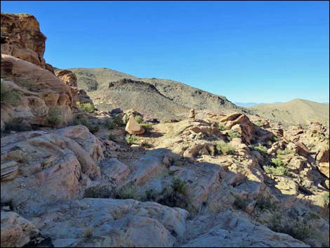
 Colorock Road (view S) |
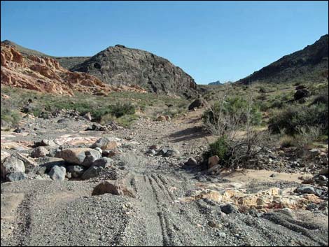
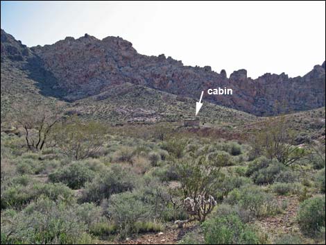
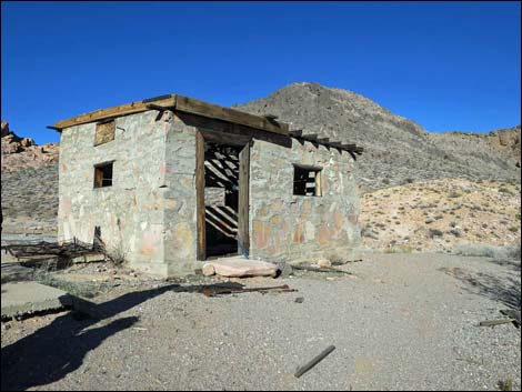
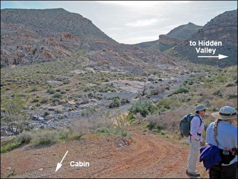
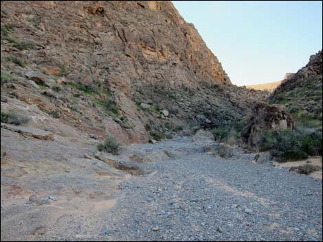
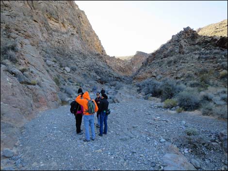
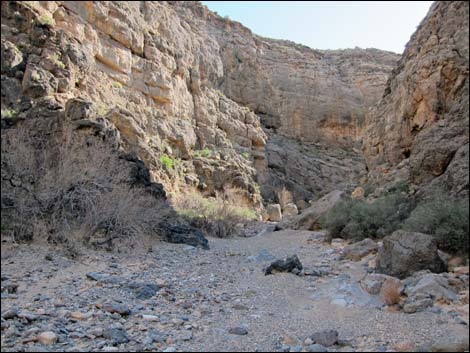
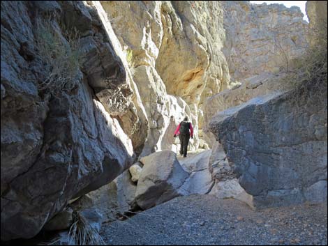
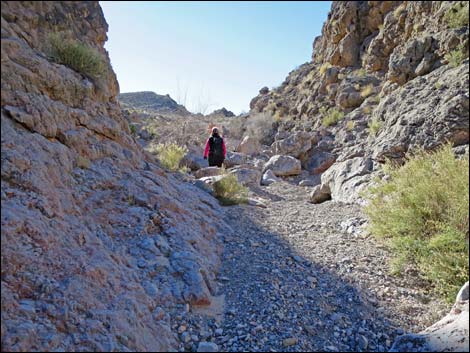
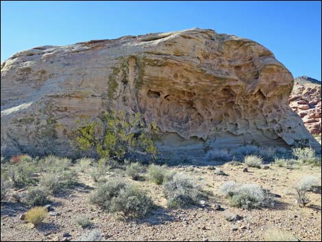
The Hike From the trailhead (Table 1, Waypoint 06), the hike follows the road up the canyon. The road crosses the wash and quickly becomes quite rocky, and then is washed out. Following ATV tracks in the wash upstream, Colorock Cabin (Wpt. 08) can be seen above the wash on the right. On the left against the cliffs, evidence of quarry work reminds hikers of people who once tried to pry a living out of this area. Past the cabin, the main wash enter Muddy Mountains Wilderness Area, and shortly an old road turns left out of the wash (Wpt. 09) to runs back left to the quarry site. Continuing southeast and up the wash, hikers soon enter the mouth of Colorock Canyon and the narrows. The wash runs south against a long, straight wall of dark limestone for about 300 yards, then enters a more open area where the canyon bends hard to the left. |
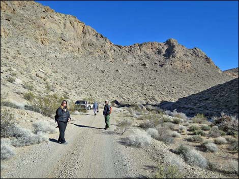
 Colorock Road (view S) |
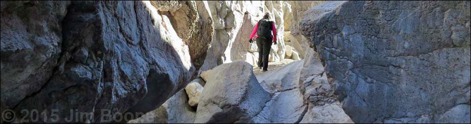
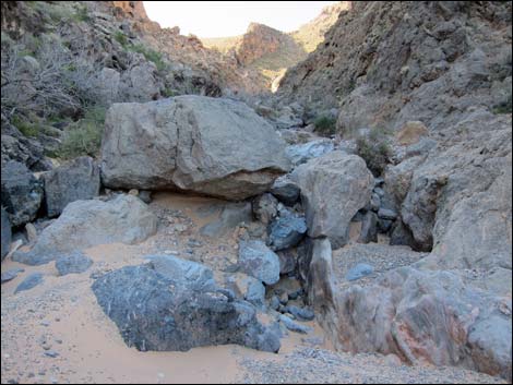
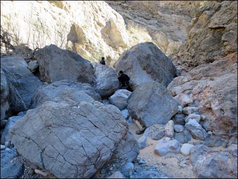
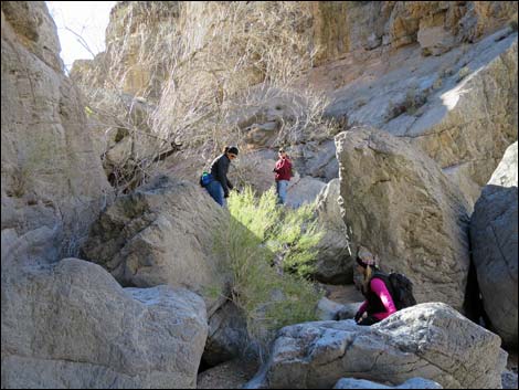
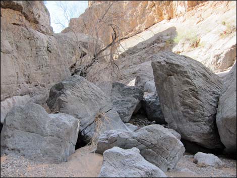
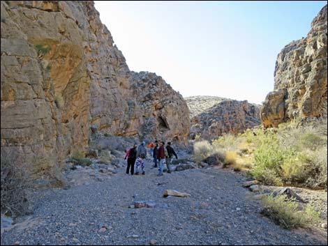
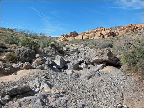
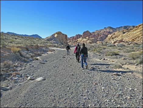
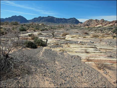
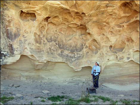
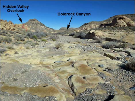
Continuing up the wash, hikers encounter more canyon narrows, but this time the wash is choked full of large boulders that require a few moments of route finding and a few Easy-Class-3 rock scrambling moves, but none that should block hikers from getting through the canyon. Unfortunately, this fun section of narrows is short -- only about 100 yards long. Beyond the boulders, the canyon widens a bit, and the wash is open. Then at about a mile out, the canyon opens into Hidden Valley. Hidden Valley is a broad bowl surrounded by sandstone cliffs and limestone cliffs at the south end, and then by the imposing cliffs of Muddy Mountain at the north end. Between, the green valley bottom flats are punctuated by colorful sandstone domes -- quite a scenic area, and the entire view is Wilderness. Hiking up the sandy Hidden Valley Wash, hikers repeatedly encounter sculpted bedrock sandstone where the wash has eroded away the rock, but this depends on the amount of gray, limestone gravels that have recently wash down from the mountains. |
 Colorock Cabin in the distance (view SW) |
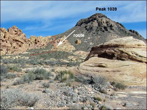
As the valley opens up, hikers pass beneath a relatively high peak (Peak 1039) on the right. This hike exits Hidden Valley via the Arch Trail, which runs on the other side of Peak 1039. So here, hikers need to make a choice of exit routes. Hikers looking for the shortest loop can exit the wash to the right and head west as soon as the angle of the cliffs lie back enough to allow hikers to head cross-country across the slopes to the Arch Trail. An easier, but also short exit, is to hike up the wash to where the Arch Trail enters the wash (Wpt. 11). There are a lot of biological soils crusts in Hidden Valley, so staying in the wash, on old roads, and on trails will reduce human impacts on the plant and soil community. For hikers with a little more time, there is a very nice rock art site just up the valley that makes a nice "destination" for the loop hike. Hiking up the wash, keep an eye out on the right. For hikers with lots of time, connect with the Arch Trail and walk out to Sandstone Arch. |
 Colorock Cabin (view NW) |
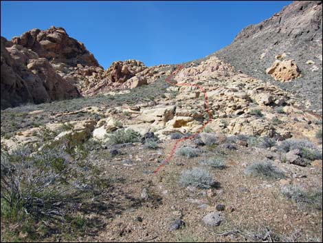
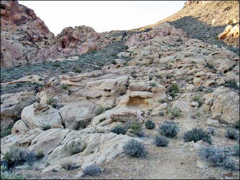
From where Hidden Valley Wash encounters the Arch Trail (Wpt. 11), the route turns right and starts up the old dirt road towards a big patch of yellow sandstone that lies up against the southwest side of Peak 1039. The old road ends at what is now a faint turn-around (Wpt. 05), and a footpath continues up the hill to the sandstone. The trail, intermittent dirt and marked with cairns in the rocks, stays towards the center of the sandstone, then drifts to the left edge and eventually exits the sandstone onto a tongue of gray limestone gravels between yellow sandstone patches. The trails is washed out in this area, but can be followed as it makes short switchbacks climbing the hillside and eventually crests out on the ridgeline in a rocky area, which is Hidden Valley Overlook (Wpt. 04). From the overlook, the trail descends across the rocky hillside, but the trail is obvious. The trail runs down into a gully overlooked by a thumb of sandstone. At the base of the thumb, the trail turns hard left and climbs natural ledges onto a low saddle (Wpt. 03). |
 Hidden Valley Wash (view SE from Colorock Cabin) |
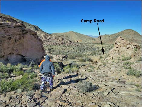
Continuing over the sandstone following cairns and intermittent bits of trail, the Arch Trail passes a Wilderness boundary sign (Wpt. 02) and shortly drops into the Arch Trail Trailhead (Wpt. 01). The loop route now follows dirt roads. From the Arch Trail Trailhead, the route follows the short spur road out and then right on a road that leads into the Colorock Camp Area. It is shortest to stay left along the wash rather than turn right into campsites. Past the camp area, the Colorock Camp Road runs north over a low saddle and down a canyon to intersect Colorock Road. Near the road intersection, hikers can look right and see vehicles at the trailhead. Turning right at the intersection with Colorock Road, hikers walk some 0.4 miles back to the Colorock Canyon Trailhead. |
 Hidden Valley Wash, entering Colorock Canyon (view SE) |
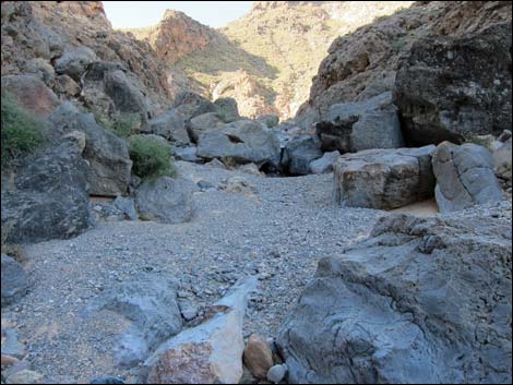
 Hidden Valley Wash, mouth of Colorock Canyon (view S) |
 Colorock Canyon obstacles (view S) |
 Colorock Canyon gravel wash and obstacles (view S) |
 Colorock Canyon gravel wash (view E) |
 Colorock Canyon obstacles (view E) |
 Colorock Canyon obstacles (view S) |
 Colorock Canyon obstacles (view S) |
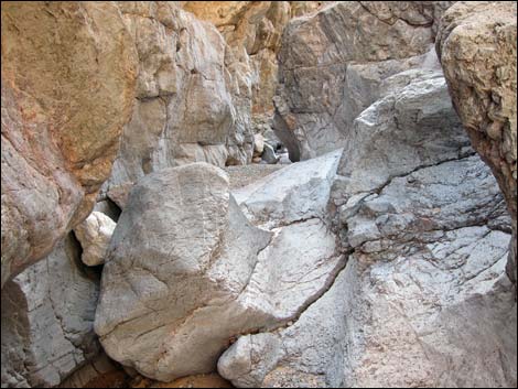 Colorock Canyon obstacles (view S) |
 Colorock Canyon, last of the obstacles (view S) |
 Colorock Canyon wash (view S) |
 Colorock Canyon wash (view S) |
 Exiting Colorock Canyon (view SW) |
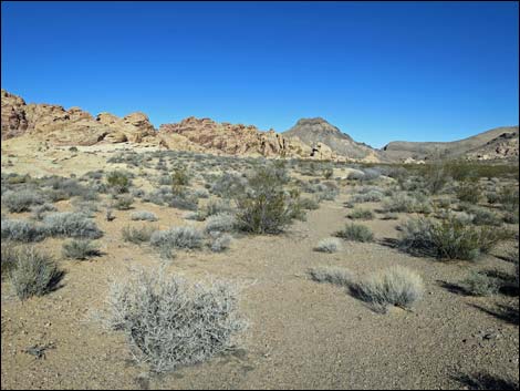
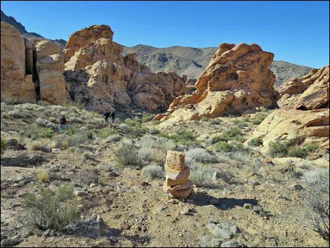
 Entering Hidden Valley (view SW) |
 Hidden Valley Wash (view SW) |
 Looking back, the Arch Trail is visible on Peak 1039 (view NW) |
 Hidden Valley Wash, bedrock section (view S) |
 Hidden Valley Wash, gravel section (view S) |
 Hidden Valley Wash, mixed bedrock and gravels (view S) |
 Native people's shelter site (view SW) |
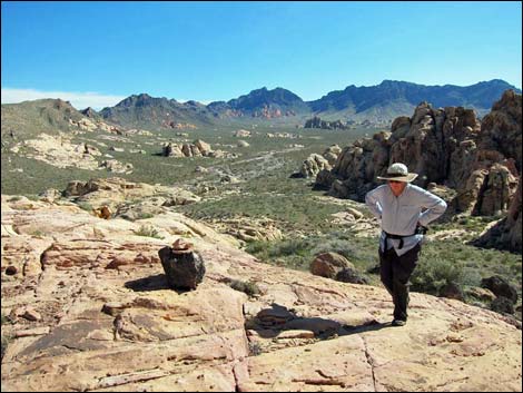
 Hiker admiring handiwork (view SW) |
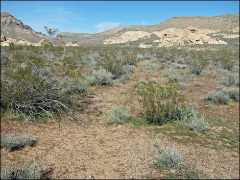 Faint two-track old road runs parallel to Hidden Valley Wash (view N) |
 Faint two-track old road runs parallel to Hidden Valley Wash (view N) |
 Faint two-track old road runs parallel to Hidden Valley Wash (view N) |
 Hidden Valley Wash, returning downstream (view N) |
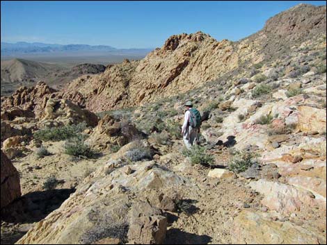
Arch Trail on flank of Peak 1039 (view N from Hidden Valley Wash) |
 Arch Trail runs up rocky, sandstone area (view NW) |
 Arch Trail runs up rocky, sandstone area (view NW) |
 Looking back, hiker on Arch Trail in sandstone with cairn (view NE) |
 Hiker descending Arch Trail (view NW from H.V. Overlook) |
 Hiker descending Arch Trail (view NW) |
 Arch Trail marked with large cairn (view W) |
 Cairn marks Arch Trail across sandstone (view W) |
 Cairns and intermittent trail across sandstone (view W) |
 Hikers descending towards Arch Trail Trailhead (view NW) |
 Passing the last campsite |
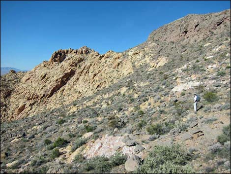
 Descending Camp Road towards Colorock Road (view N) |
 Hikers on Colorock Road arriving at the trailhead (view E) |
Table 1. Hiking Coordinates and Distances based on GPS Data (NAD27; UTM Zone 11S). Download hiking GPS waypoints (*.gpx) file.
| Wpt. | Location | UTM Easting | UTM Northing | Elevation (ft) | Point-to-Point Distance (mi) | Cumulative Distance (mi) | Verified |
|---|---|---|---|---|---|---|---|
| 06 | Wash Trailhead | 705876 | 4027012 | 2,808 | 0.00 | 0.00 | GPS |
| 08 | Colorock Cabin | 706005 | 4026598 | 2,845 | 0.35 | 0.35 | GPS |
| 09 | Old Road Crosses Wash | 706058 | 4026586 | 2,836 | 0.04 | 0.39 | GPS |
| 11 | HV Wash at Arch Trail | 706020 | 4025367 | 2,987 | 0.98 | 1.37 | GPS |
| 05 | End of Old Road | 705937 | 4025640 | 3,057 | 0.22 | 1.59 | GPS |
| 04 | Hidden Valley Overlook | 705866 | 4025894 | 3,247 | 0.18 | 1.77 | GPS |
| 03 | Sandstone Ridge | 705588 | 4026159 | 3,021 | 0.33 | 2.10 | GPS |
| 02 | Wilderness Boundary Sign | 705407 | 4026284 | 2,913 | 0.17 | 2.27 | GPS |
| 01 | Arch Trail Trailhead | 705412 | 4026301 | 2,905 | 0.01 | 2.28 | GPS |
| 06 | Colorock Canyon Trailhead | 705876 | 4027012 | 2,808 | 0.69 | 2.97 | GPS |
Happy Hiking! All distances, elevations, and other facts are approximate.
![]() ; Last updated 240330
; Last updated 240330
| Hiking Wilderness Areas | Hiking Around Las Vegas | Glossary | Copyright, Conditions, Disclaimer | Home |