
Birding Around Las Vegas, Outside the Las Vegas Valley, Pahranagat Valley

 Pahranagat National Wildlife Refuge, south boundary sign (view NW) |
Description Pahranagat National Wildlife Refuge, administered by the U.S. Fish and Wildlife Service, covers 5,380 acres along a ten-mile section of the White River in Pahranagat Valley. The refuge includes a spring-fed riparian valley corridor with a series of broad, shallow lakes, brushy thickets, bulrush and cattail marshes, native grass meadows, and large cottonwood trees, all of which are surrounded by Mojave Desert scrub. These wetlands in the desert support a great variety of wildlife, and the refuge is an important stopping point for waterfowl and other migratory birds, and it can be a good place for watching dragonflies. Visitors to the refuge can stop at the visitor center and talk with refuge personnel and learn about the area. The refuge, located in the Pacific Flyway, was established in 1963 to protect riparian habitat for migratory waterfowl and other migratory gamebird species in this arid area. In this respect, the refuge has been great a success, and more than 230 species of birds have been recorded. Link to map. |
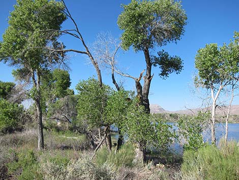 Upper Pahranagat Lake (view SW) |
Until the end of the Ice Age, the White River flowed through the Pahranagat Valley, but now the riverbed is dry, and water comes from large, thermal springs. Water is captured on the refuge in four main impoundments: North Marsh, Upper Pahranagat Lake, Middle Marsh, and Lower Pahranagat Lake. Maynard Lake, at the southern edge of the refuge, occasionally has water during wet years. Recreational opportunities on the Refuge include birding, wildlife observation, camping, fishing, and hunting. Camping and picnicking are permitted along the east shoreline of Upper Lake. Birders need to realize that this area is hunted and fished. There are a few trails in the refuge, and birding at Lower Lake and Middle Marsh is only from the roads. The access road to these areas gets little use, but use pullouts and watch for traffic. At North Marsh and Upper Lake, there is good viewing from many of the campsites along the access road. There is also a dike separating North Marsh from Upper Lake where birders can walk out and get views up and down the lake. There is a paved trail on the dam at the south end of Upper Lake. The trail is a good place to walk out and view the lake, the trees on the far side, and the marsh below the dam. |
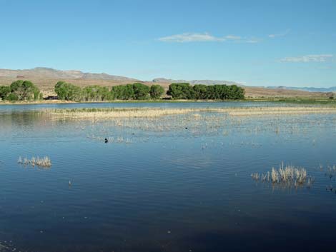 Lots of water and trees at Upper Pahranagat Lake |
Location The Pahranagat Valley is located about 90 miles northeast of Las Vegas on Highway 93 in Lincoln County. To get to Pahranagat National Wildlife Refuge from Las Vegas, drive north on Interstate 15 to Highway 93. Turn left onto Highway 93, and then drive north for 58.2 miles to the southern boundary of the refuge at Maynard Lake (Table 1, Site 700). Continue north past Lower Lake (61.6 miles), Middle Marsh (65.6 miles), the Visitor Center (66.3 miles), and Upper Lake to the turnoff to Upper Lake (69.5 miles), which is just past the lake itself (Site 701). If you are watching the highway signs, this turnoff is 3.7 miles before (south of) Alamo. With a 70-mph speed limit on this 2-lane road, it takes about 1 hour to get to from the Interstate to Upper Lake. There are several viewpoints along the highway to safely pull off the pavement, park, and look down on the lakes. Each of the lakes has an access road (the old highway) that parallels the main highway. Access to Middle Marsh and Lower Lake is prohibited during some times of year. |
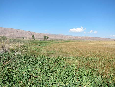 Middle Marsh |
Hours Always open. Fees None. Specialties Birding is best during the spring and fall migrations when large numbers of songbirds, waterfowl, shorebirds, wading birds, and raptors can be seen. Winter waterfowl birding is good too. Common ducks include Pintail, Cinnamon and Green-wing Teal, Mallard, and Redhead. |
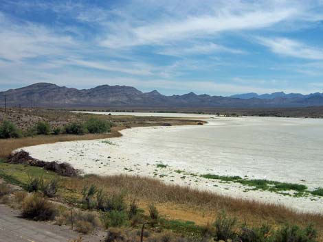 Lower Pahranagat Lake dries during summer (view S) |
Coots always seem to be abundant. Great Blue Herons, Great Egrets, Snowy Egrets, and White-faced Ibis can be found around the lakes and in the marshes. Black-necked Stilts, American Avocets, Spotted Sandpipers, Wilson's Phalaropes, and other shorebirds are found feeding in shallow water and on the edges of the lakes. Greater Sandhill Cranes can be seen during spring (February and March) and fall (October and November) migrations. Hawks are common during winter, as are Bald and Golden Eagles. During spring and summer, the cottonwood and willow trees provide habitat for nesting warblers, orioles, and flycatchers. Open fields in and around the refuge attract Loggerhead Shrikes, Western Meadowlarks, Mourning Doves, various species of blackbirds, Gambel's quail, Greater Roadrunners, and various species of sparrows. Watch for unusual species too, such as the Reddish Egret seen during September 2004. |
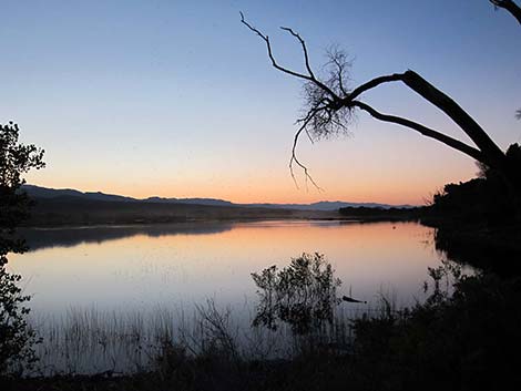 Southeast end of Upper Lake (view NW) |
Other species of wildlife are common on the refuge. Predators include kit foxes, coyotes, and mountain lions. A variety of rodent species inhabit the refuge. Mule deer are most abundant during winter months. Various species of lizards are common on the refuge; watch for desert spiny lizards, zebra-tail lizards, and western whiptails. If the number of fishermen is any guide, there are many fish in the lake too. For More Information Visit the refuge website, call 775.725.3417, or write the refuge manager at: Refuge Manager; Pahranagat National Wildlife Refuge; Box 510; Alamo, NV 89001. Visitors to the refuge can stop at the Visitor Center, located between Upper Lake and Middle Marsh (watch for signs along the highway) and learn about the area. Download a copy of the 2017 Refuge Brochure (PDF). A bird list is available online (snatch a PDF copy here), and copies are placed at the Visitor Center and information kiosks around the refuge. |
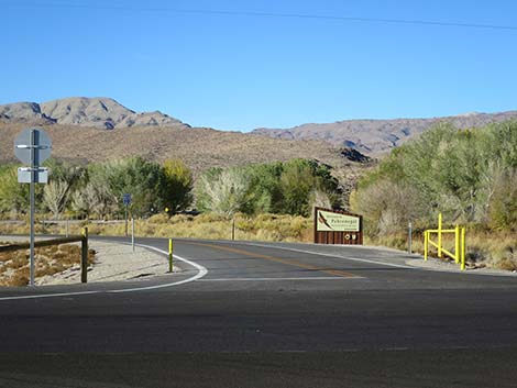 Pahranagat Visitor Center Road (view W from Highway 93) |
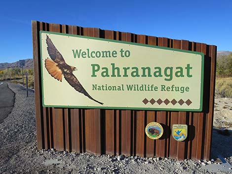 Pahranagat National Wildlife Refuge entrance sign (view W) |
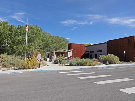 Visitor Center entrance is on the far side of the building (view E) |
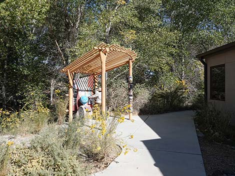 Outdoor exhibit at the Pahranagat NWR Visitor Center |
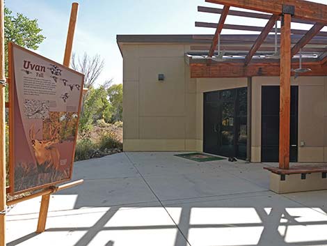 Visitor Center front door is on the backside of the building (view S) |
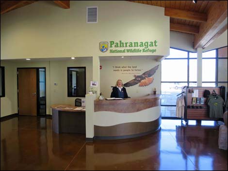 Friendly volunteer inside Pahranagat NWR Visitor Center |
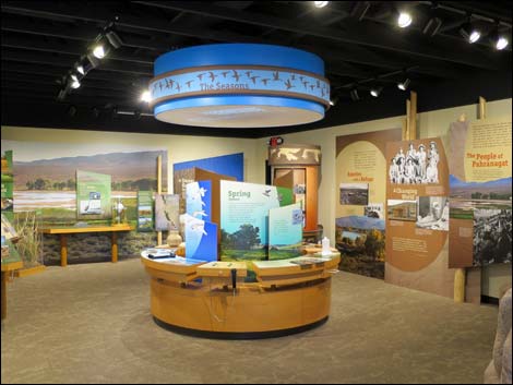 Indoor exhibit at the Pahranagat NWR Visitor Center |
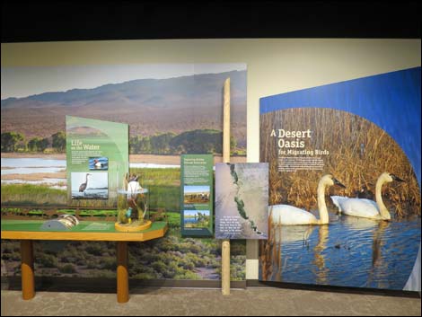 Indoor exhibit at the Pahranagat NWR Visitor Center |
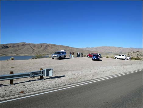 Birding over Lower Lake from Highway 93 |
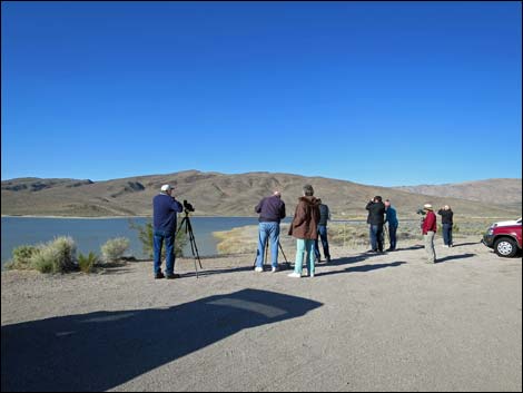 Birding over Lower Lake from edge of Highway 93 |
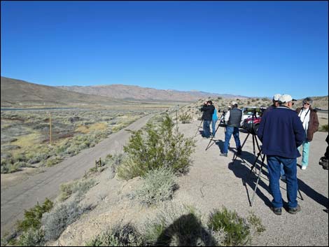 Birding over Lower Lake from edge of Highway 93 |
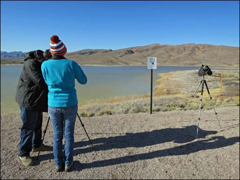 Birding over Lower Lake from edge of Highway 93 |
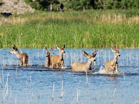 Watch for more than birds in the water! |
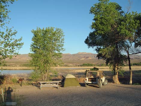 Campsite on Upper Lake (view NW) |
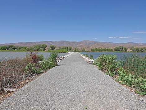 Upper Lake dike (view W) |
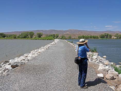 Birding Upper Lake dike during summer (view W) |
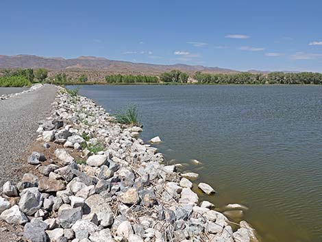 North side of Upper Lake dike is North Marsh (view NW) |
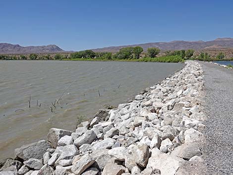 South side of Upper Lake dike (view SW) |
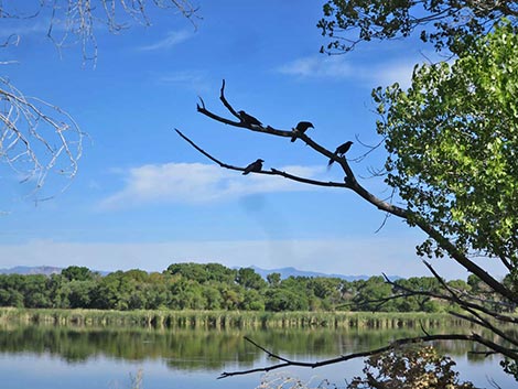 Birds in trees over North Marsh (view NW) |
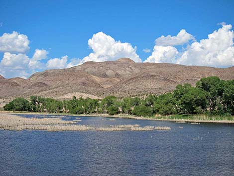 North Marsh (view N) |
 An accessible trail runs out onto Upper Lake Dam (view W) |
 Davenport Trail runs from Visitor Center to Upper Lake (view W) |
Table 1. GPS Coordinates for Highway Locations (NAD27; UTM Zone 11S). Download Highway GPS Waypoints (*.gpx) file.
| Site | Location | UTM Easting | UTM Northing | Latitude (N) | Longitude (W) | Elevation (ft) | Verified |
|---|---|---|---|---|---|---|---|
| 0442 | Lower Pahranagat Lake | 670047 | 4121341 | 37.22492 | 115.08332 | 3,205 | Yes |
| 0443 | Upper Pahranagat Lake | 666221 | 4129922 | 37.30292 | 115.12451 | 3,334 | Yes |
| 0486 | Hwy 93 at Pahranagat HQ Rd | 667132 | 4126732 | 37.27401 | 115.11495 | 3,335 | Yes |
| 0491 | Pahranagat NWR HQ | 666693 | 4126123 | 37.26860 | 115.12005 | 3,304 | Yes |
| 0700 | Maynard Lake | 675178 | 4117750 | 37.19162 | 115.02637 | 3,130 | Yes |
| 0701 | Hwy 93 at Upper Lake Rd | 665801 | 4131460 | 37.31685 | 115.12891 | 3,430 | Yes |
| 0871 | Hwy 93 at Tikaboo Rd | 666809 | 4127433 | 37.28039 | 115.11845 | 3,326 | Yes |
| 1527 | Hwy 93 at Lower Lake Rd | 669712 | 4121826 | 37.22935 | 115.08699 | 3,202 | Yes |
| 1528 | Hwy 93 at Middle Lake Road | 667683 | 4125668 | 37.26433 | 115.10899 | 3,287 | Yes |
| 1529 | Middle Marsh Rd at Dike Trailhead | 668243 | 4123684 | 37.24635 | 115.10312 | 3,213 | Yes |
Happy birding! All distances, elevations, and other facts are approximate.
![]() ; Last updated 240831
; Last updated 240831
| Birding Around Las Vegas | Southern Nevada Birds | Guide Service | Copyright, Conditions, Disclaimer | Home |