
Hiking Around Las Vegas, Grand Canyon National Park

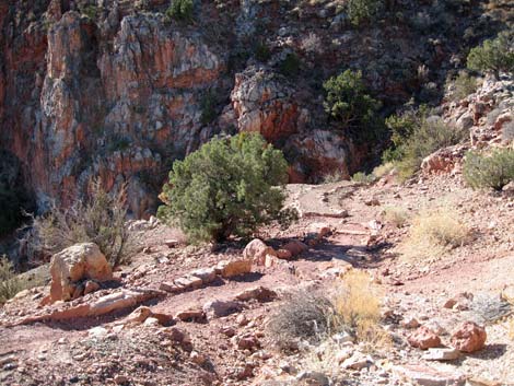 Heading for the edge (view S) |
Overview The Page Spring Trail (also called the Miner’s Trail) is one of three routes that lead down off Horseshoe Mesa to the Tonto East Trail, this one running down the southeast side and ending in Hance Canyon. This trail is the steepest, narrowest, and most exposed of the three, and from above with an 8-day backpack and evening shadows, the trail through the upper Redwall Limestone looks quite foreboding. The trail passes old copper mines and mining equipment at the top and bottom of the Redwall, and good water is available at Page Spring at the end of a short spur trail. |
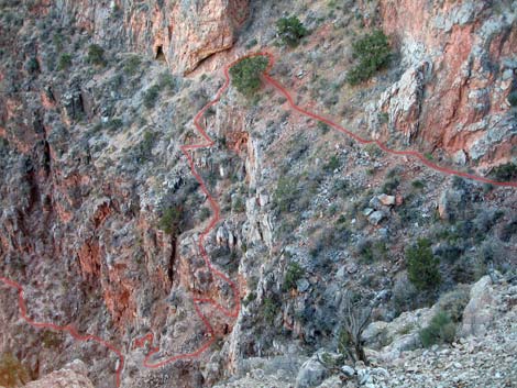 Looking over the edge of the Red Wall at the trail below (view S) |
Through the Redwall, the trail requires careful attention every step of the way, but the trail crew worked on it during the fall of 2005, so at least there is a trail (such as it is). Below the Redwall, the trail is steep dirt with loose gravel and rocks, but the trail is fine and the grades moderate as the trail nears the Tonto East Trail on the edge of the Hance Canyon gorge. From an unmarked trail junction where the Grandview Trail first hits the east edge of Horseshoe Mesa (long before getting to the stone building), the Page Spring Trail runs south a few yards along the east edge of Horseshoe Mesa, then jumps off the edge of the Redwall following a narrow track through precipitous ledges. Below the Redwall, the trail mostly runs straight down hillsides to the Tonto East Trail. Link to trail map. |
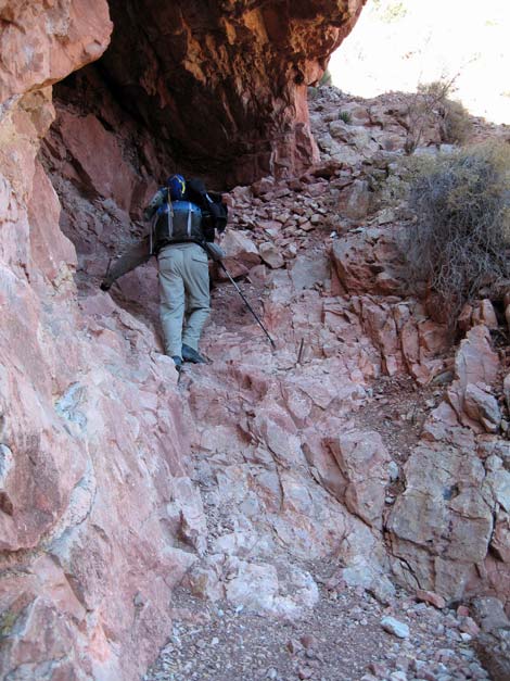 Scramble-down below the cave (view N). This looks easy, but being at the lip of the Redwall, the pucker factor is high. |
Watch Out Other than the standard warnings about hiking in the desert, ...the trail through the Redwall is steep, narrow, quite exposed, and includes some 2nd-class and 3rd-class scramble-downs. There are many places to slip on the loose gravel and fall into oblivion, so be careful every step of the way. Mines are inherently interesting, but it is never safe to enter holes in the ground. We drank raw water dripping from the ceiling of the Page Spring grotto, but it would have been safer to treat it; treat water from the springpool. While hiking, please respect the land and the other people out there, and try to Leave No Trace of your passage. Even from the South Rim, this is a long hike, so be sure to bring the 10 Essentials. Getting to the Trailhead This hike is located on the South Rim of the Grand Canyon, about 5 hours southeast of Las Vegas. From Las Vegas, drive out to the South Rim of Grand Canyon National Park. From the South Rim Visitor Center (Table 1, Site 811), drive east on South Entrance Road (Hwy 180) to Highway 64 (Site 951), the road to Desert View. Turn left towards Desert View and drive east for about 12 miles to the Grandview Point turnoff (Site 952). Turn left onto the Grandview Point access road and drive north to the parking area at the end of the road (Site 953). Park here; this is the trailhead. |
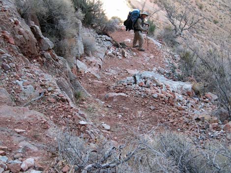 Lots of loose gravel on the trail |
The Hike From the trailhead on the rim (Table 2, Waypoint 1), the route follows the Grandview Trail for about 2.7 miles to Horseshoe Mesa (Wpt. 9), which is the top of the Redwall Limestone and about half-way down to the Colorado River. The trail begins in the Transition (Yellow Pine Forest) Life Zone where the forest is dominated by Ponderosa Pine. Just over the edge of the rim, the trail begins into the Upper Sonoran (Pinyon-Juniper Woodland) Life Zone where the forest is dominated by Two-needle Pinyon Pine and Utah Juniper, with a few Douglas Fir to keep things interesting. The top of Horseshoe Mesa is still in the Upper Sonoran (Pinyon-Juniper Woodland) Life Zone, but the vegetation is dominated by a low-growing forest of Utah Juniper with the distinct flavor of the Mojave Desert (Mojave Desert Scrub). For details of getting down to Horseshoe Mesa, see the Grandview Trail description. |
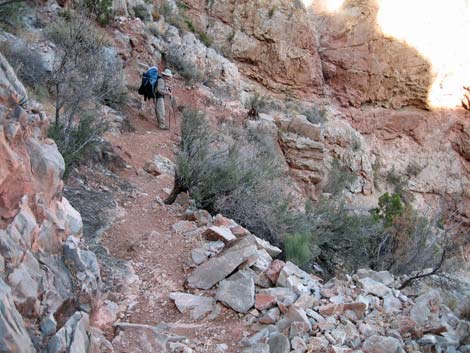 Some parts of the trail aren't so bad (view N) |
Just before getting to Horseshoe Mesa, the Grandview Trail runs onto a ridge overlooking the west edge of Horseshoe Mesa and Cottonwood Canyon (Wpt. 7). The trail then contours down and east across the toe of the ridge, past a shallow mine (part of Grand View Mine; Wpt. 8), to a flat area on the east edge of Horseshoe Mesa overlooking Hance Canyon (Wpt. 19). At this point, there is an unmarked T-intersection. To the left, the Grandview Trail continues north for about 0.3 miles to the old stone building; to the right, the Page Spring Trail runs south and over the edge of the cliff. Turning south on the Page Spring Trail, the trail quickly passes on old cable winch that was used to send materials down to mines over the edge and bring ore back to the top of Horseshoe Mesa. The winch had an arm attached to it that a mule (or some unlucky miner) could push around in circles to wind the cable up. It looks like the drum brake still works. There is a dangerous mine on the hillside above the trail. The adit runs back a ways to a shaft. I tried to steady my camera against a timber holding up the roof (barely touched it), and it gave a sickening creak, so I got out of there fast. This mine is now gated. |
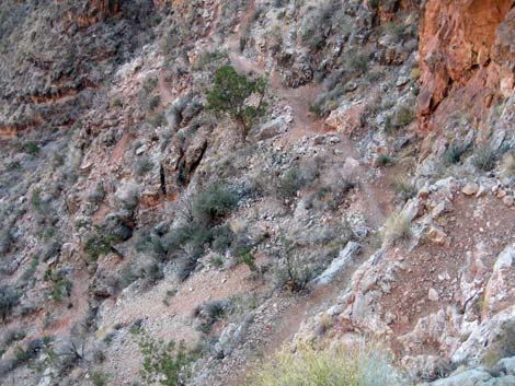 Page Spring Trail drops very steeply |
Past the cable winch, the trail runs over to the edge of the mesa (adjacent to the rock face) and follows a steep dirt gully over the edge. A few wooden stairs lead into a cavernous opening on the face of the Redwall cliff. The trail leaves the cave via a short 3rd-class scramble-down to a ledge that runs out onto the face of the Redwall. From the end of the ledge, the steep, narrow, rocky, scree covered, airy, rocky "trail" switchbacks down ledges and short scramble-downs all the way to the bottom of the Redwall. The trail was probably 2nd-class, but with an 8-day pack, it seemed like 3rd-class. Trekking poles were very helpful for stability (except on the scramble-downs), and with full packs, the descent took 30 minutes. Two notes from the voice recorder: (1) ... steep, rocky, and exposed, the trail is OK, but parts are narrower and more precarious than others. (2) The trail down to this point (the bottom) was thrilling -- steep and narrow with lots of exposure -- but reasonable and doable if you go slow. |
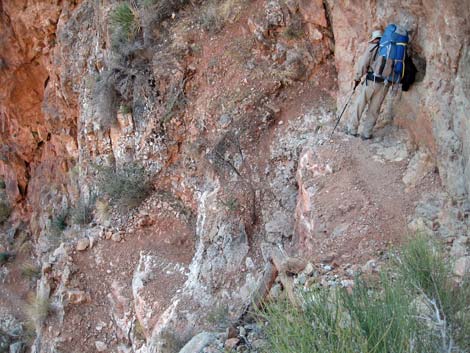 Page Spring Trail drops very steeply |
At the bottom of the Redwall (Wpt. 20), the trail bends to the northeast, crosses a gully filled with mine tailings, and runs down along the base of the Redwall that is dipping at a fair grade at this point. Watch for the “wait-a-minute” bushes (Catclaw Acacia) along the trail. About 4 minutes below the gully, the trail passes the entrance to the Last Chance Mine, which was adorned with an ore cart, something that looks like an air pump, a jack to hold rock drills, a wash pan, and other stuff. While mines are never safe to enter, this one runs straight back into the cliff, passing some short side tunnels, for 2-3 minutes to a fork. The main adit (a horizontal mine tunnel) continues straight for another minute to a dead end, while the fork to the left runs back for 1-2 minutes to a shaft (a vertical mine tunnel) with collapsed wooden floor and other structures. The support beams look particularly unstable back by the shaft. Nicely preserved ore-car tracks start before the fork and continue to the left, and there are lengths of old stovepipe that seem to have been used for an air-supply system all along the tunnel. There are nice examples of blue copper ore in the main adit and side alcoves. Please be careful with the historic objects. The mine entrance was gated in 2009. |
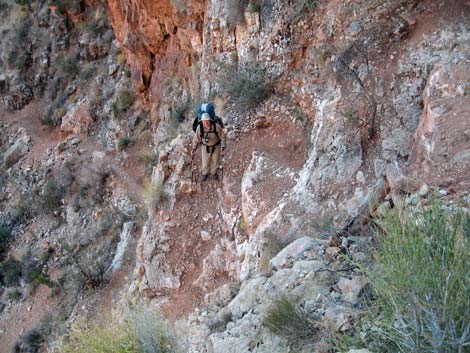 but others are a bit precipitous (view S) |
Below the mine, the trail continues along the base of the Redwall until switchbacking and descending to a junction with the Page Spring Spur Trail (Wpt. 22), which is marked with a sign and an old wheelbarrow with a metal wheel. To this point, the trail is steep dirt with scree and rocks, and it takes about 20 minutes with a full pack. From the junction, the Page Spring Spur Trail runs south across the canyon for about 5 minutes to Page Spring (Wpt. 23). Page Spring is in a grotto on a rocky ledge at the base of the Redwall, a few feet above the ground. The grotto is filled with Maidenhair Ferns, and there are Redbud and Utah Juniper trees in this shady area. Bighorn Sheep use the spring (watch for scat), so the water in the pool might not be the best to drink, but clean water drips from the ceiling of the grotto. |
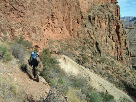 Base of the Redwall; approaching Last Chance Mine (view NE) |
Continuing from the Page Spring Spur Trail junction, the trail descends across the steep dirt hillside with lots of gravel for another 15 minutes, then cuts straight down to the wash (Wpt. 24) and crosses to the other side. Below the trail junction, the vegetation becomes typical of the Upper Sonoran (Mojave Desert Scrub) Life Zone dominated by low-growing shrubs and bunchgrasses. The shrubs include Skunkbush Sumac, Mormon Tea, Four-wing Saltbush, Matchweed, and some composite shrubs; there are fair numbers of Desert Trumpet and other buckwheats; and Soaptree Yucca becomes fairly common. Farther down, a variety of Beavertail Cactus with small pads (2-inch diameter) becomes common. |
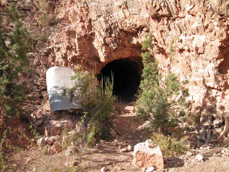 Last Chance Mine (entrance now gated) |
Across the wash, the trail follows the south edge of the gorge on a dirt trail with lots of rocks, but at more moderate grades. The shady, well-vegetated, north-facing hillside is dotted with short Ash trees. About 20 minutes below the wash crossing, the trail crosses a low ridge and enters the Hance Creek drainage, proper, and there is a small campsite just below the trail. From the low ridge, the trail turns up Hance Canyon and drops at a moderate grade to an unmarked junction with the Tonto East Trail (Wpt. 25). From the junction, the Tonto East Trail runs south for about 20 minutes to the Hance Creek camping area (Wpt. 26). In the other direction, the trail runs north and then west for about 3 hours to Cottonwood Canyon. |
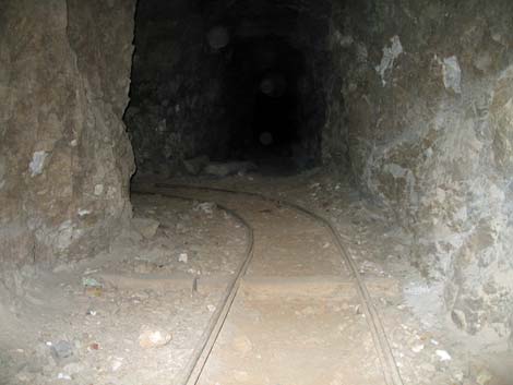 inside Last Chance Mine |
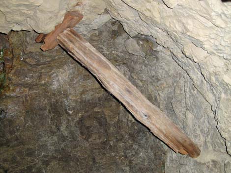 inside Last Chance Mine |
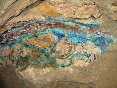 inside Last Chance Mine |
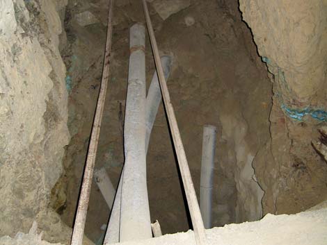 inside Last Chance Mine |
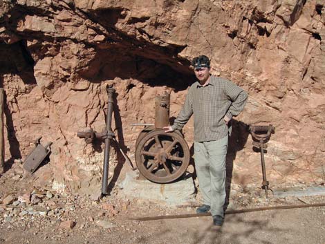 Mining debris outside Last Chance Mine |
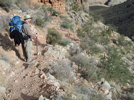 Hiker departing past Last Chance Mine |
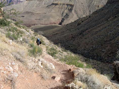 Hiker continuing past Last Chance Mine |
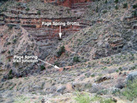 Page Spring (view S from base of Redwall) |
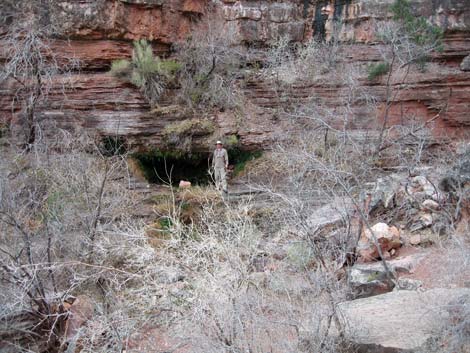 Page Spring (view S) |
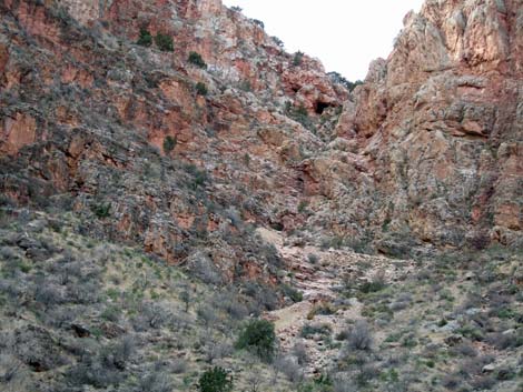 Looking back up at the trail through the Red Wash |
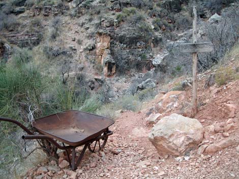 Page Spring Spur trail junction (view S) |
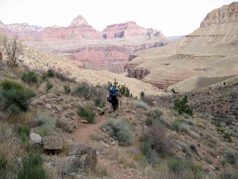 Page Spring Trail below Page Spring junction (view NE) |
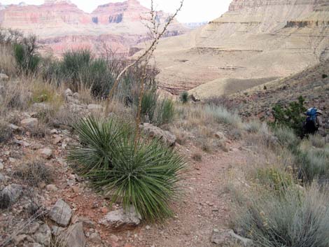 Hiker continuing down easier terrain (view NE) |
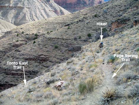 Hiker at Page Spring -- Tonto East Trail junction (view SE) |
Table 1. Highway Coordinates (NAD27, UTM Zone 12S). NOTE: This is UTM Zone 12. Download Highway GPS Waypoints (*.gpx) file.
| Site # | Location | Latitude (°N) | Longitude (°W) | UTM Easting | UTM Northing | Elevation (feet) | Verified |
|---|---|---|---|---|---|---|---|
| 811 | Visitor Center, Canyon View Information Plaza | 36.0590 | 112.1085 | 400166 | 3990857 | 7,092 | Yes |
| 951 | Highway 180 at Highway 64 | 36.0519 | 112.1049 | 400477 | 3990072 | 7,104 | Yes |
| 952 | Highway 64 at Grandview Access Road | 35.9895 | 111.9920 | 410581 | 3983037 | 7,489 | Yes |
| 953 | Grandview Point parking area | 35.9979 | 111.9870 | 411039 | 3983967 | 7,418 | Yes |
Table 2. Hiking Coordinates (Waypoints; NAD27; UTM Zone 12S). Download Waypoints (*.gpx) file.
| Wpt. | Location | Easting | Northing | Elevation (ft) |
|---|---|---|---|---|
| 01 | Grandview Trailhead | 411047 | 3984027 | 7,418 |
| 07 | Campsite on ridge | 412042 | 3986128 | 5,019 |
| 08 | Mine shaft (adit) | 412093 | 3986147 | 5,026 |
| 10 | Trail junction (sign) | 412138 | 3986213 | 4,925 |
| 12 | Stone building | 412122 | 3986440 | 4,865 |
| 19 | Page Spring Trail | 412141 | 3986110 | 5,000 |
| 20 | Gully at bottom of Redwall | 412217 | 3986061 | 4,675 |
| 21 | Last Chance Mine | 412238 | 3986138 | 4,597 |
| 22 | Page Spring Trail junction | 412420 | 3986091 | 4,320 |
| 23 | Page Spring | 412473 | 3986021 | 4,272 |
| 24 | Crossing wash | 412693 | 3986413 | 3,932 |
| 25 | Tonto Trail junction | 413181 | 3986517 | 3,739 |
| 26 | Hance Creek campground | 413574 | 3986182 | 3,658 |
Happy Hiking! All distances, elevations, and other facts are approximate.
![]() ; Last updated 240326
; Last updated 240326
| Hiking the Grand Canyon | Hiking Around Las Vegas | Glossary | Copyright, Conditions, Disclaimer | Home |