
Backroads Around Las Vegas, Gold Butte
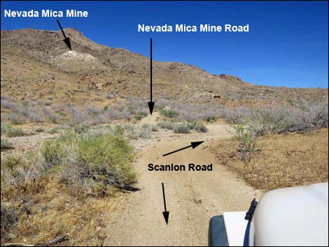 Scanlon Road, approaching Nevada Mica Mine Road (view E) |
Overview Nevada Mica Mine Road, a spur off Scanlon Road, is located out at the far southwest end of Gold Butte. The road runs through an old camp area where historic vehicles lie scattered about rusting in the desert sun, then continues up to the mine where muscovite (mica) was scraped from the hillside. This is an historic land with lots of grand scenery. The lower portion of the road is fairly smooth and without too many rocks and is passable in a 2WD high-clearance vehicle, but the upper portion requires 4WD because the road is steep, narrow, and quite rocky. The end of the road is best suited for ATVs and boots. For details past the last decent parking spot, see Nevada Mica Mine Trail. From Scanlon Road, the road runs 0.6 miles to Nevada Mica Mine, an exposure of remarkably abundant mica, but there are no pits or mine openings (one may have collapsed). Link to road map. |
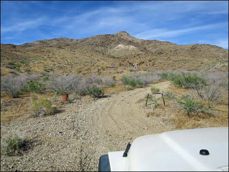 Beginning of Nevada Mica Mine Road (view NE) |
Watch Out Other than the standard warnings about driving in the desert, ... this is a wild and remote area without services of any kind (no restrooms, no water, no gas, no food). Bring what you need to survive. Be prepared and be self-reliant. It is a big place, but someone will eventually find you if you stay on a main road, but be prepared to survive alone for a day or two, or even longer on side roads. Consider signaling the tourist helicopters that traverse the area coming and going from the Grand Canyon. While out, please respect the land and the other people out there, and try to Leave No Trace of your passage. Also, this is a remote area, so be sure to bring the 10 Essentials. I don't know if it's enough to matter or not, but radioactivity was measured at the mine site and found to range from about 0.03 mR/hr (background) to 0.1 mR/hr (highest reading; US Atomic Energy Comm. Prelim. Reconn. 3333. Longwell et al., 1965). |
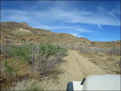 Road runs up broad canyon (view NE) |
Getting to Nevada Mica Mine Road Nevada Mica Mine Road is located out in Gold Butte at the northeast end of Lake Mead, about 4.5 hours northeast of Las Vegas. From Las Vegas, drive out Interstate 15 to about five miles before Mesquite (Exit 112). Turn right towards Riverside. Just across the Virgin River bridge, turn right and drive southwest on the paved Gold Butte Road to Whitney Pocket, then continue south on the unpaved Gold Butte Road to Gold Butte Townsite. In total, it is 44.9 miles from Interstate-15 to Gold Butte Townsite. From the townsite, continue southwest on what is now Scanlon Road. Drive south on Scanlon Road for 11.3 miles where Nevada Mica Mine Road and the mine site can be seen ahead across the wash climbing part way up Rattlesnake Peak. See also the Gold Butte Area overview map. |
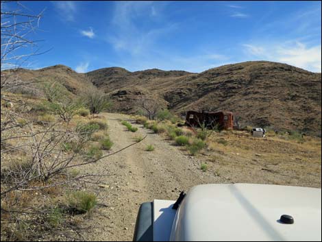 Approaching historic camp area (view S) |
The Road From Scanlon Road in Twin Springs Wash (Table 1, Site 1729), Nevada Mica Mine Road heads up onto the flanks of Rattlesnake Peak. The road runs up a bit of a canyon, then bends right and contours into the old camp and work area, which is recognized by the plethora of old vehicles and historic junk (Site 1730). The road climbs out of the camp area, passes a few more old vehicles, and quickly deteriorates. The road gets quite rough, then bends left into a flat area where a truckload of white quartz rock was spilled on the ground (maybe they rolled a truck here?). This spot makes the last place to stop and turn a truck around before the road gets quite narrow as it climbs up and across the hillside above. The road winds steeply through two switchbacks, then arrives at a third switchback. Drivers should stop here in the wide spot on the left, as it will be difficult to turn around anything bigger than an ATV a few yards ahead at the end of the road. In addition to the abundant mica, views from the mine site down into the canyon and out to the southwest are pretty good. |
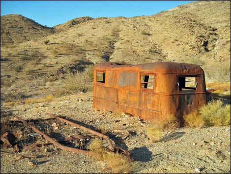 Old vehicles near the trailhead (view NE) |
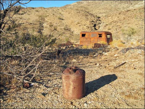 Old gear and vehicles near the trailhead (view NE) |
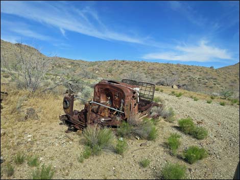 Passing on old vehicle; a good place to park & start walking (view E) |
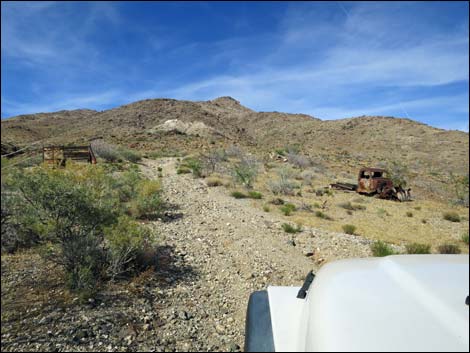 Approaching more old vehicles (view NE) |
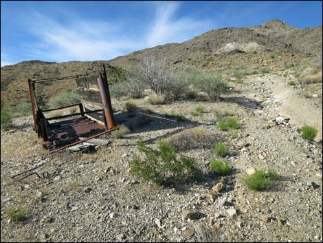 Close-up of old vehicle on the left (view NE) |
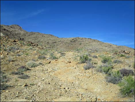 Road begins to get rocky crossing bedrock (view NE) |
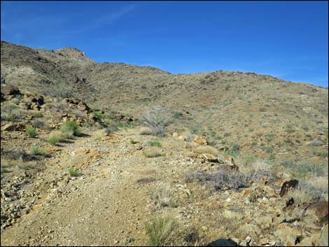 Rocky road crossing bedrock (view NE) |
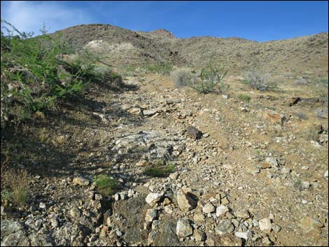 Steep road with loose rocks (view NE) |
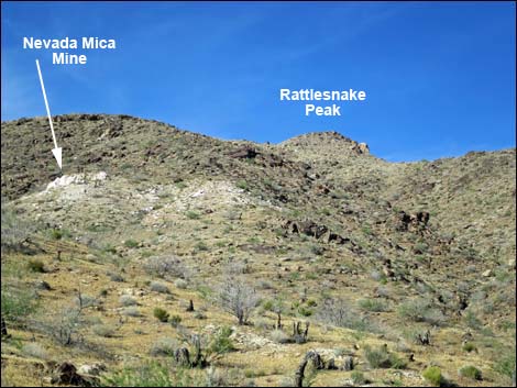 Nevada Mica Mine and quartz outcrops on hillside (view NE) |
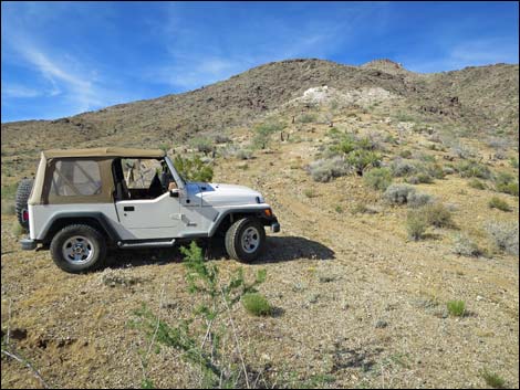 It is best to walk from here (view NE) |
Table 1. Highway Coordinates Based on GPS Data (NAD27; UTM Zone 11S). Download Highway GPS Waypoints (*.gpx) file.
| Wpt. | Location | Latitude (N) | Longitude (W) | Elevation (ft) | Point-to-Point Distance (mi) | Cumulative Distance (mi) | Verified |
|---|---|---|---|---|---|---|---|
| 1729 | Scanlon Rd at Nevada Mica Mine Rd | 36.18581 | 114.22650 | 3,244 | 0.00 | 0.00 | Yes |
| 1730 | Nevada Mica Mine Trailhead | 36.18593 | 114.22480 | 3,337 | 0.64 | 0.64 | Yes |
Happy Hiking! All distances, elevations, and other facts are approximate.
![]() ; Last updated 240326
; Last updated 240326
| Backroads Around Las Vegas | Hiking Around Las Vegas | Glossary | Copyright, Conditions, Disclaimer | Home |