Hiking Around Las Vegas, Lake Mead National Recreation Area
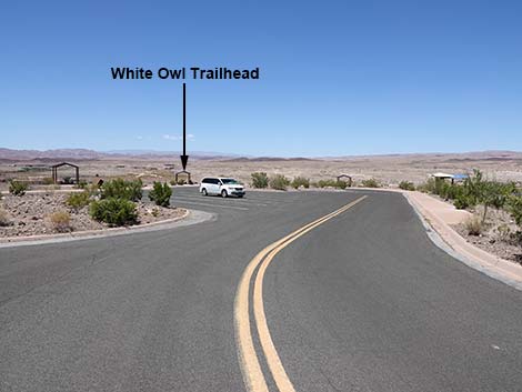 White Owl Trailhead (view N entering the parking area) |
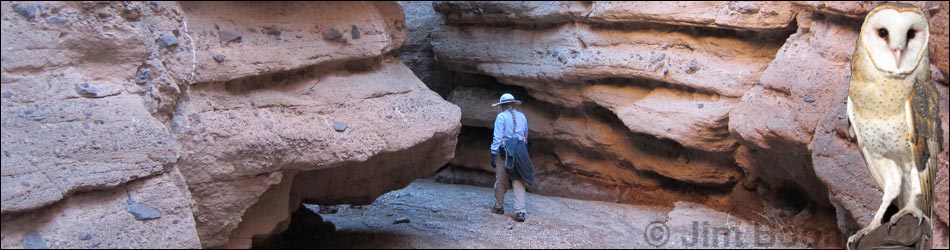
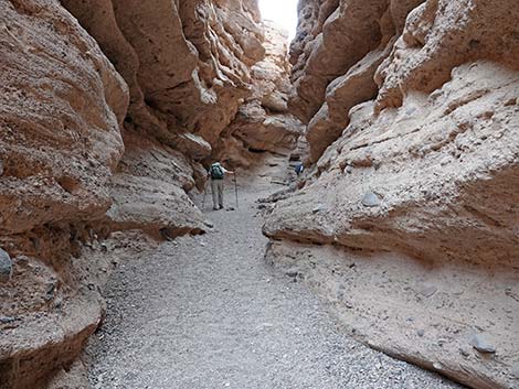
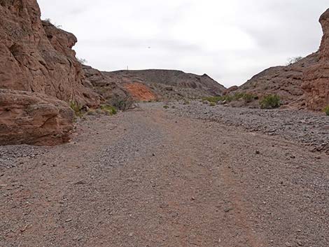
Overview White Owl Canyon, or simply Owl Canyon, is a short slot canyon near the edge of Lake Mead where water, flowing over the eons, cut down through conglomerate rock. The walls are sinuous and sculpted for about 1/2-mile, but the narrowest section is fairly short. Even so, this hike is well worth the effort required to walk 2-1/4 miles round-trip. The canyon was named for the white owls (Barn Owls) that live in the canyon. Keep an eye out for "white wash" (owl poop) on the rock walls for an indication of where they live, and watch the ground for pellets (owl barf), oblong clumps of bone and fur, to learn about what the owls have been finding to eat in the local desert. Unfortunately, hikers flush the Barn Owls off their roost, so it is best to stay out of this canyon during early spring when owls are nesting. Link to map or elevation profile. |
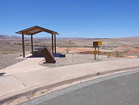 White Owl Trailhead departs from a picnic shelter (view N) |
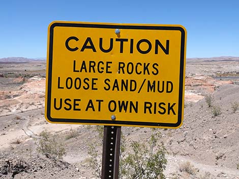
Watch Out Other than the standard warnings about hiking in the desert, ...this is a fairly safe hike. There are places where hikers could strike their head on overhanging rocks in narrow parts of the canyon, but there are no unusual hazards. Stay out of narrow canyons if flash floods threaten. While hiking, please respect the land and the other people out there, and try to Leave No Trace of your passage. Also, this hike is fairly short, so just bring what you need of the 10 Essentials. Getting to the Trailhead This hike is located along Lakeshore Drive in Lake Mead National Recreation Area, about 30 minutes southeast of Las Vegas. From Las Vegas, drive out to Lake Mead NRA. From the Las Vegas Wash entrance station (Table 1, Site 1020), continue east and then south for 3.8 miles on Lakeshore Road to 33 Hole Road (Site 1017). Turn left and drive east on the access road towards the picnic areas. |
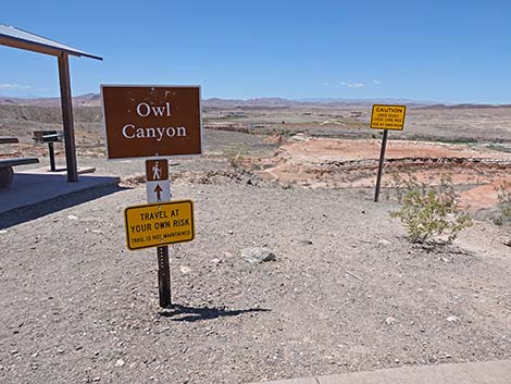
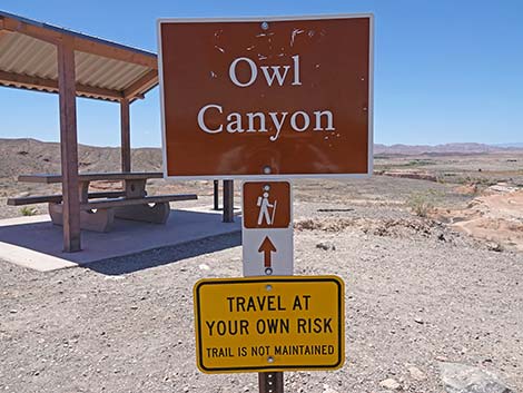
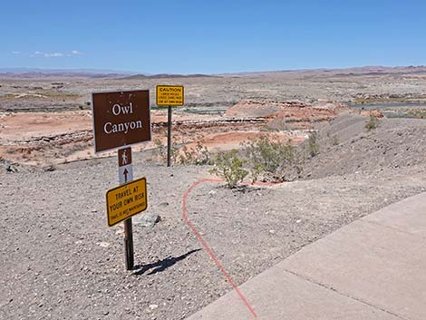 Trailhead signs at start of White Owl Trail (view N) |
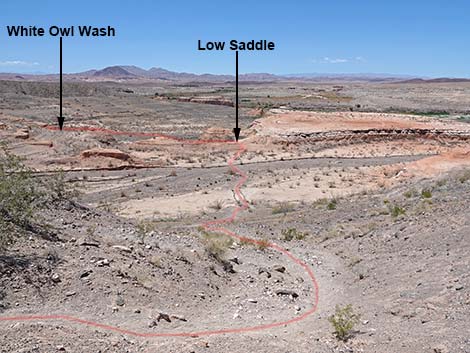
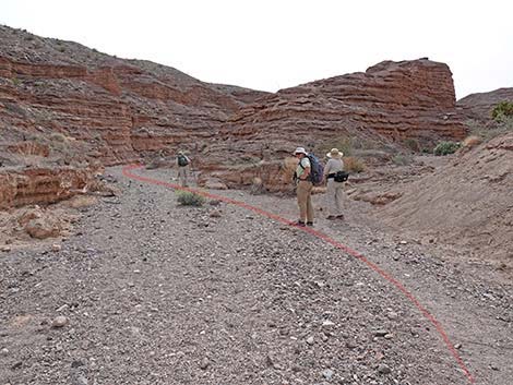
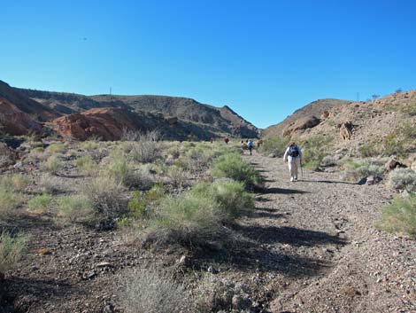
Alternatively, from Boulder City, drive out to the Boulder Beach entrance station (Site 1233), then continue north for 7.3 miles to 33 Hole Road (Site 1017). Turn right and drive east on the access road towards the lake and picnic areas. 33 Hole Road leads to three scenic overlooks, each with a different name. Turn left towards Three-Island Overlook and drive into the parking lot at the end of the road (Site 1234). Park here, this is the trailhead. The Hike From the trailhead (Table 2, Waypoint 01), the route runs past trailhead signs by the west-most picnic table and heads down over the side of the steep hill to the flats below (Wpt. 02). On the flats (Wpt. 02), which are the now-dry lakebed, the route continues northwest through saltcedar thickets following use-trails across the mud flats. The route passes a low ridge (Wpt. 03) and turns southwest into White Owl Canyon (Wpt. 04). |
 Trailhead signs at start of White Owl Trail (view N) |
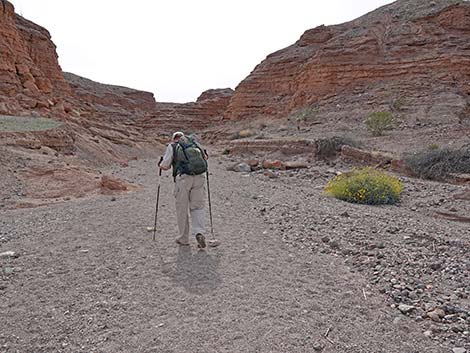
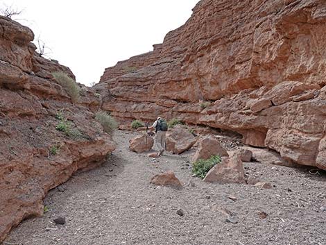
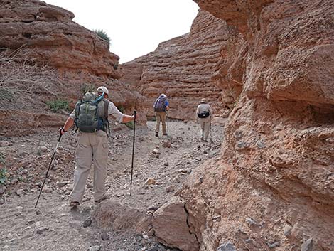
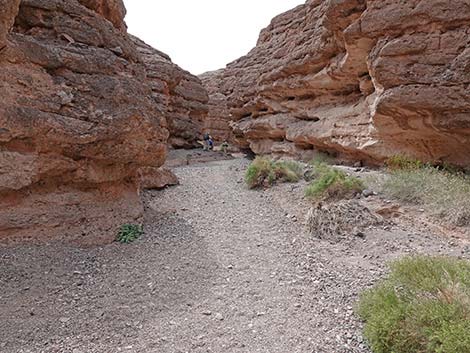
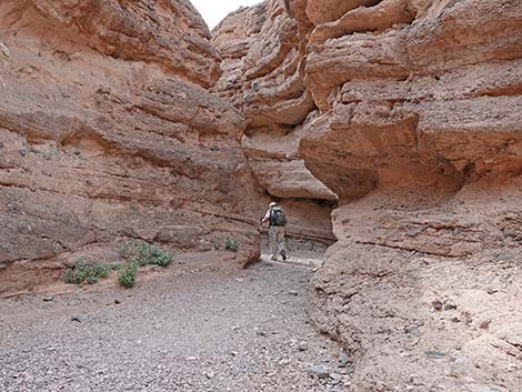
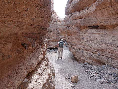
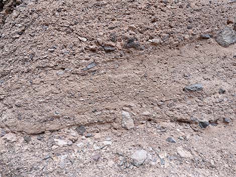
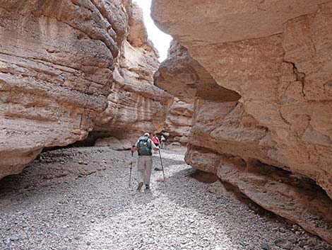
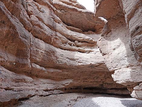
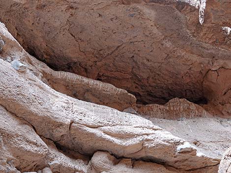
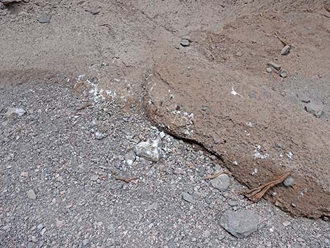
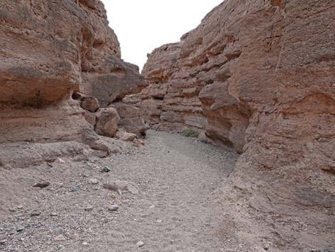
At a fork near the mouth of the canyon (Wpt. 05), the route stays in the left fork (more to the south) and ascends the canyon. Shortly, the walls steepen and become deep as the route enters the first narrows area, which is about 1/4-mile long. The narrows were cut into solid rock by flowing water. The rock here is a type of conglomerate formed from ancient alluvial fan deposits. When alluvial fan deposits consolidate to become conglomerate rock, geologist call it "fanglomerate" rock, combining the terms "alluvial fan" and "conglomerate." Winding through the narrows, watch for big splashes of "white wash" high on the rock walls. The white wash is Barn Owl poop. Lower in the canyon, small patches of bird poop reveal the presence of smaller birds, probably Rock Wrens and Say's Phoebes, but these spots of bird poop (even when they build up in little piles under rock overhangs) are quite small compared to the spray of white wash produced by Barn Owls. |
 Main trailhead sign (view NW) |
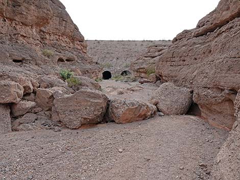
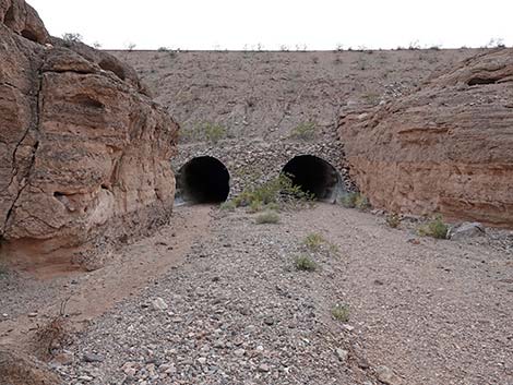
Beneath the white wash produced by the owls, look for owl pellets. These are oblong clumps of bone and fir that were regurgitated by owls. The pellets usually are 2- 3 inches long by about 1-inch in diameter. Pellets are coughed up, not pooped out, so they are relatively clean and safe to pick up and examine. Barn owls eat their prey entire without ripping it apart, so they consume everything, including the indigestible parts. They can't pass the indigestible parts, so they cough them up and spit them out. Often large leg and arm bones are evident on the surface, and skulls and jaws are easy to see. The owls here eat lots of desert woodrats and kangaroo rats. Just beyond the last of the white wash on the rock walls, the narrow canyon opens abruptly just below Lakeshore Road. A culvert runs under the road (Wpt. 06), which provides easy access to the other side of the road. Continuing upstream, the canyon narrows again just above Lakeshore Road. It is deep and narrow, but not as deep nor as narrow as the canyon below Lakeshore Road. The narrow section here is about 1/4-miles long. |
 Additional trailhead sign (view NW) |
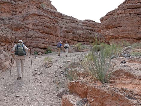
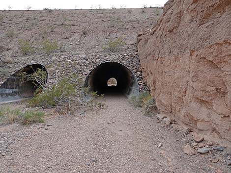
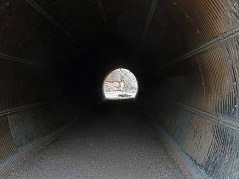
The canyon runs up against the old Lakeshore Road, now the River Mountains Loop Trail, and hikers can cross under the road in either of two culverts. Shortly beyond the culverts, the canyon opens into a broad, gravel wash. This is a good place to stop and relax, sitting in the sun or the shade depending on season. Above the narrows (view towards Wpt. 08), the narrow canyon opens into a broad, gravel wash full of cheesebush, brittlebush, and other species typical of the Creosote-Bursage habitat type. When ready to return to the trailhead, turn around, follow your footprints back down the wash, and enjoy another hike through the narrows. For photos of the descent, see Returning Down White Owl Canyon. |
 Hikers starting down from the trailhead (view NW) |
 Beginning of trail descends steeply (view NW) |
 Start of White Owl Trail; note Low Saddle in the distance (view NW) |
 Trail descends a steep erosion gully (view NW) |
 White Owl Trail stays right at a fork (view NW) |
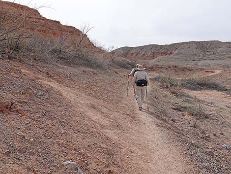
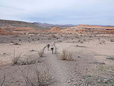 Hikers traversing mud flat (view NW) |
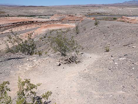
 Across mud flats, trail climbs onto low saddle (view W) |
 Hikers descending far side of low saddle (view W) |
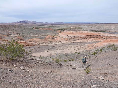
 Trail winds along mud cliffs (view SW) |
 Hikers on trail below mud cliffs (view SW) |
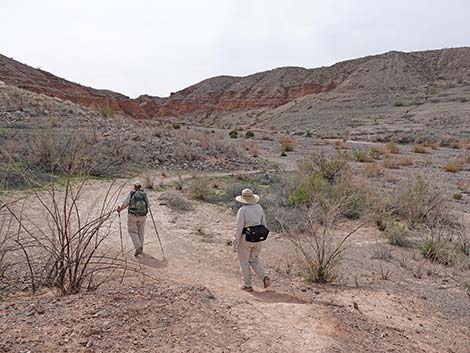 Trail drops towards gravel wash (view SW) |
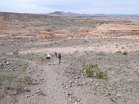
 Hikers entering gravel wash (view SW) |
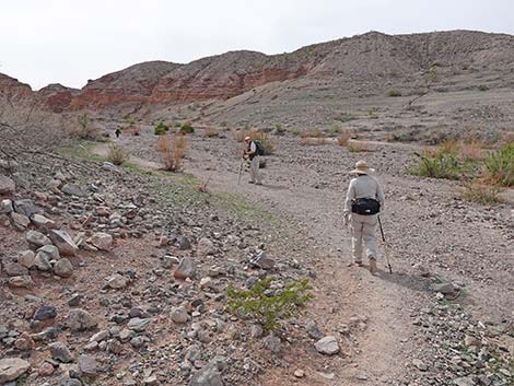
 Hiking up the gravel wash (view SW) |
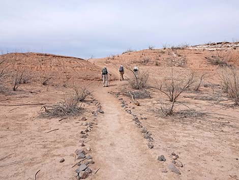
 Canyon forks, White Owl Canyon Trail stays left (view SW) |
 Trail stays in the wash bottom for the rest of the hike (view SW) |
 Hikers continuing up the canyon (view SW) |
 Rush Milkweed along the trail (view SW) |
 The canyon begins to narrow (view SW) |
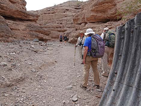
 Hiker entering the narrows (view SW) |
 Hiker in the narrows (view SW) |
 Sculpted fanglomerate rock wall |
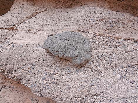 A boulder in the fanglomerate rock wall |
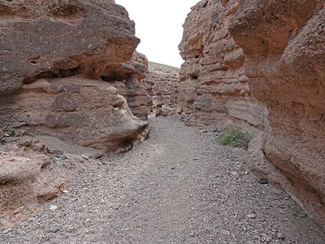
 Hiker in the narrows (view SW) |
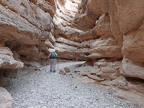 Hiker in the narrows (view SW) |
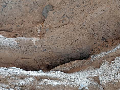
 Ledge with big-bird droppings |
 Ledge with big-bird droppings (closeup) |
 Hiker in the narrows (view SW) |
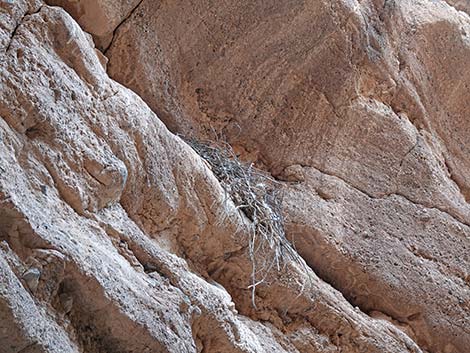 Remnants of a bird nest on a ledge |
 Another area where big-birds roost |
 Evidence of recent occupancy |
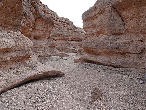
 Sculpted rock (view SW) |
 The first narrows begin to open |
 The first narrows begin to open |
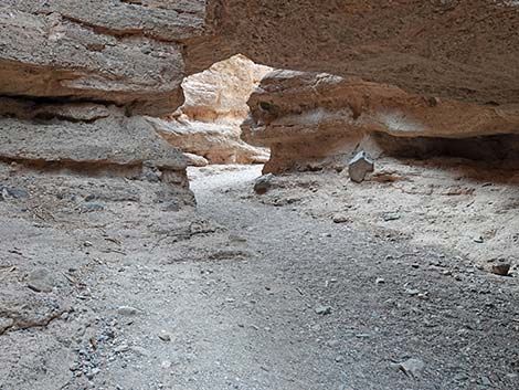
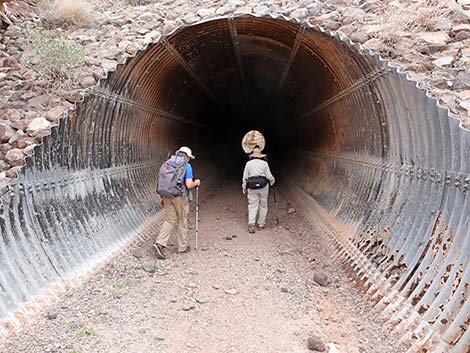
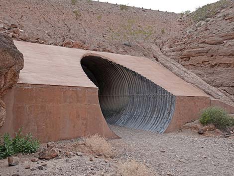 Arriving at a culvert below Lakeshore Road (view SW) |
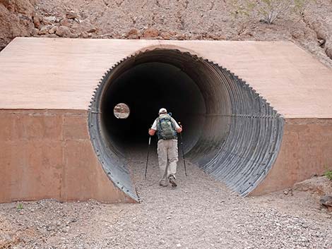 The trail goes through the culvert below Lakeshore Road (view S) |
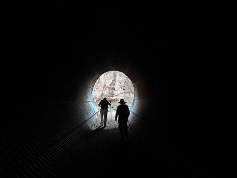
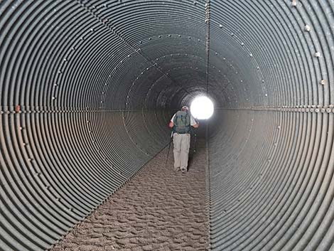 Hikers inside the culvert below Lakeshore Road (view S) |
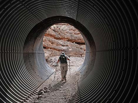 Hikers exiting the culvert below Lakeshore Road (view S) |
 Hikers above the culvert (view SW) |
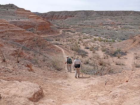
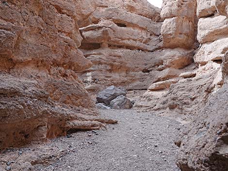
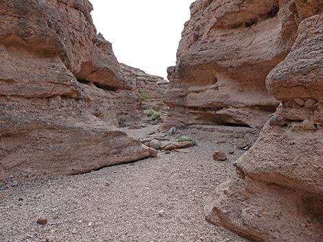
 Beyond the first culvert, the canyon is never deep (view SE) |
 Continuing up White Owl Canyon (view SW) |
 |
 |
 |
 |
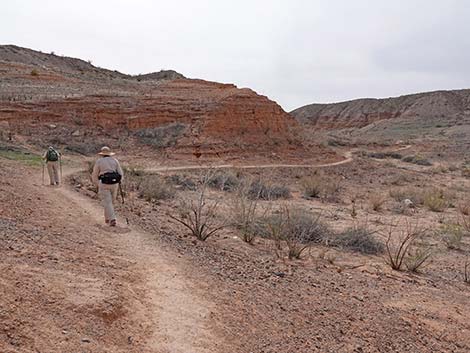
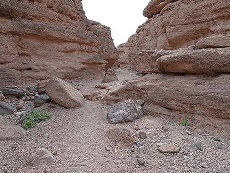
 Continuing up White Owl Canyon (view SW) |
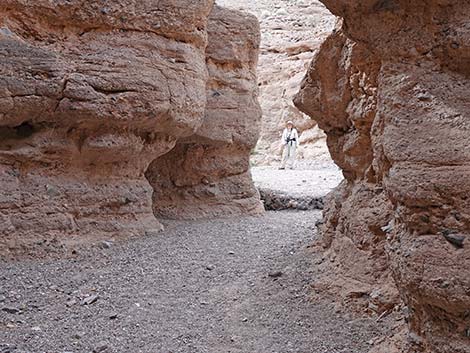
 Approaching River Mountain Loop Trail (view SW) |
 Approaching culverts under River Mountain Loop Trail (view SW) |
 Approaching culverts under River Mountain Loop Trail (view SW) |
 Two culverts under River Mountain Loop Trail (view SW) |
 Hiker at the far end of the culvert (view SW) |
 Hikers entering the right culvert (view SW) |
 Hikers inside the right culvert (view SW) |
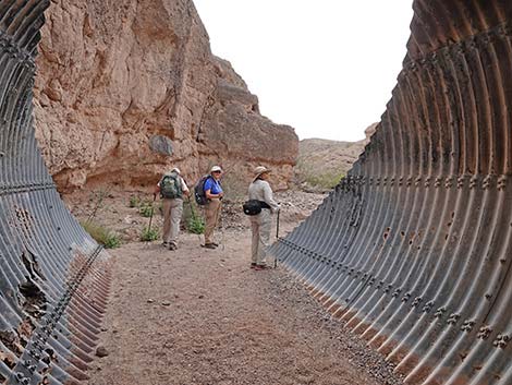 Hikers exiting the right culvert (view SW) |
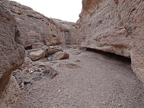
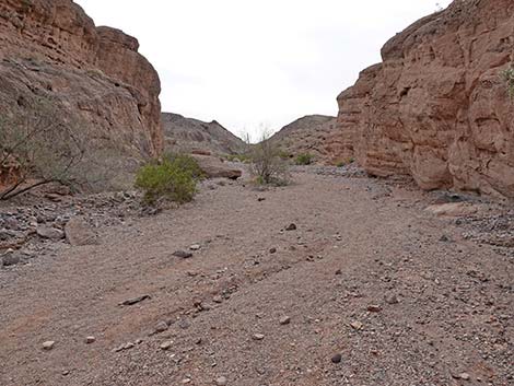 The canyon continues above the second culvert (view SW) |
 No longer a narrow canyon, but the wash continues (view SW) |
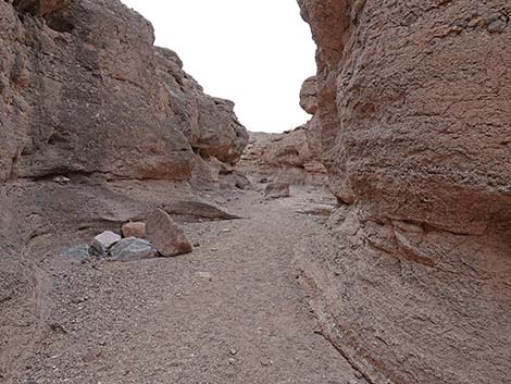
 Beyond the culverts, the canyon opens into a broad wash |
Table 1. Highway Coordinates Based on GPS Data (NAD27; UTM Zone 11S). Download Highway GPS Waypoints (*.gpx) file.
| Site | Location | UTM Easting | UTM Northing | Latitude (N) | Longitude (W) | Elevation (ft) | Verified |
|---|---|---|---|---|---|---|---|
| 1017 | Lakeshore Rd at 33 Hole Rd | 694006 | 3997679 | 36.10621 | 114.84474 | 1,316 | Yes |
| 1020 | Lake Mead Parkway Entrance Stn | 689000 | 3997470 | 36.10531 | 114.90037 | 1,602 | Yes |
| 1233 | Lakeshore Rd at Boulder Entrance Stn | 698668 | 3988316 | 36.02092 | 114.79535 | 1,440 | GPS |
| 1234 | Three-Island Overlook | 694130 | 3998261 | 36.11143 | 114.84322 | 1,234 | GPS |
Table 2. Hiking Coordinates Based on GPS Data (NAD27, UTM Zone 11S). Download Hiking GPS Waypoints (*.gpx) file.
| Wpt. | Location | Easting | Northing | Elevation (ft) | Point-to-Point Distance (mi) | Cumulative Distance (mi) | Verified |
|---|---|---|---|---|---|---|---|
| 01 | Trailhead | 694116 | 3998273 | 1,234 | 0.00 | 0.00 | GPS |
| 02 | Lakebed Flats | 694057 | 3998341 | 1,145 | 0.06 | 0.06 | GPS |
| 03 | Turning into Canyon | 693874 | 3998350 | 1,154 | 0.12 | 0.18 | GPS |
| 04 | Canyon Narrows | 693662 | 3998208 | 1,163 | 0.17 | 0.35 | GPS |
| 05 | Fork in Canyon | 693645 | 3998166 | 1,175 | 0.04 | 0.39 | GPS |
| 06 | First Culvert | 693337 | 3997936 | 1,264 | 0.27 | 0.66 | GPS |
| 07 | Second Culvert | 693074 | 3997595 | 1,355 | 0.28 | 0.94 | GPS |
| 08 | End of My Trail | 692897 | 3997438 | 1,407 | 0.16 | 1.10 | GPS |
| 01 | Trailhead | 694116 | 3998273 | 1,234 | 1.10 | 2.20 | GPS |
Happy Hiking! All distances, elevations, and other facts are approximate.
![]() ; Last updated 240722
; Last updated 240722
| Hiking Around Lake Mead | Hiking Around Las Vegas | Glossary | Copyright, Conditions, Disclaimer | Home |