Hiking Around Las Vegas, Mount Charleston Area
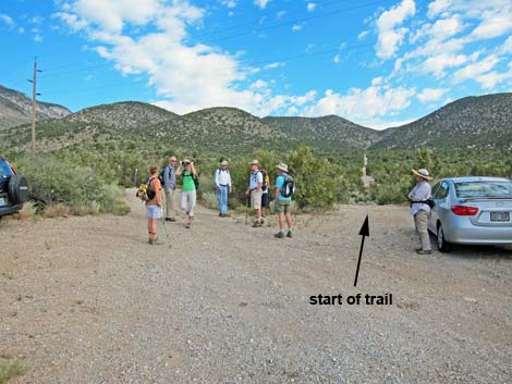 Hikers at Lower Telephone Canyon Trailhead parking |
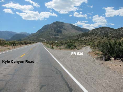
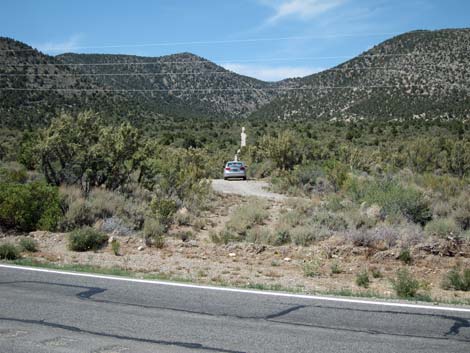
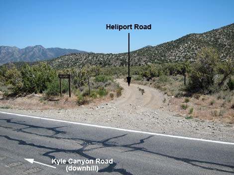
The Lower Telephone Canyon Trailhead is located up in the Spring Mountains National Recreation Area (also known as Mt. Charleston), about 30 minutes northwest of Las Vegas. From town, drive north on Highway 95 to Kyle Canyon Road (Highway 157; Table 1, Site 0667). Turn left onto Kyle Canyon Road and drive west for 15.5 miles to a seemingly unmarked dirt road on the right (Site 1279) that angles away from the road at about 45-degrees. If the road is missed, there is a "heliport" sign on the left, just past the turnoff. At that point, turn right onto another dirt road and angle back into the parking area. Link to Trailhead Map. |
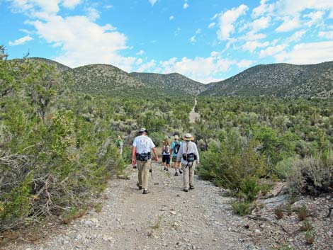 Hikers departing trailhead parking |
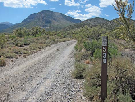
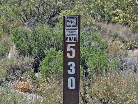
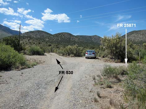
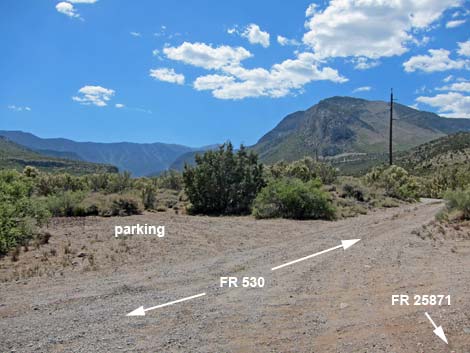
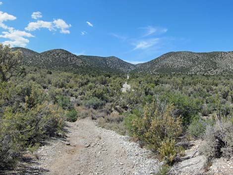
Turn right onto Lower Telephone Canyon Trailhead access road, which is marked with a carsonite sign as Forest Road 530, and drive northwest for about 250 feet to a wide spot where several dirt roads (including roads 530 and 25871) intersect (Site 1280). There are no trailhead signs; stop before driving under the powerlines. Park here; this is the trailhead. Lower Telephone Canyon Trailhead provides access to Lower Telephone Canyon Trail, various hiking and bike trails, and miles of old dirt roads. |
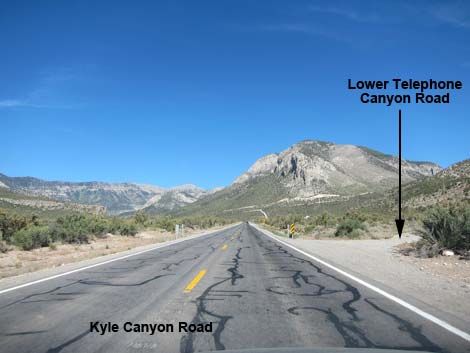 Kyle Canyon Rd at Telephone Canyon Trailhead Rd (view W) |
 Kyle Canyon Rd at Telephone Canyon Trailhead Rd (view W) |
 Telephone Canyon Trailhead Rd (USFS Rd 530; view NW) |
 |
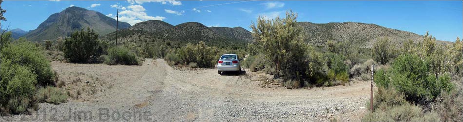
 Telephone Canyon Trailhead parking |
 Trailhead parking is not far from the pavement (view N) |
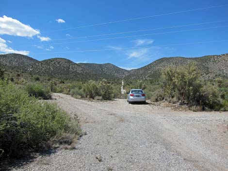 Telephone Canyon Trailhead parking |
Hikers at Telephone Canyon Trailhead parking |
 Wide pull-out on left side of trailhead parking |
 Start of Lower Telephone Canyon Trail |
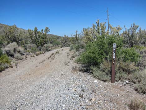 USFS Road 25871 follows the telephone poles (view east) |
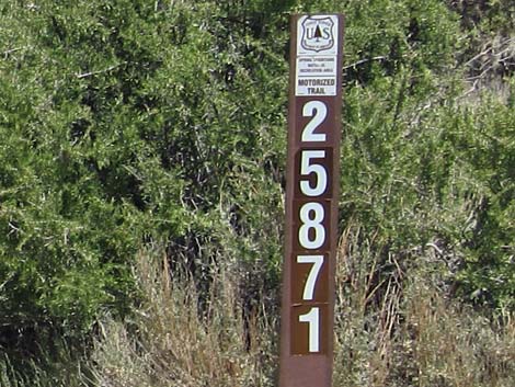 USFS Road 25871 near trailhead parking (view east) |
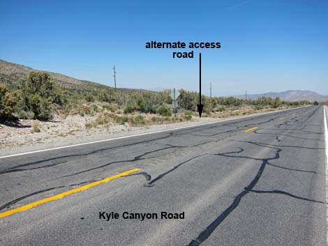 Alternate access road (view E; coming back down the highway) |
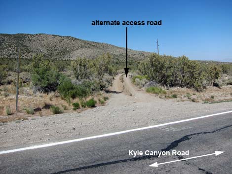 Alternate access road (view NE; coming back down the highway) |
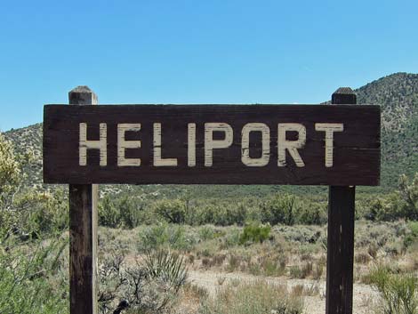 Heliport sign, on left past the turnoff (view S) |
 Heliport sign and road, on left past the turnoff (view SW) |
Table 1. Highway Coordinates (NAD27; UTM Zone 11S). Download Highway GPS Waypoints (*.gpx) file.
| Site | Location | UTM Easting | UTM Northing | Latitude (N) | Longitude (W) | Elevation (ft) | Verified |
|---|---|---|---|---|---|---|---|
| 0667 | Hwy 95 at Kyle Canyon Rd | 651544 | 4021405 | 36.32758 | 115.31167 | 2,820 | Yes |
| 1279 | Kyle Cyn Rd at Lower Telephone Cyn Access Rd | 628562 | 4014691 | 36.27042 | 115.56873 | 6,381 | GPS |
| 1280 | Lower Telephone Canyon Trailhead Parking | 628524 | 4014744 | 36.27090 | 115.56915 | 6,378 | GPS |
Happy Hiking! All distances, elevations, and other facts are approximate.
![]() ; Last updated 240329
; Last updated 240329
| Hiking Around Mt Charleston | Hiking Around Las Vegas | Glossary | Copyright, Conditions, Disclaimer | Home |