Hiking Around Las Vegas, Death Valley National Park, Death Valley Wilderness Area
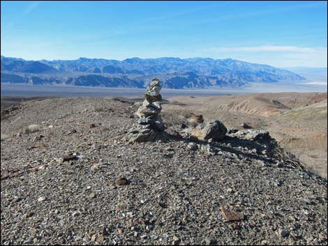
 From trailhead, use binoculars to identify Cairn Canyon (view SE) |
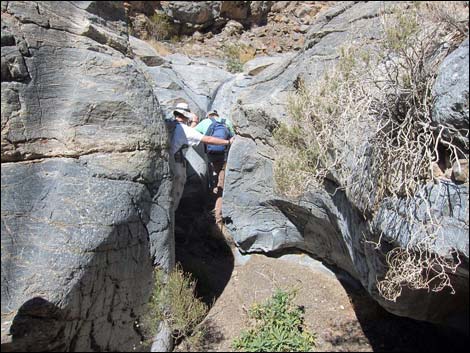
Overview The hike up Cairn Canyon is a somewhat arduous, but pleasant and geologically interesting, 10-mile round-trip hike in the Death Valley Wilderness Area. The route runs off-trail up Emigrant Wash, then turns to climb the bajada towards the mouth of Cairn Canyon. A slight detour leads past historic telephone wires. In the canyon, the route trudges up the broad wash for 2 miles to the narrows. For the next 1-1/3 miles, the route winds about and climbs several pour-overs, some challenging, but none are too dangerous. Higher in the canyon, a series of pour-overs leads to "stretched pebbles" and wondrously contorted geology. The cairns are an afterthought for the hike down. Link to topographic map. Watch Out Other than the standard warnings about hiking in the desert, ... hiking in the lower canyon is quite safe. Passing the pour-overs requires good 3rd-Class and 4th-Class rock scrambling skills, but the rock if firm and usually with plenty of hand- and foot-holds. Most hikers wouldn't want a belay rope on the pour-overs. |
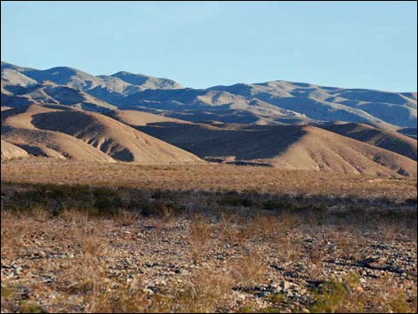
 Emigrant Wash (view S) |
While hiking, please respect the land and the other people out there, and try to Leave No Trace of your passage. This hike is in a wild and remote area, so be sure to bring the 10 Essentials. Also, the route is almost entirely within the Death Valley Wilderness Area, so pay particular attention to respecting the land and the historic objects along the route. Getting to the Trailhead This hike is located in Death Valley National Park, about 2-1/2 hours northwest of Las Vegas. Drive west on Highway 190 to a dirt pullout where Emigrant Wash crosses the highway, 14.5 miles west of Stovepipe Wells. Link to Cairn Canyon Trailhead. |
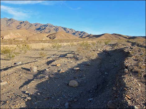
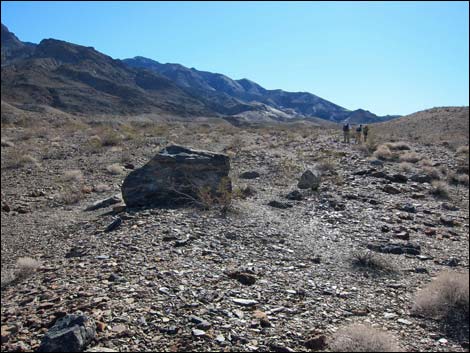
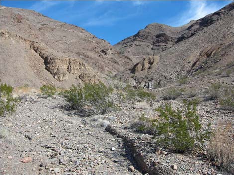
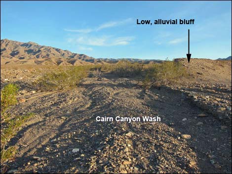 Notice the low alluvial bluff on the right (view SE) |
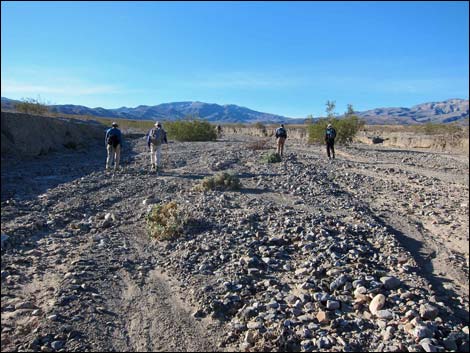
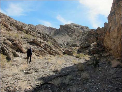
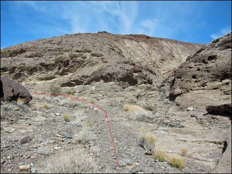
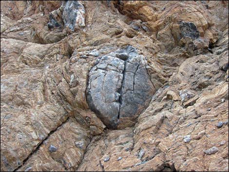
The Hike From the trailhead (Table 1, Waypoint 01), the route runs up Emigrant Wash. At about 0.4 miles out (Wpt. 02), hikers will notice a low bluff of alluvial materials (Wpt. 03) ahead on the left. Cairn Canyon Wash comes down along the north edge of the low alluvial bluff. Hikers may wish, however, to walk up another wash to see the historic Rhyolite-Skidoo telephone wires. If so, turn left into a wash about 100 yards north of the low alluvial bluff. Following this alternative wash leads to where the wires can be seen lying on the ground (Wpt. 3A). Taking either wash, hikers trudging uphill on the alluvial fan will eventually reach the mouth of Cairn Canyon (Wpt. 04). In Cairn Canyon, the wash runs fairly straight for about 0.3 miles, then bends slightly to the right (south) and continues straight another 0.50 miles to a solitary boulder (Wpt. 05) on the right side of the wash where the canyon again curves slightly to the right. The solitary boulder, "5-Mile Rock," marks 2.5 miles from the trailhead, making a visit to this point a 5-mile round-trip hike. |
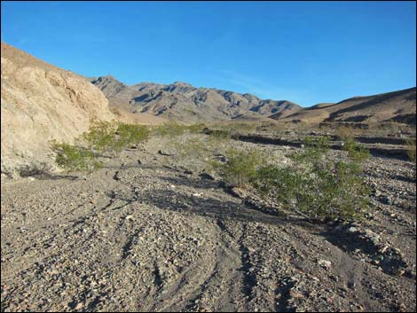
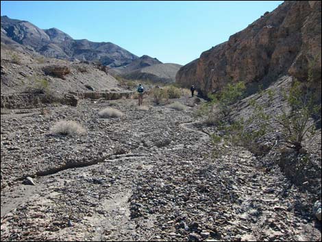
 Cairn Canyon Wash (view SE) |
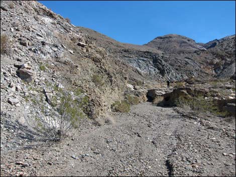
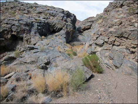
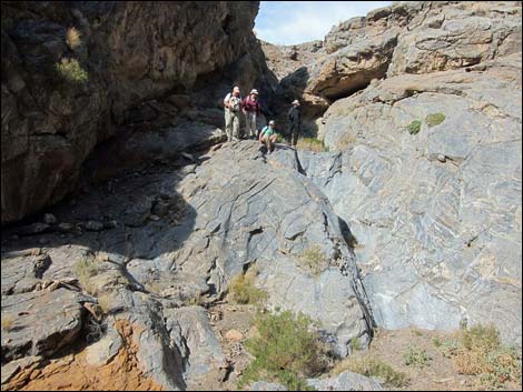
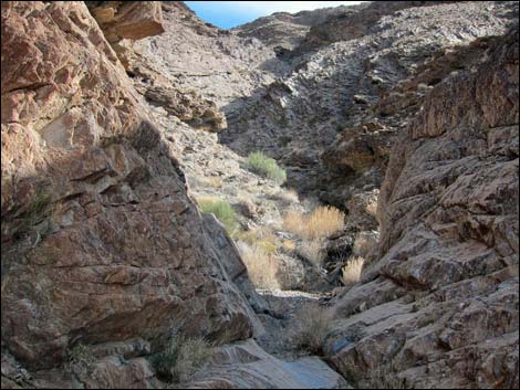
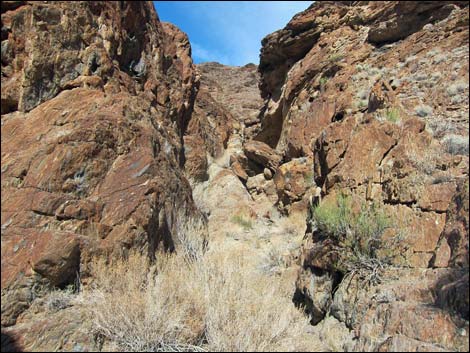
The canyon again runs fairly straight for 0.75 miles, then takes a jog to the left, and in another 0.4 miles the canyon narrows (Wpt. 06). A bit farther in, the canyon constricts, and hikers are forced to climb several water-polished pour-overs. After a well-deserved rest atop the pour-overs, the canyon continues as it winds about easy at first, but then encounters another interesting section of pour-overs. Hikers might look for a bighorn sheep skull atop these pour-overs. Then shortly, another set of interesting pour-overs leads into an area of strikingly polished, highly folded and contorted "stretched pebble" metamorphic rock. At 5 miles out and with the challenging pour-overs apparently behind, this makes a good place for day-hikers to turn around and return to the trailhead. On the way down, after leaving the narrows and pour-overs behind, watch the skyline on the south side of the canyon for large cairns on the ridgeline. These appear to be historic mining claim markers that mark out an area that runs south quite a way from the ridge overlooking the wash, but the exact purpose is unclear. |
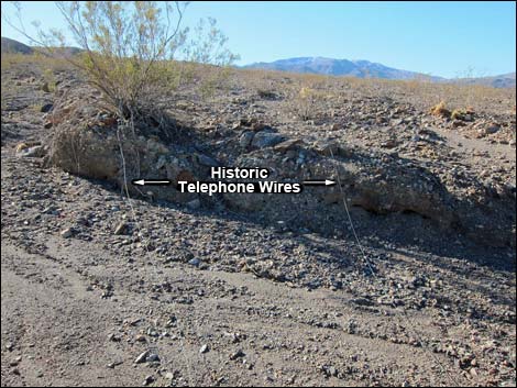 Historic telephone wires |
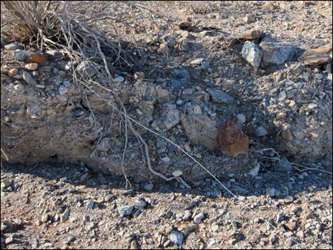 Historic telephone wire |
 Entering the mouth of Cairn Canyon (view SE) |
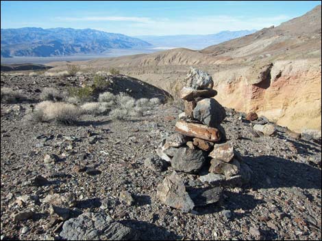
 5-Mile Rock (view SE) |
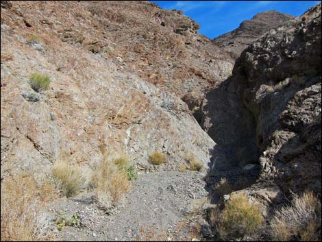
 Canyon begins to narrow (view SE) |
 Canyon finally begin to get narrow (view SE) |
 Start of the pour-overs (view N) |
 Pour-overs (view N) |
 Pour-overs (view N) |
 Beyond first set of pour-overs |
 Main wash stays left at a fork (view N) |
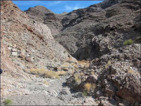
 More open canyon (view E) |
 Canyon pinches down again (view E) |
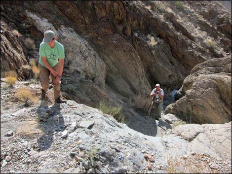 Hikers climbing a series of interesting pour-overs |
 A short bit of open canyon (view E) |
 A not-so-stretched pebble in the canyon wall |
 Fork in the canyon (view SE; straight into side canyon) |
 Fork in the canyon (view NE; left for main canyon) |
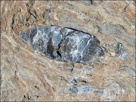
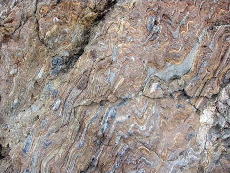 Bent and stretched stretched pebbles |
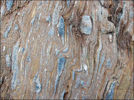 Bent and stretched stretched pebbles |
 Not-so-stretched stretched pebbles |
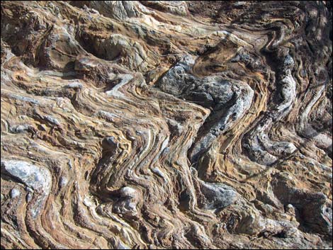 Bent and stretched stretched pebbles |
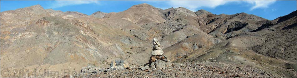
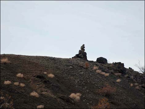 Cairn on the skyline (view W) Cairn on the skyline (view W) |
 Cairn on the skyline overlooking Cairn Canyon (view NW) |
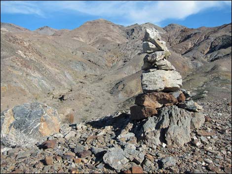 Cairn on the skyline overlooking Cairn Canyon (view SE) |
 Cairn on the skyline overlooking Cairn Canyon (view NW) |
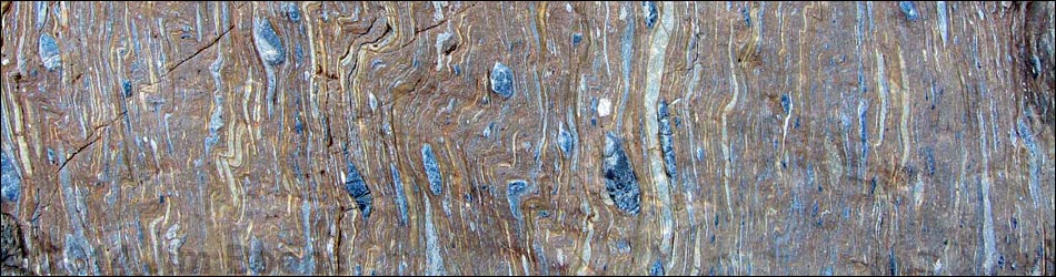
Table 1. Hiking Coordinates Based on GPS Data (NAD27; UTM Zone 11S). Download Hiking GPS Waypoints (*.gpx) file.
| Wpt. | Location | UTM Easting | UTM Northing | Elevation (ft) | Point-to-Point Distance (mi) | Cumulative Distance (mi) | Verified |
|---|---|---|---|---|---|---|---|
| 01 | Trailhead | 480626 | 4042855 | 1,366 | 0.00 | 0.00 | GPS |
| 02 | Depart Main Wash | 480649 | 4042239 | 1,522 | 0.42 | 0.42 | GPS |
| 03 | Wash | 480714 | 4042128 | 1,549 | 0.09 | 0.51 | GPS |
| 03A | Historic Telephone Wires | 481300 | 4041601 | 1,710 | . | . | GPS |
| 04 | Mouth of Canyon | 481620 | 4040844 | 1,967 | 1.05 | 1.56 | GPS |
| 05 | 5-Mile Rock | 482777 | 4040041 | 2,350 | 0.92 | 2.48 | GPS |
| 06 | Start of Narrow Canyon | 483824 | 4038716 | 2,873 | 1.17 | 3.65 | GPS |
| 07 | Pour-Overs | 484275 | 4038622 | 3,130 | 0.38 | 4.03 | GPS |
| 08 | Bighorn Skull | 485077 | 4038988 | 3,585 | 0.88 | 4.91 | GPS |
| 09 | Polished Stretched Pebbles | 485234 | 4038933 | 3,746 | 0.15 | 5.06 | GPS |
| 01 | Trailhead | 480626 | 4042855 | 1,366 | 5.06 | 10.12 | GPS |
Happy Hiking! All distances, elevations, and other facts are approximate.
![]() ; Last updated 240324
; Last updated 240324
| Death Valley | Hiking Around Las Vegas | Glossary | Copyright, Conditions, Disclaimer | Home |