Hiking Around Las Vegas, Death Valley National Park, Death Valley Wilderness Area
 Cottonwood Canyon Road |
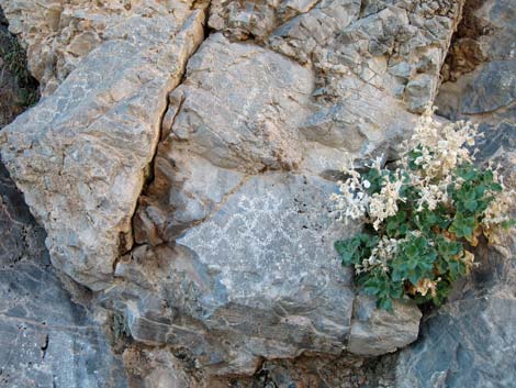
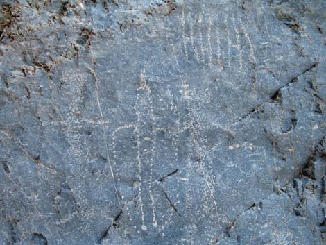
Overview This great hike runs up the south fork of Marble Canyon into the Death Valley Wilderness Area for about 2-1/2 miles where much of the canyon is deep and narrow, the gentle grade provides easy hiking, and there is little to climb over. After 2-1/2 miles, the regular route continues up the main canyon to the southwest, but this route turns up a major side canyon to the northwest. For another 1-1/2 miles, the side canyon runs out through some truly amazing narrows and desert landscapes. Keep an eye out for fossils, prehistoric and historic petroglyphs, and of course -- dragon eggs -- throughout the hike. Rude people have been damaging the petroglyphs in these canyons. Please help preserve the area and protect the petroglyphs for the enjoyment and enlightenment of future generations! Link to map or elevation profile. |
 |
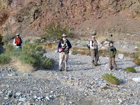
Watch Out Other than the standard warnings about hiking in the desert, ... this hike is fairly safe and easy, and I saw no unusual hazards. However, be mindful of thunderstorms, as this canyon is regularly swept by flashfloods. While hiking, please respect the land and the other people out there, and try to Leave No Trace of your passage. Also, this hike is in a wild and remote area, so be sure to bring the 10 Essentials. This hike runs up into designated wilderness, so be extra careful with the land. |
 |
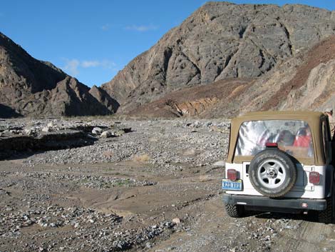
Getting to the Trailhead This hike is located in Death Valley National Park, about 3.5 hours northwest of Las Vegas. From town, drive out to Death Valley. From the Furnace Creek Visitor Center (Table 1, Site 0712), drive north and west on Highway 190 to Stovepipe Wells (Site 0751). From the Stovepipe Wells general store, continue west for about 0.1 miles to the campground entrance road (Site 0985). Turn right onto this road, but then stay to the left bypassing the campground, and drive west to the airport. Continue past the airport, turning onto a graded dirt road that runs west. |
 |
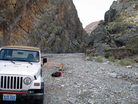
For the first 8.6 miles out to a flat area at the edge of Cottonwood Wash (Site 0986), the road can be a bit rough and sandy, but is should be suitable for a carefully driven sedan (check with the rangers for up-to-date road conditions). In a 4WD vehicle, continue into the wash and drive upstream through the narrows. Be sure to pay attention to the rock walls along the way. About 2.2 miles from the edge of the wash, the road forks (Site 0987). Cottonwood Canyon Road continues straight (south), while the Marble Canyon Road turns to the right (west). Turn and drive up the Marble Canyon Road for 2.4 miles to a barricade at the end of the road (Site 0988). Park here; this is the trailhead. |
 |
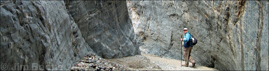
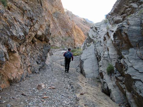
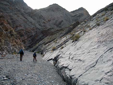
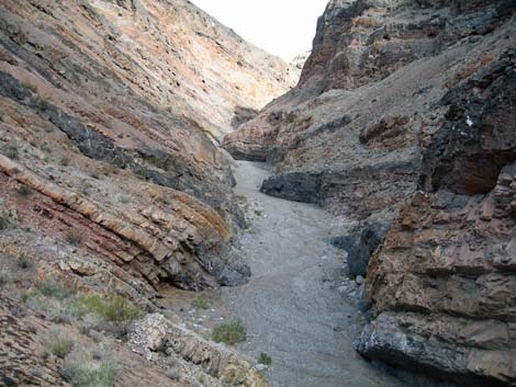
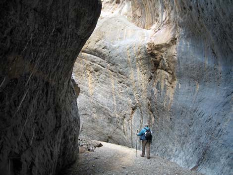
The Hike From the trailhead (Table 2, Waypoint 01), the route runs south and up the gravel wash into the First Narrows. The canyon is already narrow, and it immediately narrows further, but it is never extremely narrow nor extremely deep. Nonetheless, the polished rock, layered canyon walls, chert nodules and calcite stripes in the carbonate rocks, and sense of adventure keep you longing to see around the next corner. The entire canyon is in the Upper Sonoran Life Zone (Mojave Desert Scrub), but the canyon here is sparsely vegetated because of the frequent scouring by flash floods. Keep an eye out for black-banded rabbitbrush, netvein goldeneye, cheeseweed, and desert stingbush (rock nettle). Higher up the canyon where the wash is wider, these species become more common. On the hillsides above the wash where plants can grow, there are creosote bush and white bursage, plus fair numbers of cottontop and beavertail cactus. |
 |
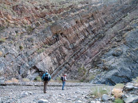
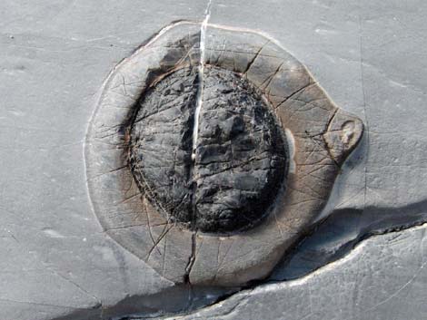
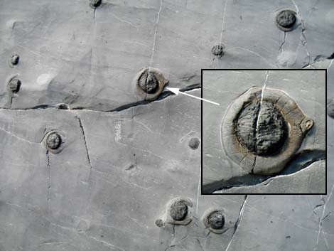
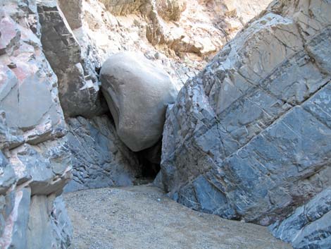
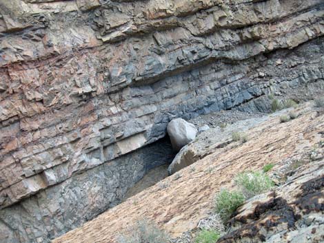
The rocks in this area are mostly Paleozoic sedimentary carbonates (i.e., limestone or dolomite) dating from about 490-290 million-years-ago. These layered rocks were laid down in an ocean, and the few fossils suggest that it was shallow some of the time. Mostly, however, the rocks record only the tilting, twisting, and folding that jumbled up this country. There are, however, large numbers of interesting black chert nodules in the rock walls. Chert often develops around organic matter, but I don't know what to make of so many rounded nodules here. The desert is full of mysteries. Another geologic mystery in the canyon that we noticed starting at the trailhead was the nearly round, baseball-sized rocks that young Ben decided were dragon eggs. I'm not sure how they were formed, but if you hike far enough, you can find the dragon's nest. The First Narrows end at a big, round chockstone wedged across the top of a pour-over (Wpt. 02). The boulder is quartz monzonite, a type of granite, that is completely out of place in this limestone landscape. It was washed all the way down from the flanks of Hunter Mountain, several air-miles to the southwest. |
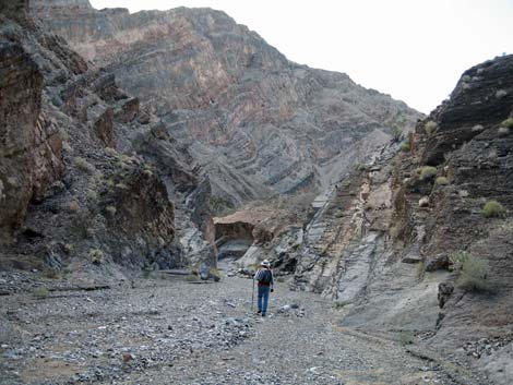
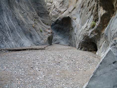
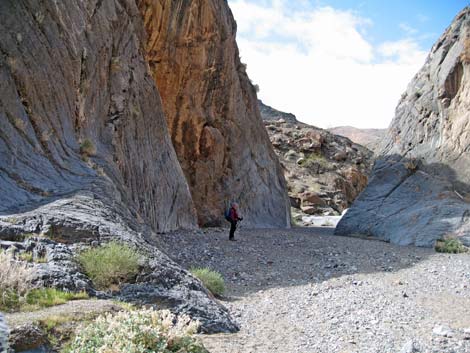
 Trailhead below the First Narrows (view SW) |
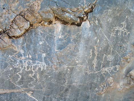
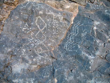
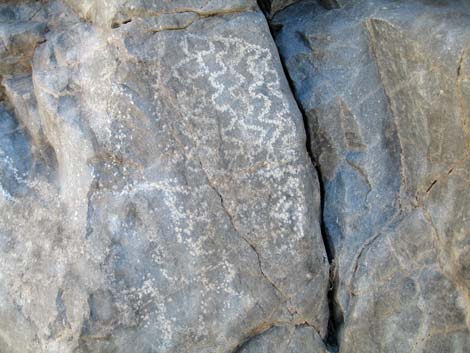
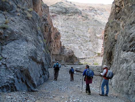
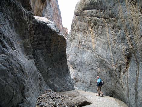
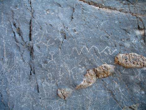
It is probably possible to climb the rock wall and pass the chock stone, but it likely is easier to walk back down the wash, past the tipped-up swimming pool on the side of the canyon, to a gully on the north side. Starting up the gully, it quickly becomes apparent that a use-trail runs up and around the cliffs above the swimming pool and past the chockstone. Beyond the chockstone, the canyon opens for a bit, then constricts into the Second Narrows. These narrows are much narrower, deeper, darker, and longer than the First Narrows, and the gracefully flowing walls often overhang the wash entirely blocking the view of the sky. The route continues up the sinuous wash as it snakes back and forth through the carbonate rock formation until suddenly opening into an open wash on the other side (Wpt. 03). Winding through the Second Narrows, be sure to watch the walls for historic and prehistoric petroglyphs. Enjoy them when you find them, but please do not add to them. People don't seem to realize how hard it is to make a good petroglyph, evidenced by their lame attempts and embarrassing scribbling. |
 |
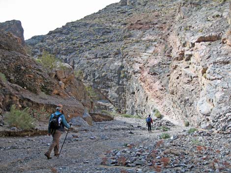
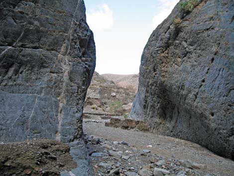
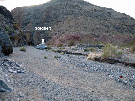
Above the Second Narrows, the canyon runs open and fairly wide for miles. The scenery is grand, and the cliffs are beautifully layered in various colors, but the wash is a wash, not narrows, until the Third Narrows another 2.5 miles up the canyon. The wash does, however, pass through interesting constrictions (Wpt. 04, Wpt. 07) formed of polished carbonate rocks that make good signposts. Continuing up the wash, a major side canyon forks off to the north (Wpt. 05). At the confluence with the side canyon, there is a large, rounded granite boulder on the north side of the wash with the word "Goldbelt" and an arrow pointing left pecked into the surface. This is a highway sign telling miners which canyon to take to get to the Goldbelt Mining District, which is about 5 miles farther up the canyon. At the confluence, I hiked a short way farther up the main canyon to just past the next constriction (Wpt. 07), which was far enough to see around the corner and realize that the canyon continues wide and open for some ways. I walked back, and our group turned up the side canyon to the northwest. |
 |
I'll leave the details to be discovered by adventuresome hikers, but dragon eggs become quite common in the wash until reaching the dragon's nest, part of which lies in the center of the wash. Beyond the dragon nest lie the most amazing narrows that I know of in Death Valley -- even better than Titus Canyon and Upper Fall Canyon. There are some short scramble-ups in the narrows, but they shouldn't be too much trouble for hikers who can make it that far. Beyond the narrows (Wpt. 10), the canyon opens into a broad, well vegetated wash that runs through more grand scenery. When daylight starts to run out, turn around and head back down the canyon. Despite the gentle grades throughout, the trip down the canyon is a lot faster than the trip up. |
 Layers of time recorded in the canyon walls |
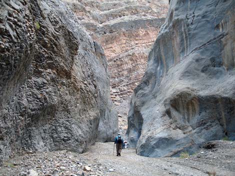
 Hiking in First Narrows (view S) |
 Smooth wall on the right |
 Chert nodules in the carbonate rock |
 Chert nodules in the carbonate rock |
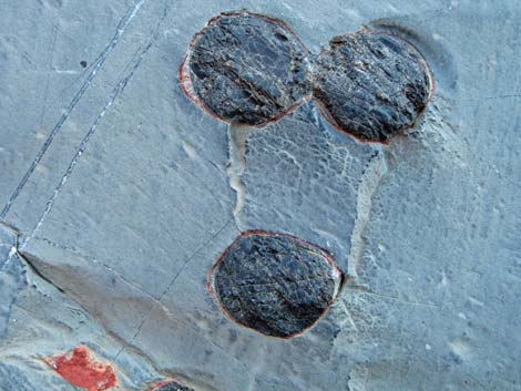
 Chert nodules and enlargement (note: these are not dragon eggs) |
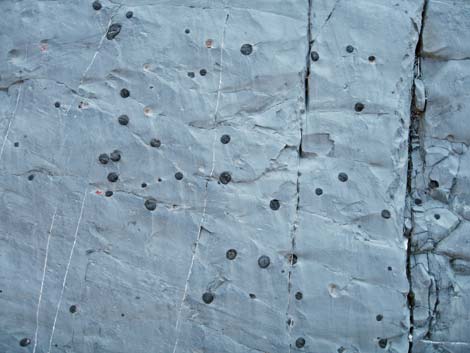 Chert nodules in the carbonate rock |
 Chert nodules in the carbonate rock |
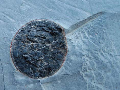 Chert nodules in the carbonate rock |
 Hiker in the wash |
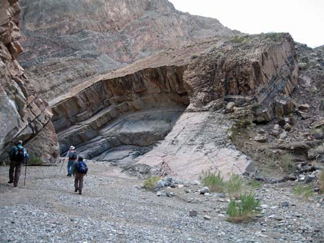 Hikers approaching granitic chockstone |
 Granitic chockstone blocks canyon and ends First Narrows (view S) |
 On bypass, looking down on granitic chockstone |
 Looking back down the bypass |
 Happy hikers above the granitic chockstone |
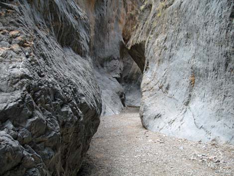
 Approaching the second Narrows |
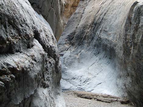
 Second Narrows |
 Second Narrows |
 |
 |
 |
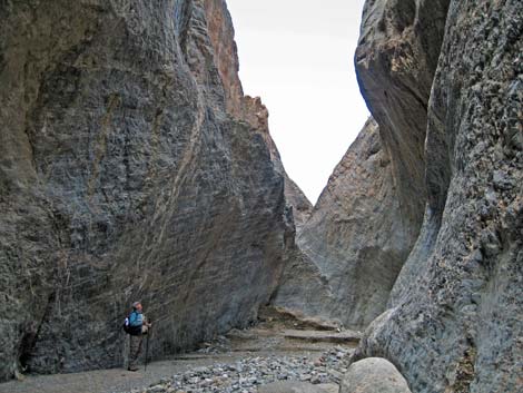 |
 Upper end of the Second Narrows (view NW) |
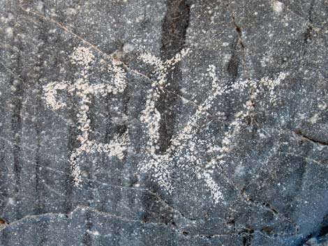
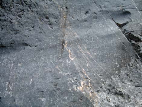 Pioneer graffiti |
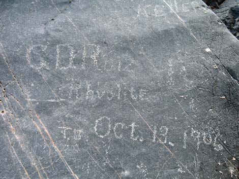 C.D. Ruiz, from Rhyolite, was here on October 13, 1906 |
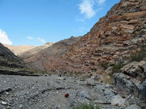 More layers of time recorded in the canyon walls |
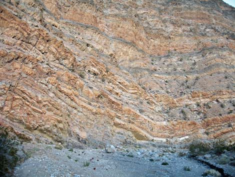 More layers of time recorded in the canyon walls |
 Constriction in the otherwise wide canyon (view W) |
 Approaching the Goldbelt Road sign (view W) |
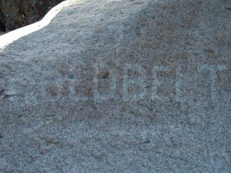 Goldbelt "road" sign on boulder at a confluence (view W) |
 |
 |
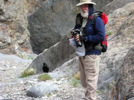 Photographing the begging Common Ravens |
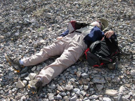 Hiker resting in the wash |
Table 1. Highway Coordinates (NAD27; UTM Zone 11S). Download Highway GPS Waypoints (*.gpx) file.
| Site | Location | Latitude | Longitude | Easting | Northing | Elevation (ft) | Verified |
|---|---|---|---|---|---|---|---|
| 712 | Furnace Creek Visitor Center | 36.46159 | 116.86574 | 512030 | 4034954 | -186 | Yes |
| 751 | Highway 190 at Stovepipe Wells | 36.60654 | 117.14594 | 486948 | 4051034 | 0 | Yes |
| 985 | Highway 190 at Stovepipe Campground | 36.60594 | 117.14661 | 486888 | 4050967 | 8 | GPS |
| 986 | Cottonwood Canyon Rd (end of 2WD) | 36.64260 | 117.26957 | 475902 | 4055058 | 719 | GPS |
| 987 | Cottonwood Canyon Rd at Marble Canyon Rd | 36.63191 | 117.29508 | 473618 | 4053879 | 1,167 | GPS |
| 988 | Marble Canyon Trailhead | 36.61884 | 117.32964 | 470523 | 4052439 | 1,762 | GPS |
Table 2. Hiking Coordinates Based on GPS Data (NAD27; UTM Zone 11S). Download Hiking GPS Waypoints (*.gpx) file.
| Wpt. | Location | Easting | Northing | Elevation (ft) | Point-to-Point Distance (mi) | Cumulative Distance (mi) | Verified |
|---|---|---|---|---|---|---|---|
| 01 | Trailhead | 470523 | 4052439 | 1,762 | 0.00 | 0.00 | GPS |
| 02 | Highpoint on Bypass | 470063 | 4051120 | 2,189 | 1.19 | 1.19 | GPS |
| 03 | Top of Second Narrows | 469703 | 4051045 | 2,304 | 0.42 | 1.61 | GPS |
| 04 | First Constriction in Canyon | 469395 | 4051444 | 2,349 | 0.35 | 1.96 | GPS |
| 05 | Major Side Canyon | 468743 | 4051466 | 2,443 | 0.42 | 2.38 | GPS |
| 06 | Goldbelt Sign (Carved on Boulder) | 468727 | 4051454 | 2,406 | 0.02 | . | GPS |
| 07 | Second Constriction in Main Canyon | 468579 | 4051356 | 2,429 | 0.11 | . | GPS |
| 08 | Nest of Dragon Eggs | 468404 | 4051893 | 2,564 | 0.36 | 2.74 | GPS |
| 09 | Bottom of Narrows | 468028 | 4051968 | 2,684 | 0.27 | 3.01 | GPS |
| 10 | Top of Narrows | 467417 | 4052299 | 3,060 | 0.86 | 3.87 | GPS |
| 11 | End of Our Trail | 467025 | 4052620 | 3,161 | 0.34 | 4.21 | GPS |
Happy Hiking! All distances, elevations, and other facts are approximate.
![]() ; Last updated 240324
; Last updated 240324
| Death Valley | Hiking Around Las Vegas | Glossary | Copyright, Conditions, Disclaimer | Home |