Hiking Around Las Vegas, Death Valley National Park
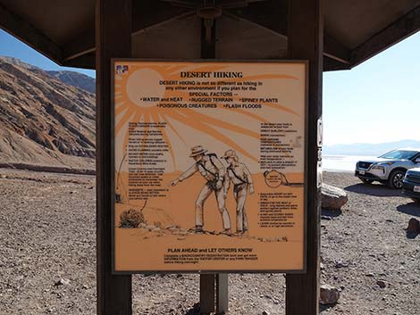
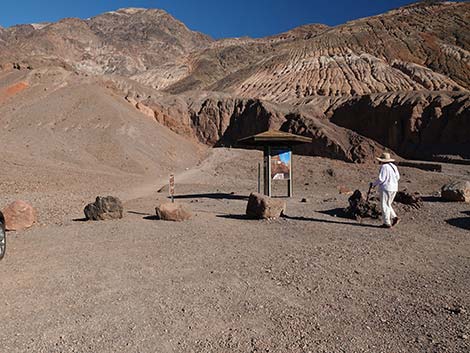 Trailhead and information kiosk (view E) |
Overview Natural Bridge Canyon is short 0.36 mile (10-15 minutes), fairly easy walk up a narrow canyon to a surprisingly large natural bridge in the Death Valley Wilderness Area. Hiking and scrambling farther up the canyon to a 20-ft-high pour-over, which blocks further progress, makes for a nice 1-hour (1.4 miles) round-trip walk in an interesting canyon. Link to map. |
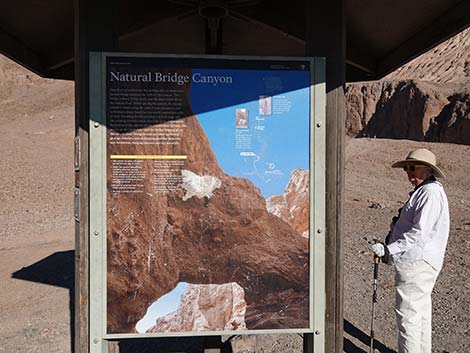 Information kiosk, panel 1 (view NE) |
Watch Out Other than the standard warnings about hiking in the desert, ...the hike to the bridge is pretty safe (rocks occasionally fall from the cliffs), but stay out of the canyon if it is raining or threatens to rain because of flash flood dangers. Beyond the bridge, there are two pour-overs to scramble over, both of which are easy 3rd-class scrambling (which is to say, fairly easy). However, the rock is water-polished and slick, plus it is covered with dust and gravel, so the risk of slipping is greater than usual. The Park Rangers practice rescue skills on the pour-over at the end of this canyon because they often haul injured people out of there. That is a hint: they practice here because they need to -- don't try to climb the final pour-over. While hiking, please respect the land and the other people out there, and try to Leave No Trace of your passage. Also, this is a fairly short hike, so just bring what you need of the 10 Essentials. |
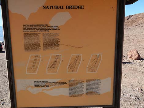 Information kiosk, panel 2 (view NW) |
Getting to the Trailhead This hike is located in Death Valley National Park, about 3.25 hours northwest of Las Vegas. From town, drive out to Death Valley. From the Furnace Creek Visitor Center (Table 1, Site 0712), drive south on Highway 190 for about 1.25 miles to the Badwater (Highway 178) turnoff (Site 0741). Turn south (right) towards Badwater, and drive for about 13.0 miles to the Natural Bridge access road (Site 0771). Turn east (left) towards the mountains and drive for 1.5 miles over an unusually rough dirt road (it takes 8-9 minutes to drive 1.5 miles) to the parking lot at the end of the road (Site 0772). Park here; this is the trailhead. |
 Information kiosk, panel 1 (view SW) |
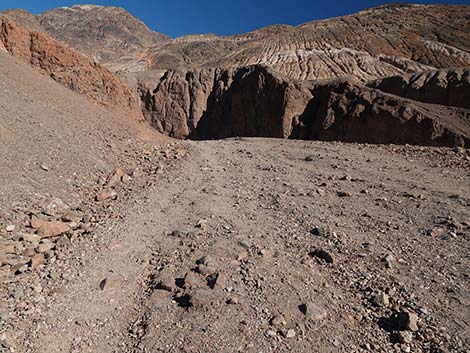
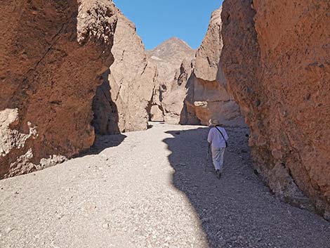
The Hike Before leaving the parking area, stop at the information kiosk and read about the local geology. This information is helpful for understanding the geologic formations seen in the canyon. From the trailhead (Table 2, Waypoint 01), the trail runs northeast on an old dirt road towards the mouth of the canyon, which is only a few minutes away. Here, the trail runs along the top of an alluvial fan with beautiful deposits (i.e., water-washed and sorted sands, silts, gravels, and boulders) and cliffs with various shades of gray, tan, purple, white, and red. The trail turns a corner and heads up into the canyon. Entering the canyon, which is fairly steep but not too bad, hikers are greeted with towering reddish cliffs formed from ancient alluvial materials. The 60- to 80-ft-high wall on the north (left) side of the canyon is a hard conglomerate rock that shows bands of different-sized alluvial materials. Tracing the bands along the wall, little faults and offsets can be seen where the rock fractured, slipped, and the bands no longer line up properly. |
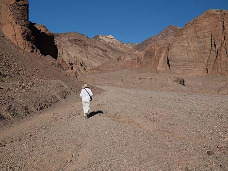
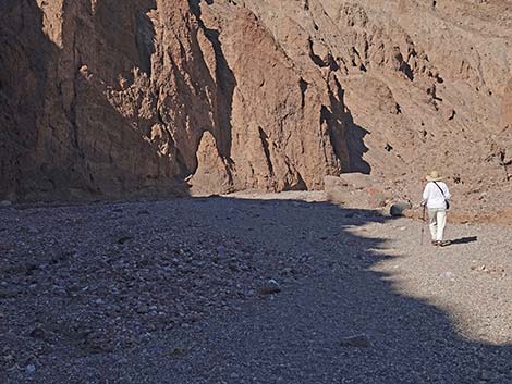
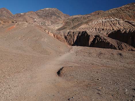 Start of the trail (view NE) |
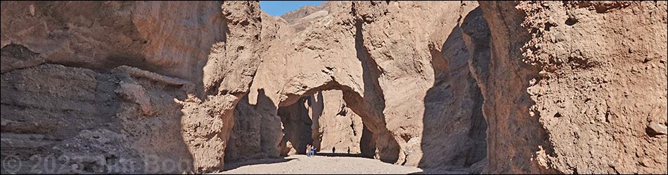
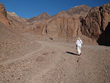
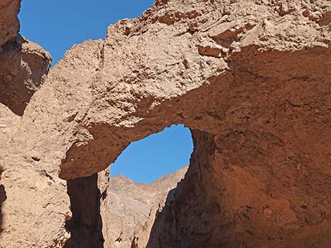
The cliff on the south (right) side of the canyon is a softer alluvial material, and this side is not as steep or as high as the north side. Throughout this canyon, there are many interesting colors and textures in the walls. A few minutes up the trail, the canyon narrows to about 20-ft wide with vertical walls on both sides that are about 25-ft high. At this point, hikers might see the natural bridge farther up the canyon. After a total of about 10-15 minutes of walking in the canyon, hikers arrive at Natural Bridge (Wpt. 02). This arch is about 25-ft tall, 30-ft across, and 10-ft thick at the base. The top of the arch is even with the top of the cliffs on the south side, but not as high as the wall on the north side. Hikers that read the sign at the trailhead will recognize the old watercourse around the north side of the bridge. |
 The trail follows an old roadway into the canyon (view NE) |
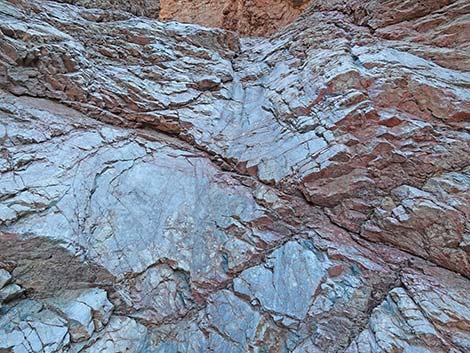
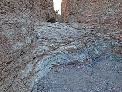
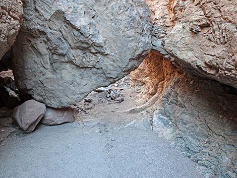
Continuing up the canyon beyond Natural Bridge, hikers quickly come to a fairly thin, rocky fin that sticks out into canyon from the south wall. Given time, the flash floods might punch a hole through this fin and make another arch. Just past the fin, there is an interesting pour-over in the south wall where the rock has eroded such that the pour-over is back in a narrow slot. A few minutes past the pour-over in the slot, hikers arrive at Cave Fault, which is on the north wall. Here, the rock has fractured, and one side of the fault has eroded to form a cave. A few minutes above Cave Fault, you get to a point where the canyon walls change from alluvial deposits to the metamorphic rocks that form the mountains that tower above Death Valley. Here, you can see that the alluvial deposits were laid down on top of the metamorphic "parent material" and that the forces of erosion have cut down through both of them. In places, you can see where alluvial deposits are stuck to the sides of the metamorphic canyon walls and haven't yet completely eroded away. In the metamorphic rock, which originally was sedimentary rock, you can see pretty swirls of blue, red, gray, and white, especially where the water has polished the rock. |
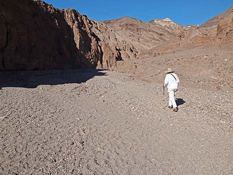
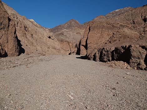
 Old roadway ending; entering the canyon (view NE) |
The metamorphic rocks are harder than the alluvial materials, so they erode more slowly along the bottom of the wash, and shortly after getting into the metamorphic rocks, you arrive at two water-polished pour-overs. The two pour-overs involve a bit of 2nd-class scrambling, maybe 3rd-class climbing, and are fairly easy to get over, but the slick, water-polished rock is covered with dust and gravel, so watch your step. Above the second pour-over, a big boulder fell into canyon, and you have to crawl under it. It makes you wonder when the next one will fall. A few minutes after the boulder, you arrive at a 20-ft pour-over that blocks the trail (Wpt. 03). Enjoy the scenery, contemplate what it would be like with a flash flood blast through here, and then return to the trailhead by following your footprints in the gravel. For photos of the descent, see Natural Bridge Canyon - Return to the Trailhead. |
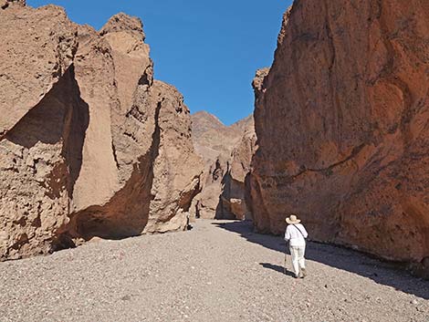
 Hiker starting into the canyon (view N) |
 Lots of loose gravel in the wash (view N) |
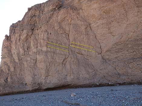 Faulting in the north wall of the canyon (view W) |
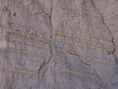 The yellow lines outline an offset layers of alluvial material (view W) |
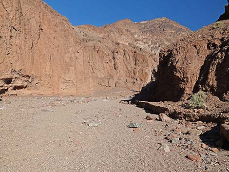
 More loose gravel in the wash (view N) |
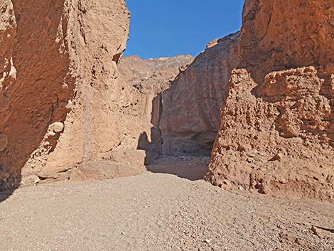
 The canyon bends a bit to the right (view NE) |
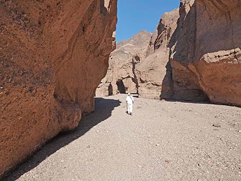
 The canyon begins to narrow (view NE) |
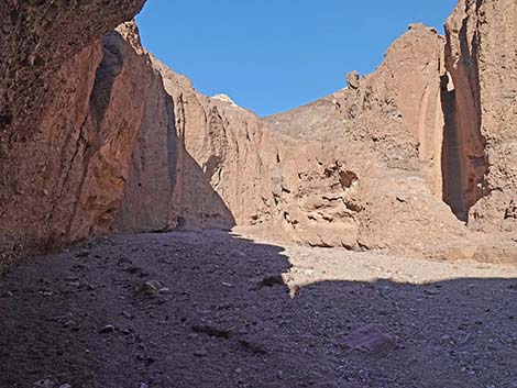
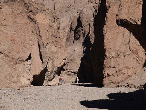 Hikers up the canyon (view NE) |
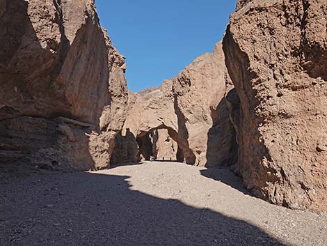
 A slight bend left and the bridge comes into view (view NE) |
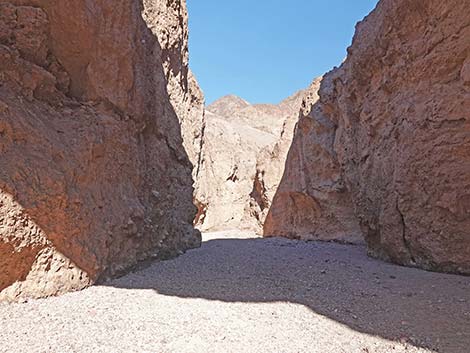
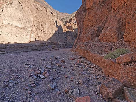
 Narrow canyon (view NE to the bridge) |
 Natural Bridge with humans underneath (view NE) |
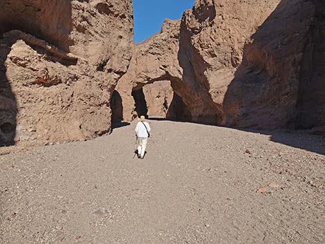 Hiker approaching Natural Bridge (view NE) |
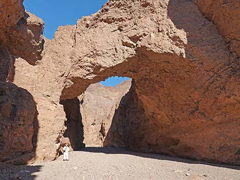 Natural bridge with an adult human for scale (view E) |
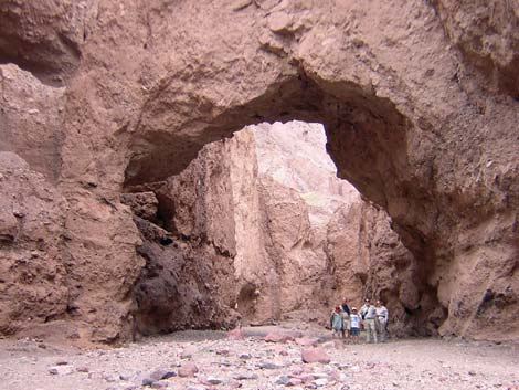 Family under the arch (view E) |
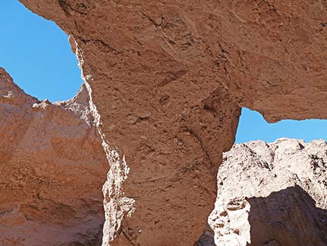
 Natural Bridge (view NE, up) |
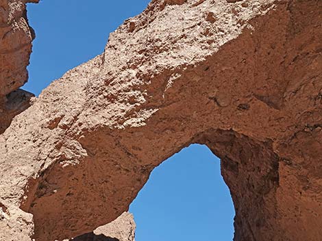 Natural Bridge (view NE, up) |
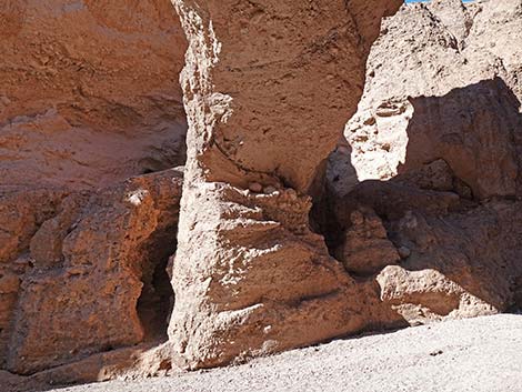 Natural Bridge north pillar (view N) |
 Natural Bridge (view N) |
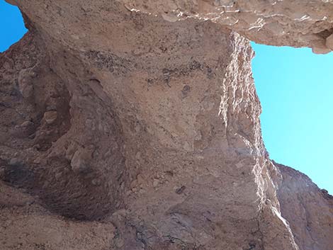 Natural Bridge south pillar (view up) |
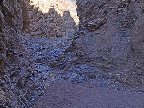
 Continuing up canyon past Natural Bridge (view NE) |
 Continuing up canyon past Natural Bridge (view NE) |
 Continuing up canyon past Natural Bridge (view NE) |
 Continuing up canyon past Natural Bridge (view NE) |
 Continuing up canyon past Natural Bridge (view E) |
 Continuing up canyon past Natural Bridge (view NE) |
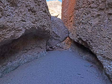
 Approaching first pour-over (view E) |
 Base of first pour-over (view E) |
 Upper section of first pour-over (view E) |
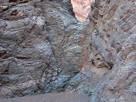
 Approaching second pour-over (view E) |
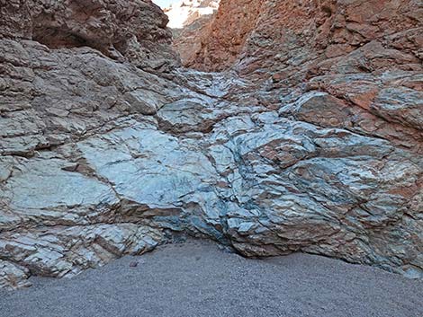
 Base of second pour-over (view E) |
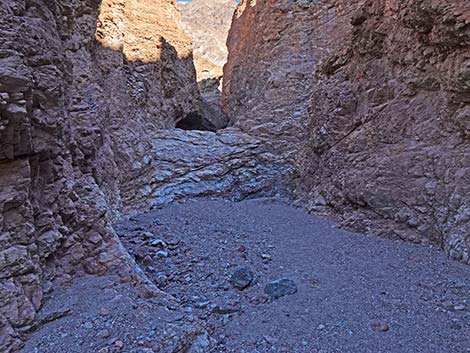
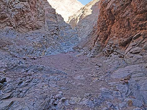
 Approaching boulder spanning the canyon (view E) |
 Boulder spanning the canyon (view E) |
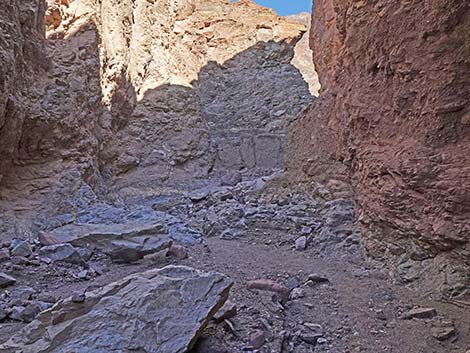 Continuing up canyon (view E) |
 Continuing up canyon (view E) |
 Continuing up canyon (view E) |
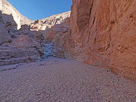
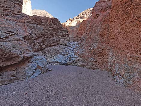
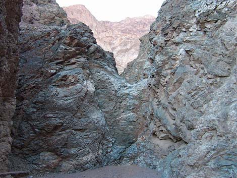 Approaching 20-foot pour-over that blocks canyon (view E) |
 20-foot pour-over that blocks canyon (view E) |
 More to come ... |
Table 1. Highway Coordinates Based on GPS Data (NAD27; UTM Zone 11S). Download Highway GPS Waypoints (*.gpx) file.
| Site # | Location | Latitude (N) | Longitude (W) | Easting | Northing | Elevation (ft) |
|---|---|---|---|---|---|---|
| 0712 | Furnace Creek Visitor Center | 36.46159 | 116.86574 | 512030 | 4034954 | -186 |
| 0741 | Hwy 190 at Badwater Rd | 36.44841 | 116.85192 | 513271 | 4033494 | 4 |
| 0771 | Hwy 178 at Natural Bridge Canyon Rd | 36.27409 | 116.79192 | 518689 | 4014169 | -237 |
| 0772 | Natural Bridge Canyon Parking | 36.28119 | 116.76888 | 520757 | 4014961 | 374 |
Table 2. Hiking Coordinates Based on GPS Data (NAD27, UTM Zone 11S). Download Hiking GPS Waypoints (*.gpx) file.
| Wpt. | Location | UTM Easting | UTM Northing | Elevation (ft) | Point-to-Point Distance (mi) | Cumulative Distance (mi) |
|---|---|---|---|---|---|---|
| 01 | Trailhead | 520767 | 4014972 | 374 | 0.00 | 0.00 |
| 02 | Natural Bridge | 521111 | 4015357 | 460 | 0.36 | 0.36 |
| 03 | Pour-Over | 521529 | 4015579 | 812 | 0.31 | 0.67 |
| 01 | Trailhead | 520767 | 4014972 | 374 | 0.67 | 1.34 |
Happy Hiking! All distances, elevations, and other facts are approximate.
![]() ; Last updated 240324
; Last updated 240324
| Death Valley | Hiking Around Las Vegas | Glossary | Copyright, Conditions, Disclaimer | Home |