Hiking Around Las Vegas, Death Valley National Park
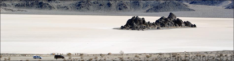
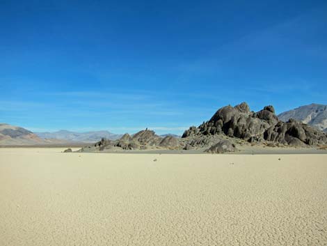
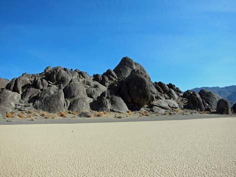
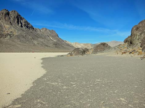
 Overview of Grandstand area (view SE from side of Ubehebe Peak) |
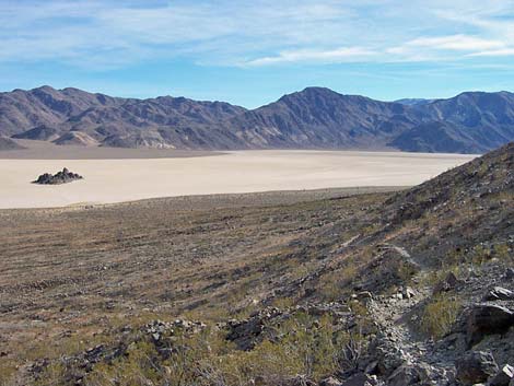
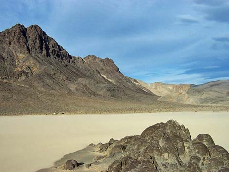
Overview The Grandstand is an easy walk out to an interesting geological feature -- the top of a mountain sticking up from a dry lakebed -- in a picturesque place deep within the Death Valley Wilderness Area. This hike is entirely flat out to the grandstand. From there, pick any route and scramble up the rocks for a higher view. The drive to the Grandstand is too long for such a short walk, so combine this short route with a visit to the Racetracks or Little Ubehebe Peak. The Racetracks, where you can see tracks left in the mud by rocks that slide about due to forces not entirely understand by geologists, are at the far (south) end of the playa. There are few, if any, moving rocks or racetracks around the Grandstand. Stay off the mud if it is wet; footprints in the mud scar the playa and take years to disappear. For details of the journey, see the Racetrack Road webpage. Link to map. |
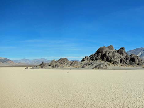
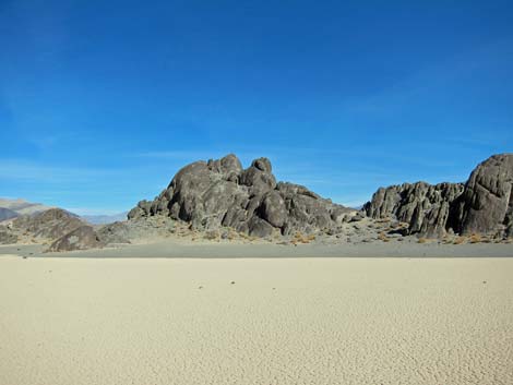
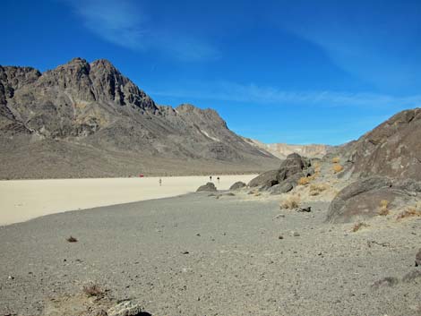
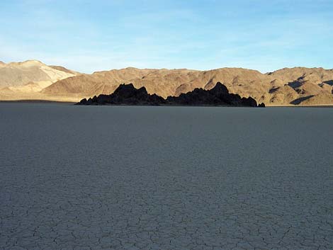 The Grandstand (view E from near trailhead) |
Watch Out Other than the standard warnings about hiking in the desert, ...this hike is entirely safe, but be sure your vehicle is in good working condition, carry plenty of extra water (radiator and drinking), pack a lunch, and drive slowly and carefully. Stay off the playa if it is muddy, as footprints will scar the surface for years. Climbing to the highest point on the Grandstand is minimal 5th-class face climbing with no opportunity for protection or for rappelling off the summit; don't be tempted to climb up there -- it isn't worth the risk. From the top, the fall is worse than you thought because the close landing zone is quite small, while the larger landing zone is a long way down. While hiking, please respect the land and the other people out there, and please try to Leave No Trace of your passage. This is a short walk, so you don't need to bring the 10 Essentials. |
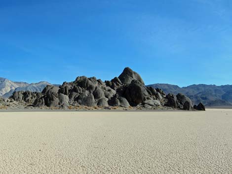
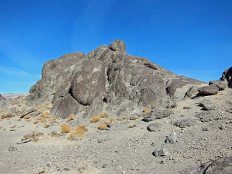
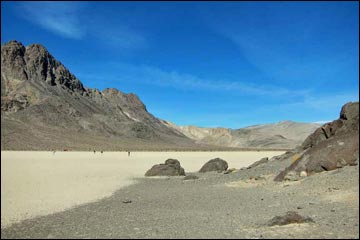
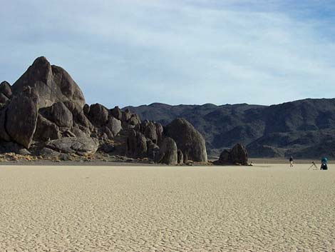 The Grandstand with humans for scale (view E) |
Getting to the Trailhead The Grandstand is located along Racetrack Road in the north end of Death Valley National Park, about 5-1/2 hours northwest of Las Vegas. From town, drive out to Death Valley. From the Furnace Creek Visitor Center (Table 1, Site 0712), drive north about 50 miles to the Grapevine Ranger Station, turn left onto Ubehebe Crater Road (Site 0754), and drive northwest for 5.7 miles to Racetrack Road (Site 0756). Turn right onto Racetrack Road and drive 19.5 miles to Teakettle Junction (Site 0757), then continue straight for 5.7 miles to the north end of Racetrack Playa (Site 758), where a wide parking area on the right (west) side of the road and an information sign on the left (east) mark the destination. Park here; this is the trailhead. For details of the journey, see the Racetrack Road webpage. |
 |
The Hike From the trailhead (Table 2, Waypoint 01), the route runs east onto the playa. There is no trail, just the Grandstand as a landmark. Just walk out on the playa, wander around looking at things, scramble up onto the Grandstand (Wpt. 02), have a good look around at the spectacular scenery, and then wander back to the trailhead when you are ready. The parking area is visible from out on the playa, so there is no chance of getting lost during daylight hours. |
 |
 |
 |
 |
 |
 |
 |
 |
 |
 |
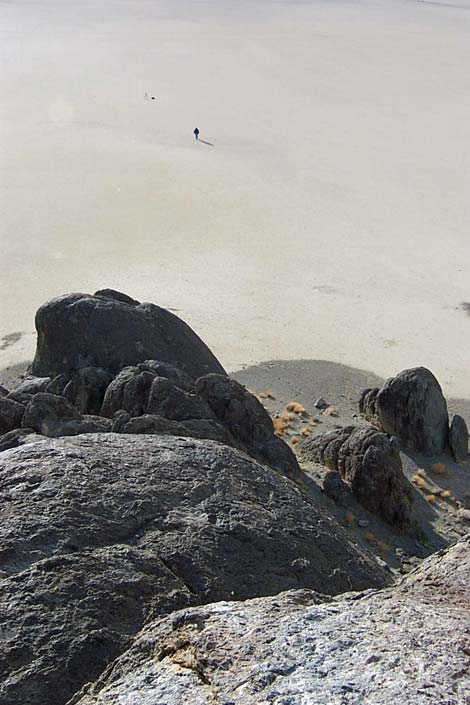 |
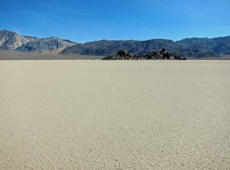
Looking down from the top of the Grandstand at a human out on the playa. Don't climb up here, it isn't worth it and I wouldn't do it again because you can't get down safely. Remember -- it is always easier to climb up something than it is to climb back down (view SE). |
Table 1. Highway Coordinates based on GPS Data (NAD27; UTM Zone 11S). Download Highway GPS Waypoints (*.gpx) file.
| Site | Location | Latitude (°N) | Longitude (°W) | UTM Easting | UTM Northing | Elevation (feet) | Verified |
|---|---|---|---|---|---|---|---|
| 0712 | Furnace Creek Visitor Center | 36.46159 | 116.86574 | 512030 | 4034954 | -186 | Yes |
| 0756 | Ubehebe Crater Rd at Racetrack Rd | 37.01291 | 117.45699 | 459345 | 4096199 | 2,515 | Yes |
| 0754 | Scotty's Castle Rd at Ubehebe Rd | 36.99863 | 117.36605 | 467429 | 4094580 | 2,292 | Yes |
| 0757 | Racetrack Rd at Teakettle Junction | 36.76008 | 117.54142 | 451674 | 4068192 | 4,143 | Yes |
| 0758 | Racetrack Rd at Grandstand Parking | 36.69430 | 117.57073 | 449015 | 4060911 | 3,719 | Yes-2 |
Table 2. Hiking Coordinates Based on GPS Data (NAD27, UTM Zone 11S). Download Hiking GPS Waypoints (*.gpx) file.
| Wpt. | Location | Easting | Northing | Elevation (ft) | Verified |
|---|---|---|---|---|---|
| 01 | Racetrack Grandstand Trailhead | 449034 | 4060916 | 3,710 | GPS |
| 02 | Grandstand | 449475 | 4060737 | 3,770 | GPS |
Happy Hiking! All distances, elevations, and other facts are approximate.
![]() ; Last updated 240324
; Last updated 240324
| Death Valley | Hiking Around Las Vegas | Glossary | Copyright, Conditions, Disclaimer | Home |