Hiking Around Las Vegas, Lake Mead National Recreation Area, Bootleg Canyon
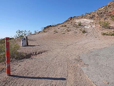
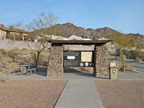 Hike-up trailhead kiosk at bottom of River Mt Hiking Trail |
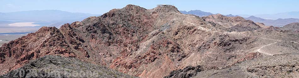
Overview The Red Mountain Overlook Trail is a great hike near Boulder City, just outside the border of Lake Mead NRA. This trail is actually more of an extension to the River Mountains "Foot" Trail than a separate trail in its own right, but road access to the summit of Red Mountain provides an alternate trailhead that makes Red Mountain Overlook accessible to many more people. Thus, there are two ways to start this trail: hiking 2-3/4 miles up from Boulder City or driving up the backside and hiking 1/2 mile to the summit. Either way, the trail leads past the top of the zip-lines to Red Mountain Overlook, which provides grand views out over Boulder City and lands to the east and south across Nevada and Arizona. Link to map or elevation profile. |
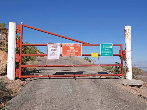
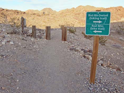 Sign at top of River Mt Hiking Trail near drive-up trailhead (view NE) |
Watch Out Other than the standard warnings about hiking in the desert, ...this is a fairly safe hike. There are some places where a hiker could stumble off the trail near the crest of the mountains, but there are no unusual hazards on this trail. The Red Mountain Overlook Trail is part of the Bootleg Canyon Bicycle Trail System, so be sure to watch for bikers careening down the trail. While hiking, please respect the land and the other people out there, and try to Leave No Trace of your passage. Also, this hike is fairly short, so just bring what you need of the 10 Essentials. |
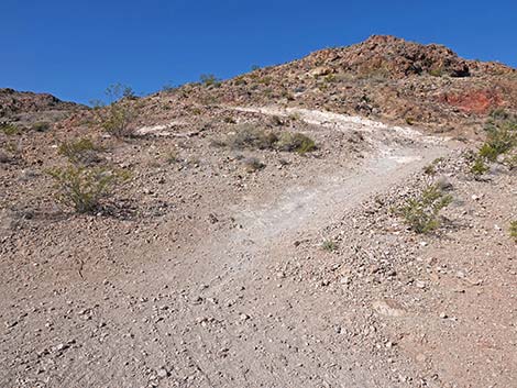
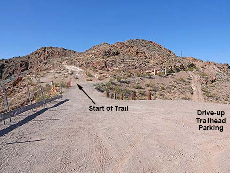 Drive-up trailhead on north side of Red Mountain |
Getting to the Trailhead This hike is located in the Bootleg Canyon Area in Boulder City, just west of the Lake Mead National Recreation Area Visitor Center, about 45 minutes southeast of Las Vegas. There are two trailheads: one at the foot of the mountains in Boulder City (Highway 93 Trailhead), and one at a parking lot high on the backside of Red Mountain (Red Mountain Trailhead). In either case, from Las Vegas, drive out to Boulder City and Bootleg Canyon. For the Highway 93 Trailhead, from the stoplight and left turn on Highway 93 near downtown Boulder City (Table 1, Site 0802), turn left and continue eastbound on Highway 93 for 0.7 miles. Watch for a large brown "River Mountain Trail Parking" sign and left turn (Site 1016) onto a short access road that leads to a parking lot with spaces for 25 vehicles. Park here; this is the Highway 93 trailhead. |
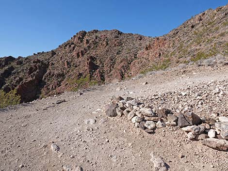
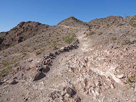
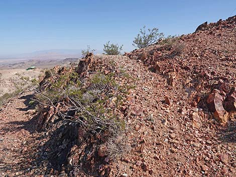
 Start of the trail (view S) |
For the Red Mountain Trailhead, from Highway 93 in Boulder City, turn left onto Yucca Street (Site 1021), which is about 0.6 miles before the stoplight and left turn on Highway 93. Watch for "Bootleg Canyon Trails" signs. From Yucca Street, turn right onto Industrial Road and then left onto Canyon Road, which leads up towards the Red Mountain Trailhead. The pavement ends, but continue to the end of the road. Park here; this is the drive-up trailhead. The Hike From the Highway 93 trailhead (Table 2, Waypoint 1), the River Mountains "Foot" Trail runs past the kiosk and picnic table running northwest between a cement-lined flood control channel and a housing development. At the edge of the housing development, the trail bends to the left and runs more-or-less west past a flood control retention basin, then continues northwest into the desert heading towards the canyon that separates Red and Black mountains. Follow the trail up the canyon all the way to the end of the River Mountains "Foot" Trail atop the saddle between Red and Black mountains (Wpt. 07). For details of this trail, see the description of the River Mountains "Foot" Trail. |
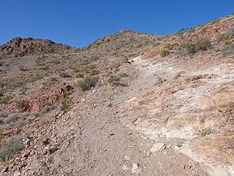
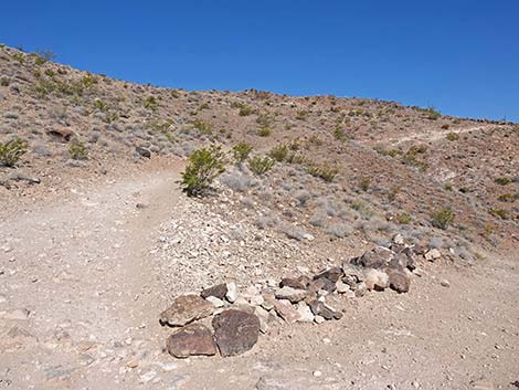
 The road is closed beyond the trailhead (view W) |
At the saddle, a trail sign indicates that the Red Mountain Trail runs to the left, while the Black Mountain Trail runs to the right. This actually is the beginning of these two trails. From here at the trail intersection (Wpt. 07), the Red Mountain Trail runs west and up the hillside, then switchbacks back to the south and climbs onto the north end (Wpt. 11) of the Drive-up Trailhead parking area. The Red Mountain Trail runs out of the south end the Drive-up Trailhead parking area (Wpt. 12), then leaves the parking area on a trail to the left and climbs the skyline ridge. For people using the drive-up trailhead, this is the place to start hiking. The vegetation near the summit is typical Mojave Desert Scrub dominated by creosote bush and other common plants, but also keep an eye out for Heermann's Buckwheat, an odd, brain-shaped plant that is fairly uncommon. During spring, watch for the blue daisy flowers of Desert Aster and the red flowers of Littleleaf Ratany. |
 Starting up the trail (view S) |
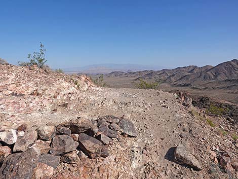
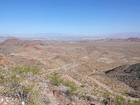
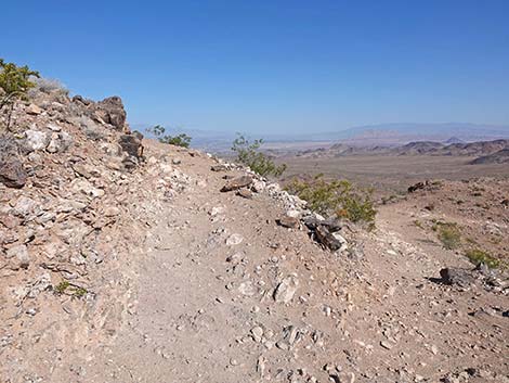
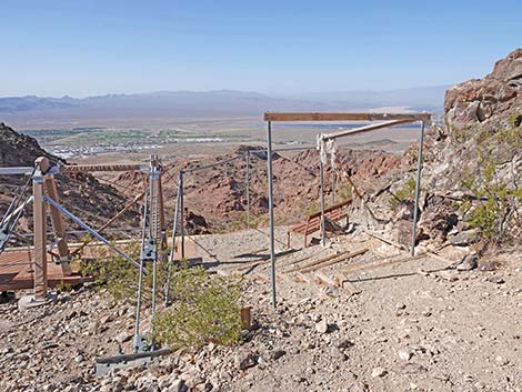
After climbing past three switchbacks, at about 0.28 miles out, the trail gains the summit ridge and the top of the zip-line. The actual summit is off to the west, but it is occupied by communication facilities and is closed to the public. The Red Mountain Overlook, which serves as the summit, is a few minutes walk to the southeast. The trail passes left of the zip-lines and continues southeast dropping along the summit ridge into a saddle (Wpt. 14). A steep use-trail climbs straight up the ridge, but the regular trail crosses the sideslope and switchbacks up the hillside. Both routes eventually arrive at Red Mountain Overlook (Wpt. 15). The overlook is a great place to sit, relax, and take in the grand scene. To the north is Las Vegas, to the east is Lake Mead, to the south is Boulder City, and to the west are the Black Mountains. In all direction, mountain ranges stretch off into the distance. When ready to head down, follow your footprints back down the trail. While doing so, consider hiking out to Black Mountain Overlook, which is another 1.1 miles, round-trip, from the drive-up trailhead. |
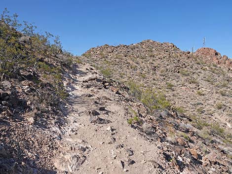
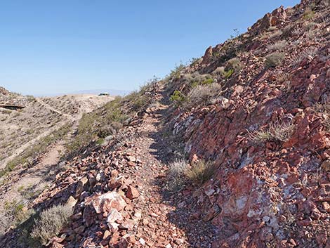
 The trail starts a bit rocky (view S) |
 First switchback (view S) |
 Turning the first switchback (view NW) |
 Second switchback (view N) |
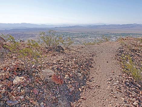
 Nice view of Las Vegas from the switchback (view NW) |
 Turning the second switchback (view SW) |
 Third switchback (view S) |
 Turning the third switchback (view NW) |
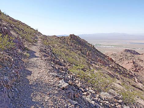
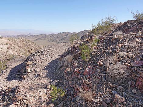
 The trail wraps around the north side of the ridge (view W) |
 Climbing towards the ridgeline (view SW) |
 Approaching the ridgeline (view SW) |
 Approaching the top of the zip-line (view S) |
 Top of the zip-line (view S) |
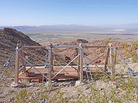 Zip-line platform (view S) |
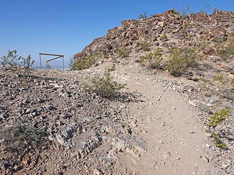
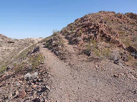
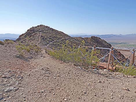 Trail continues past zip-line towards Red Mtn Overlook (view SE) |
 Trail descends towards Red Mtn Overlook (view SE) |
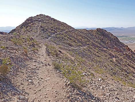
 Saddle at base of Red Mtn Overlook (view SE) |
 Trail resumes climbing (view SE) |
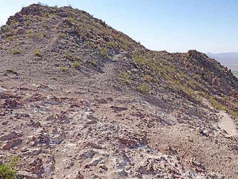
 Approaching switchback and Boulder City Viewpoint (view SE) |
 Boulder City Viewpoint; continuing from switchback (view N) |
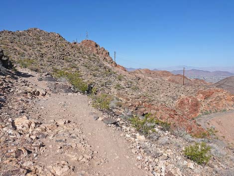
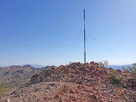
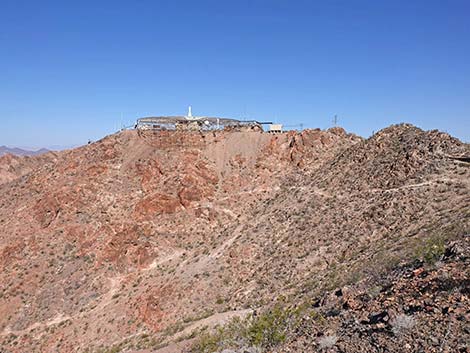 Communication facility atop Red Mountain (view NW) |
 Trail climbs towards the Overlook (view NW) |
 Approaching trail junction and another switchback (view N) |
 Turning back towards the Overlook (view SE) |
 Approaching the last switchback (view SE) |
 Turning the last switchback (view N) |
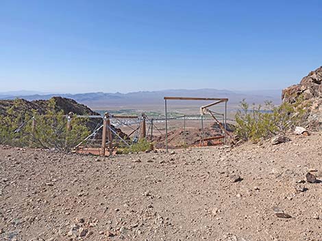
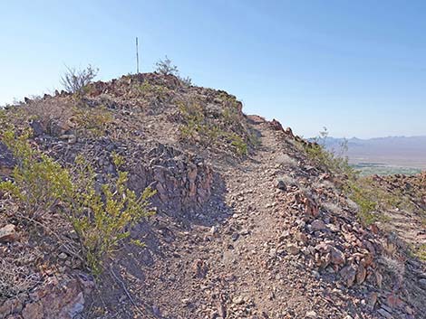
 Arriving on the summit (Red Mtn Overlook (view NE) |
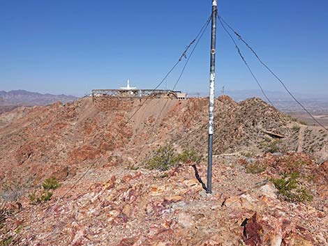 Summit View: FFA communications facility (view W) |
 Summit View: Las Vegas (view NW) |
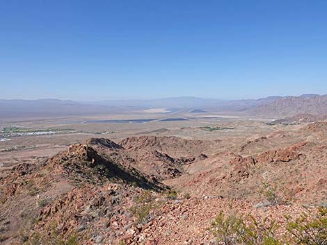 Summit View: Eldorado Valley (view S) |
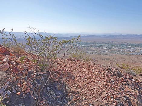
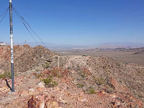
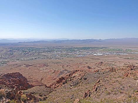 Summit View: Boulder City (view SE) |
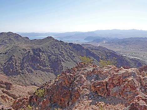 Summit View: Lake Mead and mountains in Arizona (view E) |
Table 1. Highway Coordinates (NAD27; UTM Zone 11S). Download Highway GPS Waypoints (*.gpx) file.
| Site # | Location | Latitude (N) | Longitude (W) | UTM Easting | UTM Northing | Elevation (feet) | Verified |
|---|---|---|---|---|---|---|---|
| 0802 | Hwy 93 at Stoplight | 35.97418 | 114.84526 | 694284 | 3983031 | 2,460 | Yes |
| 1016 | Trailhead Access | 35.98371 | 114.84151 | 694599 | 3984096 | 2,423 | GPS |
| 1021 | Hwy 93 at Yucca St. | 35.96959 | 114.85416 | 693493 | 3982504 | 2,435 | GPS |
| 1022 | Bootleg Cyn Rd at River Mt Loop Trail | 35.98223 | 114.85735 | 693174 | 3983900 | 2,670 | GPS |
| 1023 | Bootleg Canyon Park | 35.98377 | 114.86138 | 692807 | 3984063 | 2,732 | GPS |
| 1024 | Bootleg Cyn Rd Drive-up Trailhead | 35.99882 | 114.86019 | 692877 | 3985734 | 3,396 | GPS |
Table 2. Hiking Coordinates Based on GPS Data (NAD27, UTM Zone 11S). Download Hiking GPS Waypoints (*.gpx) file.
| Wpt. | Location | Easting | Northing | Elevation (ft) | Point-to-Point Distance (mi) | Cumulative Distance (mi) | Verified |
|---|---|---|---|---|---|---|---|
| 07 | Top of Canyon | 692969 | 3985836 | 3,295 | 0.00 | 0.00 | GPS |
| 11 | North Edge Parking | 692877 | 3985763 | 3,389 | 0.14 | 0.14 | GPS |
| 12 | South Edge Parking | 692877 | 3985677 | 3,396 | 0.06 | 0.20 | GPS |
| 13 | Top of Zip-line | 692786 | 3985469 | 3,591 | 0.28 | 0.48 | GPS |
| 14 | Saddle | 692827 | 3985445 | 3,571 | 0.03 | 0.51 | GPS |
| 15 | Red Mt Overlook (summit) | 692876 | 3985410 | 3,622 | 0.03 | 0.54 | GPS |
Happy Hiking! All distances, elevations, and other facts are approximate.
![]() ; Last updated 240326
; Last updated 240326
| Hiking Around Lake Mead | Hiking Around Las Vegas | Glossary | Copyright, Conditions, Disclaimer | Home |