Hiking Around Las Vegas, Spring Mountains (Mt. Charleston), Kyle Canyon Area
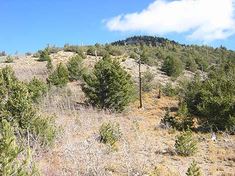
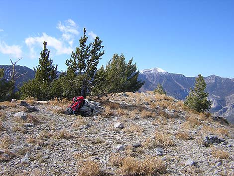
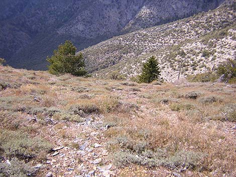
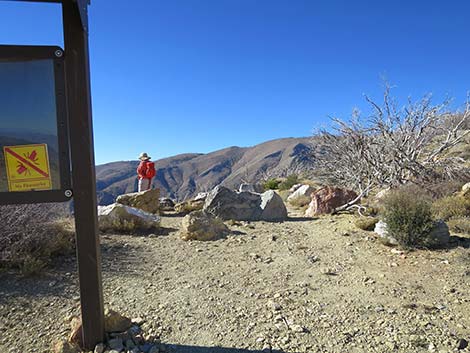 Trailhead (view NW) |
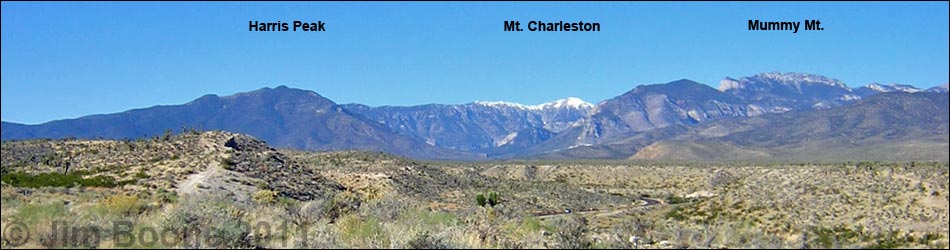
Overview The Harris Mountain Route is a pleasant, 5.4-mile partial-loop that climbs from the Griffith Peak Trailhead to Harris Saddle, then turns east and climbs off-trail to the summit of Harris Mountain. The return trip can be done as a partial loop by descending a very steep hillside, or hikers can return the way they came. Although the Carpenter 1 Fire burned most of the trees, the trail starts at the upper edge of the Pinyon-Juniper Woodland (Upper Sonoran Life Zone), runs up into the Pine-Fir Forest (Canadian Life Zone) at Harris Saddle, and then climbs into the Bristlecone Pine Forest (Hudsonian Life Zone) on the peak. All of which provides a nice variety of vegetation. The summit provides great views in all directions, but especially towards Las Vegas to the southeast, Mt. Charleston to the northwest, and Mt. Potosi and other desert ranges off to infinity in the southwest. Link to map or elevation profile. |
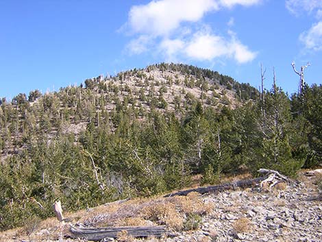
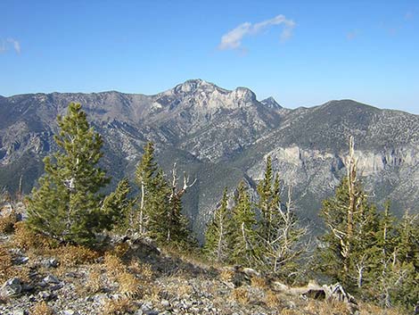
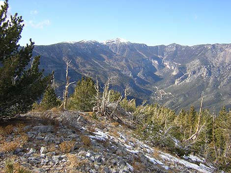
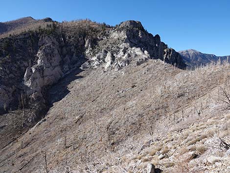 Harris Saddle and Mt. Charleston (view NW) |
Watch Out Other than the standard warnings about hiking in the desert, ... this is a fairly safe hike. Most of the trail to Harris Saddle is wide and secure, but the sidehill below the road is steep. The hike up the ridge is fairly steep and brushy, but there are no cliffs or other unusual obstacles. Making the return loop, the descent off the side of the ridge is quite steep, but again, there are no cliffs or other unusual hazards. The access road requires a 2WD-HC vehicle. While hiking, please respect the land and the other people out there, and try to Leave No Trace of your passage. This hike runs off-trail where nobody will find you, so be sure to bring the 10 Essentials. |
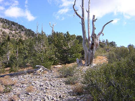
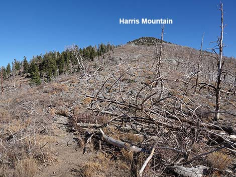 Harris Mountain (view E from Harris Saddle) |
Getting to the Trailhead This hike is located in the Spring Mountains National Recreation Area (generally called Mt. Charleston) south of Kyle Canyon Road off Harris Springs Road, about 1.5 hours northwest of Las Vegas. From town, drive north on Highway 95 to Kyle Canyon Road. Turn left onto Kyle Canyon Road, then drive west to Harris Springs Road. Turn left onto Harris Springs Road and drive south to Harris Mountain Road. Finally, fork right onto Harris Mountain Road and drive up the mountain to the end of the road at the Griffith Peak Trailhead. |
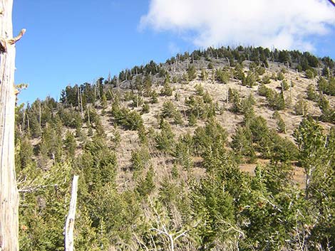
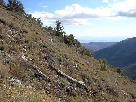
 Route up the West Ridge (view E; photo before fire) |
The Hike From the trailhead (Table 1, Waypoint 01), the Griffith Peak Trail runs west on the old Harris Canyon Road. The old road runs out onto steep, west-facing slopes high above Lovell Canyon, providing great views across the desert towards mountain ranges that disappear into the distance across southern California. Soon, the trail bends right to run northwest, and the high peak to the left is Griffith Peak. The 2013 Carpenter 1 Fire burned off almost all of the vegetation in this area, but shrubby pioneer species are coming back. The trail follows the old, one-lane road for about 1.5 miles to where the road abruptly ends high in Lovell Canyon. Shortly before the old road actually ends, the trail is blocked by rocks (Wpt. 02), and a foot-trail switchbacks steeply up to the right and abruptly begins to climb the hillside. Hikers pass four steep switchbacks, then continue north across the slope to cross the gully (washed out below) at a bedrock crossing. From there, the trail descends back to reconnect with the old road (Wpt. 03). |
 Route up the West Ridge (view E; photo before fire) |
The trail continues towards Harris Saddle. Along the upper section, although burned, the vegetation transitions from a mix of dry, middle-elevation species to a cool, alpine-feeling zone. The trail approaches Harris Saddle a little high and eventually drops into the saddle where a few remaining trees provide some shade. Near the highpoint on the trail (Wpt. 04), just before the trail descends to the bottom of Harris Saddle (Wpt. 05), a use-trail cuts up through a bank of sagebrush to the crest of the ridge (a matter of only a few feet in elevation). At this point (Wpt. 04), the route to the summit leaves the trail and climbs onto the ridge. For details, photos, and some history about this part of the route, see the description of the Harris Saddle Trail. The route (no trail) towards Harris Mountain continues up the ridge, working through and around burned thickets of Curlleaf Mountain Mahogany and Limber Pine. |
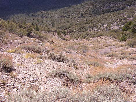
 Route passes a knob on the ridgeline (view SE; photo before fire) |
The route passes a small knob (Wpt. 06) and climbs onto a larger knob (Wpt. 07) where Bristlecone Pine used to be common (Bristlecone Pine Forest; Hudsonian Life Zone). From the top of the knob, the route descends through a shallow saddle, then starts up the broad, west face of the mountain towards the summit. Working up and across the sidehill towards the Northwest Ridge, the route passes a limestone outcrop with coral fossils that, because of the way the rock fractured, reveals the three-dimensional nature of the corals. From the coral fossils, the route continues up and across the face to the Northwest Ridge, which is followed to the summit (Wpt. 08). The summit provides grand views in all directions. To the west are Griffith and Charleston peaks. The north is Mummy Mountain. To the east is the black-and-white banded Sheep Range. To the southeast are the La Madre Range, Las Vegas, and the backside of the Red Rocks cliffs. To the south are Mt. Potosi and the Clark Range. To the southwest are the Kingston Range and other mountain ranges stretching off to the horizon. |
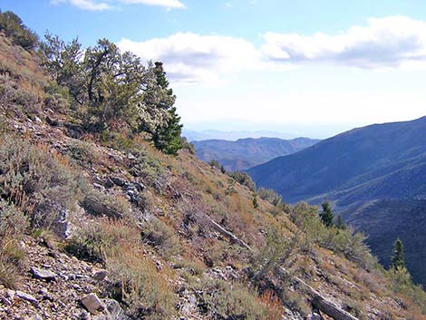
 West Ridge, approaching the summit (view E; photo before fire) |
From the summit, hikers can retrace their steps down the ridge to Harris Saddle (Wpt. 05), or they can descend the South Ridge to make a loop. Following the South Ridge, the route stays more-or-less on the ridgeline until arriving on a broad, open saddle (Wpt. 09). From the saddle, the route drops off the very steep West Face of the ridge. The side of the ridge is open except for a low-growing species of sagebrush, and all of the burned Curlleaf Mountain Mahogany thickets can be avoided. The ground surface is mostly covered with small stones (like scree), but it is not loose. The route eventually intersects the Harris Saddle Trail at the top of the switchbacks, and follow the trail back to the old road (Wpt. 02). Hikers then follow the old road back to the trailhead (Wpt. 01). |
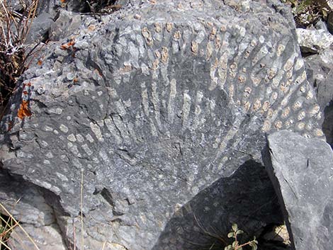 Fossil Coral (side view) |
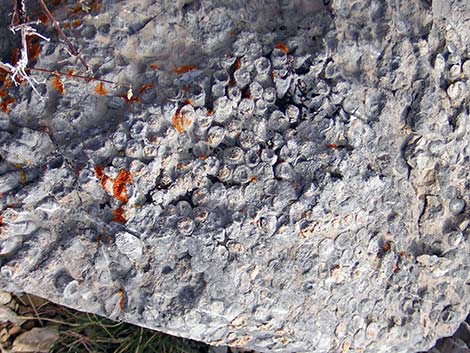 Fossil Coral (top view) |
 Summit (view NW towards Mt. Charleston) |
 Summit (view N towards Mummy Mountain) |
 Summit (view NW up Kyle Canyon) |
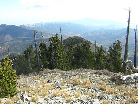 Route runs down South ridge (view S; photo before fire) |
 Route runs down South ridge (view S; photo before fire) |
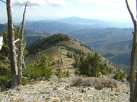
 Route runs down South Ridge to saddle (view S; photo before fire) |
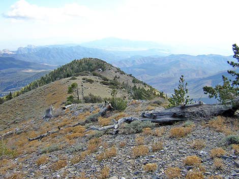
 From saddle, route drops down sideslope (view W; photo before fire) |
 Steep hillside (view S; photo before fire) |
 Steep hillside (view S; photo before fire) |
 Hillside approaching Griffith Peak Trail (view S; photo before fire) |
Table 1. Hiking Coordinates Based on GPS Data (NAD27; UTM Zone 11S). Download Hiking GPS Waypoints (*.gpx) file.
| Wpt. | Location | UTM Easting | UTM Northing | Elevation (ft) | Point-to-Point Distance (mi) | Cumulative Distance (mi) |
|---|---|---|---|---|---|---|
| 01 | Trailhead | 626075 | 4009077 | 8,351 | 0.00 | 0.00 |
| 02 | Detour Starts | 624628 | 4010786 | 8,835 | 1.52 | 1.52 |
| 03 | Detour Ends | 624473 | 4010860 | 8,863 | 0.28 | 1.80 |
| 04 | Harris Saddle (just before) | 623851 | 4011300 | 9,080 | 0.57 | 2.37 |
| 05 | Harris Saddle | 623738 | 4011296 | 9,080 | . | . |
| 06 | Top of small knob | 624177 | 4011337 | 9,381 | 0.25 | 2.62 |
| 07 | Top of larger knob | 624483 | 4011340 | 9,625 | 0.23 | 2.85 |
| 08 | Summit | 624845 | 4011417 | 10,018 | 0.32 | 3.17 |
| 09 | Saddle | 625030 | 4010918 | 9,632 | 0.38 | 3.55 |
| 02 | Detour Starts | 624628 | 4010786 | 8,835 | 0.35 | 3.90 |
| 01 | Trailhead | 626075 | 4009077 | 8,351 | 1.52 | 5.42 |
Happy Hiking! All distances, elevations, and other facts are approximate.
![]() ; Last updated 240329
; Last updated 240329
| Hiking Around Mt Charleston | Hiking Around Las Vegas | Glossary | Copyright, Conditions, Disclaimer | Home |