Backroads Around Las Vegas, Spring Mountains (Mt. Charleston)
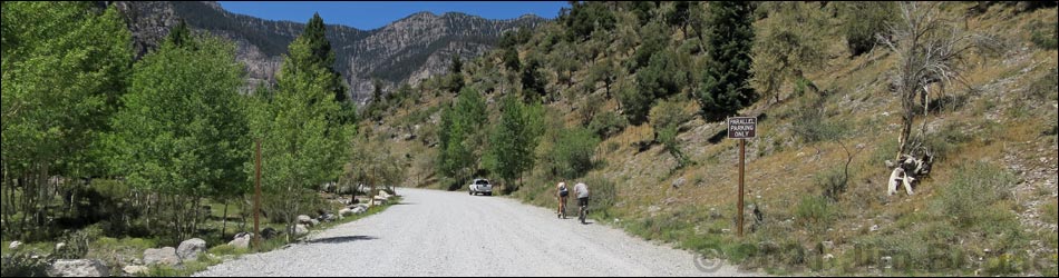
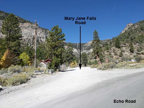
 Echo Road approaching directional sign (view NW) |
Overview Mary Jane Road is a gravel, 0.3-mile-long road in upper Kyle Canyon that runs from Echo Road to Mary Jane Falls Trailhead, all of which is located in the high mountains of the Spring Mountains National Recreation Area. The road provides access to Mary Jane Meadow, Mary Jane Falls Trailhead, public toilets, and tremendous scenery all around. Link to map. Watch Out Other than the standard warnings about driving in the desert, ...this is a fairly safe drive. The road is narrow and should be considered 15 mph. Nonetheless, always watch for crazy drivers careening around blind corners. The road is closed during winter, but always open during the hiking season. There is no gasoline on the mountain. |
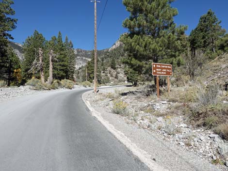
 Directional sign: left to Mary Jane Road (view NW) |
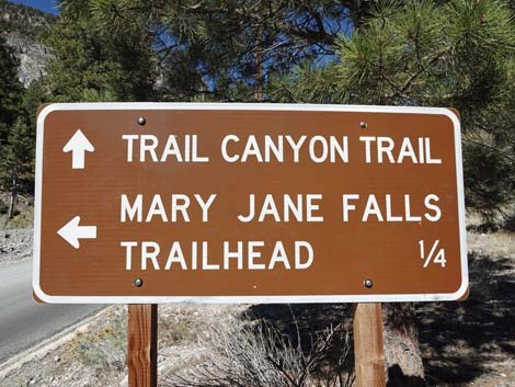
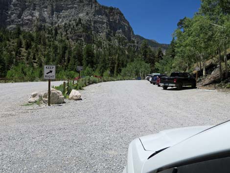
While out, please respect the land and the other people out there and try to Leave No Trace of your passage. Also, even though this is a paved road, be sure to bring what you need of the 10 Essentials. Getting to the Roadhead This road is located off Kyle Canyon Road about 45 minutes northwest of Las Vegas. From town, drive north on Highway 95. Just on the outskirts of town, turn left onto Kyle Canyon Road and drive west into the Spring Mountains National Recreation Area. From the highway, drive 20.4 miles to Echo Road, which forks to the right at the start of a sharp curve to the left. Turn onto Echo Road and drive 0.4 miles to Mary Jane Road (Site 0734), which forks to the left. The Road From Echo Road, Mary Jane Road forks to the right onto graded gravel. The road immediately passes (on the right) the two exits from the Trail Canyon Trailhead. Note that both sides are posted "Do not Enter." The entrance is 0.1 miles farther up Echo Road. On the left behind chain-link fencing is a water pumping facility. |
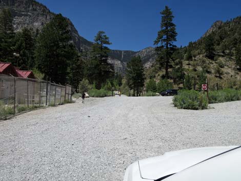
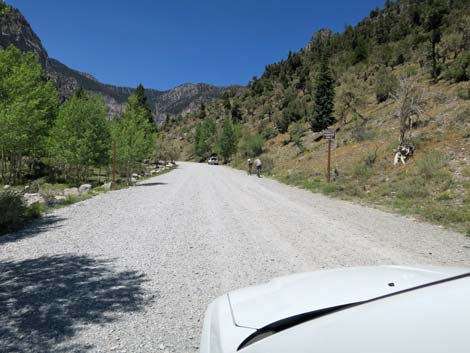
 Echo Road approaching Mary Jane Road (view NW) |
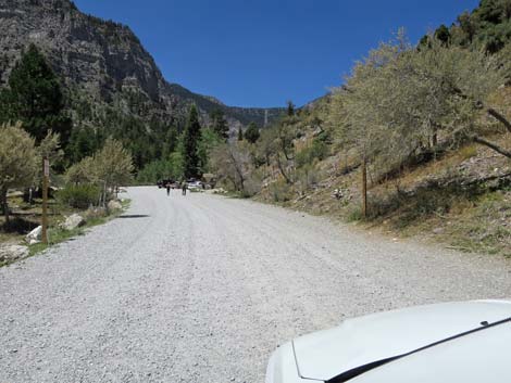
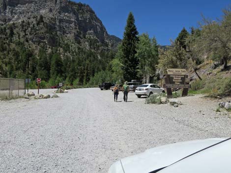
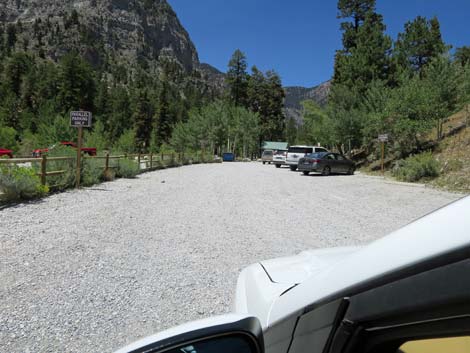
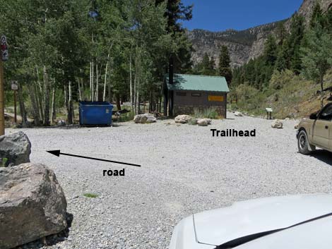
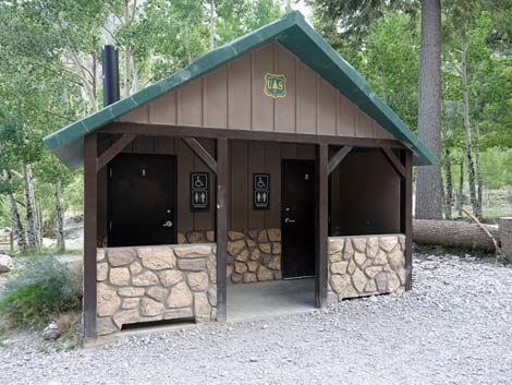
Staying left, in about 75 yards, Mary Jane Road passes through a fence with a heavy metal gate. The gate is always open during hiking season, but it is closed during winter when the road is not plowed to remove snow. People can walk in and ski when the gate is closed. Mary Jane Road runs northwest along Kyle Creek with tall confer trees and quaking aspen providing shade. The right side of the road can be used for overflow parking, but the left side is marked "No Parking" to ensure the roadway remains open for emergency vehicles. Continuing, at about 350 yards out, Mary Jane Road enters the Mary Jane Falls Trailhead parking area. In another 100 yards, Mary Jane Road actually arrives at Mary Jane Falls Trailhead (Site 0541), and the end of the road. This trailhead provides access to Mary Jane Falls Trail and Big Falls Trail, and a public toilet. At the end of the road, the road loops back to the left, passes along Mary Jane Meadow, and eventually closes the turn-around loop to exit back onto Mary Jane Road eastbound. |
 Echo Road at Mary Jane Road (view NW) |
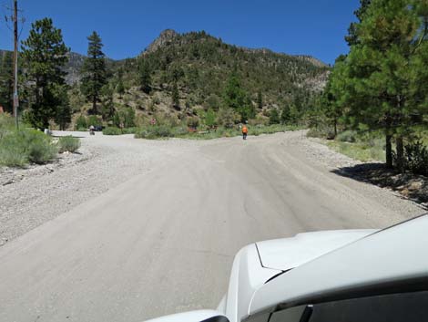
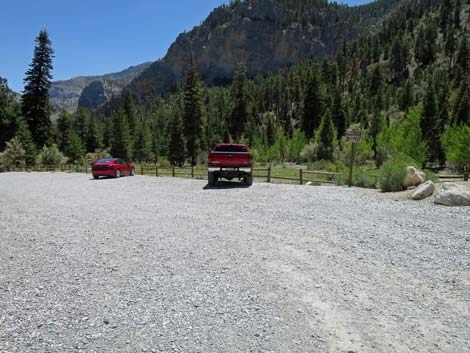
 Mary Jane Road passing Trail Canyon Trailhead parking (view NW) |
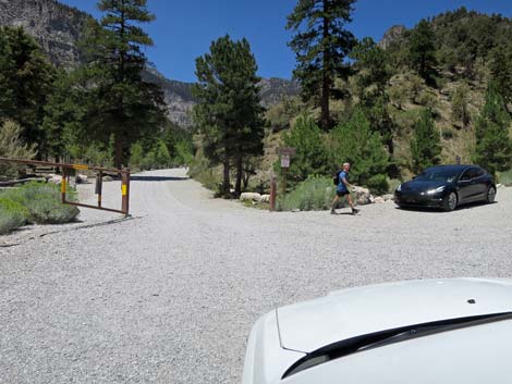 Mary Jane Road approaching a heavy gate (view NW) |
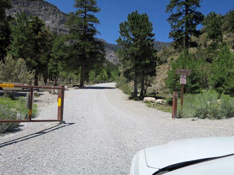 The gate is open during summer (view NW) |
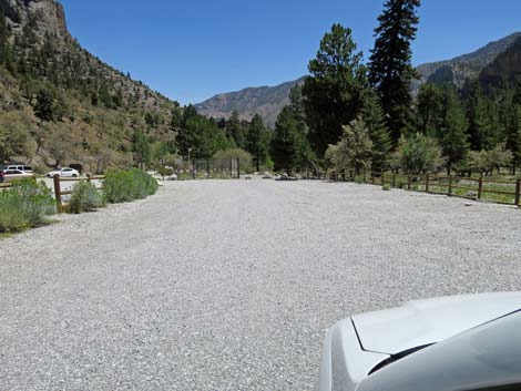
 Mary Jane Road; parking is okay on the right (view NW) |
 Mary Jane Road; parking is prohibited on the left (view NW) |
 Mary Jane Road (view NW) |
 Mary Jane Road approaching Mary Jane Falls Trailhead (view NW) |
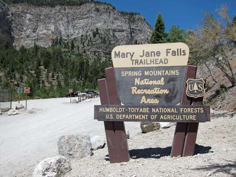 Mary Jane Falls Trailhead sign (view NW) |
 Mary Jane Road entering the parking area; stay right (view NW) |
 Mary Jane Falls parking area (view NW) |
 Mary Jane Road turns back at the trailhead (view NW) |
 Public toilet at the trailhead (view SW) |
 Mary Jane Road loops back through the parking area (view SE) |
 Mary Jane Road loops back through the parking area (view SE) |
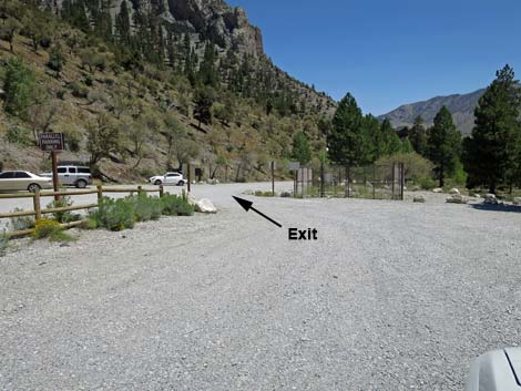 Mary Jane Road closes the loop to exit the area (view SE) |
Table 1. Backroad Coordinates (NAD27; UTM Zone 11S). Download Roadway GPS Waypoints (*.gpx) file.
| Site | Location | UTM Easting | UTM Northing | Latitude (N) | Longitude (W) | Elevation (ft) |
|---|---|---|---|---|---|---|
| 0490 | Trail Canyon Trailhead Parking | 620571 | 4014082 | 36.26596 | 115.65777 | 7,683 |
| 0541 | Mary Jane Falls Trailhead Parking | 620230 | 4014205 | 36.26711 | 115.66154 | 7,825 |
| 0733 | Kyle Canyon Rd at Echo Rd | 621129 | 4013659 | 36.26208 | 115.65163 | 7,697 |
| 0734 | Echo Rd at Mary Jane Falls Rd | 620598 | 4014013 | 36.26533 | 115.65748 | 7,739 |
| 1281 | Trail Canyon Trailhead Parking | 620598 | 4014120 | 36.26630 | 115.65746 | 7,785 |
| 1282 | Echo Trailhead Parking | 620956 | 4013706 | 36.26252 | 115.65354 | 7,605 |
Happy Hiking! All distances, elevations, and other facts are approximate.
![]() ; Last updated 240329
; Last updated 240329
| Backroads | Hiking Around Las Vegas | Glossary | Copyright, Conditions, Disclaimer | Home |