Hiking Around Las Vegas, Mount Charleston Area
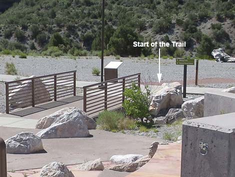
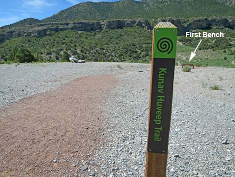 Sign post for start of Kunav Huveep Trail: this is the trailhead |
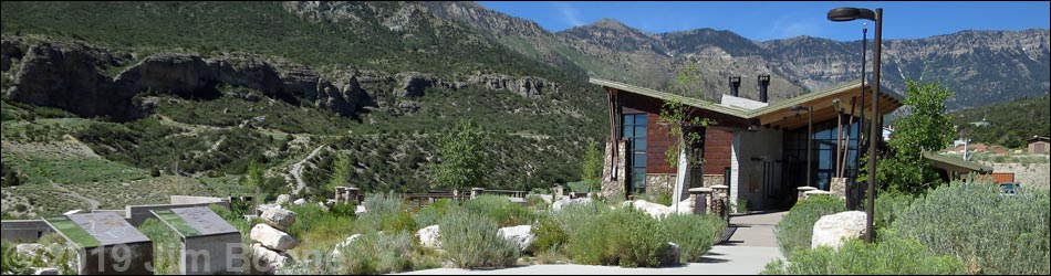
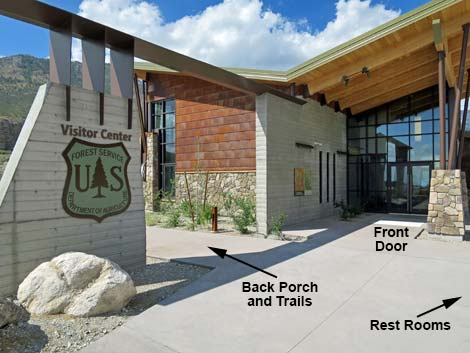
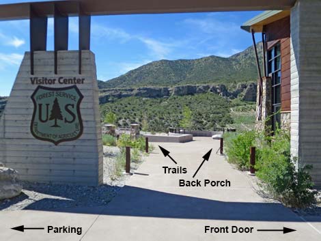
The Visitor Center Trailhead is located up in the Spring Mountains National Recreation Area, behind the Visitor Center building at about 6700-ft elevation. Hikers need to park in the general parking lot, walk to the Visitor Center building, then turn left and head down through the amphitheater to the trailhead. The trailhead is marked only with a single post and a sign with a map of area trails. This trailhead directly serves four trails. The Kunav Huveep Trail (this is the Paiute name for Kyle Canyon) drops into Kyle Canyon Wash, makes a loop and comes back out. This is the only trail named on the trailhead marker post. The Pack Rat Trail and the Escarpment Trail both start here on the Kunav Huveep Trail, but make longer loops before coming back out. The fourth trail, the Acastus Trail, starts here and runs up the canyon through Kyle Canyon Campground to Fletcher Canyon Trailhead. Link to Trailhead Map. |
 Visitor Center area trail |
Getting to the Spring Mountains Visitor Center Trailhead The Visitor Center is located in Kyle Canyon up in the Spring Mountains National Recreation Area, about 45 minutes northwest of Las Vegas. From downtown, drive north on Highway 95 for 17.0 miles towards Reno. Just beyond the edge of urban Las Vegas, turn left onto Highway 157 (Kyle Canyon Road) towards Kyle Canyon. Drive west on Kyle Canyon Road and head up the hill for 16.3 miles to a "round-about." Drive 3/4ths of the way around the loop and exit right under the ranch gate, which leads into the large visitor center parking lot. Continue towards the taller building ahead in the distance and find a convenient place to park. From the parking lot, walk to the Visitor Center building, but turn left under the arch just before the front door. Walk down and left through the amphitheater and out the bottom. The trailhead sign marker post is just ahead. |
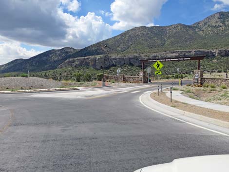 In the round-about, aiming for the third exit (view NE) |
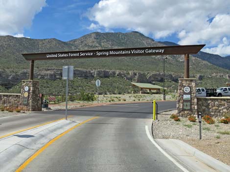 Entrance to the Visitor Center area (view S) |
 Entering the large parking area (view SW) |
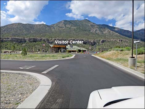
 Start of the trail to the Visitor Center building (view SW) |
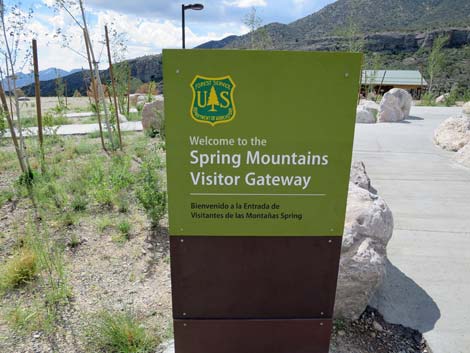 Entrance sign (view S) |
 Walkway to the Visitor Center (view W) |
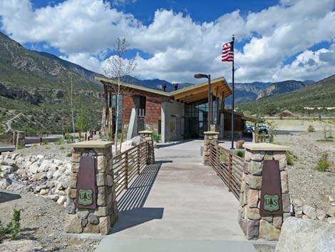 Bridge to the Visitor Center (view W) |
 Approaching the Visitor Center front doors (view SW) |
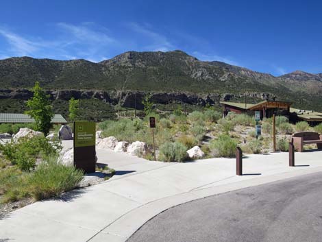
 Walkway to the trails and back porch (view S) |
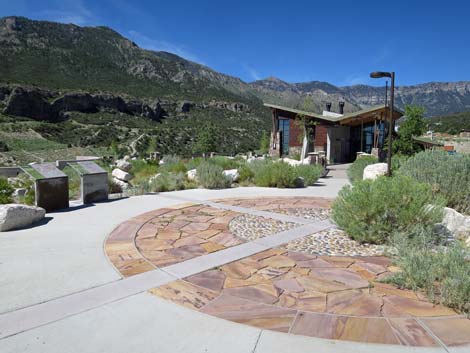
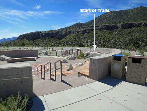 Overlooking the outdoor amphitheater (view SE) |
 Exit from the outdoor amphitheater (view SE) |
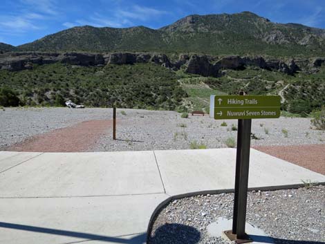 Sign: Hiking Trails straight ahead (view S) |
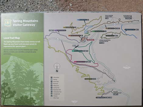 Sign: Trails in the Visitor Center area (note: North is at the bottom) |
Sign post for start of Kunav Huveep Trail: this is the trailhead |
Table 1. Highway Coordinates (NAD27; UTM Zone 11S). Download Highway GPS Waypoints (*.gpx) file.
| Site | Location | UTM Easting | UTM Northing | Latitude (N) | Longitude (W) | Elevation (ft) |
|---|---|---|---|---|---|---|
| 1609 | Spring Mountains Visitor Center Parking | 626923 | 4014786 | 36.27149 | 115.58696 | 6,647 |
Happy Hiking! All distances, elevations, and other facts are approximate.
![]() ; Last updated 240329
; Last updated 240329
| Hiking Around Mt Charleston | Hiking Around Las Vegas | Glossary | Copyright, Conditions, Disclaimer | Home |