Hiking Around Las Vegas, Red Rock Canyon National Conservation Area
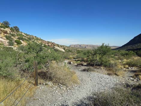
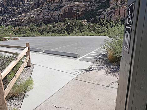
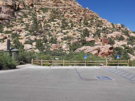 Handprints trailhead parking (view E) |
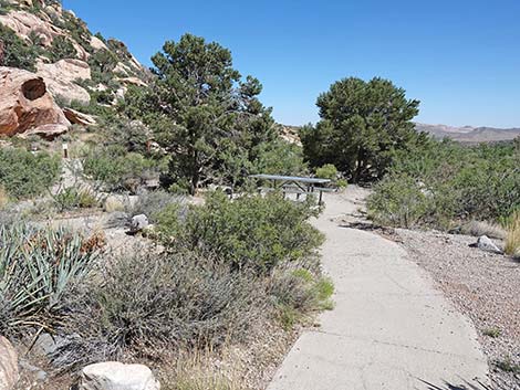
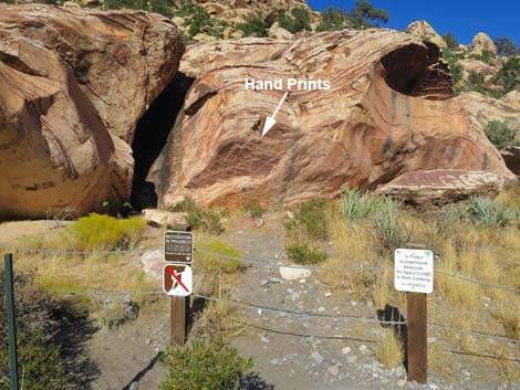
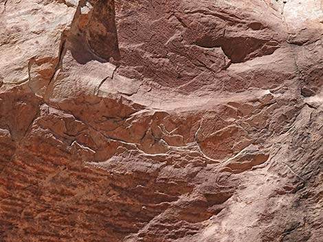
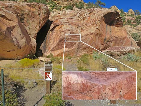
Overview The Handprints Trail is a short, ADA compliant trail that runs 250 feet from an accessible trailhead parking area, past information signs and picnic tables, to an archeological site where Native Peoples did "high 5s" on the rocks with painted hands. Leaving behind hand paintings (pictographs using red paint), these people might have been leaving a signature saying: "I was here." Native Peoples also cooked meals here in an agave-roasting pit, suggesting that this was a ceremonial gathering place. There is more rock art hanging on the wall of Red Rock Canyon, but hikers need to search for it. The scenery is great, the desert vegetation is relatively lush for the desert, there are nearby springs with riparian vegetation, and there is always the chance of seeing bighorn sheep up in the cliffs. Link to map. |
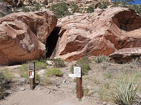
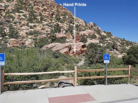 Handprints are visible from the trailhead (view E) |
Watch Out Other than the standard warnings about hiking in the desert, ...this is a safe hike if you don't stray off the trail. Watch for Catclaw Acacia (also called Wait-a-Minute Bush) growing on the edge of the trail. The curved spines catch and tear clothing and skin, causing people to Wait-a-Minute and untangle themselves. Please respect the Native American sites and don't deface them; they are part of the history of this land, and when they are gone, they are gone forever. Sites like this are protected by the federal Antiquities Act, and the Friends of Red Rock Canyon offer a reward for information leading to the arrest of people defacing the site. While hiking, please respect the land and the other people out there, and try to Leave No Trace of your passage. Also, even though this hike is short, be sure to bring what you need of the 10 Essentials. Please respect these important sites and stay behind the fence. |
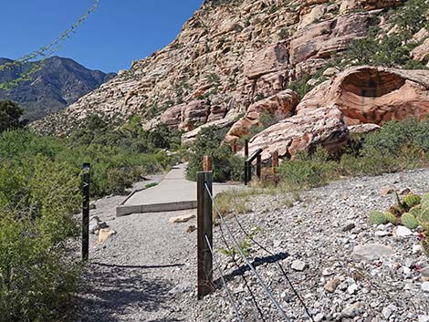
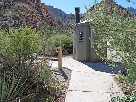
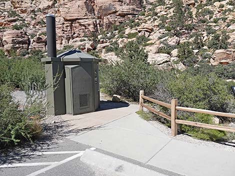 Trail starts by outhouse (view NE) |
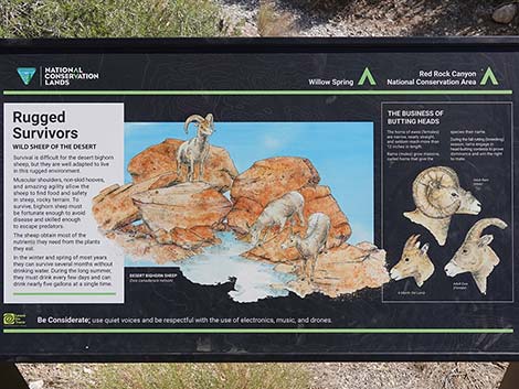
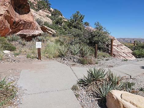
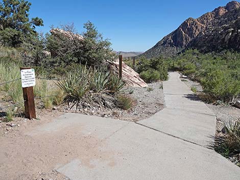
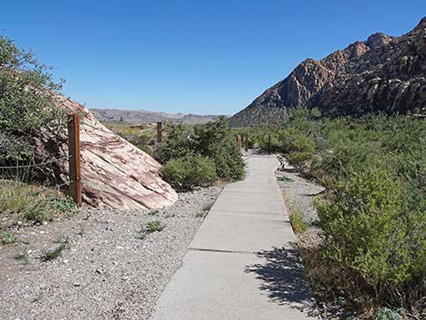
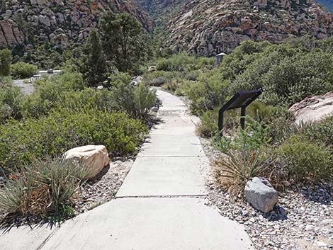
Getting to the Trailhead This hike is located along the Scenic Loop Road in Red Rock Canyon National Conservation Area, about 1 hour west of Las Vegas. Drive out to Red Rocks, pay the fee, and then drive about half-way around the Scenic Loop Road to Willow Springs Road. Turn right and drive north 0.5 miles to the close end of the Willow Springs Trailhead parking area. Watch for reserved parking stalls. Park here; this is the trailhead. The Hike From the trailhead parking area by the lower restroom (Table 1, Waypoint 01), a cement trail leads east 80 yards towards huge boulders against the canyon wall. Starting out, visitors quickly encounter the first information sign: Rugged Survivors: Wild Sheep Of The Desert, which provides information about the Desert Bighorn Sheep who live here. |
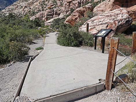
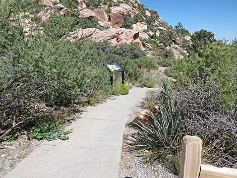 Concrete trail runs towards the handprints (view E) |
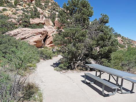
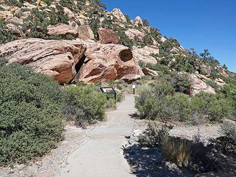
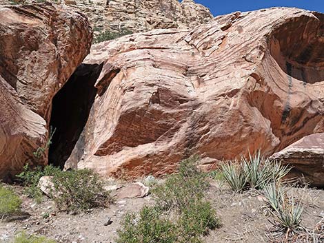
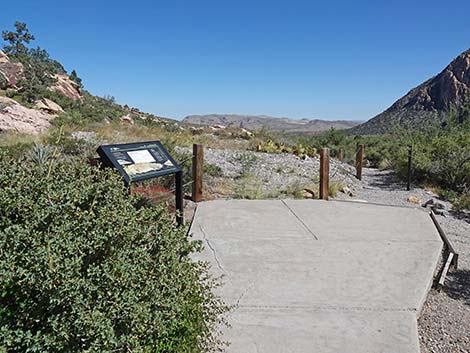
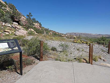
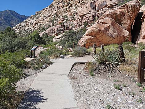
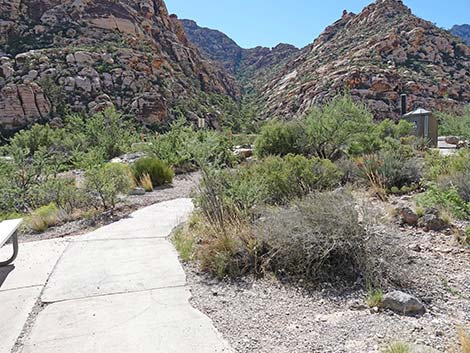
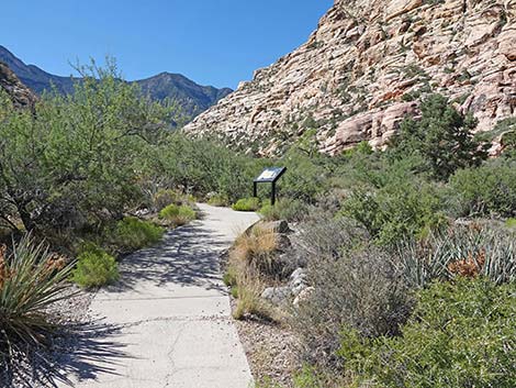
Continuing, the trail bends a little right and then a little left to arrive at a picnic table. On winter days, this table in the sun is a nice place to sit and enjoy the scenery or even to enjoy a picnic lunch. Continuing under a tall Singleleaf Pinyon Pine, the trail soon arrives at the second information sign: Rock Impressions, Stories over Time, which provides information about petroglyphs. Just beyond the sign, hikers arrive at a viewpoint (Wpt. 02) where five handprints can be seen on the boulder ahead. From the handprints viewpoint, the concrete trail turns right and continues to an agave roasting pit viewpoint (Wpt. 03). Another sign here provides information about this site: Agave Roast, a Time for Feasting and Ceremony. After spending a few minutes contemplating the lives of people who lived here hundreds or thousands of years ago, return up concrete trail to the trailhead (Wpt. 01). |
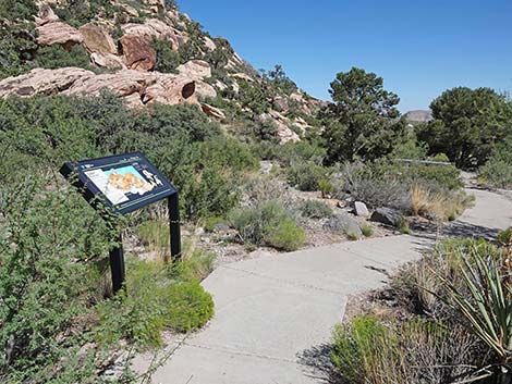 Approaching information sign (view SE) |
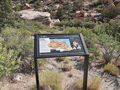 Information sign: Rugged Survivors: Wild Sheep of the Desert |
 Details of information sign (view NE) |
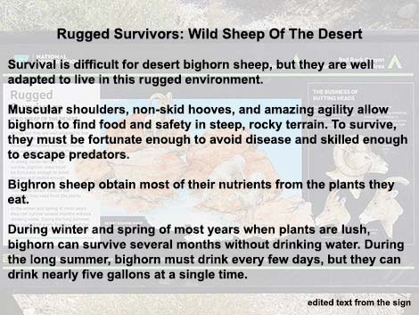 Edited text from the information sign (left side) |
 Edited text from the information sign (right side) |
 The trail continues (view SE) |
 Last picnic table (view E) |
 The trail continues under a pinyon pine (view E) |
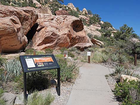 Second information sign (view E) |
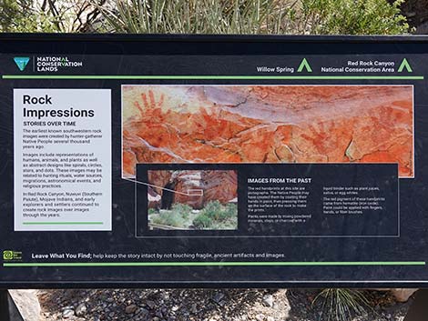 Information sign: Rock Impressions, Stories over Time |
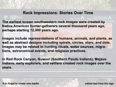 Edited text from the information sign (left side) |
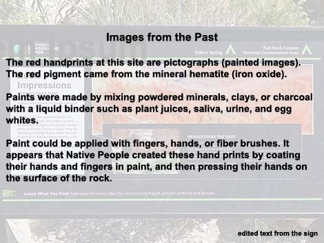 Edited text from the information sign (right side) |
 Trail continues past the information sign |
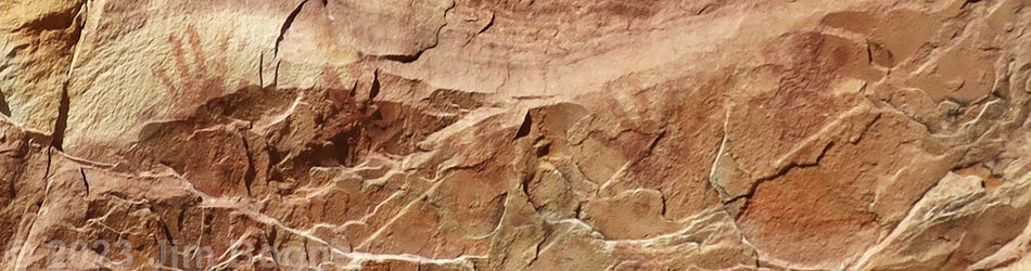
 Painted Hands viewpoint: handprints pictograph site (view NE) |
 Painted Hands pictograph site (view NE) |
 Painted Hands pictograph site (view NE) |
 Painted Hands pictograph site (view NE) |
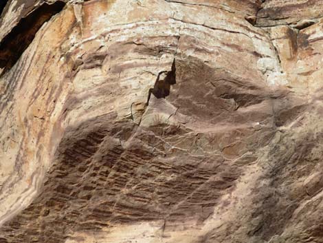 Painted Hands pictograph site; they can be hard to see (view NE) |
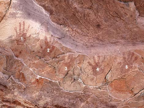 Five ancient handprints (view NE) |
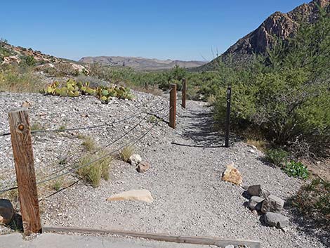
 The trail continues to the right (view S) |
 Grand scenery (view S) |
 Approaching the Agave Roasting Pit viewpoint (view S) |
 Agave Roasting Pit viewpoint (view S) |
 Third information sign (view SE) |
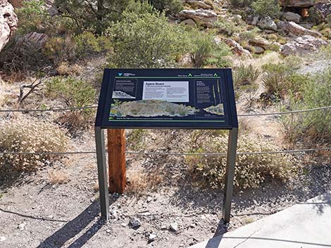
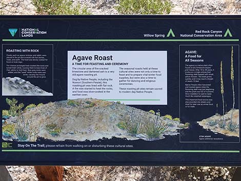 Information sign: Agave Roast, a Time for Feasting and Ceremony |
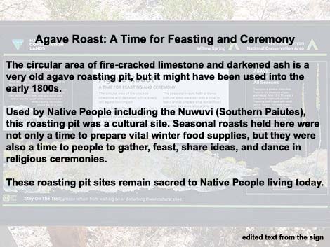 Edited text from the information sign (middle) |
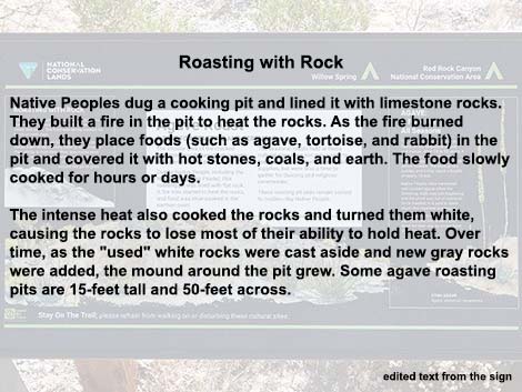 Edited text from the information sign (left side) |
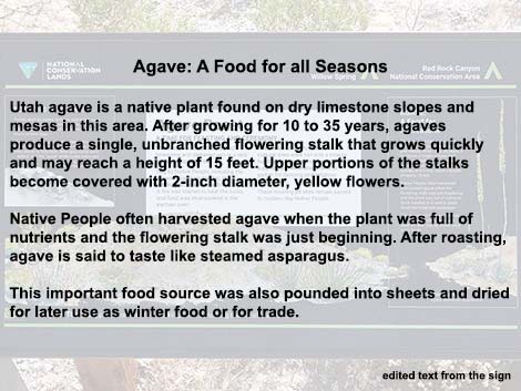 Edited text from the information sign (right side) |
 Agave roasting pit (view E) |
 The Willow Springs Loop Trail continues past the concrete (view S) |
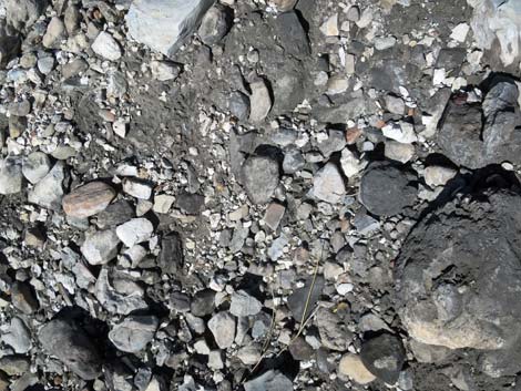 Ash and burnt rocks from ancient cooking fires (view down) |
 A better view into the Agave roasting pit (view E) |
 Dirt trail continues down canyon past agave roasting pit (view SE) |
 More to come ... |
Returning to the Trailhead
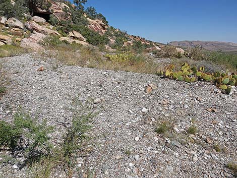
 Dirt trail approaching concrete trail (view N) |
 Returning to the concrete trail (view N) |
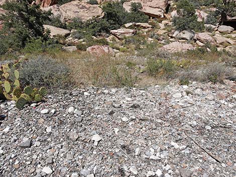
 The trail returns to the handprints viewpoint (view N) |
 One last look from the handprints viewpoint (view NE) |
 The Handprints Trail bends left (view W) |
 The Handprints Trail returns past the picnic table (view W) |
 The Handprints Trail returns towards the first info sign (view NW) |
 The Handprints Trail returns towards the outhouse (view NW) |
 The Handprints Trail arriving at the trailhead (view NW) |
More to come ... |
Table 1. Hiking Coordinates Based on GPS Data (NAD27; UTM Zone 11S). Download Hiking GPS Waypoints (*.gpx) file.
| Wpt. | Location | UTM Easting | UTM Northing | Elevation (ft) | Point-to-Point Distance (ft) | Cumulative Distance (ft) |
|---|---|---|---|---|---|---|
| 01 | Trailhead | 635186 | 4002569 | 4,557 | 000 | 000 |
| 02 | Handprints Viewpoint | 635232 | 4002570 | 4,550 | 182 | 182 |
| 03 | Agave Roasting Pit Viewpoint | 635241 | 4002555 | 4,547 | 065 | 247 |
| 01 | Trailhead | 635186 | 4002569 | 4,557 | 247 | 494 |
Happy Hiking! All distances, elevations, and other facts are approximate.
![]() ; Last updated 240330
; Last updated 240330
| Hiking Around Red Rocks | Hiking Around Las Vegas | Glossary | Copyright, Conditions, Disclaimer | Home |