Hiking Around Las Vegas, Red Rock Canyon National Conservation Area
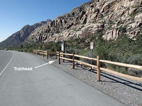
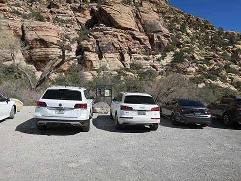
 Trailhead at Willow Spring Picnic Area (view NE) |
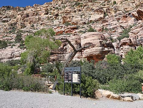
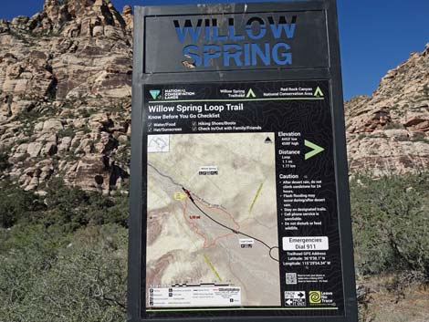
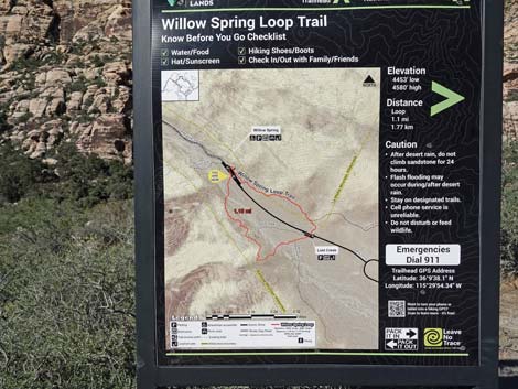
The Willow Springs Trailhead is located in Red Rock Canyon National Conservation Area and provides access to several trails, each with a trailhead sign. These trails lead to Native American archeological sites, springs, seasonal waterfalls, many miles of easy to strenuous hiking, and a pretty rough dirt road. There is a nice picnic area here too with trees and water that bring in birds. The Willow Springs Trailhead Parking area serves four trailheads. At the north end of the parking area, Rocky Gap Road serves northbound hikers. At the northwest corner of the parking area, the Petroglyph Wall Trail runs across the wash. On the west side of the parking area, a small sign announces the Willow Springs Loop Trail. At the southeast corner of the picnic area, the Willow Springs Loop trail runs south past an archeological site with petroglyphs, pictographs, and an agave roasting pit. Link to trailhead map. |
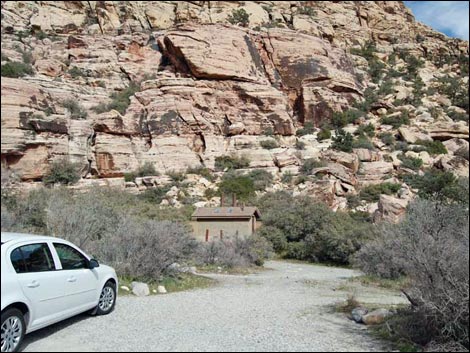 Willow Spring Picnic Area Restrooms (view E) |
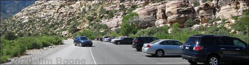
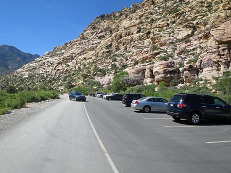
Willow Springs Trailhead is located in Red Rock Canyon National Conservation Area, about 50 minutes west of Las Vegas, inside the Scenic Loop Road fee area. From town, drive out to Red Rocks. From West Charleston at the Scenic Loop Road (Table 1, Site 0519), turn right onto Scenic Loop Road and drive north for 0.2 miles to the entrance station (Site 0855). Pay the fee, then drive around the one-way Scenic Loop Road for 7.2 miles to Willow Spring Road (Site 0526), on the right. |
 Willow Spring (behind the cottonwood tree) |
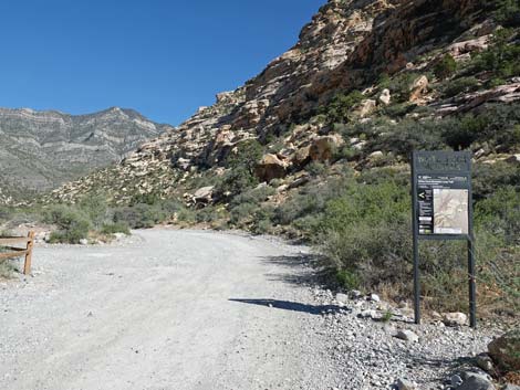
Turn right onto Willow Spring Road and drive north for 0.6 miles to the end of the pavement (Site 0181) at Willow Spring Picnic Area. Paved and unpaved parking is available on both sides of the road. Park here; this is the trailhead. Trails: Willow Springs Loop Trail, Petroglyph Trail, White Rock Loop Trail, Waterfalls Canyon Route, Upper Lost Creek Falls, La Madre Spring, and La Madre Miner's Cabin. |
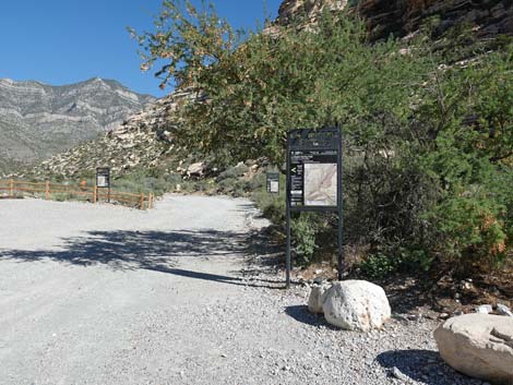
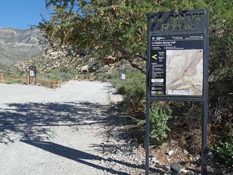
La Madre Spring Trailhead
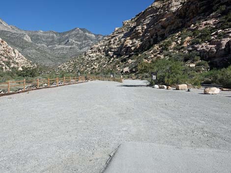 La Madre Spring Trailhead (view NW from end of pavement) |
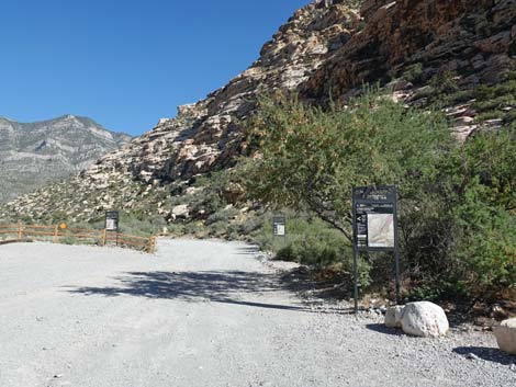 La Madre Spring Trailhead (view NW) |
 La Madre Spring Trailhead (view NW) |
 La Madre Spring Trailhead sign (view NW) |
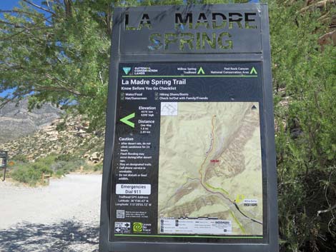 La Madre Spring Trailhead sign (view NW) |
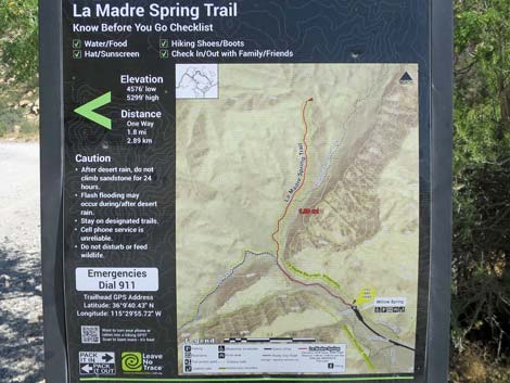 La Madre Spring Trailhead map (view NW) |
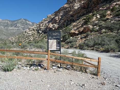
White Rock Mountain Trailhead
 White Rock Mountain Trailhead (view NW) |
 White Rock Mountain Trailhead (view NW) |
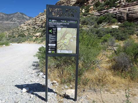 White Rock Mountain Trailhead sign (view NW) |
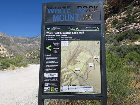 White Rock Mountain Trailhead sign (view NW) |
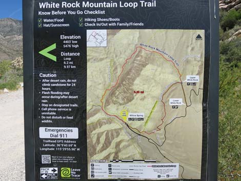 White Rock Mountain Trailhead map (view NW) |
 More to come ... |
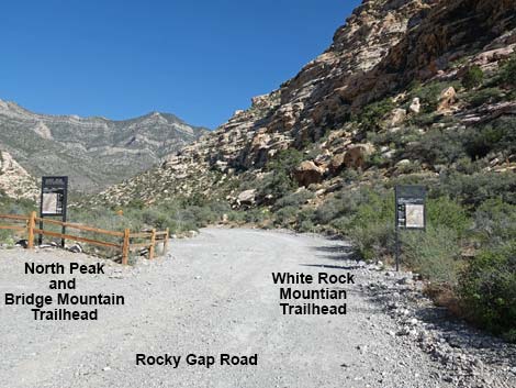
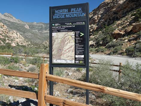
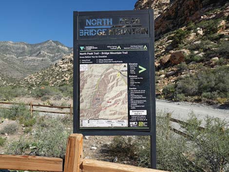
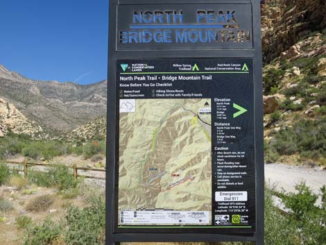
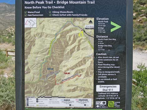
North Peak and Bridge Mountain Trailhead
|
 |
 |
 |
 |
 |
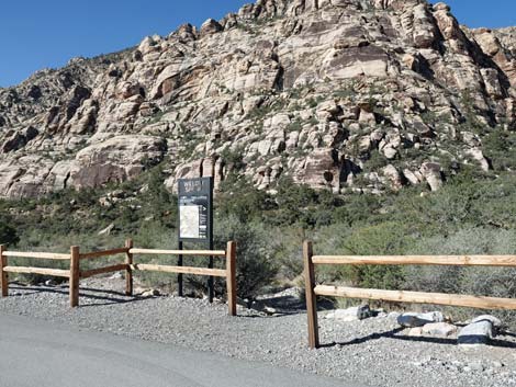
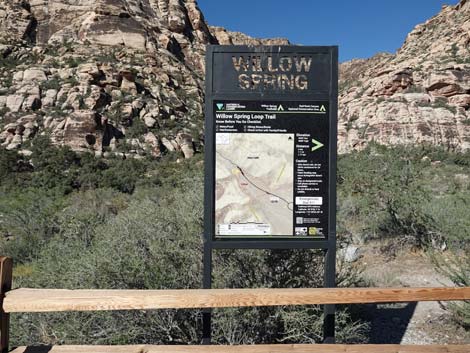
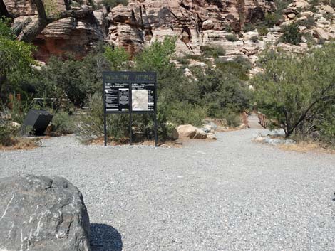
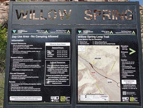
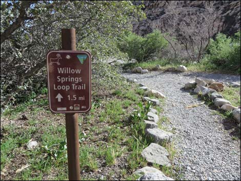
Willow Springs Loop Trailhead, west side
 Willow Springs Loop Trail, west side (view SW) |
 Willow Springs Loop Trail, west side |
 |
 |
 |
 |
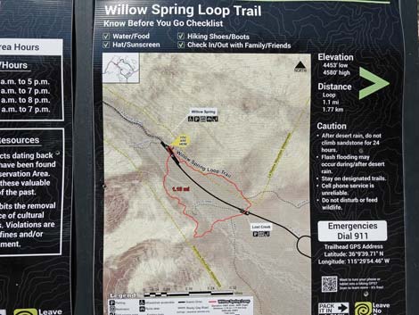
 Willow Springs Loop Trailhead map (view W) |
 Willow Springs Loop Trail, west side (view NW) |
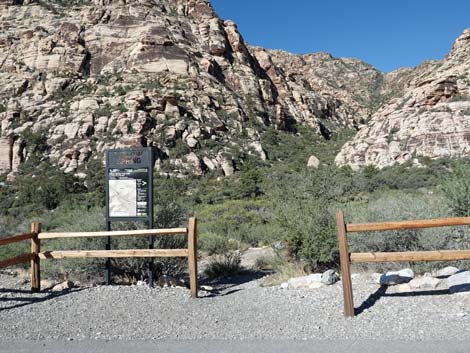
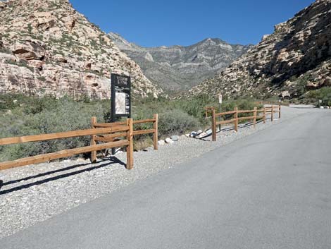
Willow Springs Loop Trailhead, east side
 Willow Springs Loop Trailhead (view E) |
 Willow Springs Loop Trailhead (view SE) |
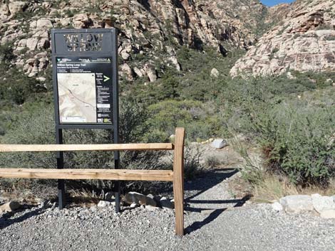
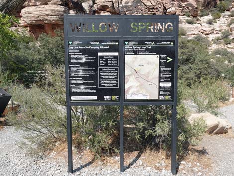 Willow Springs Loop Trailhead sign (view E) |
 Willow Springs Loop Trailhead sign (view E) |
 Willow Springs Loop Trailhead sign (close-up; view E) |
 Willow Springs Loop Trail, east side (view SE) Willow Springs Loop Trail, east side (view SE) |
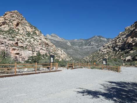
Petroglyph Trail Trailhead
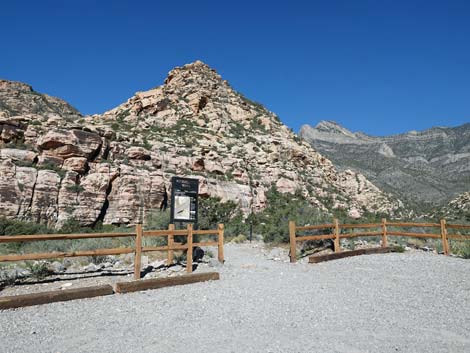
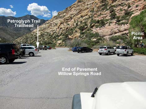 Petroglyph Wall Trailhead parking (view N) |
 Petroglyph Wall Trailhead parking (view W) |
 |
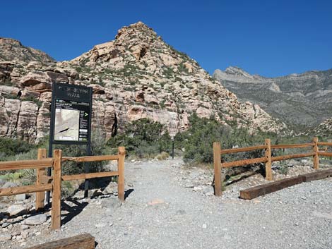 |
 Petroglyph Wall Trailhead (view NW) |
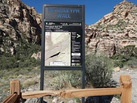 Petroglyph Wall Trailhead sign (view NW) |
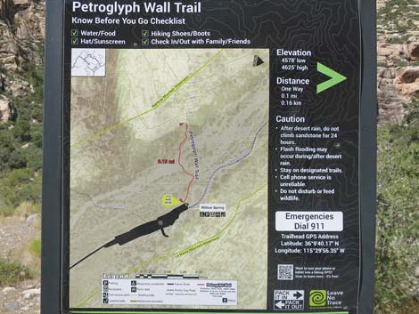 Petroglyph Wall Trailhead sign (view NW) |
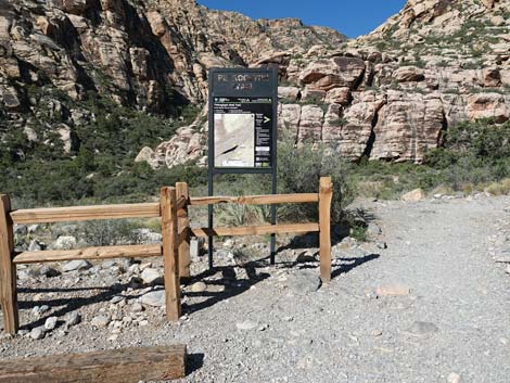
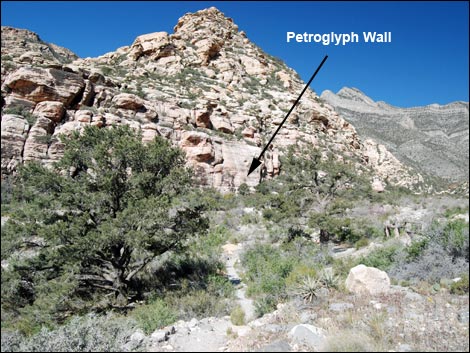 Start of the Petroglyph Wall Trail (view NW) |
Historical Rocky Gap Road trailhead signs
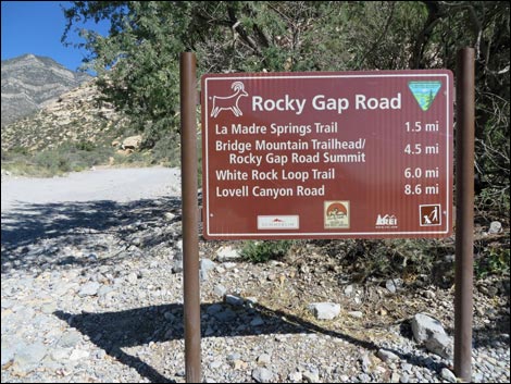 Historical Rock Road Gap sign (view NW) White Rock Loop Trail, Waterfalls Canyon Route, Upper Lost Creek Falls, La Madre Spring, and La Madre Miner's Cabin, Rocky Gap Rd |
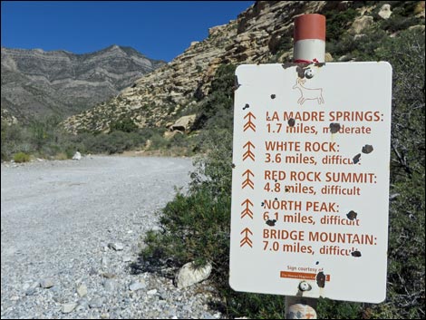 Historical Rocky Gap Road sign (view NW) White Rock Loop Trail, Waterfalls Canyon Route, Upper Lost Creek Falls, La Madre Spring, and La Madre Miner's Cabin, Rocky Gap Rd |
Table 1. Highway Coordinates (NAD27; UTM Zone 11S). Download Highway GPS Waypoints (*.gpx) file.
| Site # | Location | Latitude (N) | Longitude (W) | UTM Easting | UTM Northing | Elevation (feet) | Verified |
|---|---|---|---|---|---|---|---|
| 0181 | Willow Springs Picnic Area | 36.16104 | 115.49798 | 635106 | 4002654 | 4,575 | Yes |
| 0519 | Charleston at Scenic Loop Entrance | 36.13161 | 115.42048 | 642131 | 3999501 | 3,681 | Yes |
| 0526 | Scenic Loop Rd at Willow Spring Rd | 36.15609 | 115.48918 | 635906 | 4002118 | 4,441 | Yes |
| 0855 | Scenic Loop Entrance Station | 36.13252 | 115.42282 | 641918 | 3999598 | 3,682 | Yes |
Happy Hiking! All distances, elevations, and other facts are approximate.
![]() ; Last updated 240330
; Last updated 240330
| Hiking Around Red Rocks | Hiking Around Las Vegas | Glossary | Copyright, Conditions, Disclaimer | Home |