Hiking Around Las Vegas, Spring Mountains NRA
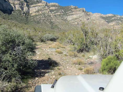
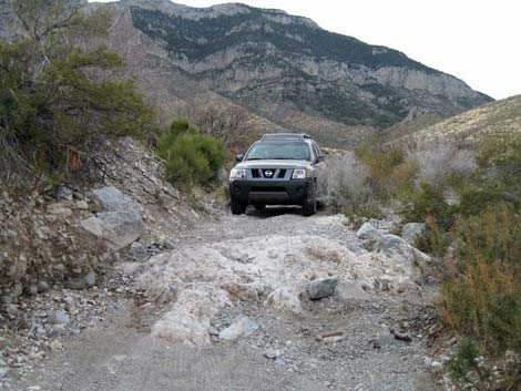
 Direct Route trailhead parking (view SW) |
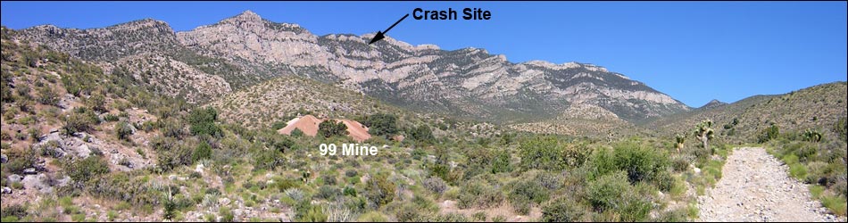
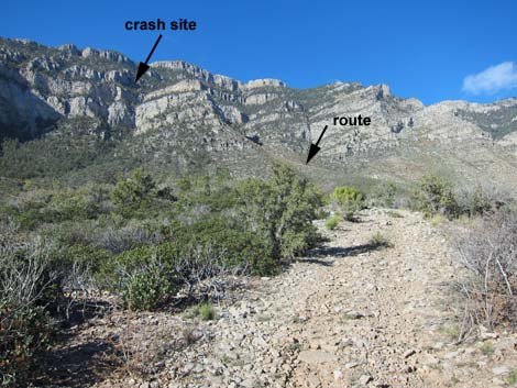
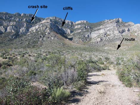
Overview This tough hike is one of those quintessential Las Vegas routes. A playground for the rich and famous, Las Vegas attracts many celebrities; some never make it home. In 1942, a plane carrying Carole Lombard (famous movie star and wife of Clark Gable) crashed high on the east face of Mt. Potosi. The site is now a footnote in history, visited occasionally by plane crash buffs, Carole Lombard fans, and tough Las Vegas hikers. Fireball by Robert Matzen provides lots of information about circumstances surrounding the crash. The crash site has been picked over for decades, but much material remains, including small bits of human remains. Please respect the site and the memory of those who died here. For more photos of crash site debris, click here. Link to hiking map, or elevation profile. |
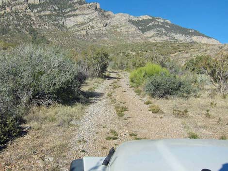
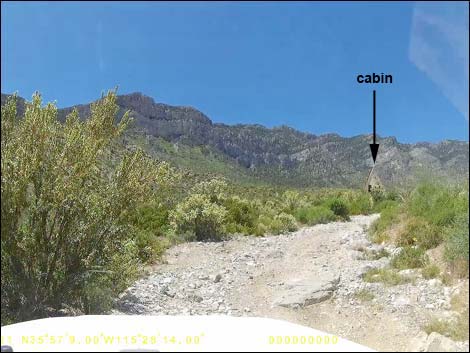 Direct Route starts towards the A-frame cabin (view W) |
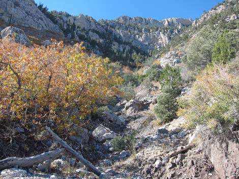
The traditional route to the crash site via Mt. Potosi Road is closed to private vehicles, but hikers may "walk" the road and drop down to the crash site from above. However, hiking the road is long, hot, and arduous, so do it during winter and bring more water than you think you'd need. People report turning back because they ran out of water on the hot, south-facing slopes. Direct hiking routes now start in Cottonwood Valley on the east side of Mt. Potosi. Cottonwood Valley Road, graded in the old days when land management agencies had money, now requires a high-clearance vehicle, and driving southbound over Cottonwood Pass probably requires a 4WD vehicle now. After leaving Cottonwood Valley Road, a 3-mile 4WD road leads west to the base of the steep east face of Mt. Potosi. The lower slopes of Mt. Potosi burned in 2005, so much of the singleleaf pinyon pine forest is gone, but the shrubs are recovering. Cottonwood Valley burned again in 2020, but not the hiking route. |
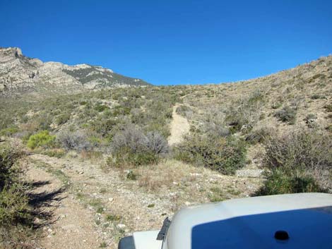
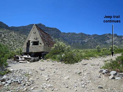 Jeep trail approaching the A-frame cabin is very bad (view W) |
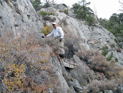
Watch Out Other than the standard warnings about hiking in the desert, ...this is a tough hike on a steep, rocky mountain, but other than falls and loose rocks, there are no unusual hazards and the route is only Class-2, although the cliffs are nearly 4th-class because of exposure in a couple of spots. Mt. Potosi was a mining district, and there are several mines along the access road, but remember: mines are never safe to enter. Some metal shards at the crash site have sharp, rusty edges. While hiking, please respect the land and the other people out there, and try to Leave No Trace of your passage. This is a tough hike, so be sure to bring the 10 Essentials. Make sure this route of the appropriate difficulty for your skills. Cell phones work from some parts of the route. |
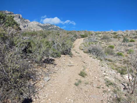
 Road continues past the cabin (view W) |
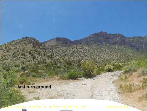
Getting to the Trailhead This hike is located on the east side of Mt. Potosi, about 1-1/2 hours southwest of Las Vegas. From Las Vegas, drive west on Highway 160 (Pahrump Highway) to the Cottonwood Valley Trailhead, which is about 200 yards down Cottonwood Valley Road. Continue south on Cottonwood Valley Road for 5.6 miles to Ninetynine Mine Road, signed as FR-800C on the right. Turn onto Ninetynine Mine Road and drive west 3.3 miles to a fork. For the Direct Route, which passes the old A-frame cabin, stay left on Road FR-800 and continue southwest another 80 yards to the trailhead parking area. For the Wash Route, turn right onto Road FR-800E and drive 0.5 miles to the end of the road at a pour-over. All of these roads require a 4WD vehicle. For people who don't have a vehicle suitable for Ninetynine Mine Road, consider hiking from Cottonwood Pass (Site 0850) using Road FR800A to access Ninetynine Mine Road (Site 1128). From Cottonwood Valley Road, walking up Road FR-800A is shorter than walking up Ninetynine Mine Road, but Road FR-800A is steeper. |
 Road continues past the cabin (view W) |
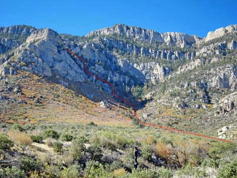
The Hike From the trailhead area, hikers can look up, above the limestone cliffs (southwest), and see the gully that holds the aircraft wreckage. To get there, the easier route runs up the canyon to the north (right) of the crash site, crosses southeast over a ridge, and then runs up the gully to the crash site. It is only 2.0 miles from the trailhead to the crash site, but it is a tough 2 miles -- don't let the distance fool you into thinking this is a "short" hike. Many people who try this hike don't make it through the cliffs. Direct Route: From the trailhead below the A-frame cabin (Table 1, Waypoint 01), the route continues up the rocky road to the cabin (Wpt. 02). From the cabin, the old road continues up the wash. Beyond the cabin, the old road climbs out of the wash and gets narrow and steep as it winds among bushes and rocks to a fork (Wpt. 03). The Direct Route stays right (NW) and drops steeply to cross a wash. |
 Road forks; stay right and cross wash (view NW) |
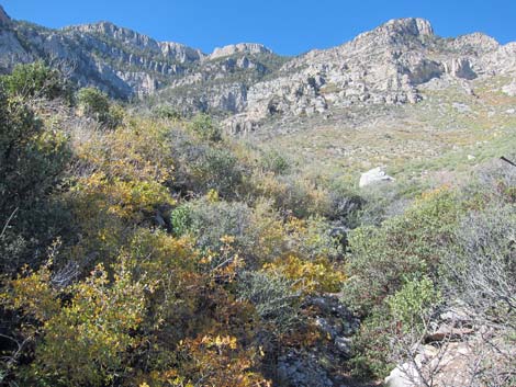
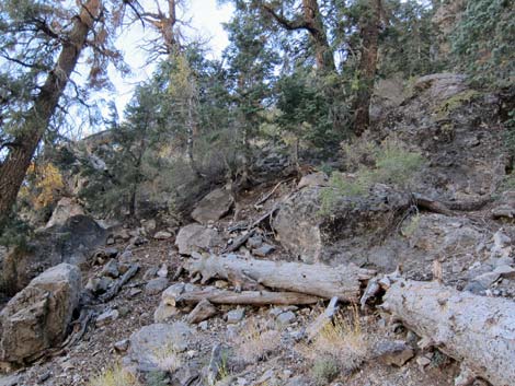
Across the wash, the old road climbs steeply, then runs west across relatively gentle terrain. The old road eventually intersects a major wash (Wpt. 04) that comes down the canyon to the left of communication towers on the skyline. The route turns left into the over-grown wash and follows it upstream. Wash Route: From the trailhead at the low pour-over in the wash (Table 2, Waypoint 01A), the route continues up the wash about 0.25 miles to a confluence of washes (Wpt. 02A). The route turns left and heads up the brushy side-wash. This is the canyon that comes down to the left (east) of communications towers on the ridgeline. The two routes rejoin in another 0.25 miles where the old road from the cabin crosses the wash (Wpt. 04). |
 Road climbs the hillside (view NW) |
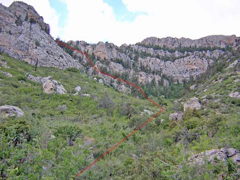
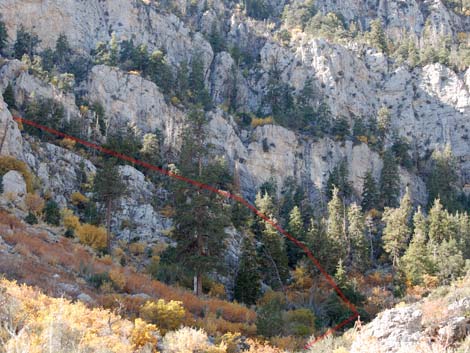
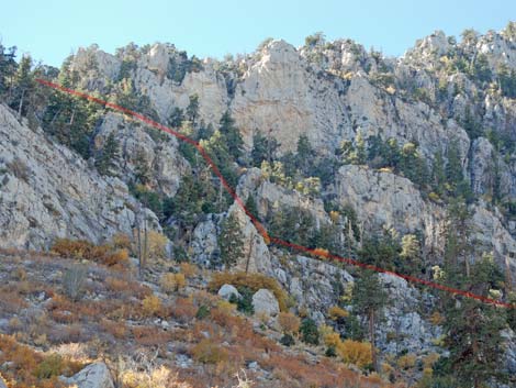
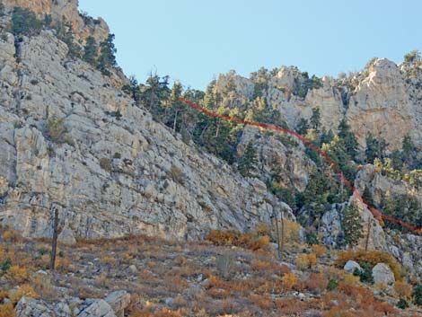
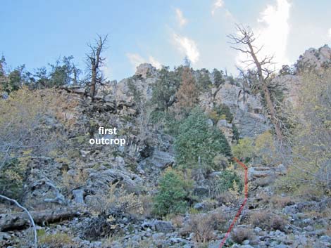
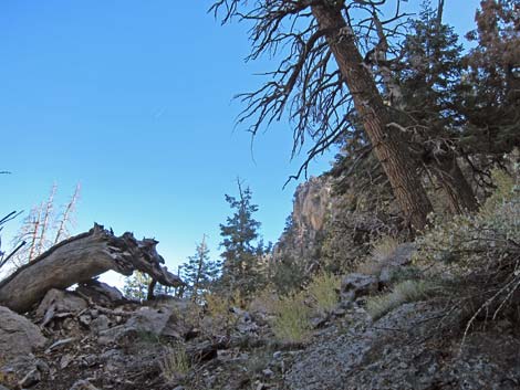
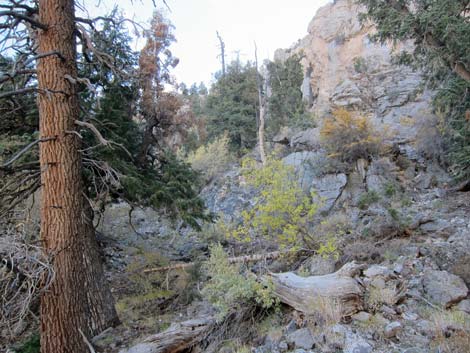
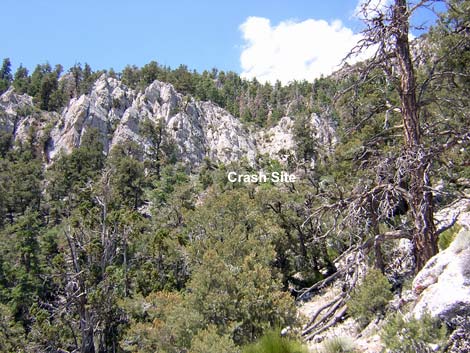
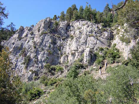
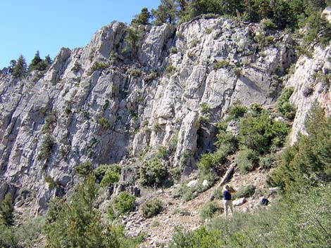
Routes Converge: In the brush-filled wash (Wpt. 04), the route runs up the canyon to near the limestone cliffs that cap the canyon (Wpt. 05). From the top of the canyon, the route runs up and left (facing the cliff) to a knob with dead trees (Wpt. 06). The route then climbs up and left into a steep scree chute. At the top of the scree slope, the route traverses left, then climbs another steep chute to a saddle above the cliffs (Wpt. 07). It is better to hike up the canyon nearly as far as possible before cutting left into the cliffs. Cutting up too early, the route is blocked by cliffs. Staying high, there is an exposed, but only 2nd-class, route from the wash all the way to the ridgeline. There is a faint use-trail, but it is easier to follow on the way down. The route reaches the ridgeline at a saddle (Wpt. 07) behind a knob. Out on the knob, there are nice views of the valley below and the crash site above. |
 Road curves left and levels out a bit (view SW) |
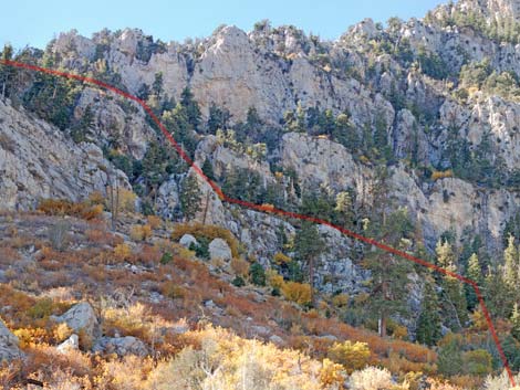
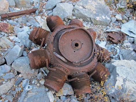
From the saddle (Wpt. 07), the route crosses onto the south side of the ridge and continues uphill, staying near the crest of the ridge but avoiding the little crags along the ridgeline. When the bottom of the gully is close and the sidehill can be easily crossed, the route drops into the gully (Wpt. 08). At this point, wreckage begins to appear in the gully. If hikers drop into the gully too soon, they will be caught in a small box-canyon and have to back track. The route continues up the steep gully to the cliffs. The amount of wreckage increases towards the base of the cliffs, which was the impact site (Wpt. 09). Some debris were thrown above the cliff, but it is hard to determine whether what remains above the cliff resulted from the force of the impact or was carried up, but discarded, by exhausted hikers. The largest pieces of wreckage include engine parts and landing gear, which are in the gully below the impact site. People already recovered the large aluminum parts (body and wings), so those are gone. However, thousands of small pieces of aluminum, lots of cabling, lots of fuel or hydraulic lines, bits of glass and ceramics, rubber hoses, and many other metallic parts litter the ground. |
 Road continues across rolling hillsides (view NW) |
People have been collecting the more interesting artifacts for decades, so what remains is too big to carry or not particularly interesting. There are also many interesting shell fossils in the rocks at the crash site. Family members of the dead mounted a bronze plaque on the cliff just left of the impact site to memorialize the event, but it was placed illegally and has been removed. Whether removed officially or by vandalism, I suspect it might come back someday. Small bits of human remains remain at the crash site. Please respect those who died and bury any remains found on the surface. Return to the trailhead by following your footprints carefully back down the mountain to the trailhead. |
 Route through the cliffs comes into view (view SW) |
 Route arrives in shrub-choked wash (routes join here; view SW) |
Wash Route (alternate trailhead)
 Trailhead (some drives dare to go farther; view NW) |
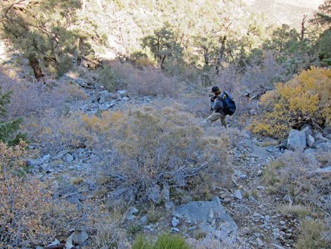
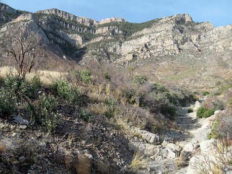 Route runs up the main wash, then turns up a side wash (view W) |
Combined Routes
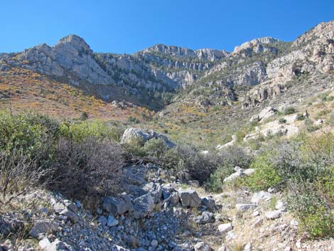 The combined route continues up the wash (view SW) |
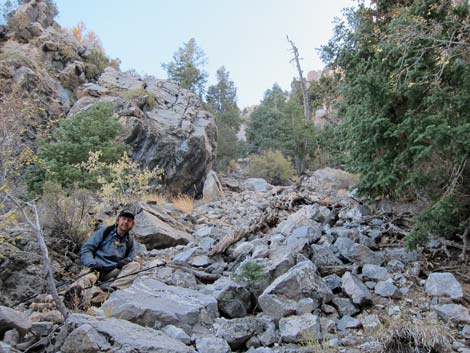
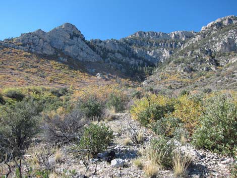 Sometimes it is easier to get out of the wash bottom (view SW) |
 Sometimes it is easier in the wash bottom (view SW) |
 Route through the cliffs (view SW) |
 Route through the cliffs (view SW) |
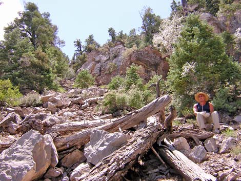
 Before losing sight of route, study path through cliffs |
 Before losing sight of route, study path through cliffs |
 Before losing sight of route, study path through cliffs |
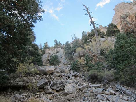
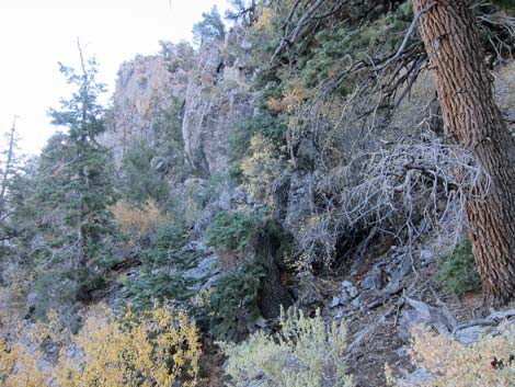
 Near base of cliffs, view becomes obscured (view SW) |
 Near base of cliffs, view is obscured (view SW) |
 Make no mistake -- the cliffs are steep! |
 Route starts steeply through gap in the trees (view SW) |
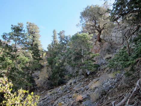
 Details get lost in the gray shadows below towering cliffs (view SW) |
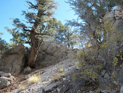
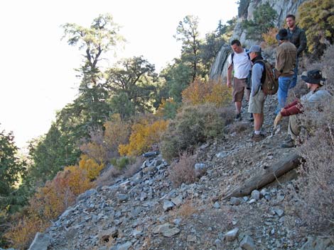
 Route starts into the cliffs (view SE) |
 Most places have adequate footing (view SE) |
 Working up along ledges through the cliffs (view E) |
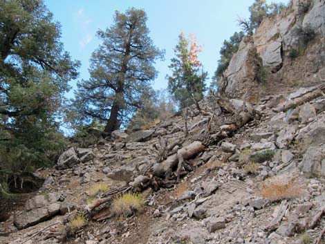
 Steep scree gully (view up; you too will fall on your butt) |
 Steep scree gully (view S) |
 Loose rocks and logs in the cliffs (view SE) |
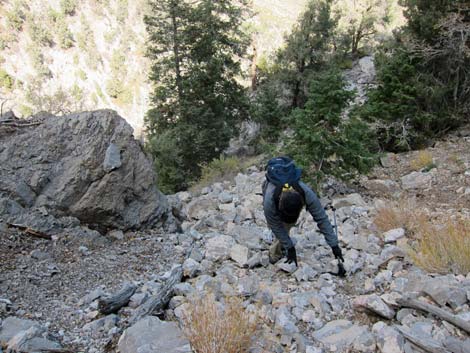 Ascending the scree gully (view down; you too will roll loose rocks) |
 Nearing the top of the cliffs (view E) |
 Traversing below top of the cliffs (view E) |
 Traversing below top of the cliffs (view E) |
 Approaching saddle atop the cliffs (view SE) |
 Crash site (view SW from saddle) |
 Working up along top of the cliffs (view |
 Hiker arriving at the impact site (view SW) |
 Impact site: cliff just above-left of hiker (view S) |
 Hiker inspecting impact site |
 Hiker at crash site (view down) |
 Hillside at crash site is quite steep (view S) |
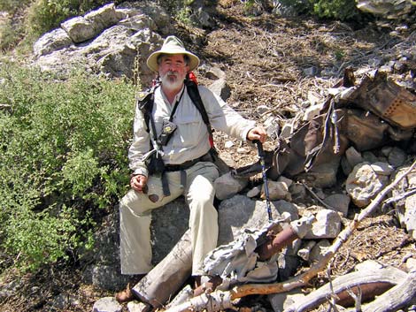 Resting by wreckage |
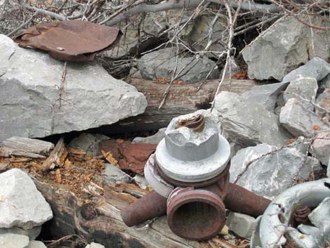 Wreckage [more debris photos] |
 Wreckage [more debris photos] |
Table 1. Direct Route Hiking Coordinates Based on GPS Data (NAD27, UTM Zone 11S). Download Hiking GPS Waypoints (*.gpx) file.
| Wpt. | Location | UTM Easting | UTM Northing | Elevation (ft) | Point-to-Point Distance (mi) | Cumulative Distance (mi) |
|---|---|---|---|---|---|---|
| 01 | Road FR-800 Trailhead | 637996 | 3979581 | 5,751 | 0.00 | 0.00 |
| 02 | Fork in Road | 637923 | 3979596 | 5,727 | 0.04 | 0.04 |
| 03 | Fork in Road | 637508 | 3979745 | 5,949 | 0.30 | 0.34 |
| 04 | Old Road at Wash | 636899 | 3980150 | 6,307 | 0.63 | 0.97 |
| 05 | Base of Cliffs | 636213 | 3979641 | 7,140 | 0.63 | 1.60 |
| 06 | In the Cliffs | 636211 | 3979574 | 7,259 | 0.07 | 1.67 |
| 07 | Saddle atop Cliffs | 636343 | 3979510 | 7,501 | 0.13 | 1.80 |
| 08 | First Wreckage | 636269 | 3979433 | 7,710 | 0.08 | 1.88 |
| 09 | Crash Site | 636152 | 3979371 | 7,825 | 0.11 | 1.99 |
| 01 | Road FR-800 Trailhead | 637996 | 3979581 | 5,751 | 1.99 | 3.98 |
Table 2. Wash Route Hiking Coordinates Based on GPS Data (NAD27, UTM Zone 11S). Download Hiking GPS Waypoints (*.gpx) file.
| Wpt. | Location | UTM Easting | UTM Northing | Elevation (ft) | Point-to-Point Distance (mi) | Cumulative Distance (mi) |
|---|---|---|---|---|---|---|
| Wpt. | Location | UTM Easting | UTM Northing | Elevation (ft) | Point-to-Point Distance (mi) | Cumulative Distance (mi) |
| 01A | Wash Route Trailhead | 637583 | 3980046 | 5,855 | 0.00 | 0.00 |
| 02A | Turn out of Wash | 637239 | 3980242 | 6,117 | 0.25 | 0.25 |
| 04 | Old Road at Wash | 636899 | 3980150 | 6,307 | 0.26 | 0.51 |
| 05 | Base of Cliffs | 636213 | 3979641 | 7,140 | 0.63 | 1.14 |
| 06 | In the Cliffs | 636211 | 3979574 | 7,259 | 0.07 | 1.21 |
| 07 | Saddle atop Cliffs | 636343 | 3979510 | 7,501 | 0.13 | 1.34 |
| 08 | First Wreckage | 636269 | 3979433 | 7,710 | 0.08 | 1.42 |
| 09 | Crash Site | 636152 | 3979371 | 7,825 | 0.11 | 1.53 |
| 01A | Wash Route Trailhead | 637583 | 3980046 | 5,855 | 1.53 | 3.06 |
Happy Hiking! All distances, elevations, and other facts are approximate.
![]() ; Last updated 240330
; Last updated 240330
| Hiking Around Las Vegas | Glossary | Copyright, Conditions, Disclaimer | Home |