Hiking Around Las Vegas, Other Areas
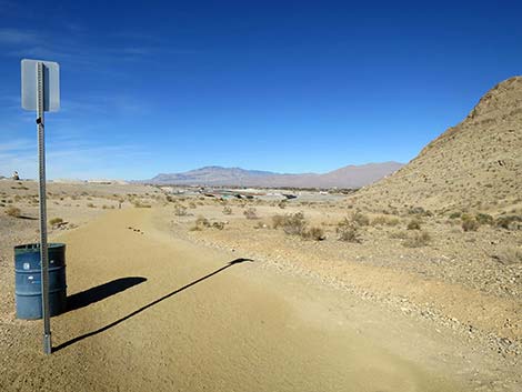
 Departing Vegas Vista Trailhead Parking (view NE) |
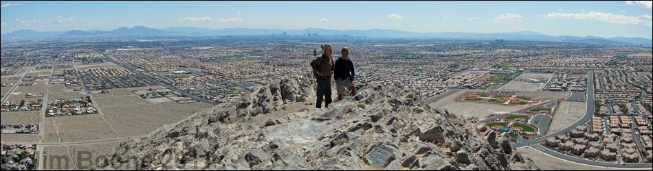
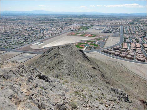
Overview Lone Mountain is a steep, isolated, rocky butte in NW Las Vegas just inside the Interstate-215 Beltway. The summit stands some 600 feet above the surrounding homes, giving great views of the city and the surrounding mountains. There are several routes up Lone Mountain. The Regular Route is short and steep (0.67 miles) and takes only about 30 minutes if you stop to enjoy the scenery. The North Ridge, South Ridge, and East Buttress provide more challenging routes. Lone Mountain is good place for a quick get-away or after-work hike; and as one guy on the trail said, it beats an afternoon workout on a treadmill. Link to route map or elevation profile. |
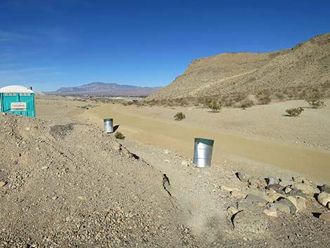
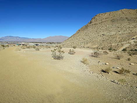
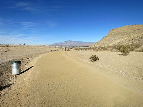 Perimeter Trail (view NE) |
Watch Out Other than the standard warnings about hiking in the desert, ...this is a fairly safe hike, but there are places where you could stumble off the mountain and roll all the way to the bottom. The west face of the summit is nearly vertical, so don't fall off that side. There is a fair bit of loose gravel on the use-trail, and some of the bedrock is dirty and slick, although most of the footing is secure. While hiking, please respect the land and the other people out there, and try to Leave No Trace of your passage. Although this hike is short, be sure to bring what you need of the 10 Essentials. |
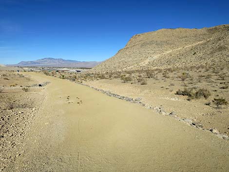 Perimeter Trail (view NE) |
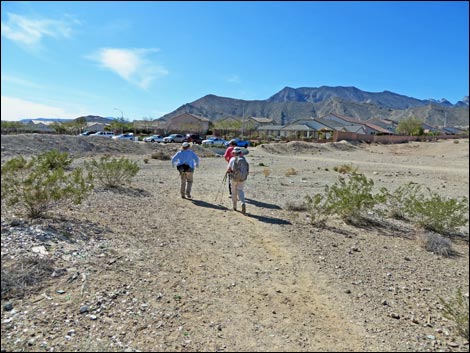
Getting to the Trailhead Lone Mountain is located in the northwest part of urban Las Vegas, just inside the Western Beltway (Highway I-215) between Lone Mountain and Alexander roads. From town, drive north on Highway 95 or Highway 215 to the northwest part of town. Continue to the Vegas Vista Trail Trailhead, which is located on the west side of the mountain. |
 Perimeter Trail (view NE) |
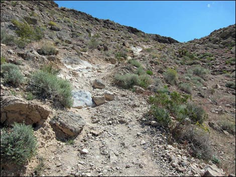
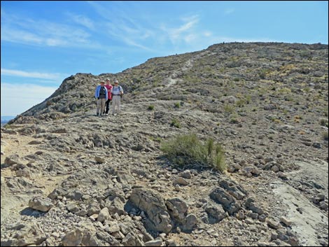
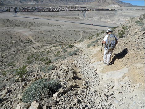
The Hike From the Vegas Vista trailhead (Table 1, Waypoint 01), the route runs between cement parking barriers (December 2013) heading northeast towards a use-trail that can be seen climbing the hillside in the distance. Following foot trails and dirt roads, the route climbs onto the lower flank of the mountain (Wpt. 04), then starts steeply up the hillside running southeast. The use-trail is well defined and easy to follow, but there is a bit of loose gravel on the steep parts. The route actually starts as an ATV trail, but it is a foot trail from the base of the steep hillside on up. The vegetation at the base of the mountain is typical of Mojave Desert Scrub, with creosote bush, white bursage, Mojave yucca, Nevada ephedra, and desert almond. On the hillside, the desert almond drops out of the mix, but California barrel cactus, and several species of buckwheat and other low-growing plants join the mix. |
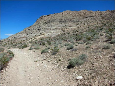
 Perimeter Trail at start of Regular Route (view NE) |
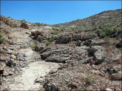
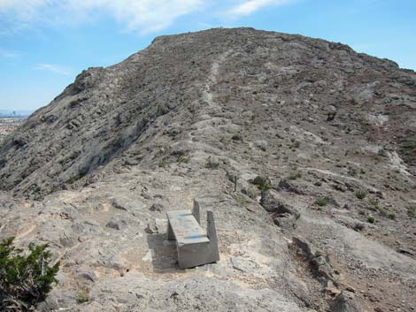
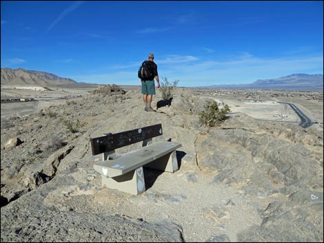
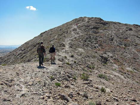
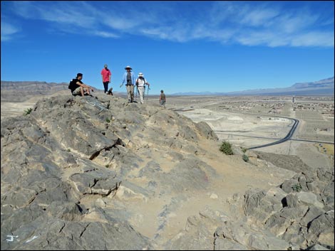
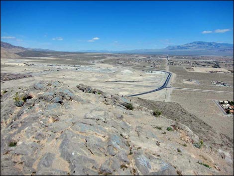
The use-trail runs up to the top of the steep part (Wpt. 05), then levels out a bit and approaches the crest of the ridge (Wpt. 06). A concrete bench on the crest (Wpt. 07) makes a nice place to sit, relax, and enjoy the view of the city. For people who can't or don't want to climb all the way to the summit, just getting to this point makes for a nice hike and a good place to stop. At this point, routes from the north ridge join the main route. Watch for fossils in this area. I saw lots of chert, which frequently is associated with fossils, but the only fossils I found (corals) were south of the summit. More fossils can be found on the south ridge. On the crest of the ridge (Wpt. 06), the use-trail turns south and runs up the ridgeline. A single, obvious, use-trail starts up the rocky ridge, but higher up there is a bit of multiple trailing. However, all trails lead the same way -- up the ridge. |
 Stay right at fork in the trail (view NE) |
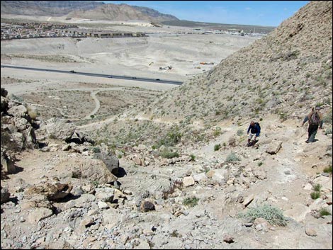
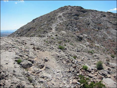
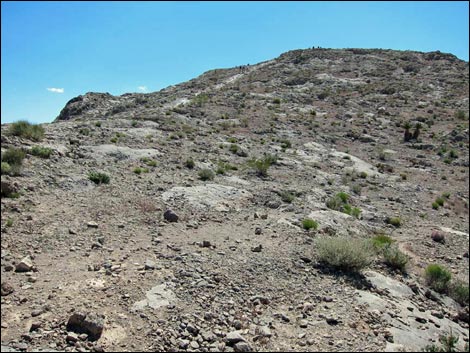
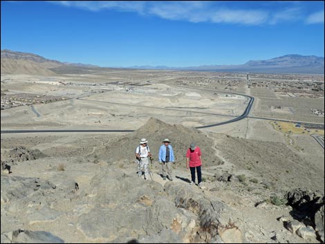
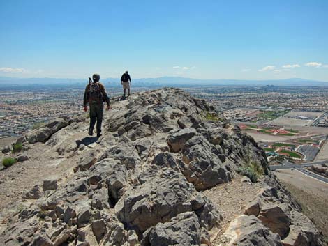
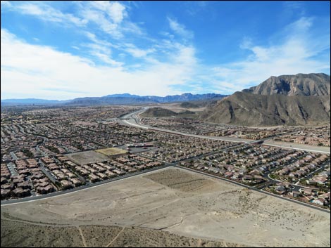
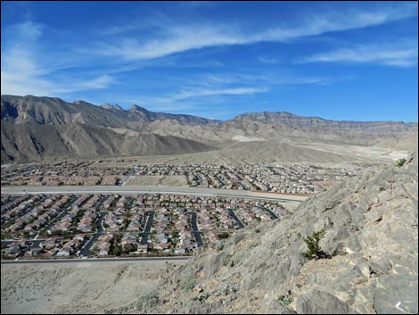
The steep ridge gives way to a flat area with nice views at the base of another steep section (Wpt. 10), then continues steeply to the summit (Wpt. 11). Views from the summit include a complete 360-degree panorama of the city and surrounding mountains; even the summit of Mt. Charleston peeks over the ridge to the west. While not a wilderness experience, the grand views from all along the ridgeline make the hike worth the effort. The strip and downtown buildings are off to the southeast. Chances are that you can even see your neighborhood from the summit. To the north, are the Sheep Range and Las Vegas Range on the Desert National Wildlife Range, to the east are the Mormon, Muddy, Sunrise, and Black mountains. To the south are the South McCullough Range and peaks along the Red Rock Escarpment. To the west, the La Madre Range towers above the city. When ready, return to the trailhead by following the use-trail back down the mountain. |
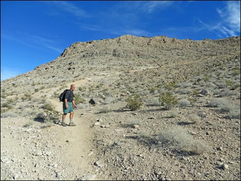 Hiker getting onto steep side-slope (view NE) |
 Steep dirt trail (view E) |
 Steep rock trail (view E) |
 Hikers on trail near top of the steep part (view NW; down) |
 Trail approaching the crest of the ridge (view SE) |
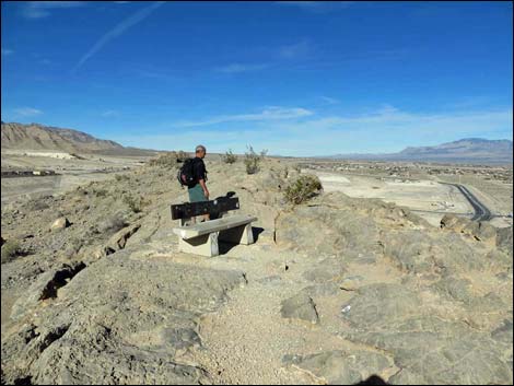 Hiker at the bench (view N) |
 Bench and route up the ridgeline (view S) |
 The bench (view N) |
 Flat area before final push to the summit (view S) |
 Hikers on flat area before final push to the summit (view S) |
 Hikers approaching the summit (view S) |
 Hikers approaching the summit (view N; down) |
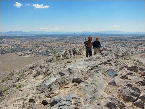
 Hikers on the summit (view S) |
 Hikers on the summit (view N) |
 Summit view of downtown Las Vegas (view SE) |
 Summit (view SW towards Red Rocks) |
 Summit (view NW towards the La Madre Range) |
 Summit (view S across western Las Vegas) |
 Summit (view N across Las Vegas towards the Sheep Range) |
 More to come ... |
The Descent
 Descending the side of the ridge below the bench (view NW) |
 Returning to the trailhead (view SW) |
Table 1. Hiking Waypoints Based on GPS Data (NAD27, UTM Zone 11S). Download Hiking GPS Waypoints (*.gpx) file.
| Wpt. | Location | UTM Easting | UTM Northing | Elevation (ft) | Point-to-Point Distance (mi) | Cumulative Distance (mi) | Verified |
|---|---|---|---|---|---|---|---|
| 01 | Lone Mt Trailhead West | 651072 | 4011723 | 2,789 | 0.00 | 0.00 | GPS |
| 02 | Trail Forks | 651130 | 4011796 | 2,792 | 0.07 | 0.07 | GPS |
| 03 | Trail Forks | 651176 | 4011910 | 2,794 | 0.08 | 0.15 | GPS |
| 04 | Base of Hillside | 651200 | 4011956 | 2,784 | 0.03 | 0.19 | GPS |
| 05 | Top of Hillside | 651297 | 4011912 | 2,798 | 0.08 | 0.27 | GPS |
| 06 | Crest of Ridge | 651356 | 4011886 | 2,844 | 0.05 | 0.32 | GPS |
| 07 | Bench | 651340 | 4011922 | 3,009 | . | . | GPS |
| 08 | Top of Next Steep Section | 651387 | 4011778 | 2,971 | 0.09 | 0.41 | GPS |
| 09 | Multiple Trails Join | 651423 | 4011713 | 3,035 | 0.05 | 0.46 | GPS |
| 10 | Flats Below Summit Ridge | 651465 | 4011583 | 3,196 | 0.10 | 0.56 | GPS |
| 11 | Summit | 651486 | 4011469 | 3,301 | 0.11 | 0.67 | GPS |
Happy Hiking! All distances, elevations, and other facts are approximate.
![]() ; Last updated 240330
; Last updated 240330
| Lone Mountain | Hiking Around Las Vegas | Glossary | Copyright, Conditions, Disclaimer | Home |