Hiking Around Las Vegas, Other Areas
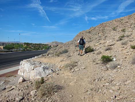 Toe of South Ridge along Alexander Rd (view W) |
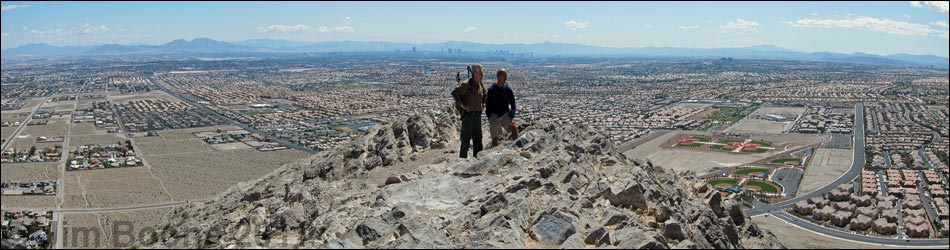
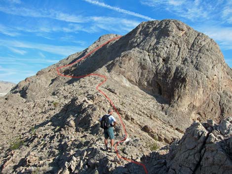
Overview Lone Mountain is a steep, isolated, rocky butte in NW Las Vegas just inside the Interstate-215 Beltway. The summit stands some 600 feet above the surrounding homes, giving great views of the city and the surrounding mountains. There are several routes up Lone Mountain. The South Ridge (Class 4) is short and steep (0.58 miles), and it takes only about 45 minutes to reach the summit if you stop to enjoy the scenery. The North Ridge and East Buttress also provide challenging routes. Lone Mountain is good place for a quick get-away or after-work hike; and as one guy on the trail said, it beats an afternoon workout on a treadmill. Link to route map. |
 Toe of South Ridge along Alexander Rd (view NW) |
Watch Out Other than the standard warnings about hiking in the desert, ...this is a challenging hike with a bit of Class-4 scrambling, and there are many places where hikers could stumble off the mountain and roll all the way to the bottom. The west face of the summit is nearly vertical, so don't fall off that side. There is a fair bit of loose gravel on the use-trail and plenty of loose rocks to roll on others in the hiking party. While hiking, please respect the land and the other people out there, and try to Leave No Trace of your passage. Although this hike is short, be sure to bring what you need of the 10 Essentials. |
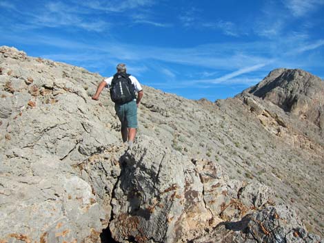
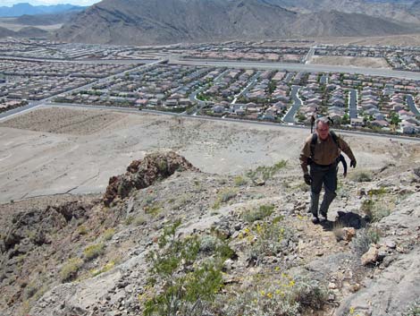
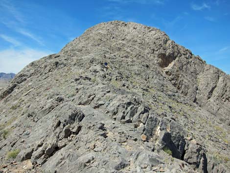
 Hiker on South Ridge (view N) |
Getting to the Trailhead Lone Mountain is located in the northwest part of urban Las Vegas, just inside the Western Beltway (Highway I-215) between Lone Mountain and Alexander roads. From town, drive north on Highway 95 or Highway 215 to the northwest part of town. Continue to the Lone Mountain Discovery Park Trailhead, which is located on the east side of the mountain, or to the Vegas Vista Trail Trailhead, which is located on the west side of the mountain. |
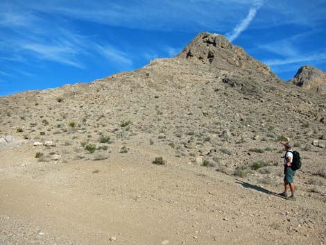
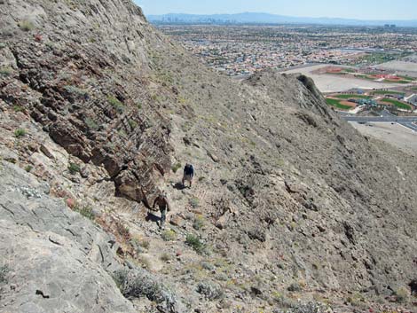
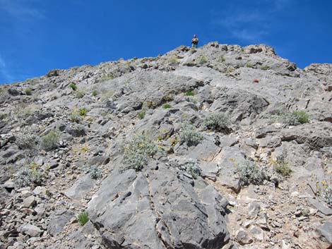
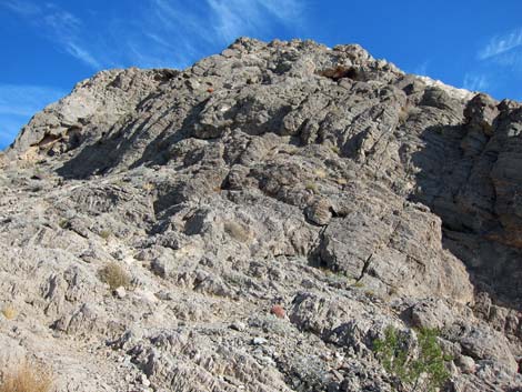 Base of First Buttress (view N) |
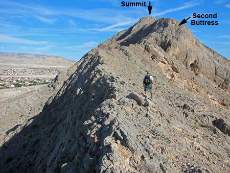
The Hike From either trailhead parking area, hike to the south end of Lone Mountain (Wpt. 30). Here, right along Alexander Road, the South Ridge Route turns north and begins to climb the South Ridge. Gaining the crest of the ridge, the route climbs towards the first buttress, which is passed on the southwest side (Wpt. 31). Several possibilities present, but 3rd-class climbing into the bowl on the southwest corner, and then climbing to the right of a Hole-in-the-Rock leads back onto the crest. After a few steps of airy 4th-class, hikers can scramble along the edge of the cliff to get above the Hole-in-the-Rock. Beyond the Hole-in-the-Rock, the route follows the more-or-less level, but knife-edge South Ridge towards the Second Buttress. At the base of the buttress (Wpt. 32), the Southeast Gully routes gain the crest of the South Ridge. |
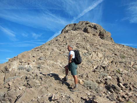
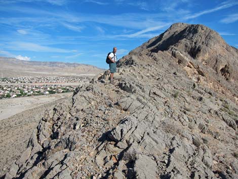
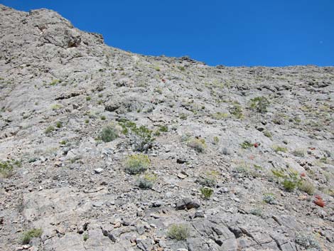
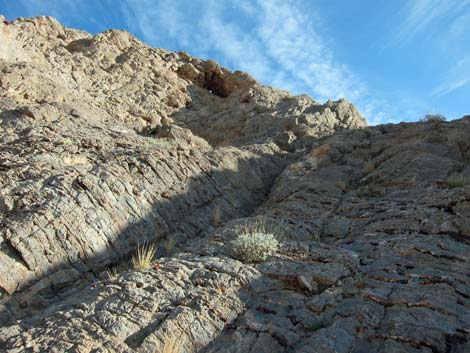 Easiest route on South Ridge (view NE) |
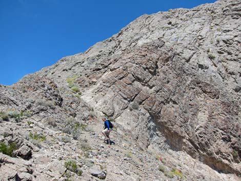
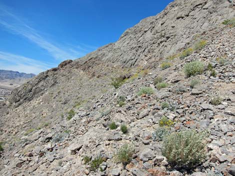
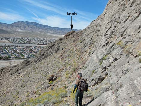
Continuing, the route climbs onto steep, west-facing slopes staying tight against the base of near-vertical limestone cliffs. Near to the southwest corner of the Second Buttress (Wpt. 33), a very steep route climbs skyward, but it appears to be minimal 5th-class. Bypassing this steep rock, hikers can continue north below the cliffs following use-trails onto a knob (Wpt. 34) on the side-slope. From atop the knob, hikers can pick their way up the steep slope to safely regain the top of the ridge (Wpt. 35). Following the ridgeline north, where the route is not so steep as it looks, hikers soon climb onto the edge of the summit plateau (Wpt. 36) and then arrive at the summit (Wpt. 11). Returning from the summit by the Regular Route would be the safest option. |
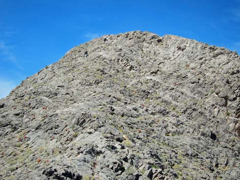
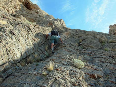 Hiker on South Ridge (view NE; 4th class section) |
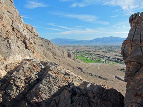 Notch on ridgeline (view N towards Lone Mtn Park) |
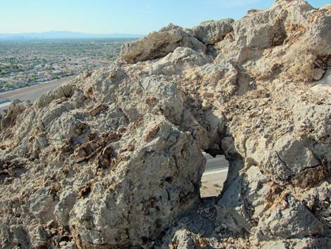 Hole-in-the-Rock (view S) |
 Route follows ridgeline (view N) |
 Route follows ridgeline (view N) |
 Route on east side of ridgeline (view N) |
 Route on west side of ridgeline (view N) |
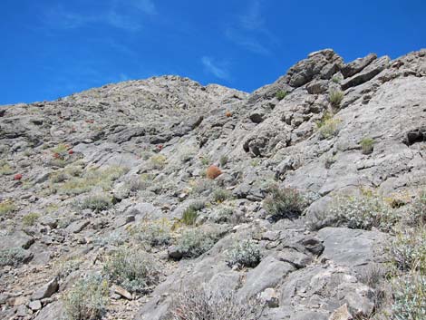
 Approaching Second Buttress (view N) |
 Base of Second Buttress (view N) |
 Route across west face below Second Buttress (view N) |
 Hiker crossing west face below Second Buttress (view N) |
 Hikers crossing west face below Second Buttress (view S) |
 Steep slope on west side of Second Buttress (view NE) |
 Hiker on steep slope on west side of Second Buttress (view NE) |
 Steep slope on west side of Second Buttress (view NE) |
 Ridgeline below summit (view N) |
 Hikers on ridgeline below summit (view N) |
 Hikers on summit (view N from steep slope) |
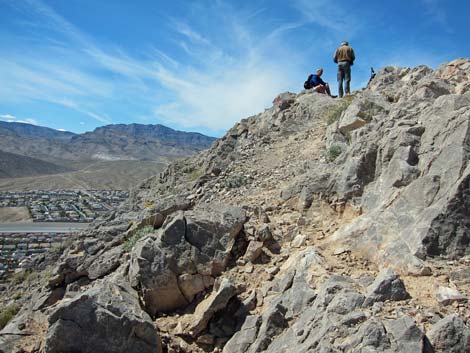 Hikers on summit (view W) |
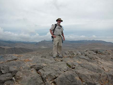 Hiker on the summit (view W) |
Table 1. Hiking Coordinates and Distances based on GPS Data (NAD27; UTM Zone 11S). Download Hiking GPS Waypoints (*.gpx) file.
| Wpt. | Location | UTM Easting | UTM Northing | Elevation (ft) | Point-to-Point Distance (mi) | Cumulative Distance (mi) | Verified |
|---|---|---|---|---|---|---|---|
| 30 | Toe South Ridge | 651771 | 4010935 | 2,669 | 0.00 | 0.00 | GPS |
| 31 | First Crest of the Ridge | 651669 | 4011027 | 2,880 | 0.13 | 0.13 | GPS |
| 32 | Base of Headwall | 651557 | 4011264 | 3,071 | 0.21 | 0.34 | GPS |
| 33 | Base of Gully | 651563 | 4011296 | 3,147 | 0.04 | 0.38 | GPS |
| 34 | Bottom of Summit Slope | 651470 | 4011372 | 3,160 | 0.08 | 0.46 | GPS |
| 35 | Crest of the Ridge | 651524 | 4011397 | 3,248 | 0.05 | 0.51 | GPS |
| 36 | Edge of Summit Plateau | 651503 | 4011455 | 3,340 | 0.06 | 0.57 | GPS |
| 11 | Summit | 651486 | 4011469 | 3,301 | 0.01 | 0.58 | GPS |
Happy Hiking! All distances, elevations, and other facts are approximate.
![]() ; Last updated 240330
; Last updated 240330
| Lone Mountain | Hiking Around Las Vegas | Glossary | Copyright, Conditions, Disclaimer | Home |