Hiking Around Las Vegas, Sloan Canyon NCA
Overview | Trailhead Section | West Section | Central Section | East Section
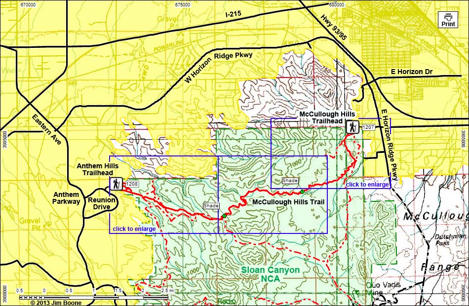
Note: Roads are black (solid = paved; dashed = unpaved). Trails and routes are red (solid = main; dashed = adjacent or alternate). Map based on USGS 7.5-minute topo map. North is at the top. Grid is UTM NAD27 CONUS. National Conservation Areas (boundaries dashed green, fill light green) based on BLM data. Urban Areas (yellow) based on Google Earth (9/2012) image.
Happy Hiking! All distances, elevations, and other facts are approximate.
![]() ; Last updated 161214
; Last updated 161214
| McCullough Hills | Hiking Around Sloan Canyon | Glossary | Copyright, Conditions, Disclaimer | Home |