Hiking Around Sloan Canyon National Conservation Area
Hiking Around Las Vegas
Note: Nawghaw Poa Road is closed during construction of the new visitor center. Walk in from Democracy Drive.
Hikes in Sloan Canyon National Conservation Area
Locate hikes on a click map. Locate trailheads on a click map.
| Hikes | Trailheads | Roads |
|---|---|---|
|
Points of Interest |
|
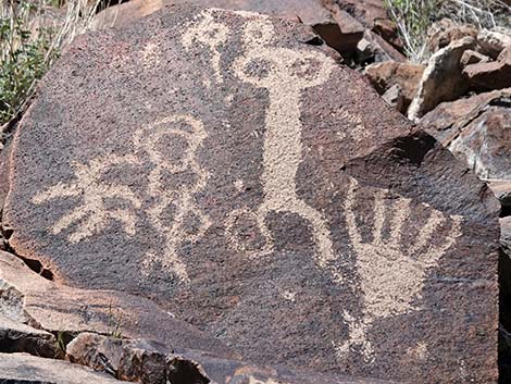 Sloan Canyon Archeological District |
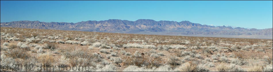
Sloan Canyon National Conservation Area (NCA) was established in 2002 and encompasses 48,438 acres on the south edge of the Las Vegas Valley. Administered by the U.S. Bureau of Land Management, the primary features of the NCA are the Sloan Canyon Archeological District, the Black Mountains, and the entire North McCullough Wilderness Area (14,763 acres). There are no roads inside the NCA, but the number of trails has been increasing over the years. Activities in the NCA primarily are orientated around day-hiking and nature photography. Backpacking and overnight camping are permitted only in the North McCullough Wilderness Area and the southeastern portion of the NCA; camping is not permitted in any areas inside the Las Vegas Valley. Link to Sloan Canyon NCA Map. |
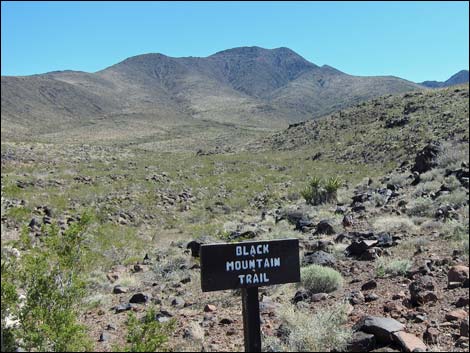 Black Mountain Trail |
The Petroglyph Canyon parking lot has a capacity of 30 parking spots and is closed when it reaches capacity. Arrive early or be prepared to add an extra mile to your hike. If the parking lot is full, hikers must park on the south side of Democracy Road. The parking lot fills about 9:30 am. on weekends and usually stay full until about 3:30 pm. The gates open at 8 am. and close at 4:30 pm. Dogs are not allowed on the Petroglyph Trail to protect wildlife and cultural resources. Please leave your dogs at home or plan on taking another trail. The NCA is located in the Mojave Desert, with biotic influences from the Great Basin Desert to the north at higher elevations. Lower elevations range from about 1,875 feet on the southeastern edge of the NCA near Eldorado Valley Dry Lake, 2,800 feet in the hills above Henderson, and 3,250 ft in Hidden Valley on the southwest edge of the NCA. The highest elevation is 5,093 feet at the summit of Black Mountain. In the Archeological District, peaks climb to about 4,000 ft, the highest being Sutor Peak at 4,186 ft. |
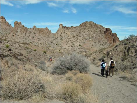
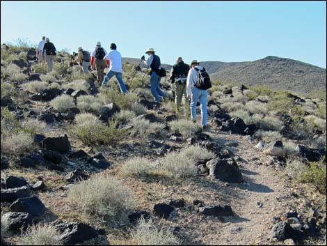 Hikers on established trail |
The lower-elevation desert-scrub areas are in the Mojave Desert Scrub Life Zone, and higher elevations in the Pinyon-Juniper Woodlands Life Zone. Variations in topography and soils make for a mix of habitats and a diverse flora and fauna, which includes the rare Blue Diamond Cholla Cactus. Temperatures in lower-elevation areas are similar to those in Las Vegas: daytime summer temperatures can exceed 110 degrees, while daytime winter temperatures occasionally drop to near freezing. Higher-elevation areas are cooler than lower-elevation areas, but summer temperatures still exceed 90 degrees, and they get a little snow during winter. Because of the high summer temperatures, hiking generally is best during October through May. Afternoon thunderstorms are common during July and August, creating flash flood and lightning hazards. |
 Hikers in wash |
Services inside the NCA include only one visitor contact station at Petroglyph Trailhead. The BLM has plans to build a full visitor center and more trails, but these remain in the planning stage. The City of Henderson has built trails in the NCA along the east edge of the Anthem neighborhood, and they have built trails that provide access to the NCA in the Railroad Pass area. This is wild country, so bring what you need. For More Information on Sloan Canyon National Conservation Area, visit the Sloan Canyon National Conservation Area Overview Page. |
Happy Hiking! All distances, elevations, and other facts are approximate.
![]() ; Last updated 250106
; Last updated 250106
| Hiking Around Las Vegas | Glossary | Copyright, Conditions, Disclaimer | Home |