
Birding Around Las Vegas, Desert National Wildlife Range

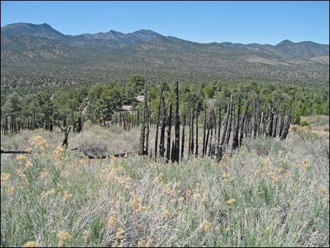
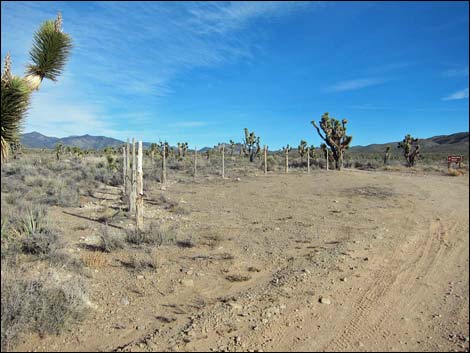 Pine Nut Road at Mormon Well Road (view NE) |
Overview Mormon Well is a remote spring in the mountains that attracts birds and other wildlife from miles around. This isn't a birding hotspot, but it adds spice to the adventure of driving the Mormon Well Road, a long, rough dirt road that leads across the desert and over the mountains through some spectacular scenery. There are many habitats to explore and bird, but no real hotspots, so the best way to bird the area is to stop often, get out of your vehicle, and listen for bird songs drifting on the wind. The old corral, built by Mormon pioneers, still stands near the spring and is on the National Register of Historic Places. Please help preserve Nevada heritage by treading lightly here. Mormon Well Road is a long, rough dirt road. A high-clearance vehicle is required under all but the best of conditions. There are no services. If you go out there, take at least one gallon of water per person, some food, and expect to be the only people out there. Be prepared to break down and spend a day waiting for help to find you. Your cell phone won't work except for a couple of spots. |
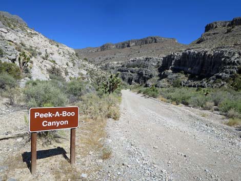 Peek-a-boo Canyon (view NE) |
Description Mormon Well Spring provides a year-round water source in a Pinyon-Juniper Forest that attracts wildlife from near and far. The Mormon Well area, used by settlers from about 1900 to 1924 for summer cattle-grazing range, provides silent testament to those who went before us. The spring and the circular corral still remain. Mormon Well isn't a birding hotspot, but getting there is an adventure. The Mormon Well Road is a long, rough dirt road that starts at Corn Creek, passes through relatively high-elevation, relatively moist, Mojave Desert scrub areas, the Yucca Forest, sagebrush flats, and a bit of Yellow-Pine Forest, all of which provides a variety of habitat types and associated species of birds and other wildlife. This region is geologically diverse too, with broad valleys, narrow canyons, and steep, rocky cliffs. |
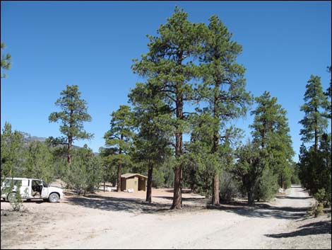 Mormon Pass Campground (view N) |
Location The Mormon Well Road is located on the Desert National Wildlife Range north of Las Vegas. Drive out to Corn Creek (Table 1, Site 0106), and then continue eastward for about 50 yards to a T-intersection. Turn south (right) onto Mormon Well Road. The road starts heading south, then turns east and cuts through Yucca Gap, traverses the Yucca Forest (Site 0096), winds through Peek-a-boo Canyon (Site 0108), heads north through sagebrush flats and a nice stand of Ponderosa Pine at Mormon Pass (Site 0648), passes Desert Campground and Mormon Well Spring (Site 0630), and ends on Highway 93 about 2 miles south of Highway 168 (Site 0649) where powerlines cross the highway). |
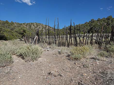 The Mormon Well corral (view N) |
To get to Mormon Well (the spring), drive north from the Mormon Pass (Site 648) for about 2 miles past the campground. Watch for a pullout (old road intersection) on the east (right) side of the road at a place where the road bends hard to the north (left) (Site 650). You can get to the spring from here, or you can drive down the main road a short distance to another parking area on the east (right) side of the road with an old cement watering trough (Site 0651). Park by the trough; this is the trailhead. From the trough, hike south and east on the old, closed road for about 5 minutes to the corral (Site 652), which is in a flat area on a bench above the bottom of the canyon. For more directions and a map of the Mormon Well area, visit the Hiking Around Las Vegas webpage about the Desert National Wildlife Range, and click on the Mormon Well link. |
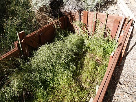 Mormon Well Spring (view E) |
Hours
Always open. Fees None. |
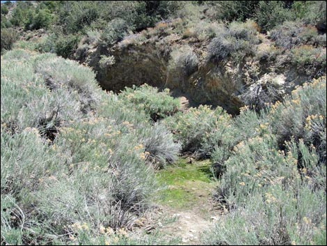 Seep below spring where birds prefer to drink |
Specialties Scenery, solitude, and hard-core desert birds. The entire area is good for desert birds, but there are no particular hot spots other than Mormon Well Spring. Watch for Golden Eagles along the cliffs north of Yucca Gap (and watch for fossils in the rocks on the south edge of the road). The intersection of Mormon Well Road and Pine Nut Road (Site 0424) usually is a good spot for birds like Scott's Oriole, Northern Mockingbird, Pinyon Jay, Ash-throated Flycatcher, and Cactus Wren. Stop in Peek-a-boo Canyon to look for Woodhouse's Scrub-Jay, Rock Wren, Spotted Towhee, and Black-throated Sparrows. Stop in the Mormon Pass area to check for Mountain Chickadee, Juniper Titmouse, Cooper's Hawks, and Black-throated Gray Warblers. Everything in the woods will come to drink at the spring, so spending the late afternoon sitting quietly near the spring likely would be rewarding (e.g., Black-headed Grosbeak, Purple Finch, House Finch, Lesser Goldfinch, Black-throated Gray Warbler, and Brown-headed Cowbird). |
 |
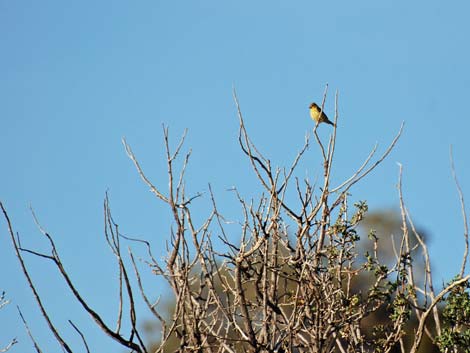 |
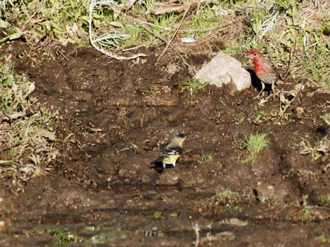 Lesser Goldfinch and House Finch |
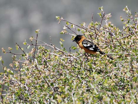 Black-headed Grosbeak |
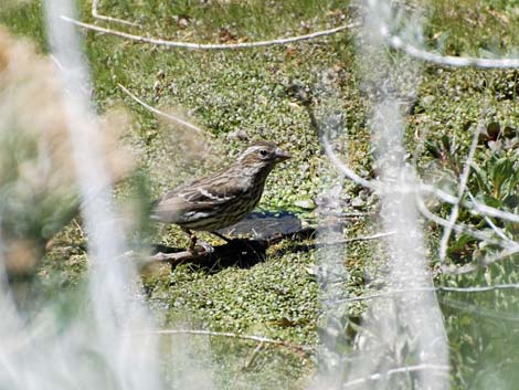 Purple Finch |
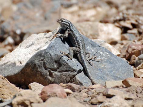 Western Fence Lizard |
Table 1. GPS Coordinates for Highway Locations (NAD27; UTM Zone 11S). Download Highway GPS Waypoints (*.gpx) file.
| Site # | Location | Latitude (°N) | Longitude (°W) | UTM Easting | UTM Northing | Elevation (feet) | Verified |
|---|---|---|---|---|---|---|---|
| 0096 | Yucca Forest | 36.4784 | 115.2007 | 661190 | 4038317 | 4,830 | Yes |
| 0106 | Corn Creek parking area | 36.4383 | 115.3575 | 647223 | 4033617 | 2,814 | Yes |
| 0108 | Mormon Well Road at Peek-a-boo Canyon | 36.5028 | 115.1515 | 665550 | 4041102 | 5,480 | Yes |
| 0424 | Mormon Well Rd at Pinenut Rd | 36.5016 | 115.1644 | 664399 | 4040953 | 5,282 | Yes |
| 0630 | Mormon Well spring | 36.6443 | 115.0963 | 670181 | 4056896 | 6,448 | Yes |
| 0648 | Mormon Pass | 36.6234 | 115.1107 | 668940 | 4054556 | 6,700 | Yes |
| 0649 | Highway 93 at Mormon Well Road | 36.7675 | 114.9402 | 683845 | 4070857 | 2,507 | Yes |
| 0650 | Mormon Well Rd at Mormon Well spring, south | 36.6462 | 115.0993 | 669910 | 4057101 | 6,350 | Yes |
| 0651 | Mormon Well Rd at Mormon Well spring, north | 36.6473 | 115.0991 | 669926 | 4057228 | 6,350 | Yes |
| 0652 | Mormon Well corral | 36.6446 | 115.0963 | 670181 | 4056936 | 6,450 | Yes |
Happy birding! All distances, elevations, and other facts are approximate.
![]() ; Last updated 240322
; Last updated 240322
| Birding DNWR | Birding Around Las Vegas | So. NV Birds | Copyright, Conditions, Disclaimer | Home |