Hiking Around Las Vegas, Lake Mead NRA, Black Canyon Wilderness Area
 Boy Scout Canyon Trailhead signs (view NE) |
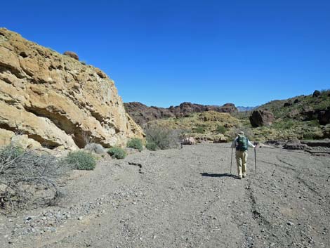
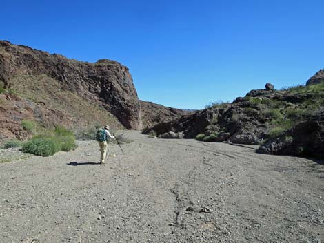
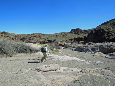
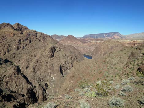
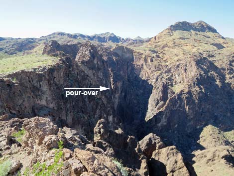
Overview The Colorado River Overlook makes for a nice, close-to-town, 4-mile hike down Boy Scout Canyon. The first 2.2 miles can be driven (Boy Scout Canyon Road) in a 4WD vehicle, but the remaining 1.8 miles is a hike in the Black Canyon Wilderness Area. The canyon is fairly open with little shade, although there is shade in narrower parts, and there is a 15-ft pour-over to pass. About 1.5 miles from the 4WD trailhead, the wash enters a deep, narrow gorge where hikers can hike out to a 20-foot pour-over that overlooks a 330-foot pour-over and provides a narrow view through the slot to the east. Just before entering the gorge, the Colorado River Overlook route exits the wash to the south and follows a use-trail out to the overlook, a knob that provides great views of the Wilderness area, two slivers of the Colorado River, and green vegetation in the bottom of Boy Scout Canyon far below. Link to hiking map. |
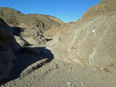
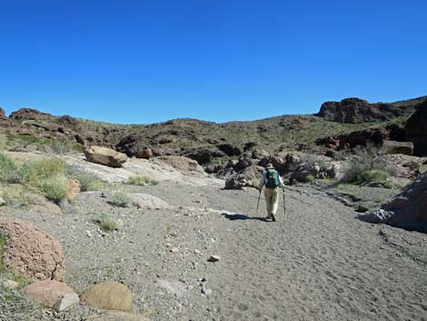
 Boy Scout Canyon Wash (view E) |
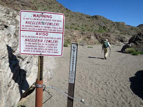
Watch Out Other than the standard warnings about hiking in the desert, ...this is a fairly safe hike. The first 2.2 miles follows a sandy jeep trail, so watch for vehicles, and there is one 3rd-class pour-over to climb, but it is only 15-ft and fairly safe. The end of the overlook route requires hiking and minor scrambling over decomposing volcanic rocks with tremendous drop-offs, so be extra careful when high enough to fall and get hurt. There are warning signs about Naegleria fowleri, a pathogenic amoebae, but this extremely rare disease is related to water, so this only applies to people hiking all the way to Boy Scout Hot Spring. While hiking, please respect the land and the other people out there, and try to Leave No Trace of your passage. Also, even though this hike is short, rescues from narrow canyons are difficult, so be sure to bring what you need of the 10 Essentials. This hike goes into the Black Canyon Wilderness Area, so pay particular attention to respecting the land. |
 Boy Scout Canyon Wash (view N) |
Getting to the Trailhead This hike is located in Lake Mead National Recreation Area, just southeast of Boulder City. From downtown Boulder City, drive southeast on Utah Street out past the cemetery into the open desert. Utah Street ends at a garbage transfer station. Just before the transfer station, turn right onto a paved road and follow it south under Interstate 11 towards the gun range. Just past the interstate and before the shooting starts, turn right onto Canyon Point Road and then left onto Boy Scout Canyon Road. The trailhead is either near the Lake Mead NRA boundary signs or at the end of the road. Link to Boy Scout Canyon Road map. |
 Sign on the rock wall -- warning about Naegleria fowleri (view NE) |
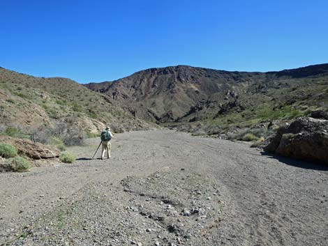
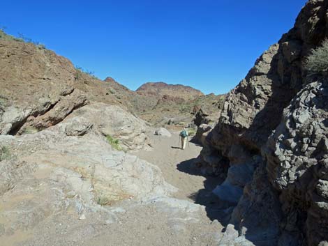
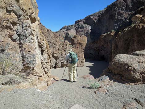
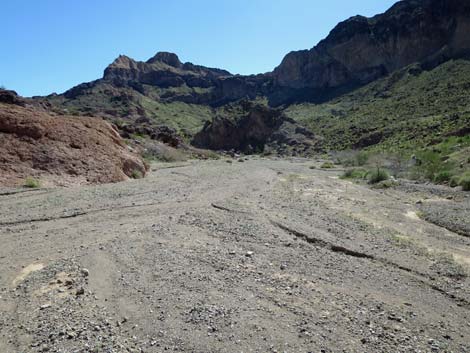
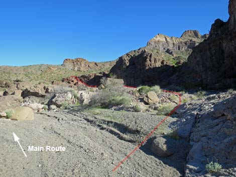
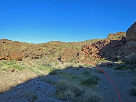
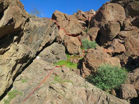
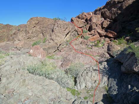
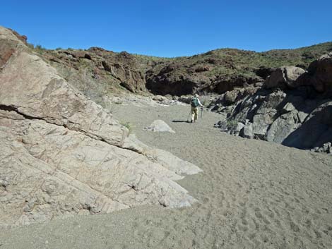
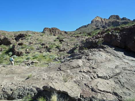
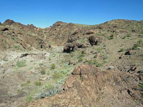
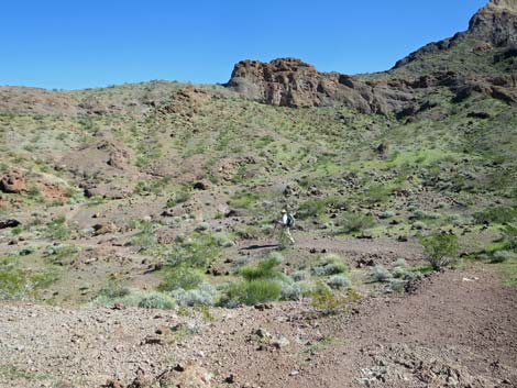
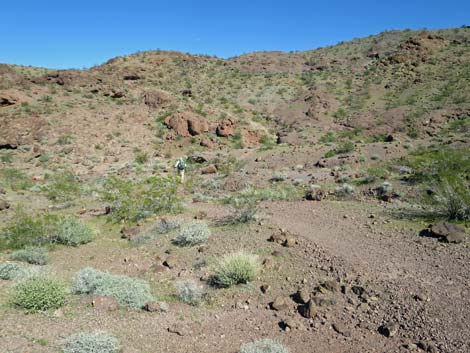
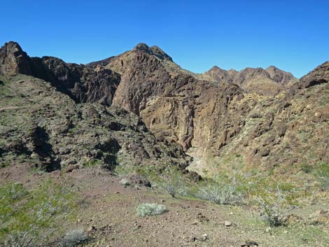
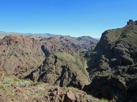
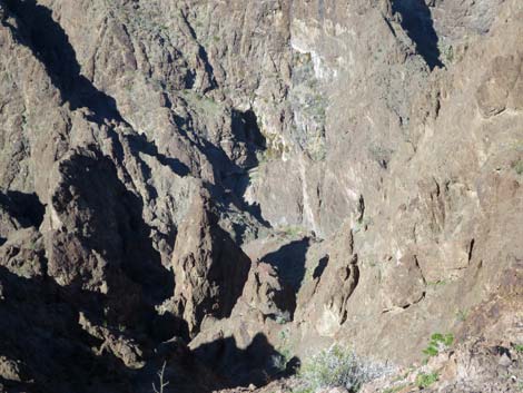
The Hike From the Lake Mead boundary, the route follows the wash down the canyon. Parts of the canyon are narrower and more cliffy than others, but the hills above are fairly low and lay back away from the wash, so the feeling generally is fairly open. The hills on both sides are in the Black Canyon Wilderness Area, so the road runs down a narrow corridor of non-wilderness. The road ends 2.2 miles down the canyon at the main trailhead. For details, see Boy Scout Canyon Road. From the end of the road (Table 1, Waypoint 01), the route follows the wash downhill to the east and enters the Wilderness area. At about 0.80 miles out, the route arrives atop a 15-ft pour-over (Wpt. 03) that is passed by an easy 3rd-class downclimb. The route continues down the wash, and at about 1.49 miles out, arrives in a wide section of canyon where the wash runs over flat, water-polished rocks and cuts some shallow, winding slots (Wpt. 04). The route forks here: down the wash to the high pour-overs versus up to the Colorado River Overlook. For details of this part of the hike, including the high pour-overs, see Boy Scout Canyon. |
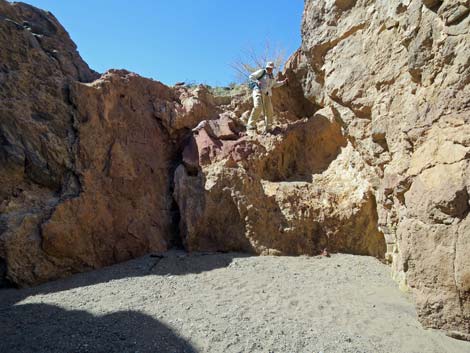
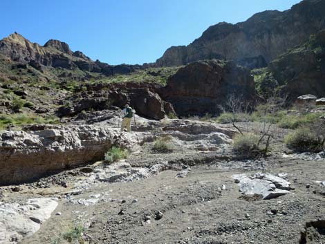
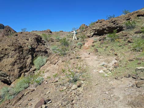
 Hiker atop 15-ft pour-over (view NE) |
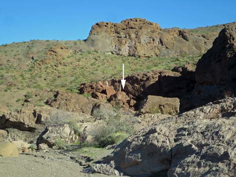
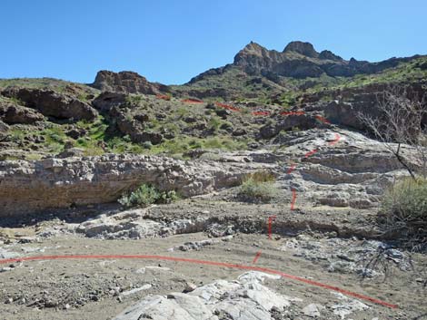
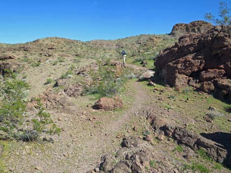
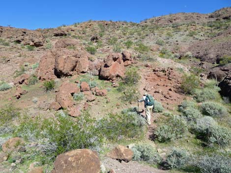
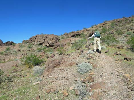
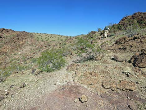
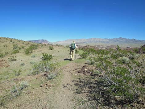
From about 100 yards back up the canyon, near the previous big bend in the wash, hikers can use an alternate for exiting the wash and starting up towards the overlook. From that bend, hikers can leave the main wash to the right and walk along the base of the wall to the east end of the cliffs, then scramble up through a boulder field to gain a use-trail. This is shorter, but not as easy as the regular route. From the flat, water-polished rocks (Wpt. 04), the regular Colorado River Overlook route turns south and climbs out of the wash on solid rock such that no trail is visible. However, when hikers cross onto dirt, a use-trail (Wpt. 06) becomes apparent. The use-trail runs east, dips through a side wash, and climbs somewhat steeply out the other side to the skyline above. In this area, the use-trail is well worn and apparent. The use-trail continues east on easier terrain, but it runs up onto solid rock again where hikers continue towards the highpoints ahead. Soon, hikers arrive atop a narrow ridgeline (Wpt. 07) with a 500-ft high, nearly vertical cliff on the north side (the south side provides safe travel). |
 Hiker starting down the pour-over (view SW) |
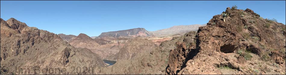
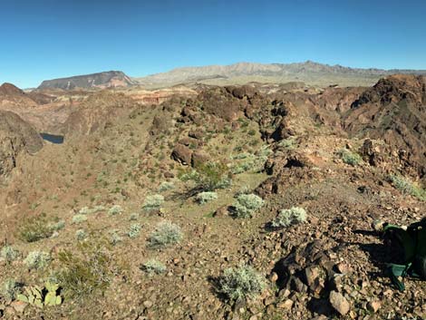
For adventuresome hikers wanting to get to Boy Scout Hot Springs, the route goes over the edge of the cliff here (Wpt. 07) and winds down through the cliffs to the spring. Hikers who can get over the edge without falling, and perhaps even those who can't, can find their way to the bottom of the canyon. Be very careful the entire way down, but especially the first step off the cliff. From this narrow spot on the ridgeline, the route continues east, dipping into a saddle and then clambering up the rocky slope ahead to the top of a knob, Colorado River Overlook (Wpt. 08). The Overlook, which sits atop the 500-ft cliff, provides great views north towards the Black Canyon Bridge, east towards the Colorado River and mountains in Arizona, south along the Colorado River, and west to the high cliffs of the Black Canyon, plus a view "from the other side" of the slot canyon that pours over the 330-ft cliffs at the end of the Boy Scout Canyon hike. Return to the trailhead by retracing your steps. For photos of the return, see Boy Scout Canyon, Colorado River Overlook -- Return. |
 Boy Scout Canyon Wash (view N) |
 Boy Scout Canyon Wash (view E) |
 Boy Scout Canyon Wash (view E) |
 Boy Scout Canyon Wash (view SE) |
 Boy Scout Canyon Wash (view E) |
 Boy Scout Canyon Wash (view E) |
Alternate, Shorter but Not so Good, Departure from Boy Scout Wash
 First view of the Overlook Route (view ESE) |
 Overlook Route: gap in the cliffs (view ESE) |
 |
 |
 |
 More to come ... |
Continuing on the Main Route
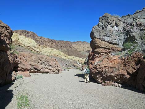
 Boy Scout Canyon Wash (view NE) |
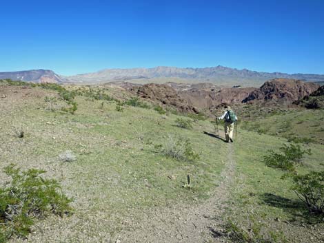
 Better start of the Overlook Route (view S) |
 Hiker starting out of the wash on solid rock (view S) |
 Hiker continuing across solid rock (view S) |
 A use-trail becomes apparent (view E) |
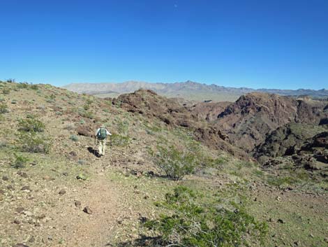
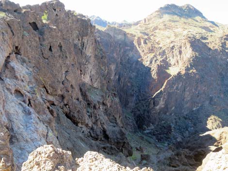
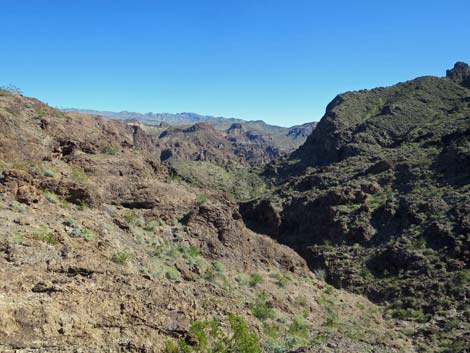
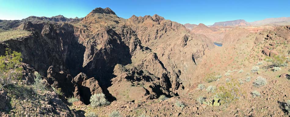
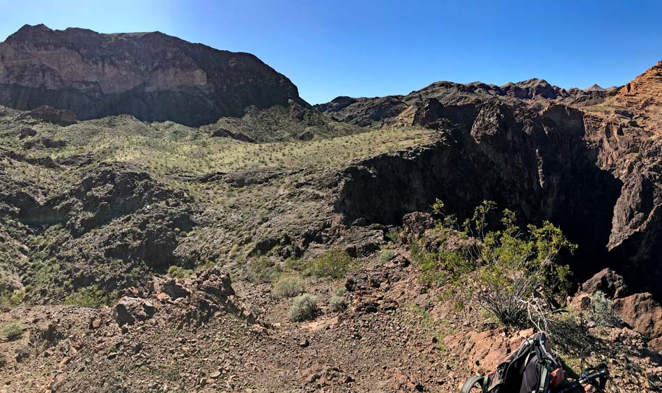
 Looking down Boy Scout Canyon, start of gorge (view N) |
 Hiker on use-trail (view E) |
 Use-trail dipping to cross gully (view E) |
 Hiker across gully and starting up steep hillside (view E) |
 Hiker on steep hillside (view E) |
 Hiker on steep hillside (view E) |
 Hiker on steep hillside (view E) |
 Nice scenery atop the steep part (view N) |
 Use-trail continues across gentle terrain (view E) |
 Use-trail crossing gentle terrain (view E) |
 Use-trail crossing gentle terrain (view E) |
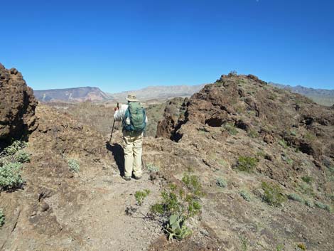 Use-trail arrives on the ridgeline (view NE) |
 Terrain on south side of ridge is safe (view NE) |
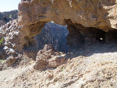
 Looking over the edge: route to Boy Scout Hot Springs (view N) |
 The route to the hot springs (view NE) |
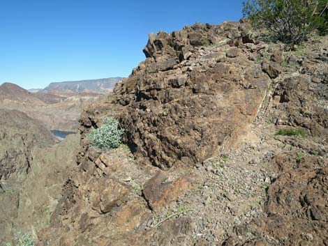
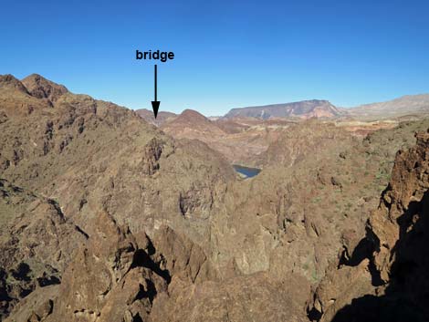 The Black Canyon Bridge is visible from this point (view N) |
 The Boy Scout Canyon 330-ft pour-over slot is not visible (view NW) |
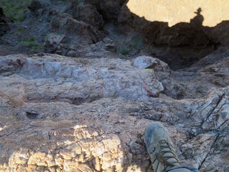
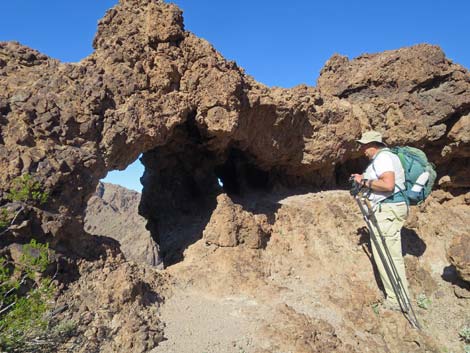 Holes in the narrow top of the ridge (view N) |
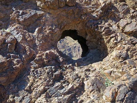 Holes in the narrow top of the ridge (view N) |
 Holes in the narrow top of the ridge (view NW) |
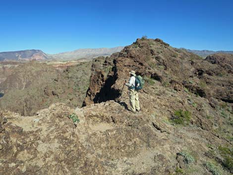
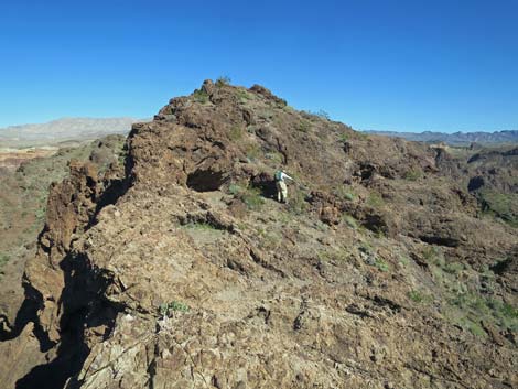 The route continues towards the highpoint (view E) |
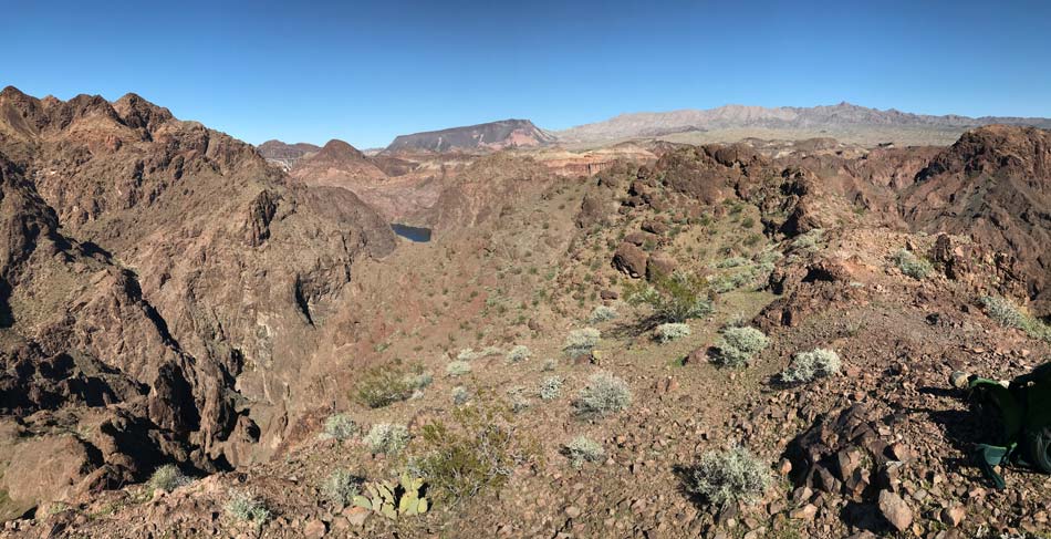
 Grand views (view SE towards Colorado River) |
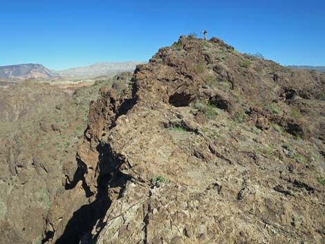 Hiker arriving at the highpoint (view E) |
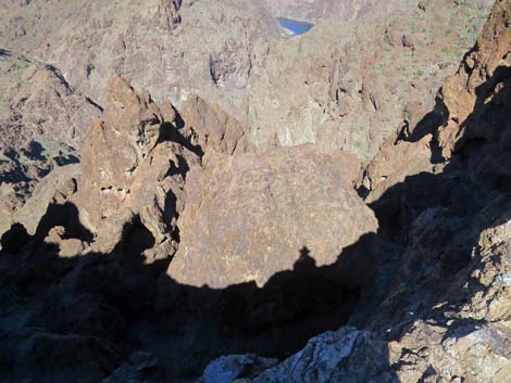
 An airy spot when arriving on the summit (view NE) |
 Arriving on the summit (view NE) |
 Summit (view N towards Black Canyon Bridge and Colorado River) |
 Summit (view NW towards 330-ft pour-over) |
 Summit (view SE) |
 Summit (view N, down to Boy Scout Hot Spring) |
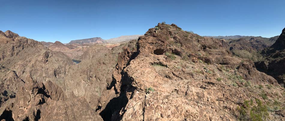
Panorama: hiker arriving at Colorado River Overlook (view NE)
Panorama: Summit view (view N towards Black Canyon Bridge, Colorado River, and Fortification Hill)
Panorama: Summit view (view NE towards Black Canyon Bridge, Colorado River, Fortification Hill, and Wilson Ridge in Arizona)
Panorama: Summit view (view SE towards Wilson Ridge in Arizona and Colorado River)
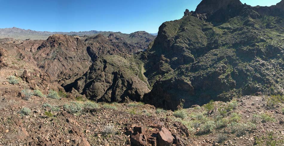
Panorama: Summit view (view W towards exit route and high cliffs of the Black Canyon)
Table 1. Hiking Coordinates and Distances based on GPS data (NAD27; UTM Zone 11S). Download Hiking GPS Waypoints (gpx) file.
| Wpt. | Location | UTM Easting | UTM Northing | Elevation (ft) | Point-to-Point Distance (mi) | Cumulative Distance (mi) |
|---|---|---|---|---|---|---|
| 01 | Boy Scout Canyon Trailhead | 701197 | 3983039 | 1,705 | 0.00 | 0.00 |
| 02 | Wash Narrows | 701717 | 3983035 | 1,636 | 0.34 | 0.34 |
| 03 | 15-ft Pour-Over | 702071 | 3983527 | 1,536 | 0.46 | 0.80 |
| 04 | Start of Overlook Route | 702811 | 3983667 | 1,410 | 0.69 | 1.49 |
| 06 | Use-trail | 702838 | 3983623 | 1,409 | 0.04 | 1.53 |
| 07 | Edge of Cliffs | 703100 | 3983802 | 1,469 | 0.24 | 1.77 |
| 08 | Overlook | 703139 | 3983815 | 1,517 | 0.04 | 1.81 |
| 01 | Boy Scout Canyon Trailhead | 701197 | 3983039 | 1,705 | 1.81 | 3.62 |
Happy Hiking! All distances, elevations, and other facts are approximate.
![]() ; Last updated 240326
; Last updated 240326
| Hiking Around Lake Mead | Hiking Around Las Vegas | Glossary | Copyright, Conditions, Disclaimer | Home |