Backroads Around Las Vegas, Lake Mead National Recreation Area
 West End Wash South Road (Road 93) sign (view S) |
Overview West End Wash South Road is a sandy two-track road that follows a broad wash as it runs south from Northshore Road towards Lake Mead. The road never gets to the lake, as it is blocked a pour-over about 1.2 miles out. Althouth illegal, some drivers are bypassing the pour-over and continuing down the wash. The sign near the end of the road is, however, confusing, so drivers in the right vehicles might not realize the violation. This road runs through spectacular country with high mountains and a deep sandy wash, but it doesn't really go anywhere, although hikers could continue down about 2 miles to Callville Bay. Driving this wash requires a 4WD vehicle because of deep, soft sand. Link to map. |
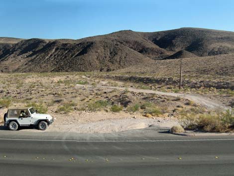 Northshore Rd at West End South Rd (view S) |
Watch Out Other than the standard warnings about hiking in the desert, ...this road is safe, but it is not maintained and suitable only for 4WD vehicles because of deep, soft sand. In my jeep, I usually stay in 2WD until I get stuck, and in this case -- I did. While out, please respect the land and the other people out there, and try to Leave No Trace of your passage. Even though this road is short, be sure to bring what you need of the 10 Essentials. Getting to the Roadhead This road is located along Northshore Road in Lake Mead National Recreation Area, about 40 minutes northeast of Las Vegas. From town, drive out to Lake Mead and then to about Mile 12.6 on Northshore Road. As Northshore Road winds down a hill, West End Wash South Road starts to the right (south). There is no highway sign, but watch for telephone wires crossing the road. |
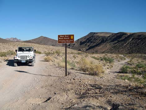 West End Wash South Road (Road 93) sign (view S) |
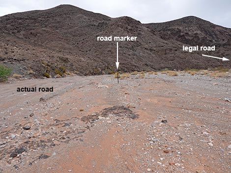
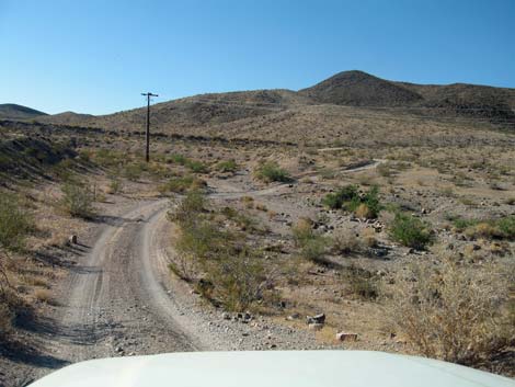
The Road From the pavement (Table 1, Site 1410), West End Wash South Road turns south to wind through a gully and then continues on firm dirt following telephone poles. At about 0.4 miles out, the road forks. The left drops directly into the wash, while the right stays on firm ground until it too drops into the wash (Site 1413). Now in the wash, tire tracks lead downstream until a layer of rocks lying across the wash forms a pour-over (Site 1414). Just before the pour-over, the legal road stays right and exits the wash to end on a rocky promontory that is part of the layer of rocks forming the pour-over. Some rock-hopper jeep drivers depart the legal road, crawl down the pour-over, and continue farther down the wash. Returning back up the road, the sandy wash bends right as the road bends left onto firm soils (just above Wpt. 1413). Tire tracks run up the wash to the Northshore Road bridge, but that is not the legal road. |
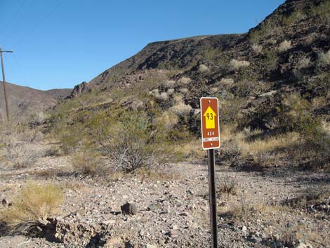 Approved road sign (view SE) |
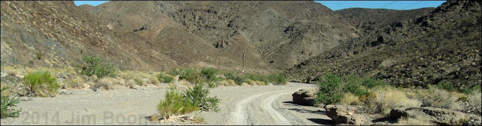
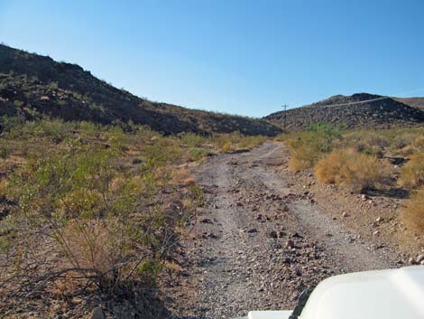
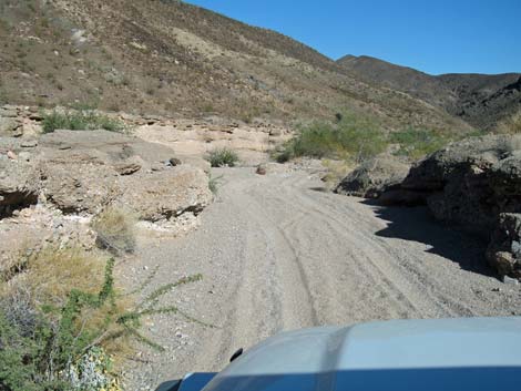 Nearing West End Wash (view SE) |
 Entering West End Wash (view SE) |
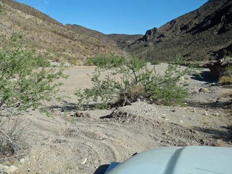
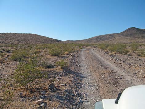
 West End Wash (view SE) |
 Actual road and legal road diverge (view S) |
 Legal road, no longer used, exits the wash (view S) |
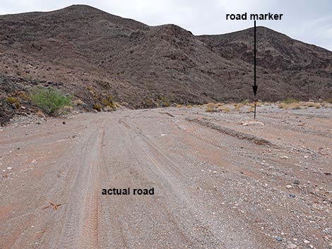
 Legal road, no longer used, approaching a power pole (view S) |
 The legal road ends top a high pour-over (view S) |
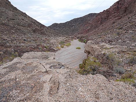
 The wash continues beyond the high pour-over (view S) |
 More to come ... |
Actual Road
Actual road and legal road diverge (view S) |
 The legal road is far to the right, outside the photo (view S) |
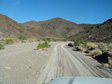
 The actual road stays on the east edge of the wash (view S) |
 The actual road drops into a rocky gully (view SW) |
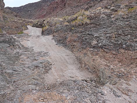 The first step down isn't too bad (view SW) |
 The second step down probably would hang up a full-size truck |
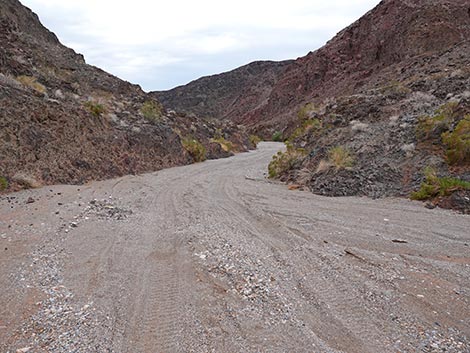 Beyond the pour-over, tire tracks continue down the wash (view SW) |
More to come ... |
Returning back up West End Wash South Road
 Firm ground after climbing out of the sandy wash (view NW) |
 Firm ground after climbing out of the sandy wash (view NW) |
 Approaching Northshore Road (view NW) |
More to come ... |
Table 1. Backroad Coordinates Based on GPS Data (NAD27; UTM Zone 11S). Download Roadway GPS Waypoints (*.gpx) file.
| Site | Location | UTM Easting | UTM Northing | Latitude (N) | Longitude (W) | Elevation (ft) | Verified |
|---|---|---|---|---|---|---|---|
| 1410 | Northshore Rd at West End Rd South | 702911 | 4006767 | 36.18627 | 114.74353 | 1,737 | GPS |
| 1413 | West End Rd South Fork | 703744 | 4006168 | 36.18070 | 114.73443 | 1,595 | GPS |
| 1414 | West End Rd South End | 704294 | 4005717 | 36.17651 | 114.72845 | 1,527 | GPS |
Happy Hiking! All distances, elevations, and other facts are approximate.
![]() ; Last updated 250703
; Last updated 250703
| Backroads Around Lake Mead | Hiking Around Las Vegas | Glossary | Copyright, Conditions, Disclaimer | Home |