
Hiking Around Las Vegas, Red Rocks National Conservation Area

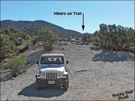 Rocky Gap Trailhead and Bridge Mountain parking (view SE) |
Overview The trail and route to the summit of Bridge Mountain make for a physically demanding and technically difficult round trip of 6.8 miles. However, the trail to either Keystone Overlook (4.0 miles) or Canyon Overlook (4.5 miles) makes for a nice day out with grand views from above the Red Rock Cliffs. The trail starts along Rocky Gap Road, a road requiring a 4WD vehicle, although high-clearance vehicles can usually make it about 1.5 miles up the 4.8-mile road. So, from the bottom, this can be a long hike. This trail runs entirely in the Pinyon-Juniper Woodland life zone, so the elevation is relatively high for the desert and there is plenty of shade. From the trailhead, the trail generally runs northeast to the crest of the mountains, turns south along the ridgetop, then finally drops off the other side of the crest to again run northeast. The view from the crest is grand, but the views from the overlooks are both grand and intimate, and for an added bonus, hikers get nearly-aerial views of a thrust fault. Link to map. Link to BLM Georeference PDF map file. |
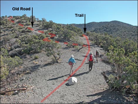 Hikers starting up the trail (view SE) |
Watch Out Other than the standard warnings about hiking in the desert, ...this hike is fairly safe, but the 4WD road is a bit of a thrill with narrow spots and high cliffs. Be sure to always drive slowly and carefully while watching for idiots on motorcycles and trucks racing on the road -- there are plenty of blind curves where drivers might meet these people. While hiking, please respect the land and the other people out there, and try to Leave No Trace of your passage. Also, this is a fairly long hike, so be sure to bring the 10 Essentials. This route runs up into the Rainbow Mountain Wilderness Area, so please pay particular attention to respecting the land. |
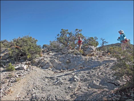 Hikers on a steep part of the trail (view NE) |
Getting to the Trailhead
This hike is located along Rocky Gap Road in Red Rock Canyon National Conservation Area, about 1-3/4 hours west of Las Vegas. Drive out to Red Rocks, pay the fee, and then drive about half-way around the Scenic Loop Road to Willow Spring Road. Turn right and drive north 0.6 miles to the end of the pavement. Without a 4WD vehicle, stop here and use the Willow Springs Trailhead. Otherwise, continue onto the unpaved Rocky Gap Road and drive 4.8 miles to Rocky Gap Summit Trailhead at the highpoint on the road. Park here; this is the trailhead. |
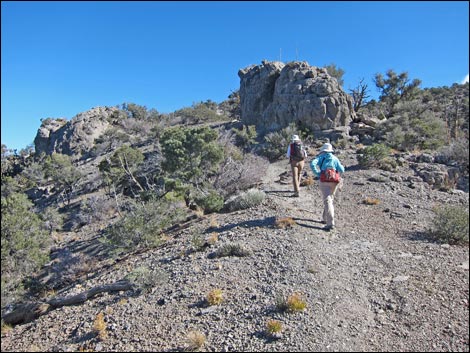 Hikers on a not-so-steep part of the trail (view NE) |
The Hike The trailhead was marked by a sign on a post, but only the white metal post remains. Nonetheless, from the trailhead (Table 1, Waypoint 01), the trail starts out running southeast before turning and generally running northeast. Shortly, the trail forks (Wpt. 02). Here, an old road scar cuts left and follows the ridgeline steeply. The trail, however, stays right (straight) and runs into the pinyon-juniper forest. The trail skirts around a rocky knob on the ridgeline, then rejoins the old road, still following the ridgeline. Eventually, the well-built trail slides off the ridge onto south-facing slopes, passes two sets of 2 switchbacks each, and climbs across west-facing slopes onto the crest of the Spring Mountain Range. The trail gains the crest at a signed trail junction (Wpt. 03). Here, the North Peak Trail cuts hard to the left and the Bridge Mountain Trail angles off to the right. |
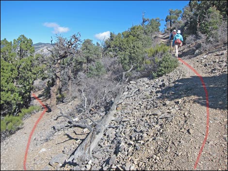 Switchback near the top of the ridge (view N) |
The crest provides grand views to the east over the top of the Red Rocks sandstone cliffs, out across the Las Vegas Valley, and into Arizona. To the west, however, tall peaks block the view, bringing into question the notion of this being "the crest of the Spring Mountain Range." Because of the unusual thrust fault geology here, water flowing off the east side of these higher peaks actually ends up flowing off the west side of the mountain range. Following the crest south, the trail runs intermittently atop the ridge and off one side or the other. In this area, the summit of Bridge Mountain can be seen with its imposing near-vertical fortifications. Although hard to believe from this perspective, the route to the summit is entirely visible from the ridgeline. Eventually, the trail reaches a "Bridge Mountain Trail" sign with an arrow to the right (Wpt. 04). Land managers prefer that we stay on the main trail here so as not to inflict additional habitat damage on the route to the left. |
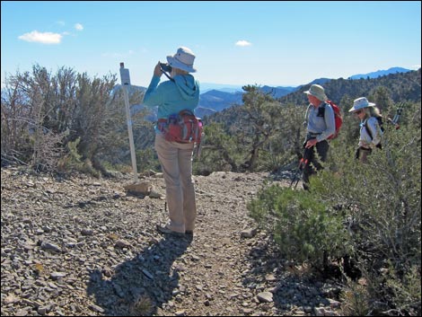 Hikers at the North Peak -- Bridge Mountain trail junction (view SE) |
Staying on the main ridgeline, the main trail runs south and eventually reaches a wide area with a campsite (Wpt. 04). Here the trail abruptly turns left and descends to the east. The trail runs northeast as it descends a ridge. The trail starts on hot, south-facing slopes, but then crosses the ridgeline onto cooler, north-facing slopes. This north-facing slope provides nearly aerial views of the world famous (at least among structural geologists) Keystone Thrust Fault. For information on the geology here, see the description of the Keystone Thrust Fault Trail. The trail descends off of limestone soils and onto a broad, sandy, sandstone area. The point of contact between these two rock types is the Keystone Fault. This place, Keystone Overlook (Wpt. 06), is the first of two good choices where hikers, not planning to bag the summit, might end this hike. The views a bit farther down are different, but hardly better than those here, plus here one can contemplate the forces of nature that thrust the limestone mountains up over the sandstone cliffs. Stay alert, however, in case the fault thrusts again! |
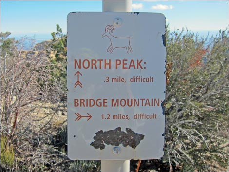 North Peak -- Bridge Mountain trail sign (view E) North Peak -- Bridge Mountain trail sign (view E) |
Continuing, the trail turns north onto red sandstone rock before descending on switchbacks a bit farther down the ridge to the east. The trail reaches the edge of a rocky cliff that is the back edge of the Sandstone Bluffs. Here at Canyon Overlook (Wpt. 07), a spindly pine tree near the edge of the overlook provides some shade. For hikers not planning to bag the summit, Canyon Overlook offers the second of two good choices to end this hike. The edge here is quite sharp and drops vertically, seemingly forever, into the North Fork of Pine Creek Canyon. For hikers continuing on, the route turns northeast and runs down across the ridge (see Bridge Mountain Route), but for the rest of us, this is a good place to sit, enjoy the view, and eat some lunch. When rested, return to the trailhead by following the trail back up and over the crest of the range, considering on the way, a visit to the summit of North Peak. |
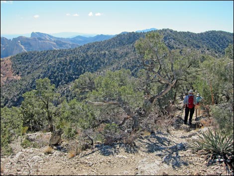 Hikers on the crest of the Spring Mountains (view S) |
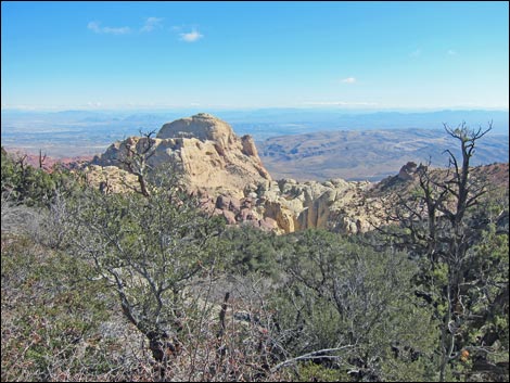 Bridge Mountain with imposing summit cliffs (view E) |
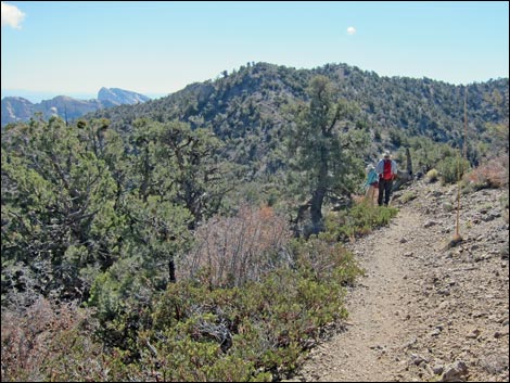 Hikers on east side of the crest (view S) |
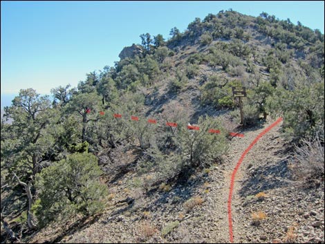 Approaching the Bridge Mountain Trail sign (view S) |
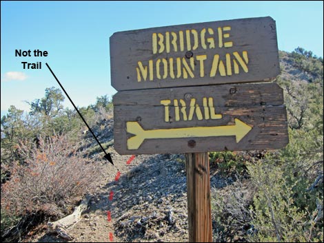 Bridge Mountain Trail sign (view SE) |
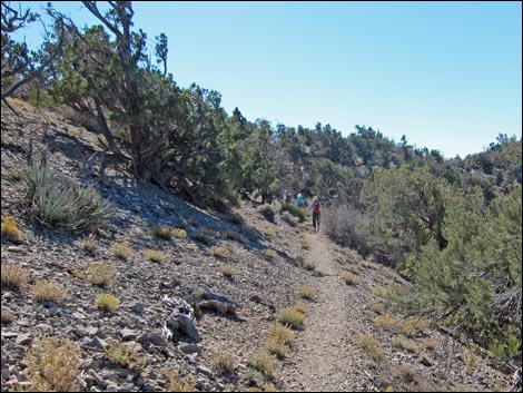 Hikers on west side of the crest (view S) |
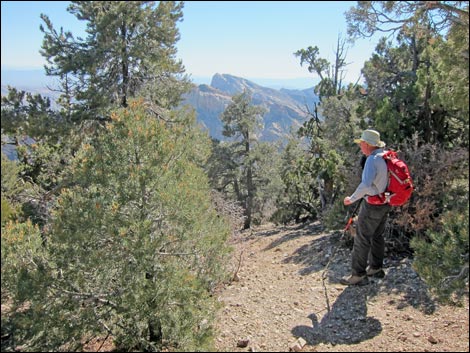 Hiker starting off the crest to the east (view SE) |
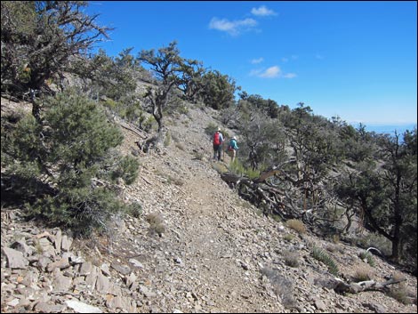 Trail descending south-facing side of a ridge (view NE) |
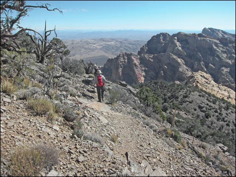 Trail descending north-facing side of a ridge (view E) |
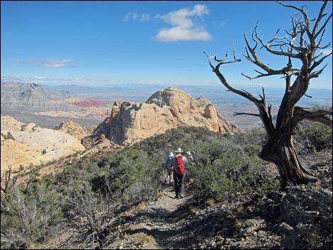 Trail descending towards Bridge Mountain (view E) |
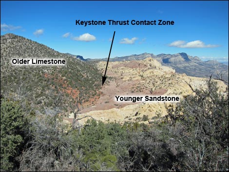 Superb view of the Keystone Thrust contact zone (view N) |
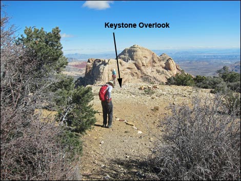 Keystone Overlook. Hiker at Keystone Thrust contact (view E) |
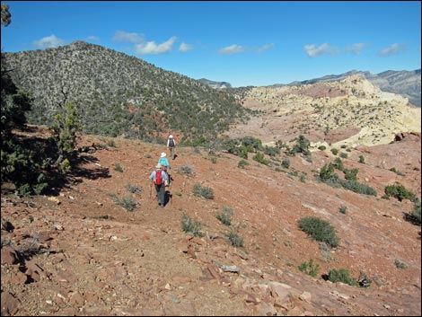 Trail crosses red sandstone and switchbacks down (view N) |
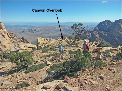 Hikers approaching Canyon Overlook (view E) |
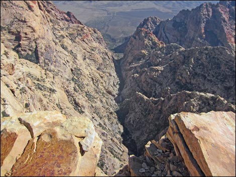 Canyon Overlook (view E into Pine Creek) |
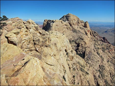 Canyon Overlook (view NE to Bridge Mountain summit) |
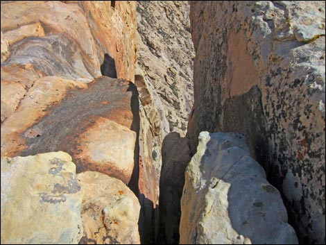 Canyon Overlook (view E through narrow gap) |
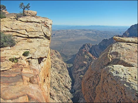 Canyon Overlook (view E into Pine Creek) |
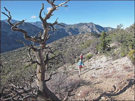 Hikers on west side of the crest (view N) |
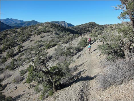 Hikers on west side of the crest (view N) |
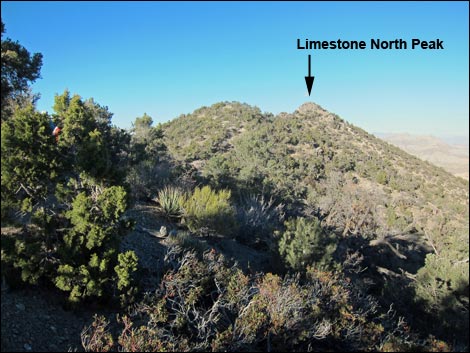 Trail on east side of the crest (view N to Limestone North Peak) |
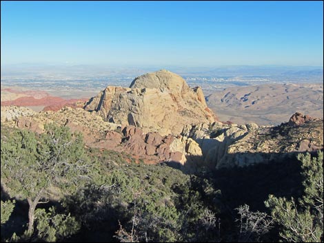 Trail on east side of the crest (view E to Bridge Mountain) |
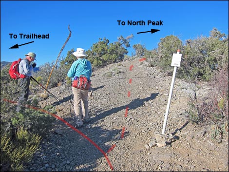 Hikers on the crest (view N at trail junction) |
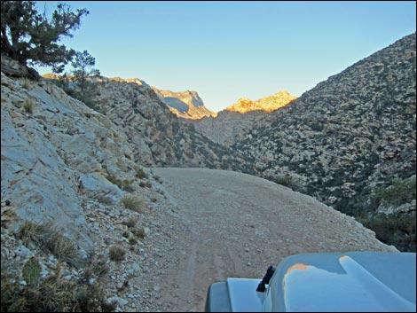 Tired drivers need to operate with care at the end of the day! |
Table 1. Hiking Coordinates Based on GPS Data (NAD27; UTM Zone 11S). Download Hiking GPS Waypoints (*.gpx) file.
| Wpt. | Location | UTM Easting | UTM Northing | Elevation (ft) | Point-to-Point Distance (mi) | Cumulative Distance (mi) | Verified |
|---|---|---|---|---|---|---|---|
| 01 | Bridge Mtn Trailhead Sign | 632066 | 3999267 | 6,483 | 0.00 | 0.00 | GPS |
| 02 | Fork in the Road, Stay Right | 632111 | 3999250 | 6,492 | 0.03 | 0.03 | GPS |
| 03 | Crest of the Ridge, Trail Junction | 633216 | 3999510 | 7,187 | 1.11 | 1.14 | GPS |
| 04 | Bridge Mtn Trail Sign | 633193 | 3999147 | 7,105 | 0.27 | 1.41 | GPS |
| 05 | Campsite on Ridgeline | 633210 | 3998865 | 7,183 | 0.19 | 1.60 | GPS |
| 06 | Keystone Overlook | 633697 | 3998966 | 6,914 | 0.40 | 2.00 | GPS |
| 07 | Canyon Overlook | 633820 | 3999058 | 6,721 | 0.22 | 2.22 | GPS |
Happy Hiking! All distances, elevations, and other facts are approximate.
![]() ; Last updated 240329
; Last updated 240329
| Hiking Around Red Rocks | Hiking Around Las Vegas | Glossary | Copyright, Conditions, Disclaimer | Home |