Backroads Around Las Vegas, Basin and Range National Monument
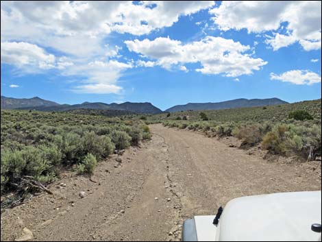
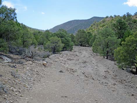
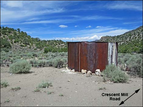
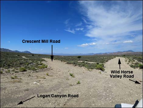 Logan Canyon-Wild Horse Roads at Crescent Mill Rd (view W) |
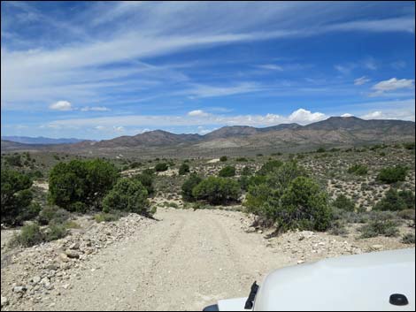
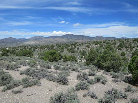
Overview Crescent Mill Road is a poorly maintained, 2-mile dirt road that starts along Highway 375 and runs north, passing Logan Canyon Road to the east and several other minor roads, then dead-ending into Mail Summit Road just west of Murphy Gap. Wild Horse Valley Road normally is suitable for 2WD vehicles, but it can be muddy. In the south, the road runs through Mojave Desert Scrub vegetation as it climbs towards the mountains. In the mountains, the road runs over a low saddle between the Tempiute Range to the west and the Mount Irish Range to the east. In this area, the road runs through Pinyon-Juniper Woodlands. Descending into Wild Horse Valley, the road passes into the Great Basin Desert where the dominant vegetation is Big Sagebrush. The road, therefore, spans the transition zone between the Mojave Desert and Great Basin Desert. |
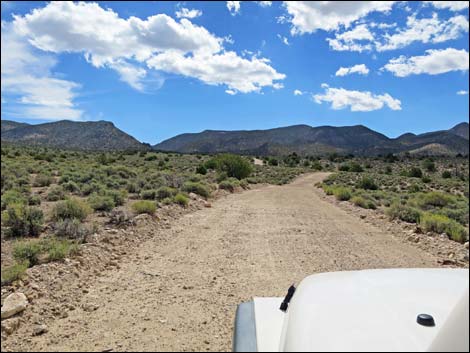
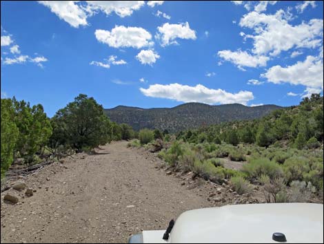
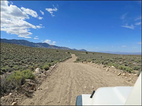 Crescent Mill Rd starts out across gently rolling country (view S) |
Watch Out Other than the standard warnings about driving in the desert, ...this road is pretty safe, but be sure that your vehicle is in good working condition, carry plenty of water (radiator and drinking), and pack a lunch. Always drive carefully; even though the road is maintained, it can be washed out and there are occasional hazards such as errant boulders in the roadway. While out, please respect the land and the other people out there, and try to Leave No Trace of your passage. This road goes into remote areas, so be sure to bring the 10 Essentials. Cell phones don't work. |
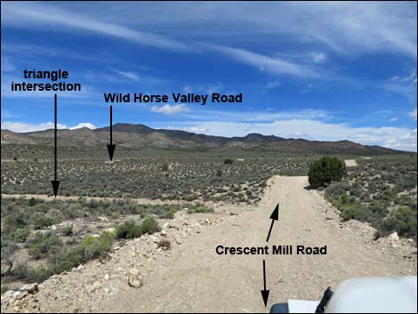
 Side road (triangle intersection; view S) |
Getting to the Road Crescent Mill Road is located in the southwest corner of Basin and Range National Monument, about 2-3/4 hours northeast of Las Vegas driving directly, or about 1 hour west of the intersection of Highway 93 and Highway 318, but off Highway 375. From Las Vegas, drive north on Interstate-15 21 miles to Highway 93. Turn left onto Great Basin Highway (Hwy 93) and top off the gas tank if necessary. Drive north past the towns of Alamo (95 miles from Las Vegas) and Ash Springs (102 miles) to the intersection of Highway 93 and Highway 318 (107 miles). Gasoline is available in Alamo, Ash Springs, Rachel, and Lund. Turn left onto Highway 318 and drive west 0.6 miles to a fork in the highway. Stay left (straight) onto Highway 375. Continue west, over Hancock Summit, and down into Tikaboo Valley. At about 21.4 miles out, turn right onto Silver Tank Road, which is Wild Horse Valley Road. Drive north 10.6 miles to the intersection of Wild Horse Valley Road with Logan Canyon Road and Crescent Mill Road. |
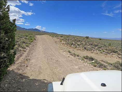
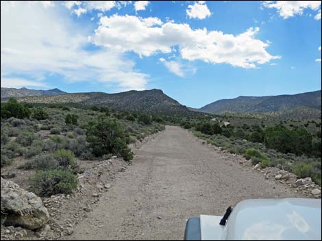
 The road turns and climbs through sagebrush hills (view E) |
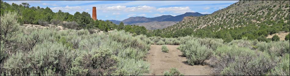
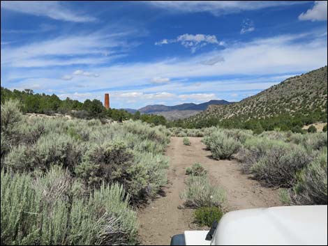
The Road From the intersection of Wild Horse Valley Road with Logan Canyon Road and Crescent Mill Road (Table 1, Site 1582), Crescent Mill Road runs south down and across the open, sagebrush covered rolling foothills of the Mt. Irish Range. About 250 yards out, the road passes a side road to the right, which is part of a large triangular intersection with Wild Horse Valley Road. Just past the intersection, Crescent Mill Road curves left to head eastward and climb towards the mountains. The road parallels, then crosses a wash, and climbs again to run on higher terrain. Still heading east, the road again parallels, crosses a wash (0.9 miles out), and climbs again. On the next slope, the road enters Basin and Range National Monument, without fanfare, at about 1.0 miles out. Again, the road climbs, drops to cross a wash, and climbs over the next ridge. At about 1.8 miles out, the road drops into and follows up a sandy wash. This area can be washed out and narrow with large boulders to wind among, but observant visitors will notice the red-brick chimney ahead in the middle distance. |
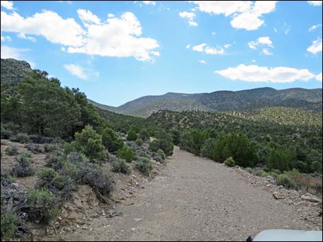
 Gently rolling hills (view E) |
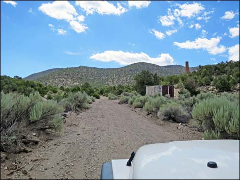
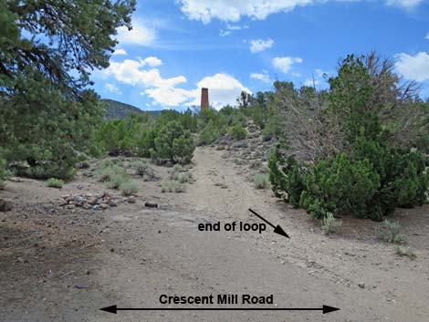
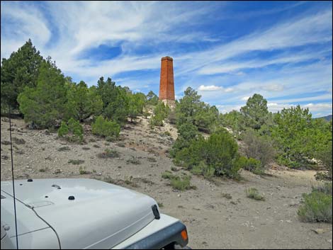
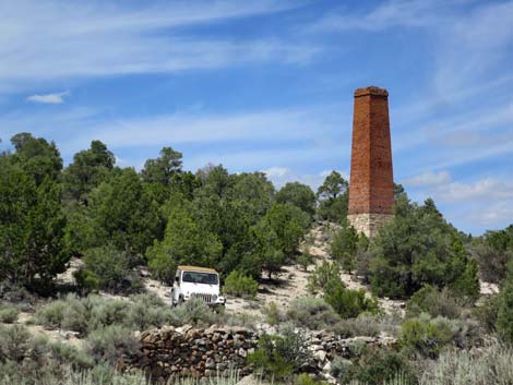
At about 2.0 miles out, the road exits the wash onto the south bank, and shortly (130 yards) arrives as a large metal water tank on the right. This is the beginning of the Crescent Mill Site historic area, although the water tank probably dates to the early ranching era rather than the mine era. Just past the water tank, the road forks. The main road stays left (straight), while the left is the end of a big "turn around" loop. The loop is damaged and not passable for normal vehicles. Staying straight, the road continues straight for another 200 yards, then begins to curve right starting to form the loop. In this area, a stone cabin, across the wash to the left, becomes visible. About halfway around the loop, a road forks left. This road runs up the canyon about 350 yards into an area of tree and ends for no apparent reason. The end of the road has been used for a campsite, but it is not entirely conducive to that purpose. Continuing around the loop, the road winds around to head west and ends at a tight turn-around in a flat area (Site 1823) shorn up by rock walls on the downhill side. For most vehicle, this is the end of the road. |
 |
 |
 Start of the washed out section (view E) |
 Back on good road (view E) |
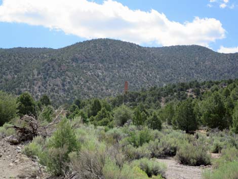 The chimney comes into view (view E) |
 Approaching the water tank (view E) |
 End of the loop merging into the main road (view SE) |
 The road loops back towards the chimney (view W) |
 Trailhead parking (view SW) |
 Mind the stone wall shoring up the roadway (view SW) |
Returning down Crescent Mill Road
 |
 |
 Timpahute Range (view NW from Crescent Mill Road) |
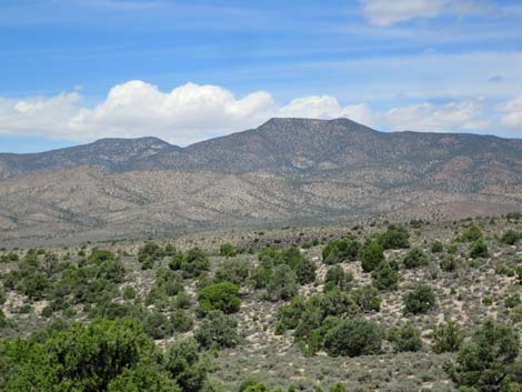 Monte Mountain in the Timpahute Range (view NW) |
 |
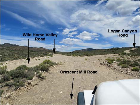 |
Table 1. Highway Coordinates and Distances based on GPS Data (NAD27). Download highway GPS waypoints (gpx) file.
| Wpt. | Location | UTM Easting | UTM Northing | Elevation (ft) | Point-to-Point Distance (mi) | Cumulative Distance (mi) |
|---|---|---|---|---|---|---|
| 1582 | Wild Horse Rd at Logan Cyn Rd | 635805 | 4163586 | 5,788 | 0.00 | 0.00 |
| 1823 | Crescent Mill Site | 638804 | 4163126 | 6,246 | 2.23 | 2.23 |
Happy Hiking! All distances, elevations, and other facts are approximate.
![]() ; Last updated 241112
; Last updated 241112
| Basin and Range | Backroads | Hiking Around Las Vegas | Glossary | Copyright, Conditions, Disclaimer | Home |