Hiking Around Las Vegas, Gold Butte National Monument
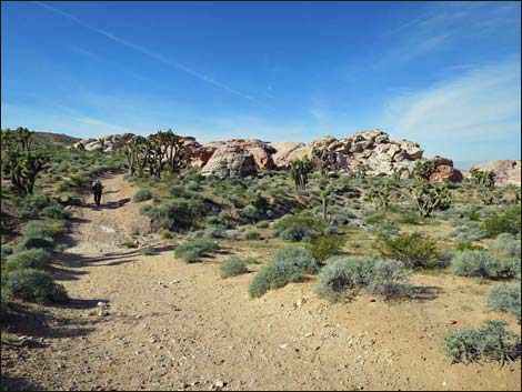
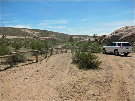 Falling Man trailhead parking (view SW) |
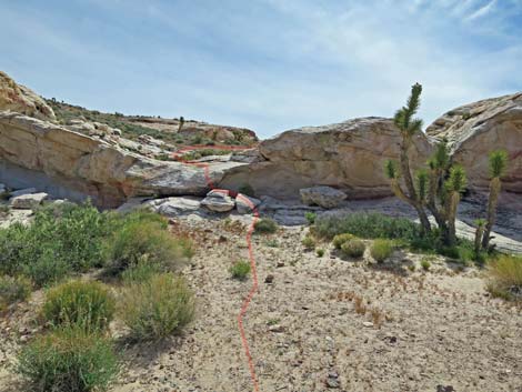
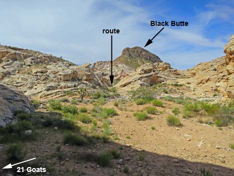
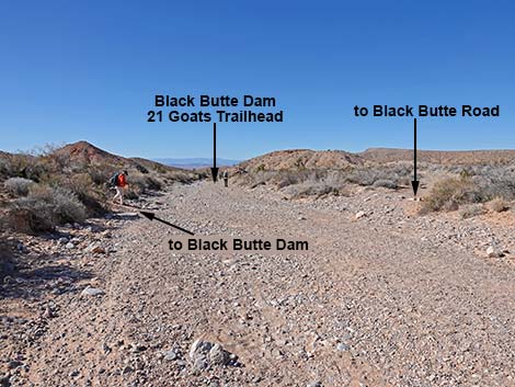
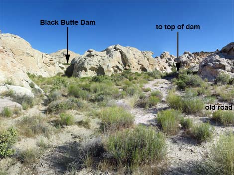
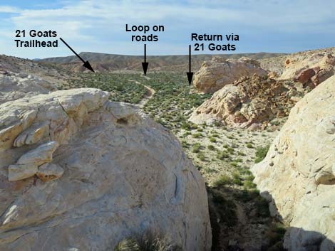
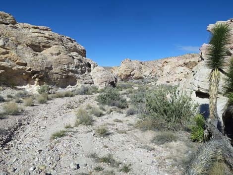
Overview The Falling Man, 21 Goats, Black Butte Dam Loop is a nice, 2.7-mile hike near Whitney Pocket that links together three interesting areas. Starting from the Falling Man Trailhead, the route passes through the Falling Man petroglyph area (0.4 miles), then continues on a use-trail to the 21 Goats petroglyph site (0.6 miles). From there, the route follows washes and another use-trail to Black Butte Dam (0.4 miles). Even when dry, Black Butte Dam is an interesting ranching-era site. Hikers can then return over the same route (1.4 miles) or continue the loop using an old, closed road and finally following Black Butte Road back to the trailhead (1.3 miles). For people with 4WD vehicles just wanting to see the dam, there is a shorter route (Black Butte Dam Direct), but the loop described here makes a nice 3-mile loop that normally is accessible in a carefully driven sedan. Link to hiking map. |
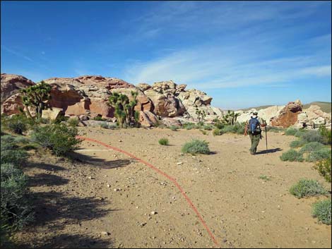
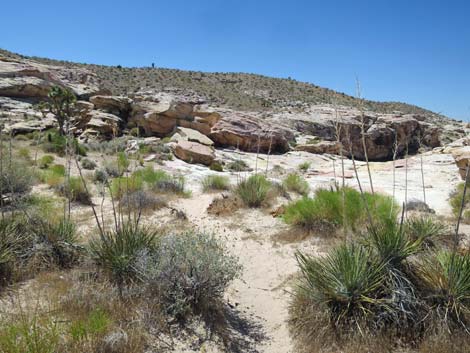
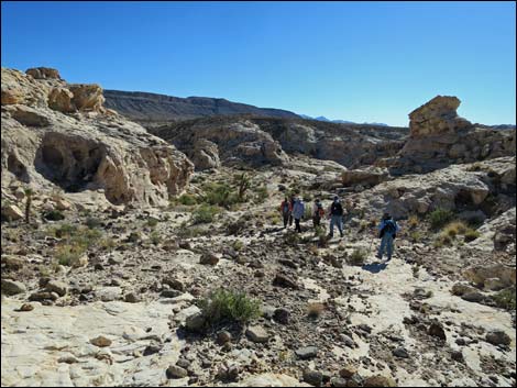
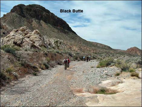
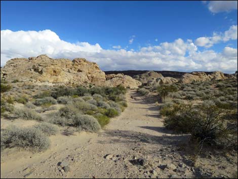
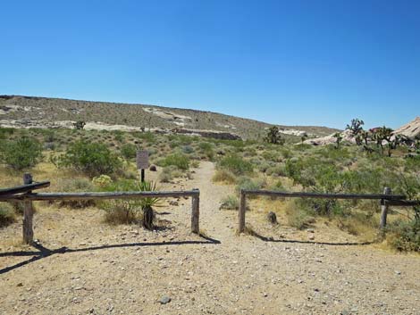 Hiker departing the trailhead (view S) |
Watch Out Other than the standard warnings about hiking in the desert, ... this is a safe area, but be careful scrambling around on the rocks. The walking is fairly easy, but parts of the route cross rocky areas where the use-trail is faint. While hiking, please respect the land and the other people out there, and try to Leave No Trace of your passage. Also, even though this hike is short, the area is remote, so be sure to bring what you need of the 10 Essentials. Cell phones don't work in this area. This is a wild and remote area without services of any kind (no restrooms, no water, no gas, no food). Bring what you need to survive. Be prepared and be self-reliant. Someone will find you eventually if you stay on a main road, but be prepared to survive alone for a day or two. While in the area, remember that petroglyphs and pictographs are national treasures and easily damaged. Please take care of the area and leave it as you found it for generations to come. |
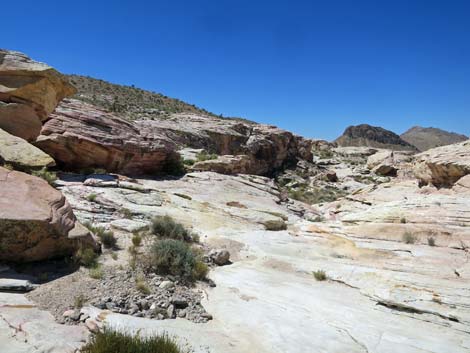
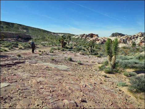 Trail crosses bedrock (view S) Trail crosses bedrock (view S) |
Getting to the Trailhead This hike is located out in Gold Butte National Monument, just south of Mesquite, Nevada, about 2 hours northeast of Las Vegas in a wild and remote, but scenic area. From town, drive out to Gold Butte National Monument. From Whitney Pocket, turn around and drive back north for 1.4 miles to Black Butte Road, an unmarked dirt road to the west, which is just past a large sandstone crag with campsites around the base. Turn left and drive west on Black Butte Road. A number of side roads branch off Black Butte Road, but most are obviously not the main road. However, at 1.2 miles from the pavement, the road forks equally; stay left. At 1.9 miles out, drivers arrive at the parking area, delineated by wooden corral fencing. Park here; this is the trailhead. |
 Trail continues beyond bedrock (view S) |
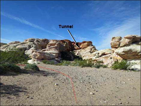
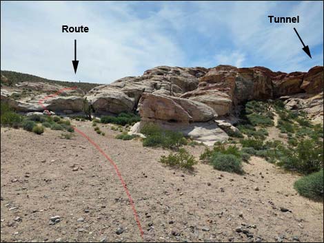
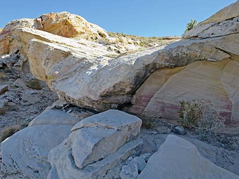
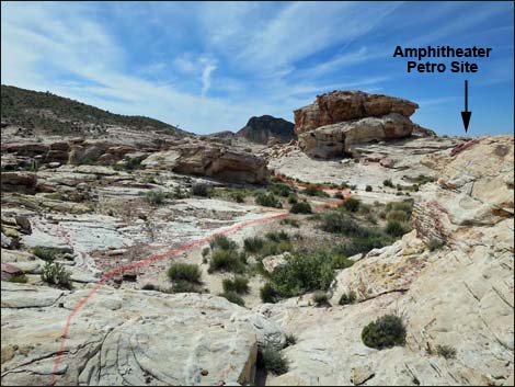
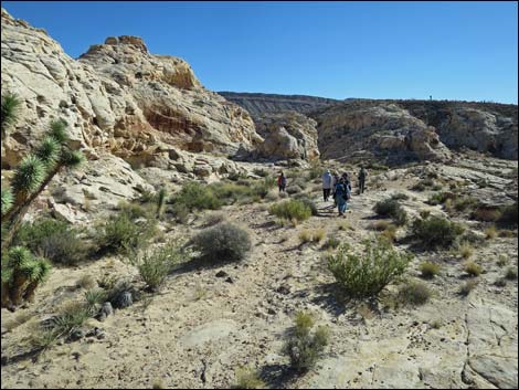
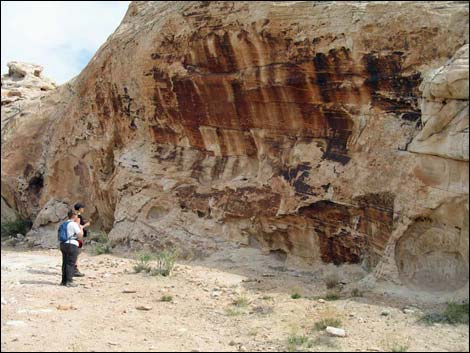
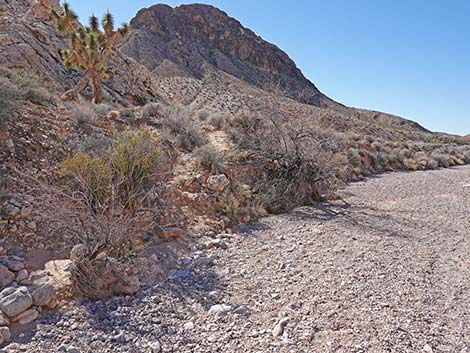
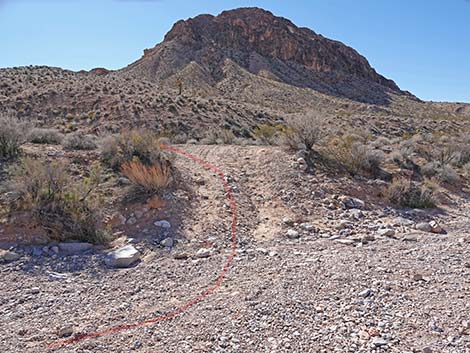
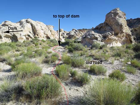
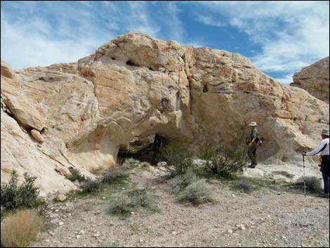
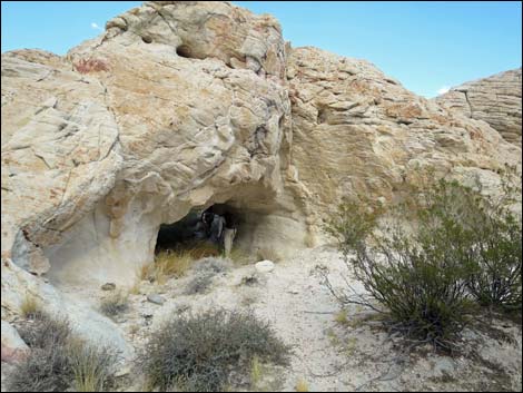
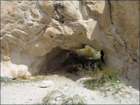
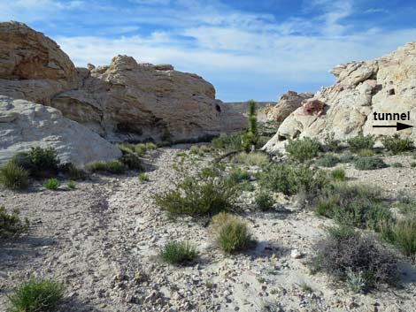
The Hike From the trailhead (Table 1, Waypoint 01), a well-defined trail runs south through a narrow gap in the fence. The trail passes the first large pile of red-and-white sandstone rock and heads towards the second. Just after walking across a patch of slickrock, hikers enter the Falling Man Petroglyph area. Look west to see the Rabbit Ears petroglyph panels atop a rocky crag. The trail, an old road, passes an open area, then passes a low, rounded crag. Just past the crag (0.16 miles out), a spur trail runs right about 70 yards to Calvin's Rock. Consider walking over to see the rock stories (petroglyphs). Back on the main trail, the old-road trail continues towards rocky crags. Approaching the crags, about 0.25 miles out, the old road ends. A use-trail departs the old road heading southwest and heads up towards a tunnel (Tunnel Petroglyph Site) through the cliff. This use-trail leads to the Falling Man petroglyph. |
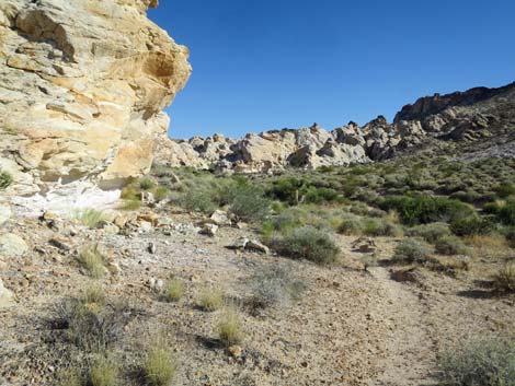
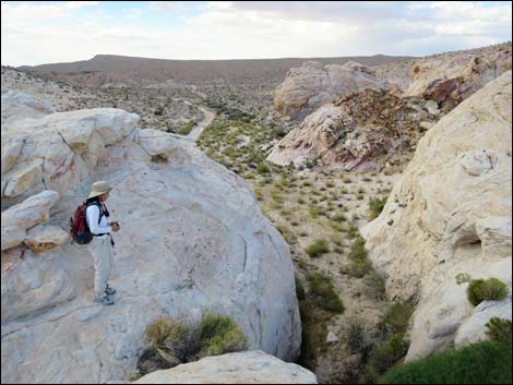
 Hiker detouring to First Boulder, route stays left (view SW) |
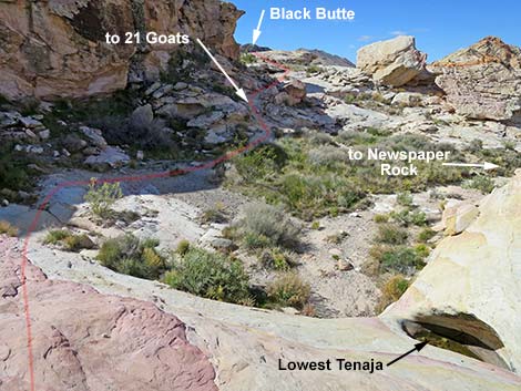
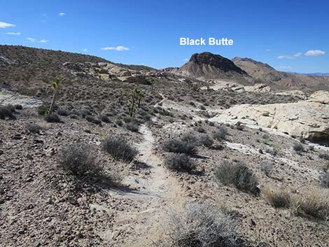
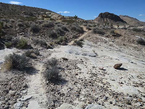
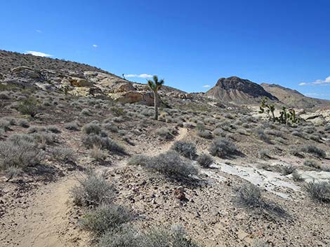
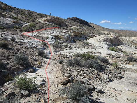
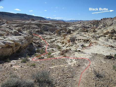
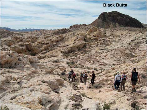
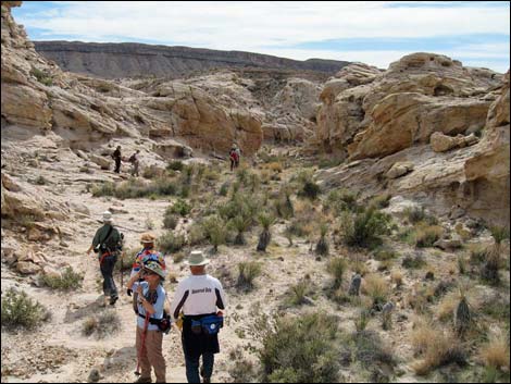
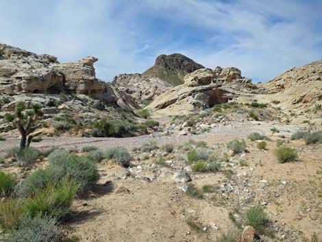
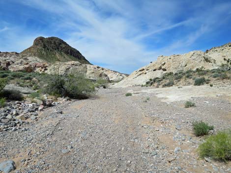
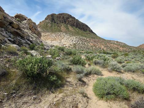
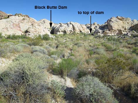
Staying straight (slightly left) at the end of the old road (see Falling Man Bypass), hikers arrive at the base of low cliffs (Wpt. 02). Hikers can hop up the low cliff, or pass it a few yards to the east. Past the cliffs, the route crosses slickrock, and staying a bit to the right, drops into an open, sandy area. Following the water course downhill, the route runs onto an area of slickrock with tinajas. After dropping onto the dirt beyond the last tinaja, the water course bends right (heading northwest) towards more petroglyph sites (e.g., Newspaper Rock). The route to Black Butte Dam, however, continues straight (southwest) on a use-trail that climbs over a low ridge (Wpt. 03). From atop this low ridge, Black Butte can be seen in the distance; this is a good landmark. The use-trail runs southwest, more-or-less on the contour, across gentle desert slopes and sandstone slickrock. It is easy to lose the trail on the slickrock, but hikers should just continue contouring across the rocks and soon the trail will be seen continuing southwest across the hillside. |
 Approaching the Tunnel area, route stays left (view SW) |
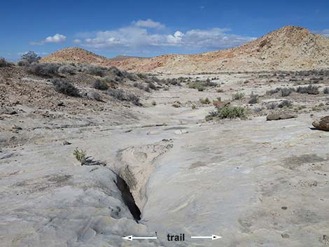
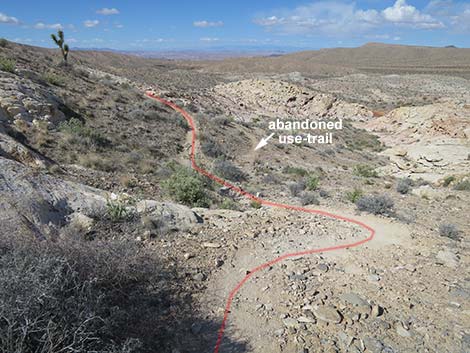
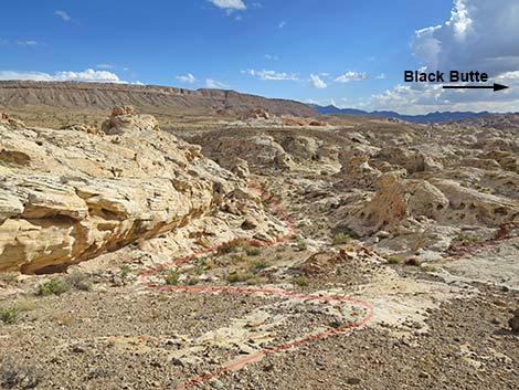
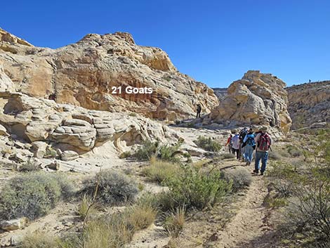
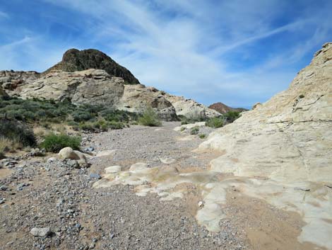
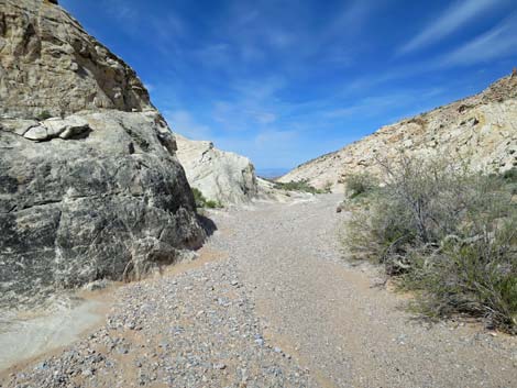
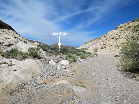
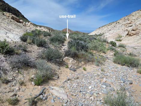
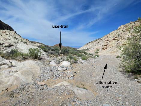
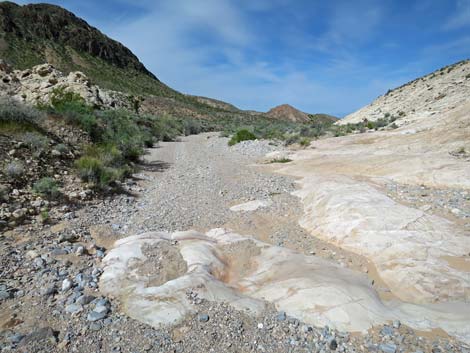
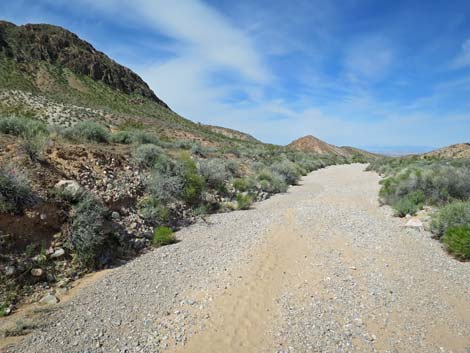
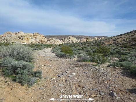
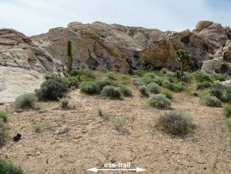
The use-trail runs out onto the crest of a ridge (Wpt. 04). The route bends left and descends the rocky gully to the south towards the broad, sandy wash below. Staying a bit to the left near the bottom of the slope, the route passes the 21 Goats petroglyph panel (Wpt. 05). The panel is on a large, west-facing wall just before hikers would reach the wash in the bottom of the canyon. Spend a few minutes communing with the 21 Goats, don't count them because it will only annoy you; plus yes, they are sheep -- not goats. From the 21 Goats panel (Wpt. 05), the route continues a few yards to the broad wash and heads downstream. The wash runs between rocky walls for a few minutes, then the walls lay back and the landscape begins to open up. After hiking down the wash for about 300 yards, the route leaves the wash and pickup up a use-trail (Wpt. 06) that runs on sandy soils above the wash bottom. Leaving the wash, the use-trail is easy to miss, but once on it, the path is obvious. |
 Approaching low cliffs (view S) |
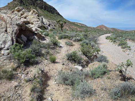
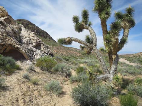
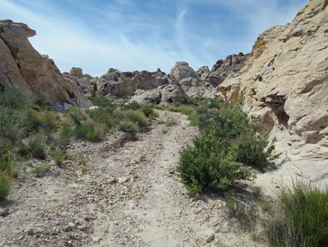
Hikers who miss the use-trail can continue down the wash for another 200 yards to where an old road (Wpt. 08) crosses the wash. They can turn left onto the old road and hike southeast to meet the use-trail near the dam. Following the use-trail (Wpt. 06), hikers head west along the base of the sandstone crags while looking down into the wash. The route passes an old cowboy camp on the left (two old bed frames), but the soil is so heavily covered with Biological Soil Crust that we encourage hikers to look from the trail, but don't bust the crust. Continuing west, the trail passes under the sagging arm of a Joshua Tree, then bends left around the corner of a sandstone crag and heads south into a side canyon bordered by sandstone crags. |
 Route uses boulders to ascend low cliff (view SE) |
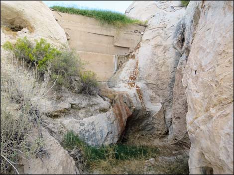
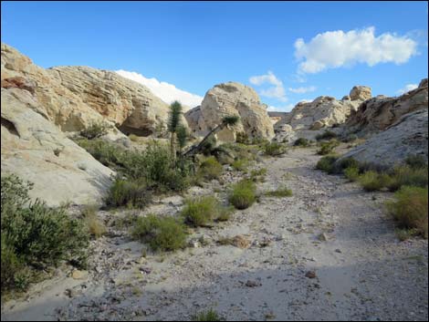
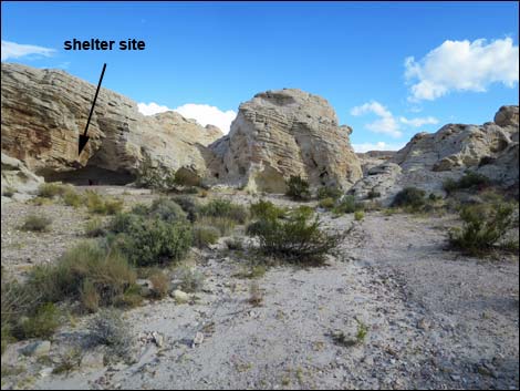
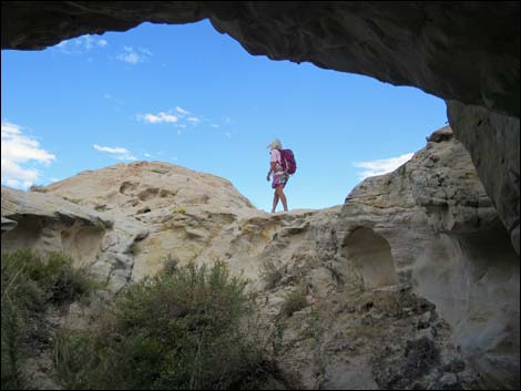
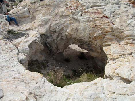
Heading south, the old road can be seen across the gully to the right. When the use-trail is about to merge with the old road, the downstream side dam can be seen on the left spanning a narrow cleft between rock piles. After visiting the base of the dam, the route continues south on the old road a few more yards to where the old road ends in a broad turn-around loop. Approaching the turn-around loop, on the left, an unusual tunnel through a sandstone crag and a short scramble leads to the top of the dam (Wpt. 07) where flat sandstone provides a nice place to sit and enjoy the scenery and look for birds and dragonflies attracted to the water. Hikers can find an above-ground route to the top of the dam a few yards past the tunnel where a cleft in the rocks on the left acts as a spillway for the dam. |
 The "hop up" is easier than it looks (view SE) |
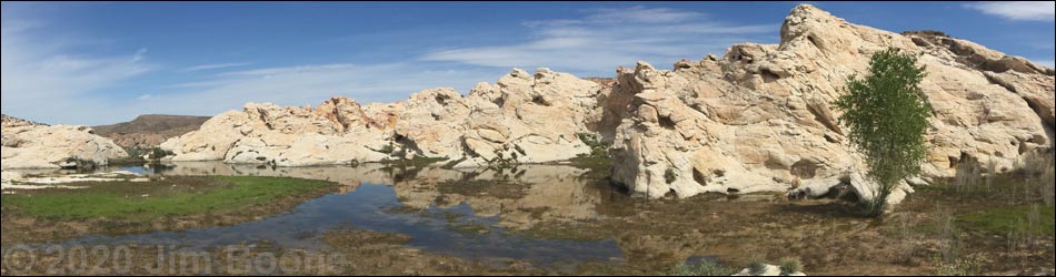
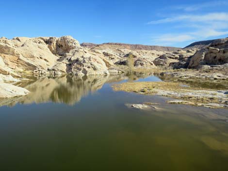
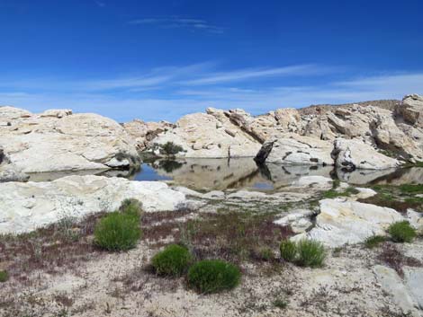
If the reservoir is full of water, hikers can get to the shore by staying right at the top of the turn-around loop and walking around the right side of the sandstone crag. In only a moment, hikers will see the water on the left. Black Butte Dam is unusual historical structure from the ranching era because it was built by a cattle-women, probably in the 1950s. The reservoir is filling in with sediment, but it still holds a fair bit of water during wet years, and a cottonwood tree is getting started at the far end of the pond. Enjoy a rest and perhaps lunch, and be sure to look for fairy shrimp in the water. From Black Butte Dam, hikers can continue the loop or return to the trailhead by following their footprints back through the washes and across the sandstone slickrock to the trailhead. |
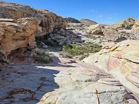
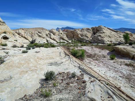
 Route crosses sandy and slickrock area (view SW) |
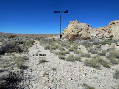
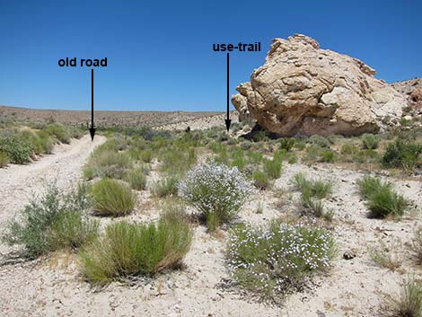
Continuing the loop, hikers depart the dam following the old road northwest back to the broad, sandy wash (Wpt. 08). At the wash, hikers might notice the Black Butte Dam Trailhead parking area, some 80 yards down the wash. Staying on the old road across the wash, the route continues into the desert heading northwest. This old road was closed because it crosses gypsum-mud hills that are the preferred habitat for the Las Vegas Bearpoppy, a protect species, and people on OHVs just couldn't stay on the road. As a result, all vehicles are kept out. While walking on the road, keep an eye out of Bearpoppies, especially when they in bloom during spring. The old road crosses a low ridge of gray gypsum soils, then bends right to head northeast. The old road crosses over the hills, crosses a wash, and continues northeast. By this time, the post-and-cable fencing along Black Butte Road is plainly visible. |
 Watch for this very old petroglyph Watch for this very old petroglyph |
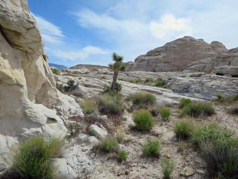
The route eventually runs out to the northeast end of the fence (Wpt. 09) and joins Black Butte Road at a small parking area with a bearpoppy information sign. Following Black Butte Road, the route runs north, northeast, and finally east as it passes more gypsum hill, sandstone crags, and returns to the Falling Man Trailhead parking area (Wpt. 01). Walking back, explore the grand scenery and interesting vegetation. This part of Gold Butte is in the Upper Sonoran (Mojave Desert Scrub) vegetation zone where creosote bush and white bursage dominate the landscape, but many other species of shrubs also are common. Around the rock piles, look for Joshua trees, and keep an eye out for our common Mojave yucca. In sandy places, look for the uncommon Utah yucca and the unusual birdcage evening primrose with its arms all rolled up like a wire birdcage. |
 Trail crosses the sandy area (view SW) |
 Trail enters the tinaja area (view W) |
 Route descends slickrock area with tinajas (view W) |
 Route descends slickrock area with tinajas (view W) |
 Lower tinaja area (view W) |
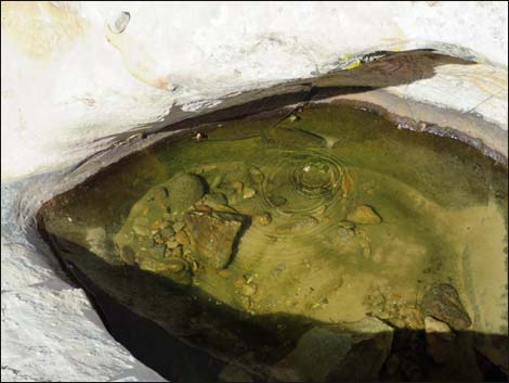 Lowest Tinaja: look! -- Red-spotted toadlets! |
 Trail crosses a shady swale (view W) |
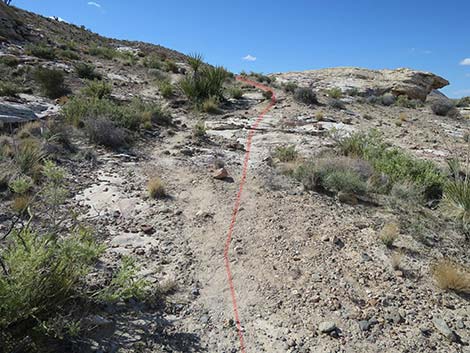
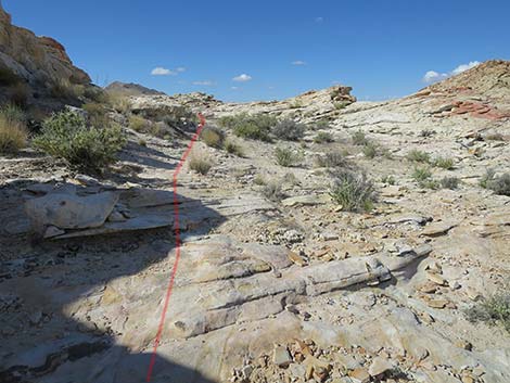
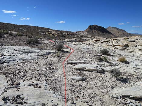
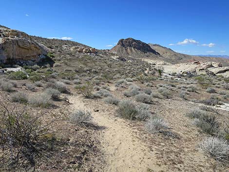
 Trail crosses slickrock sandstone more-or-less on the contour (view W) |
 Trail to 21 Goats (view W) |
 Trail crosses slickrock sandstone more-or-less on the contour (view W) |
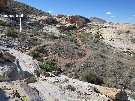
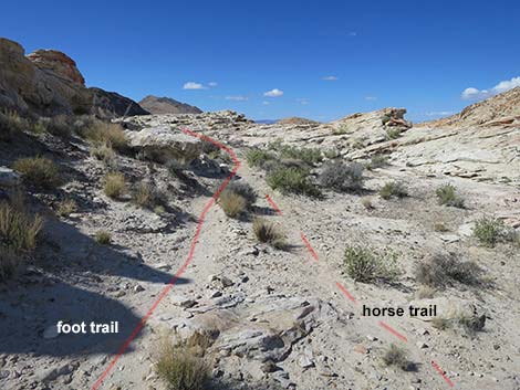
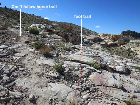 Hikers stay left; horse trail detours left (view SW) |
 Trail crosses slickrock sandstone more-or-less on the contour (view W) |
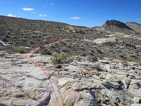
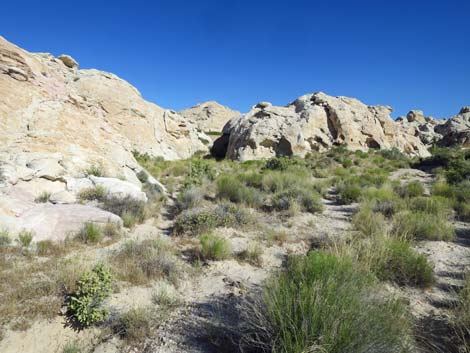
 Route crosses slickrock and follows a use-trail (view SW) |
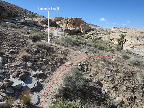 Horse trail merges with hiker trail (view SW) |
 Horse trail merges with hiker trail (view SW) |
 Trail continues to next sandstone slickrock (view SW) |
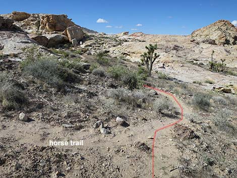
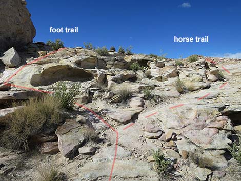 Hikers can stay left, but horses need to fork right (view SW) |
 Hiker trail continues across the sandstone (view SW) |
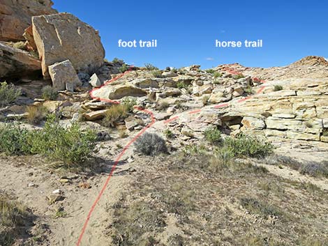
 Horse bypass merges with hiker trail (view SW) |
 Trail crosses slickrock sandstone more-or-less on the contour (view W) |
 Trail crosses slickrock sandstone more-or-less on the contour (view W) |
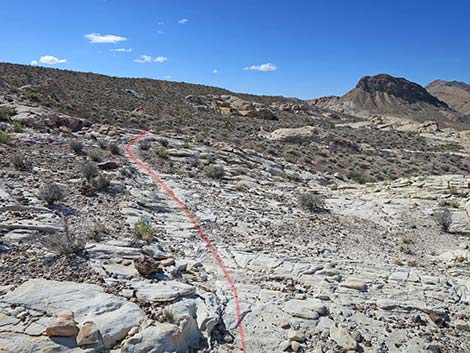 Trail crosses slickrock sandstone more-or-less on the contour (view W) |
 Trail crosses slickrock sandstone more-or-less on the contour (view W) |
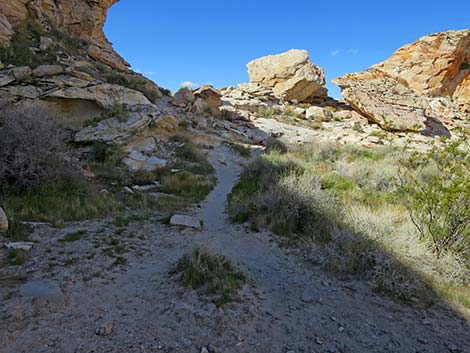
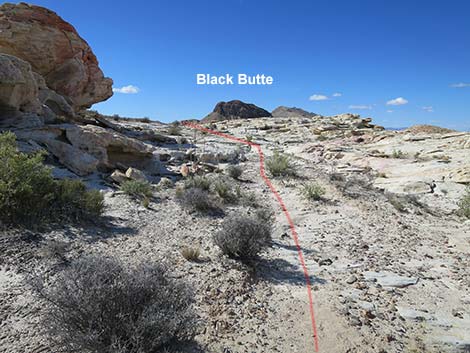
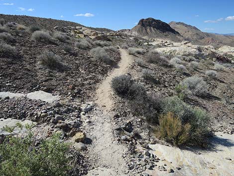 Mostly all-dirt trail the rest of the way (view SW) |
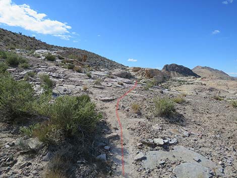
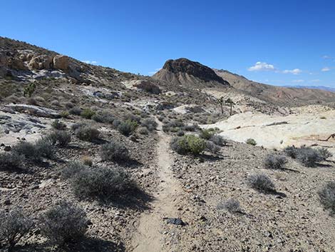
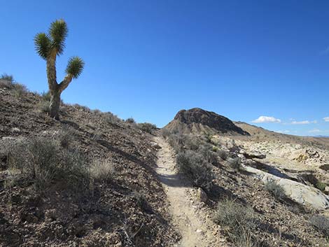
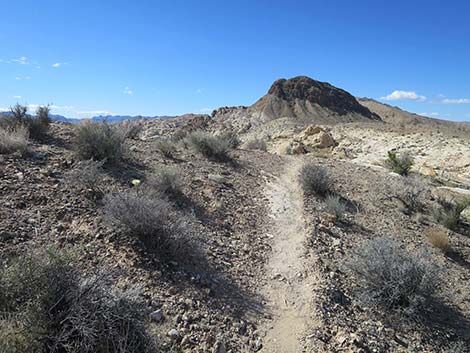
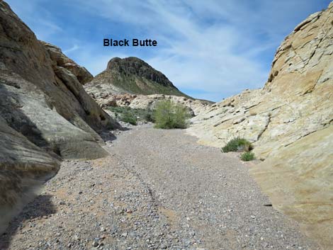
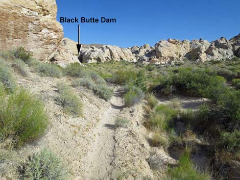
 The trail always heads towards Black Butte (view SW) |
 Approaching a small tinaja (view SW) |
 Small tinaja, but dry today (view SW) |
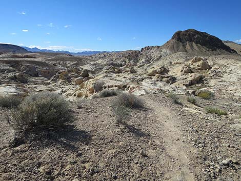
 Dirt trail continues towards the Black Butte (view SW) |
 |
 |
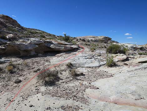
 Trail traverses another short bit of slickrock (view SW) |
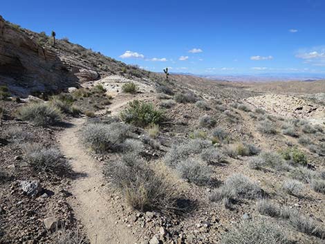 Dirt trail continues across the hillside (view SW) |
 Dirt trail continues across the hillside (view SW) |
 Dirt trail climbs towards the ridgeline (view SW) |
 Dirt trail arriving on the ridgeline (view SW) |
 Dirt trail atop ridgeline (view SW) |
 Atop ridgeline, trail turns steeply down rocky canyon (view SW) |
 Atop ridgeline, route turns left and descends into gully (view SSW) |
 Hikers descending rocky gully (view SW) |
 Hikers descending rocky gully (view S) |
 Hikers descending rocky gully (view S) |
 Hikers low in the rocky gully (view S) |
 Hikers approaching 21 Goats panel (view SE) |
 21 Goats panel (view SE) |
 Hikers at 21 Goats panel (view NE) |
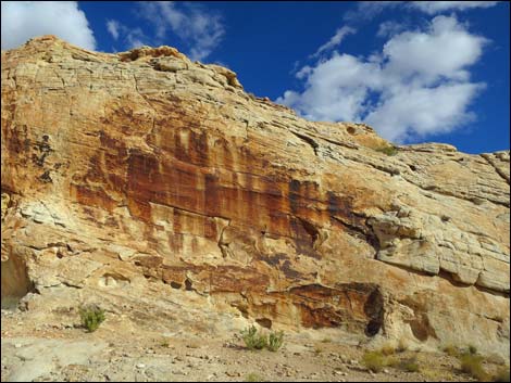
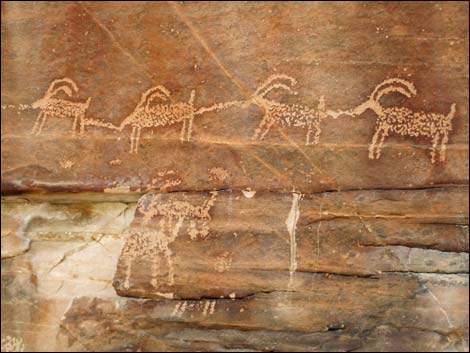 A few of the "goats" (these actually depict bighorn sheep) |
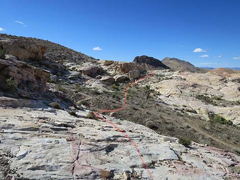
Continuing Past 21 Goats towards Black Butte Dam
 Departing 21 Goats (view SW from shade of the 21 Goats cliff) |
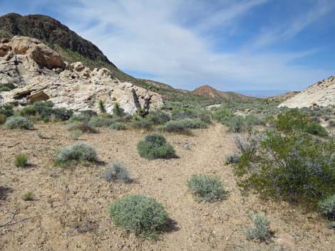
 Route enters the wash (view SW) |
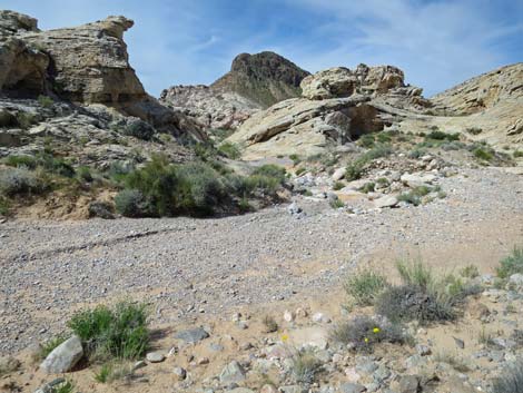 Route follows the wash downstream (view SW) |
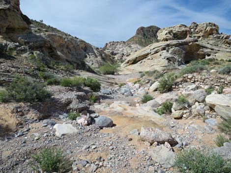 Notice nice erosion patterns in the wash (view SW) |
 Nice erosion patterns in the wash (view SW) |
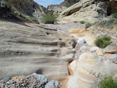
 The wash runs into a nice, little canyon (view SW) |
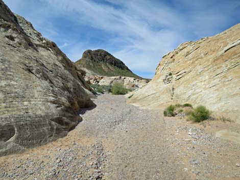 The wash enters "the narrows" (view W) |
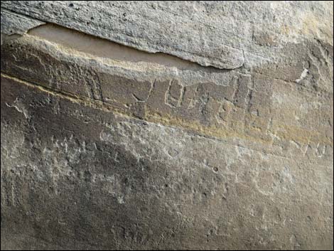 Petroglyphs and historic graffiti in the the narrows |
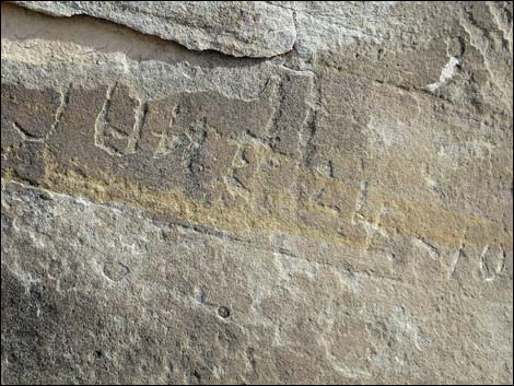 Historical graffiti: June 24, 1910 |
 Historical graffiti: horse |
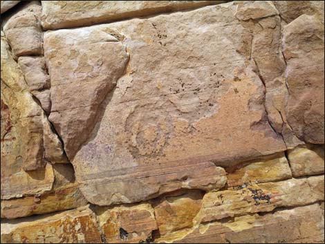
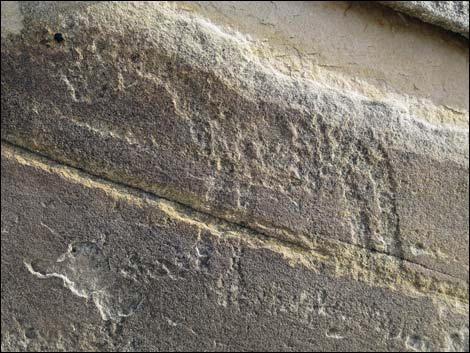
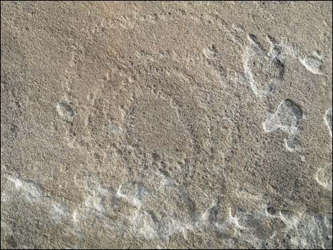 Petroglyph: spiral Petroglyph: spiral |
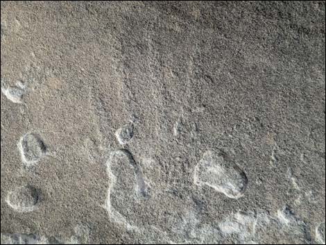
 Petroglyph: foot |
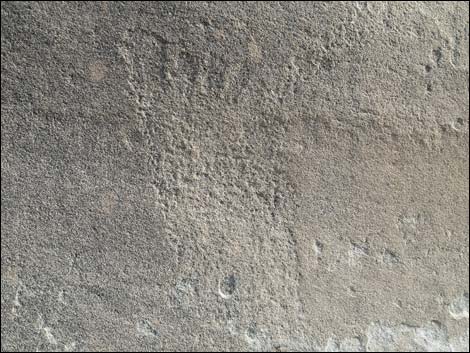
 Petroglyph: hand |
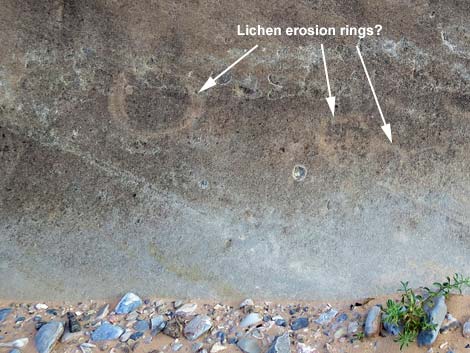 Rings may have been caused by lichens eroding the rock surface |
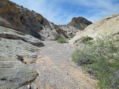
 The wash exits "the narrows" (view W) |
 The broad, gravel wash makes for easy hiking (view W) |
 Mostly under gravel, there are some nice erosion patterns here |
 The route continues down the gravel wash (view W) |
 Approaching use-trail to Black Butte Dam (view W) |
 Use-trail to Black Butte Dam (view W) |
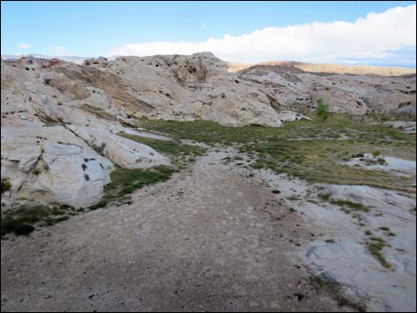
Missed the Turnoff? No problem: just follow the wash to an old road
 For hikers who miss the use-trail (view W) |
 The alternative route continues down the gravel wash (view W) |
 Hikers continuing down the broad, gravel wash (view W) |
 Hikers have recently beat in a connector trail (view W) |
 The alternative route continues down the gravel wash (view W) |
 Gravel wash approaching an old road (view W) |
 Trail junction (view W; note 21 Goats Trailhead just ahead) |
 Route exits wash onto old road (view W) |
 Route runs up old road and curves left (view SW) |
 Old road (view S from gravel wash) |
 Old road leads towards Black Butte Dam (view S) |
 Old road leads towards Black Butte Dam (view S) |
 Old road leads towards dam (view S) |
 Old road leads towards dam (view S) |
Back on the Main Route: Use-Trail to the Dam
Not-so-obvious use-trail departs the wash (view W) |
 Use-trail becomes obvious on sandy soils (view W) |
 Historical cowboy camp (view S) Don't trample Biological Soil Crust! |
 Use-trail continues above the wash (view W) |
 Use-trail passes under sagging Joshua Tree (view W) |
 Use-trail passes along last of the sandstone crags (view W) |
 Use-trail bends left into Black Butte Dam Canyon (view SW) |
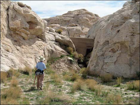
 Black Butte Dam comes into view (view S) |
 |
 |
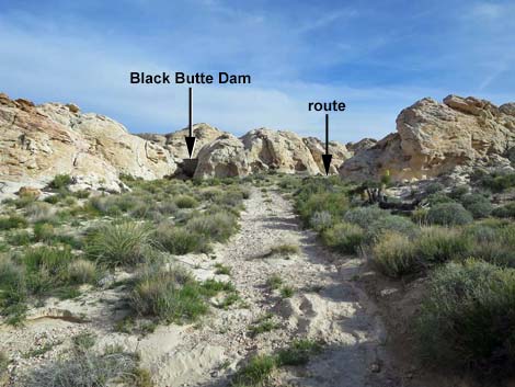
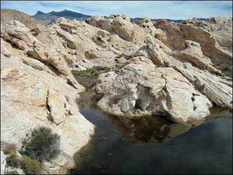
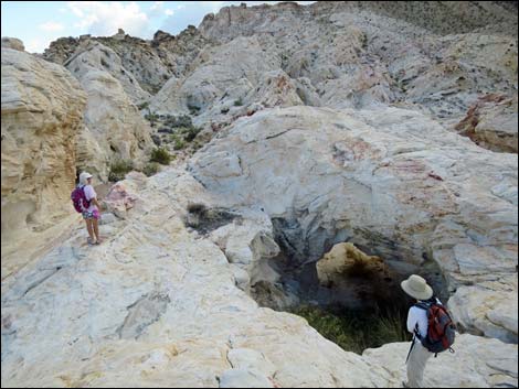
Approaching Black Butte Dam from below
 Approaching Black Butte Dam (view S) |
 Hiker below Black Butte Dam (view S) |
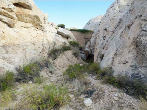 Black Butte Dam (view S) |
 Black Butte Dam strategically spans narrow passage (view S) |
Continuing to Black Butte Dam and Reservoir (Black Butte Dam from above)
 Continuing past dam to the reservoir (view S) |
 Old road runs up between sandstone crags (view S) |
 Old road continues between sandstone crags (view S) |
 Approaching end of the old road (view S) |
 End of the old road (view S) |
 More to come ... |
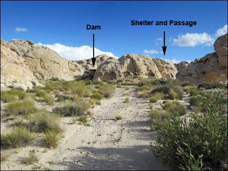
Top of Black Butte Dam (via Tunnel or Slot)
 End of the old road (view S) |
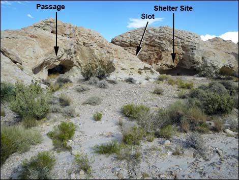
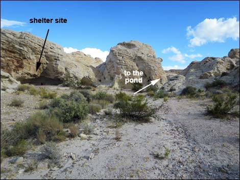
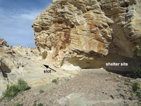 Approaching Black Butte Dam via Shelter Site and Slot (view E) |
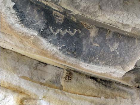 Rock art and mud wasp nest inside shelter site |
 Approaching Black Butte Dam via the Slot (view E) |
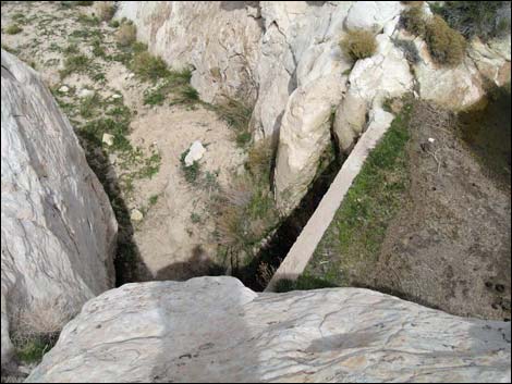
 Hikers at tunnel passageway to the dam (view SE) |
 Hikers inside the tunnel passageway (view SE) |
 Tunnel passageway to the dam (view SE) |
 Hiker beyond the passage (view SE from inside the tunnel) |
 Black Butte Dam from above (view NE) |
 Atop the dam (view N towards access route) |
 Water impounded behind the dam during winter (view SE) |
 Water impounded behind the dam during winter (view SE) |
 Water impounded behind the dam (view SE) |
 Water impounded behind the dam (view SE) |
 Water impounded (dry) during summer (view SE) |
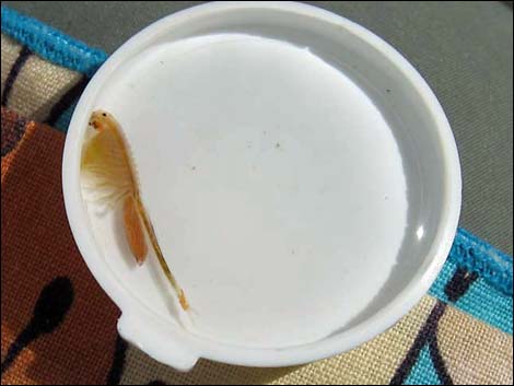 Look carefully in the water for fairy shrimp |
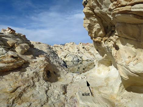
 Exit left through cleft or down through the passage (view SW) |
 Tunnel passageway to exit (view SW from stop crag) |
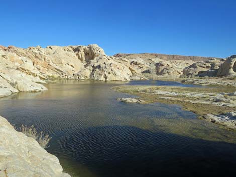
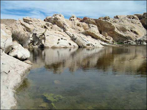
Black Butte Dam, The Reservoir
 End of the old road; route runs right around crag (view S) |
 Continuing around the Shelter Site crag (view S) |
 Bending left behind the Shelter Site crag; water is visible (view E) |
 Approaching Black Butte Reservoir (view E) |
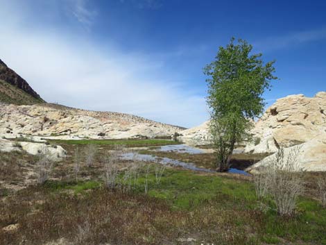
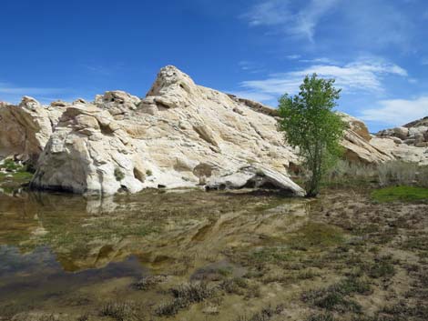 Cottonwood tree at upper end of Black Butte Reservoir (view E) |
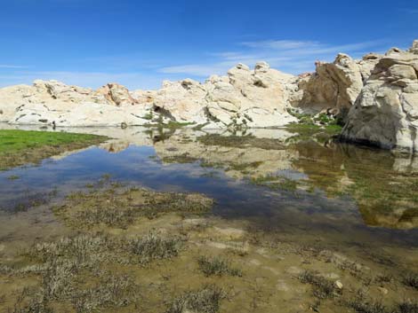 Black Butte Reservoir (view N from upper end) |
 Black Butte Reservoir (view N from upper end) |
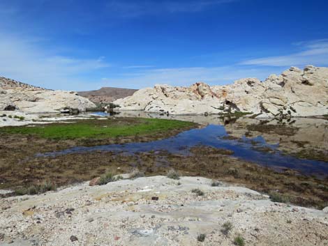 Black Butte Reservoir (view N) |
Continuing the Loop from Black Butte Dam
 Atop Black Butte Dam (view NW toward exit route) |
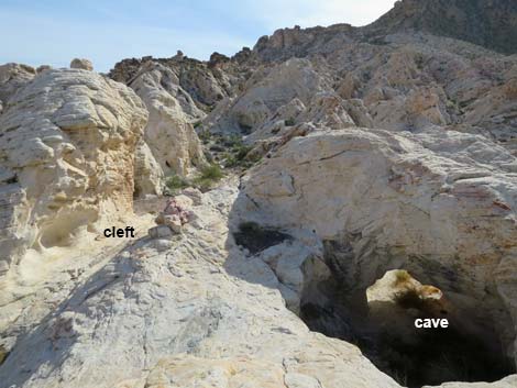 Departing the dam via cleft (left) or cave (right) (view SW) |
 Departing Black Butte Dam via the cleft (view N) |
 Departing Black Butte Dam (view N) |
 Departing the dam, hikers can loop back via roads (view N) |
 Departing the dam, hikers can return via the use-trail (view N) |
Table 1. Hiking Coordinates Based on GPS Data (NAD27, UTM Zone 11S). Download Hiking GPS Waypoints (*.gpx) file.
| Wpt. | Location | UTM Easting | UTM Northing | Elevation (ft) | Point-to-Point Distance (mi) | Cumulative Distance (mi) |
|---|---|---|---|---|---|---|
| 01 | Falling Man Trailhead | 752138 | 4044187 | 2,393 | 0.00 | 0.00 |
| 02 | End of Old Road | 752065 | 4043799 | 2,432 | 0.27 | 0.27 |
| 03 | Low Saddle | 751971 | 4043623 | 2,426 | 0.18 | 0.45 |
| 04 | Low Ridge | 751643 | 4043234 | 2,370 | 0.36 | 0.81 |
| 05 | 21 Goats Petro Site | 751672 | 4043074 | 2,315 | 0.14 | 0.95 |
| 06 | Depart Wash | 751445 | 4042961 | 2,287 | 0.18 | 1.13 |
| 07 | Black Butte Dam | 751379 | 4042816 | 2,303 | 0.19 | 1.32 |
| 01 | Falling Man Trailhead | 752138 | 4044187 | 2,393 | 1.32 | 2.64 |
| . | . | . | . | . | . | . |
| 08 | Bearpoppy Road at Wash | 751262 | 4042956 | 2,266 | 0.19 | 1.45 |
| 09 | Bearpoppy Road at Black Butte Road | 751135 | 4043581 | 2,274 | 0.48 | 1.93 |
| 01 | Falling Man Trailhead | 752138 | 4044187 | 2,393 | 0.81 | 2.74 |
Happy Hiking! All distances, elevations, and other facts are approximate.
![]() ; Last updated 240325
; Last updated 240325
| Gold Butte | Rock Art | Hiking Around Las Vegas | Glossary | Copyright, Conditions, Disclaimer | Home |