Hiking Around Las Vegas, Gold Butte National Monument
 Black Butte Road approaching trailhead parking (view SW) |
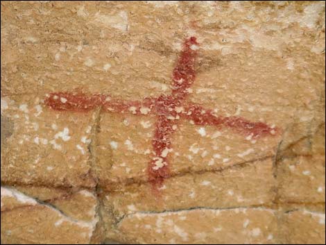
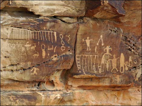
Overview The Falling Man Rock Art Site is a fascinating area where people once lived and wrote Rock Stories (petroglyphs and pictographs) on the crags and walls. Hiking to and away from the Falling Man panel, people might notice habitation sites and petroglyphs on crags and boulders along the trail, providing evidence of the lives they lived. It is interesting to consider the lives of the people who once lived here. They raised their children, obtained food and water, and created shelters. These people were every bit as modern as we "modern humans," but they didn't have book learning. They were thoughtful problem solvers, however, and wrote on the rocks instead. When considering how people lived here so long ago, realize that the environment was considerably cooler and wetter than today. When people first got here some 10-12,000 years ago, Gold Butte was covered with a pinyon-juniper forest, streams ran all year, and giant sloths and wood bison roamed the hills. Link to area map or hiking map. |
 Trailhead parking (view S) |
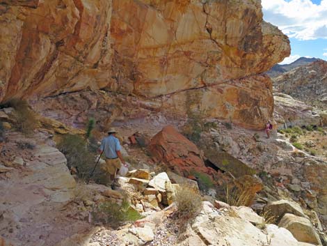
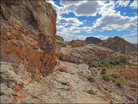
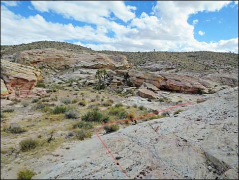
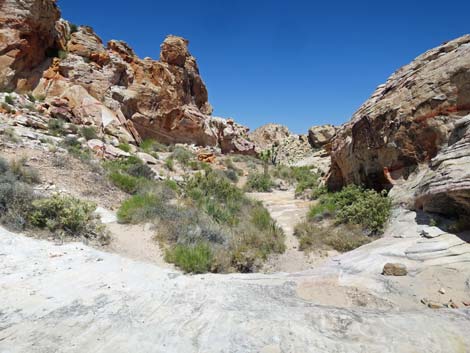
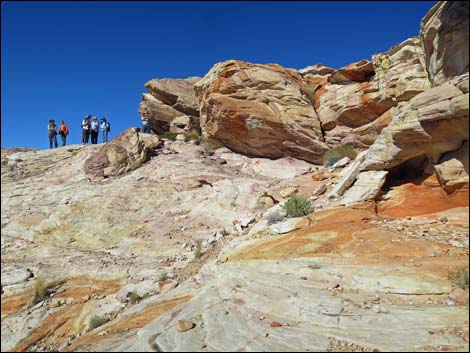
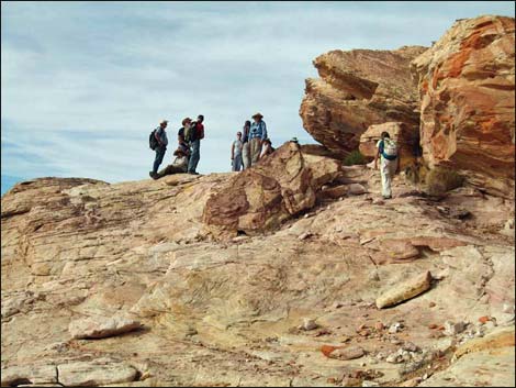
From the trailhead, people now walk a few minutes where drivers once unknowingly drove over and damaged archeological features such as agave roasting pits and a prehistoric campsite. The hike to the Falling Man panel is only about 0.3 miles, but the last bit of the route requires an easy scramble among the rocky sandstone crags. Continuing, hikers scramble among the well adorned crags, past tinajas (rock water basins) that hold water well into the dry season, pass Newspaper Rock, and climb to a highpoint that overlooks areas to the north and west. The return makes a partial loop past other petroglyph and pictograph panels. There are 10 spots to see here. Be sure to click the links to see more photos of each. Off the beaten path, the farther you go and the more you look, the more petroglyphs you find. |
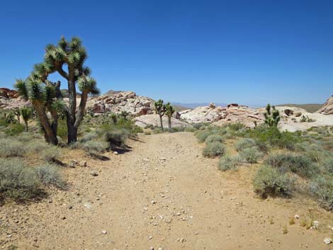
 Departing the trailhead (view S) |
Watch Out Other than the standard warnings about hiking in the desert, ... this is a fairly safe area (despite the iconic petroglyph), but be careful scrambling around in the rocks. There are places where a fall, while unlikely, would be tragic. This is a wild and remote area without services of any kind (no restrooms, no water, no gas, no food). Bring what you need to survive. Be prepared and be self-reliant. Someone will find you eventually if you stay on a main road, but be prepared to survive alone for a day or two. Cell phones only work along parts of the paved road. While hiking, please respect the land and the other people out there, and try to Leave No Trace of your passage. Also, even though this hike is short, the area is remote, so be sure to bring what you need of the 10 Essentials. There is no cell coverage. |
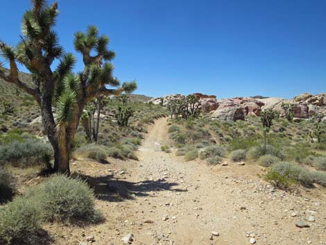
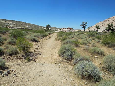 The trail starts out gentle (view S) |
While here, remember that petroglyphs and pictographs are a national treasure that is easily damaged. Don't touch the petroglyphs because oils on our hands degrade the petroglyphs. Please take care of the area and leave it as you found it for generations to come. If there is water in the tinaja, please leave it for the critters. Splashing in the tinaja inadvertently puts hand-oils and perhaps sunscreen in the water -- what little water the Red-spotted Toads and other creatures have. |
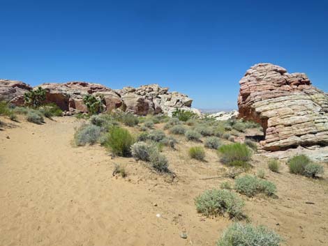
 Trail crosses bedrock (view S) |
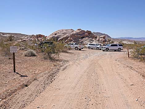
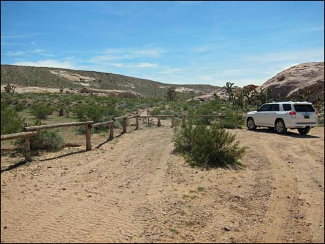
Getting to the Trailhead The Falling Man Rock Art Site is located out in Gold Butte National Monument at the northeast end of Lake Mead, about 2 hours northeast of Las Vegas in a wild and remote, but scenic area. From town, drive out to Gold Butte National Monument. From Whitney Pocket, turn around and drive back north for 1.4 miles to Black Butte Road, a dirt road to the west, which is just past a large sandstone crag with campsites around the base. Turn left and drive west on Black Butte Road. A number of side roads branch off Black Butte Road, but most are obviously not the main road. However, at 1.2 miles from the pavement, the road forks equally; stay left. At 1.9 miles from the pavement, drivers arrive at the parking area, delineated by a wooden corral. Park here; this is the trailhead. |
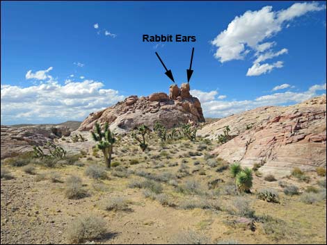 Rabbit Ears (view W) |
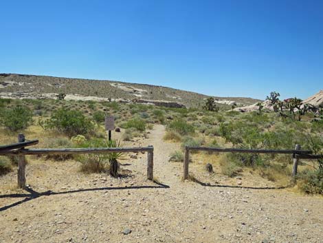
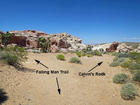
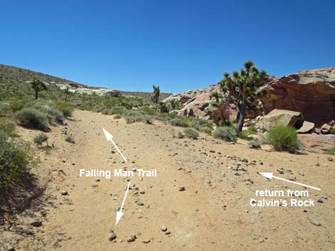
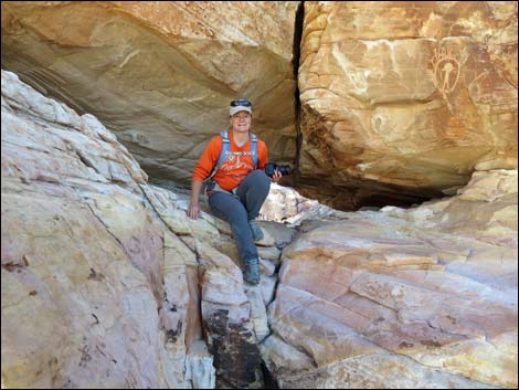
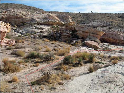
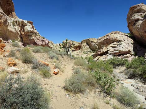
The Hike From the trailhead (Table 1, Waypoint 01), a well-defined trail runs southwest through a gap in the fence. The trail passes the first large pile of red and white sandstone rock and heads towards the second. Just after walking across slickrock, look up and right to see the Rabbit Ears (Wpt. 02) panels near the top of a rocky crag. The trail runs through an area of soft blow sand, and it is always fun to look for fresh tracks and see which creatures passed this way. Beetle, kangaroo rat, and lizard tracks are most common. The trail, an old road, passes an open area, then passes a low, rounded crag. Just past the crag, a spur trail runs right about 70 yards to Calvin's Rock (Wpt. 03). Named for Calvin Meyers, an environmental activist and former Chairman of the Moapa Band of Paiutes, who had a special connection to this boulder. Walk over to Calvin's Rock to see the artwork, and be sure to examine the entire east half of the boulder. When departing, notice petroglyphs on adjacent rock walls. |
 Rabbit Ears (view W; zoom) |
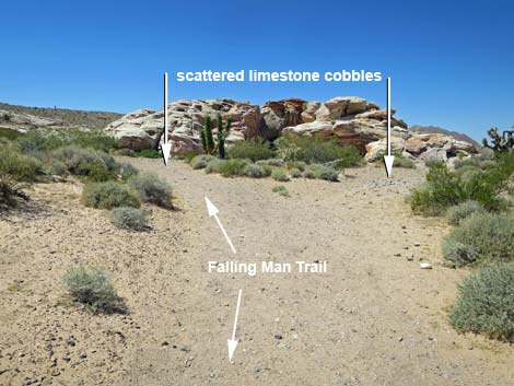
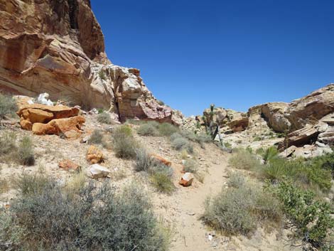
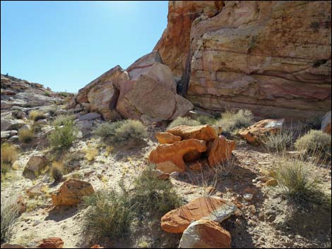
Back on the old road, the trail continues south towards more rocky crags. Near the end of the old road, the road forks in what becomes apparent as the old turn-around loop and parking area. Notice the surprising number of limestone cobbles in this sandstone area and dark-colored dirt here. Keen observers will recognize this as an old Agave Roasting Pit (Wpt. 04). Looking carefully on the ground, visitors can find colorful stone flakes chipped when native people were making stone tools such as arrowhead and scrapers. Feel free to pick up and examine the stone flakes (and the occasional pot shard), but be sure to leave them for history and for the next person to experience the excitement of finding them. Standing on this site, a very large native American campsite, it is apparent that for years visitors drove onto the site and damaged it almost beyond recognition, and understanding this fact makes it clear as to why land managers blocked off the old road back at the trailhead -- we need to do what we can to preserve what remains of this archeological site. |
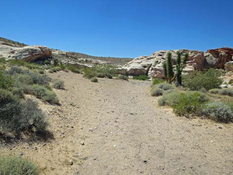
 Trail (old road) continues towards sandstone crags (view SW) |
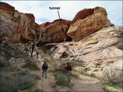
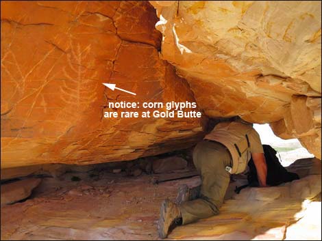
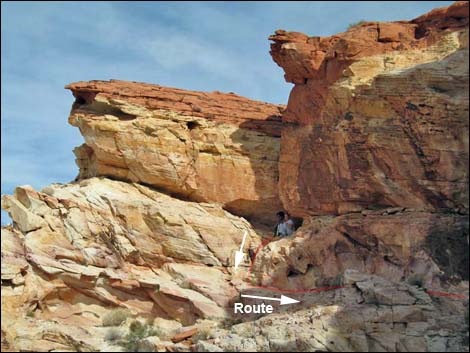
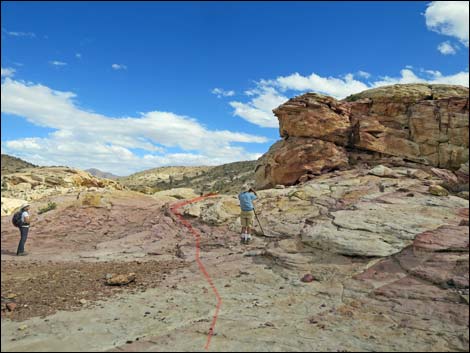
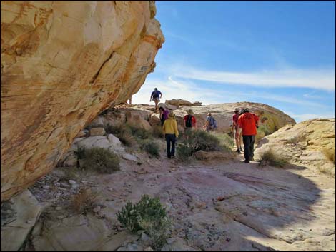
Continuing south and more closely approaching the sandstone crags, a use-trail departs the old road to the right and heads up towards a tunnel through the cliff. For hikers wanting to skip the Falling Man panel and head more quickly into the wildlands beyond, consider a bypass that stays left and hops up over the low band of cliffs just ahead. When approaching, the tunnel can be seen from below. Hiking towards the tunnel, notice the smooth rock face on the left pock-marked with bullet holes. Notice too the small bighorn petroglyph on the rock face. It is hard to understand why someone needed to shoot the rock, but it is nice that they missed the bighorn. The sandy trail runs up and ends at the edge of the sandstone crag, and from there the route scampers up the cliffs into the Tunnel (Wpt. 05). While it is fun to scramble through the tunnel, be sure to notice the rock stories around the entrance, inside, and at the exit from the Tunnel. At the entrance, the "corn plant" glyph is one of the few such corn glyphs in Gold Butte National Monument and might represent the introduction of this crop plant into the area. |
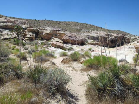
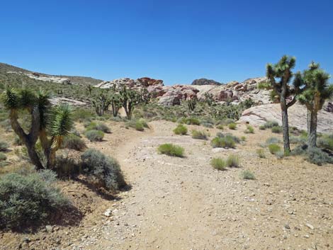 Lots of nice Joshua Trees in this area (view S) |
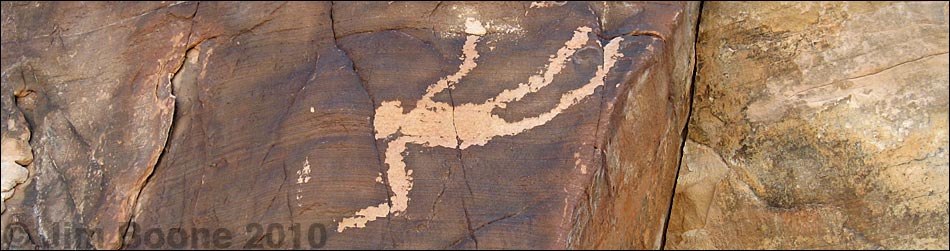
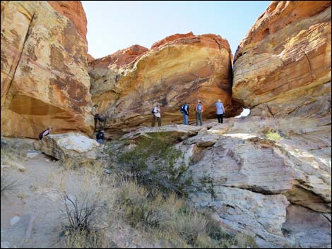
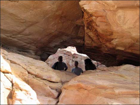
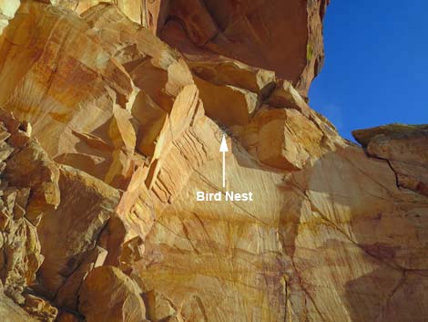
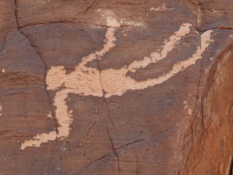
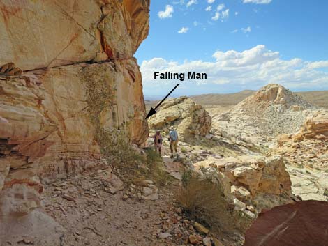
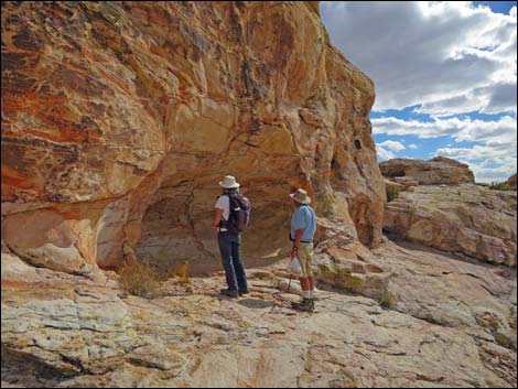
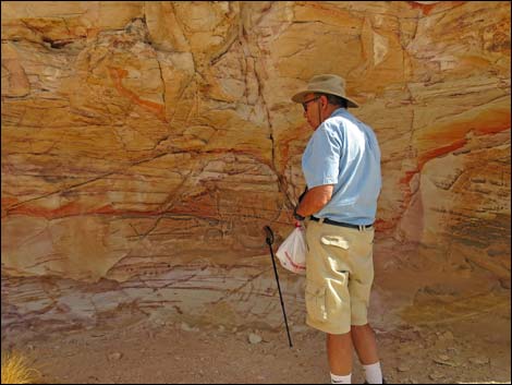
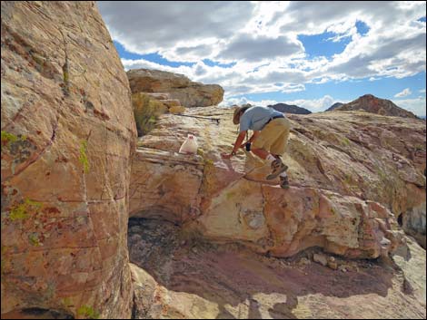
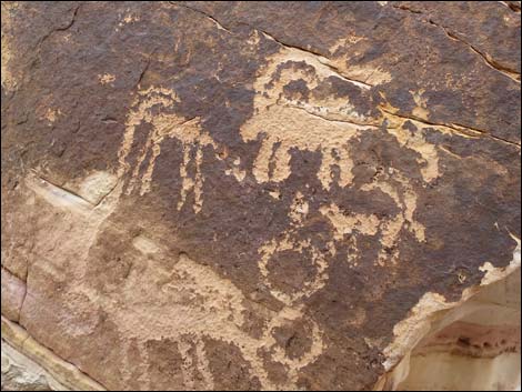
After crawling through the Tunnel, the route clambers down a few feet onto a broad ledge on the other side of the crag. The ledge runs south, then bends west. At the corner, there used to be a large stick-nest on a ledge above the trail. This was an inaccessible Common Raven nest located on the shaded side of the crag and beneath an overhang that protected the nest from wind, rain, and sun -- not a bad place to raise your kids! The Ravens, however, seem to have abandoned this site -- perhaps there are now too many hikers in this area. Passing below the old nest site and heading out towards the west corner, keep an eye out for the Falling Man petroglyph (Wpt. 06), just above head-level on the wall. While there, consider what may have inspired an ancient person to create this particular rock story. Was it a memorial to a friend or family member who suffered a tragic accident, or perhaps just a warning about being careful on the ledges -- don't back up too far when taking photos of the petroglyph! |
 Trail drops through small wash (view S) |
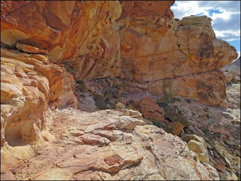
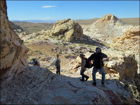
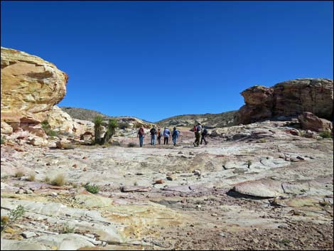
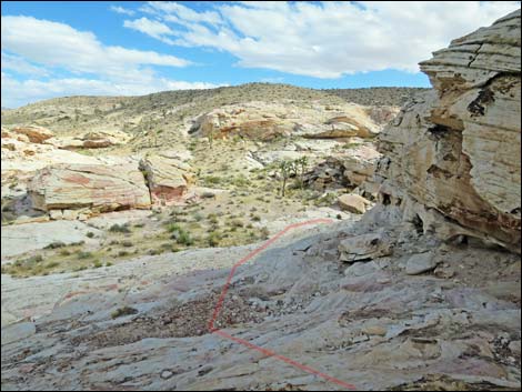
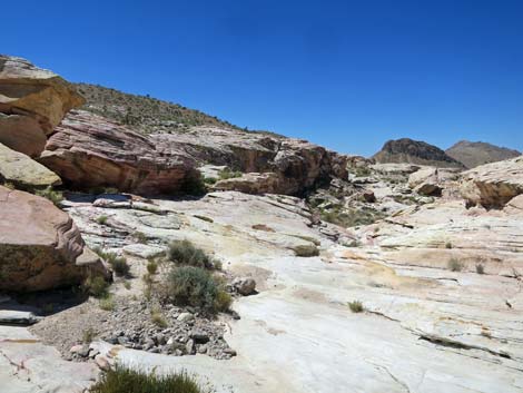
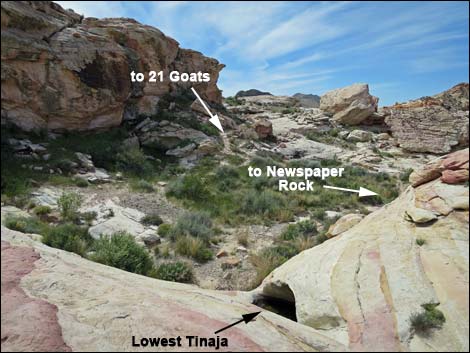
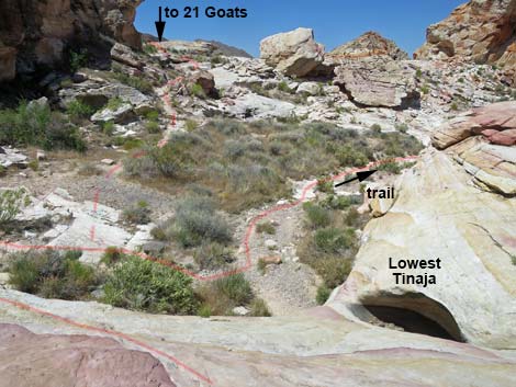
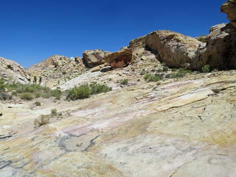
Continuing along the Falling Man ledge, the route turns the corner left to head south. Look for a pictograph in the alcove along this wall, then hop up and exit left into the open Amphitheater site (Wpt. 07). In addition to grand views west, the walls of the Amphitheater are adorned with scattered petroglyphs, and there is a curious dimple carved in the stone at the center of the amphitheater. Walking east through the Amphitheater and out the other side, the route drops into a broad, sandy area with some Utah Yuccas. A sand-loving species, this kind of yucca is unusual in Nevada. The route turns right and runs down the wash. Shortly, the sand ends, and the route continues down across slickrock where water has carved several water pockets, or Tinajas (Wpt. 09). There are a few spots of petroglyphs at the tinajas, so keep an eye out while moving through this area. |
 Soft sand from eroding sandstone crags covers the trail |
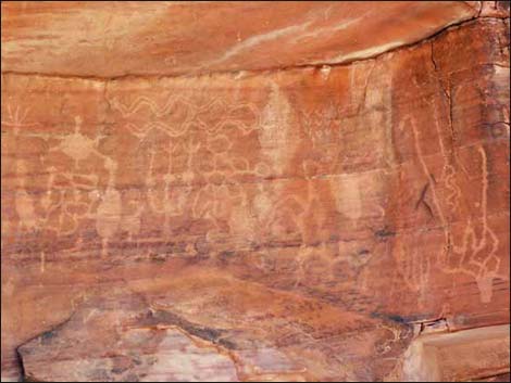
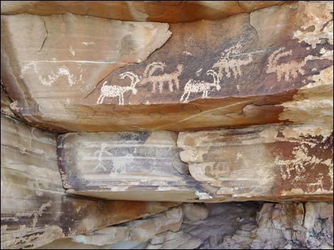
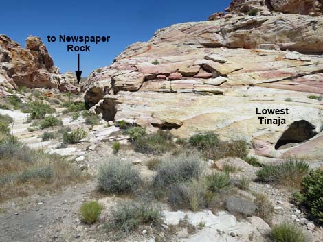
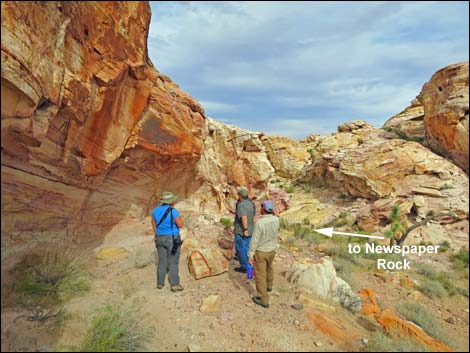
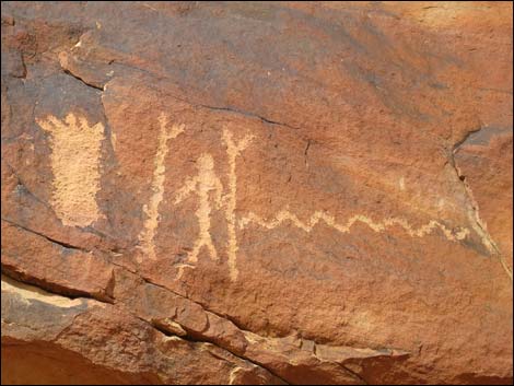
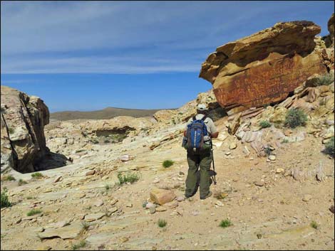
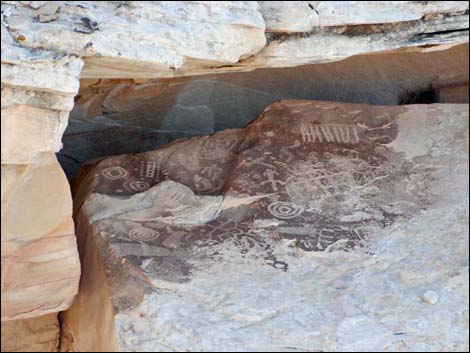
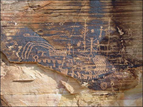
The last tinaja often holds water long into the summer and provides breeding habitat for dragonflies, Red-spotted Toads, and other aquatic creatures. Please don't mess in the water because this is the only place in the area for these toads and other aquatic species to breed. Dropping onto the sandy area below the last tinaja, the route turns right and heads downstream. About 100 yards down, the route arrives at Newspaper Rock (Wpt. 10), on the right. Every archeological district seems to have a newspaper rock, and Gold Butte National Monument's Newspaper Rock stands among the best. |
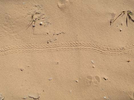 Beetle and kangaroo rat tracks in the soft sand |
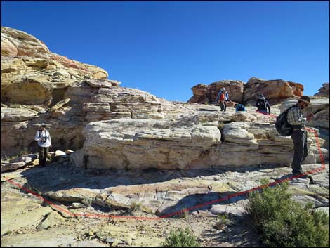
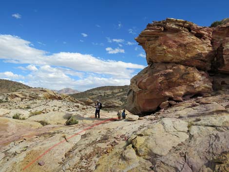
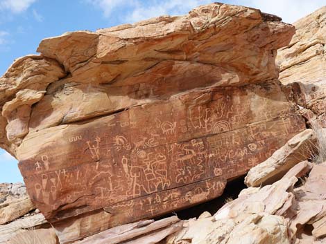
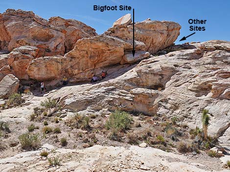
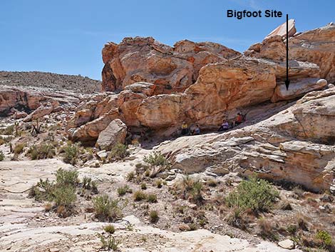
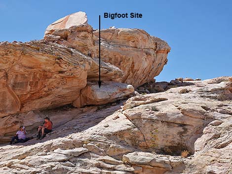
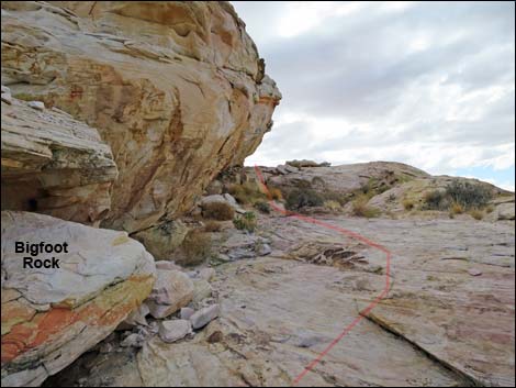
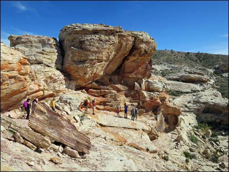
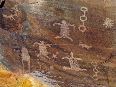
From Newspaper Rock, the route turns back a few yards, but quickly (about 80 feet out) crosses the wash and starts up a right-sloping ramp on the adjacent rocky crag. Along this north-facing cliff, notice an overhang with some large boulders in the shade. Inspect the boulders, as this is the Bigfoot (Wpt. 11) or Hang-Ten Site. There are some very nice glyphs here, including the big feet, one of which was too big to fit atop the rock, so the toes wrap over the edge (as if "hanging ten" on a surf board). From the Bigfoot site, the route continues up to a broad ledge (Wpt. 12) on the northwest corner of the crag. Here, a broad, flat ledge provides grand views to the north and west, including views of habitation sites in the not-to-far distance where overhanging rocks provided shade and shelter from the wind to people who lived here. This is also a good place for lunch, but don't sit on the flat-topped boulders while enjoying the view as you may damage the petroglyphs. |
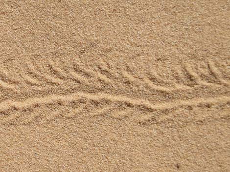 Beetle tracks in the soft sand |
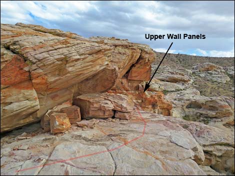
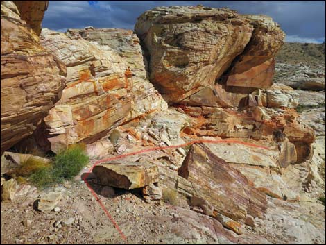
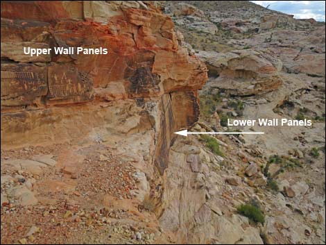
Continuing south from the broad ledge, a narrow ledge runs down and eventually pinches out, but not before arriving at a spectacular petroglyph panel, the Upper Wall Panel (Wpt. 13). While examining the petroglyphs above the ledge, notice the petroglyphs below the ledge -- this is the Lower Wall Panel (Wpt. 15) -- but you can't get there from here. To really see the Lower Wall Panel, return back up the ramp to the broad ledge (Wpt. 12), descend past the Bigfoot panel (Wpt. 11), hike up the wash to near the Tinajas, and circle around the crag to the right (to near Wpt. 14). Continue west across sandstone slickrock to an edge, then scamper down the broken cliff and around north to below the southwest corner and the Lower Wall Panel (Wpt. 15). |
 Detouring to Calvin's Rock (view SW) |
Don't stop there. Wander around among the rock piles and look for more petroglyphs. Consider walking down to the 21 Goats panel and on to Black Butte Dam. When finished in the area, wander back to the trailhead. For the return, see Returning to the Trailhead, but don't miss the Alcove Site along your way. Regardless of where you are in the rock piles, if you walk north, you will hit Black Butte Road; then turn right and walk back east to the trailhead. Rewards for exploring: hidden petroglyphs. The area around Falling Man is loaded with petroglyphs. Hikers are free to wander around and experience the history, but be careful not to trample the vegetation and don't touch the petroglyphs. More rewards for exploring: grand scenery and interesting vegetation. This part of Gold Butte National Monument is in the Upper Sonoran (Mojave Desert Scrub) vegetation zone where creosote bush and white bursage dominate the landscape, but many other species of shrubs also are common. Around the rock piles, look for Joshua trees, and keep an eye out for our common Mojave yucca. In sandy places, look for uncommon Utah yucca and unusual birdcage evening primrose with the sprawling stems that dry and roll up like a wire birdcage. |
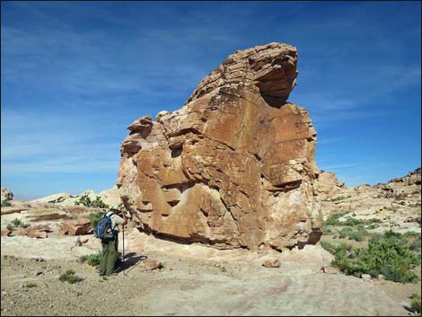 Hiker at Calvin's Rock (view W towards the east face) |
 Trail continues beyond Calvin's Rock (view S) |
 Scattered limestone cobbles from destroyed agave roasting pits |
 Approaching the turn-around loop at the end of the old road |
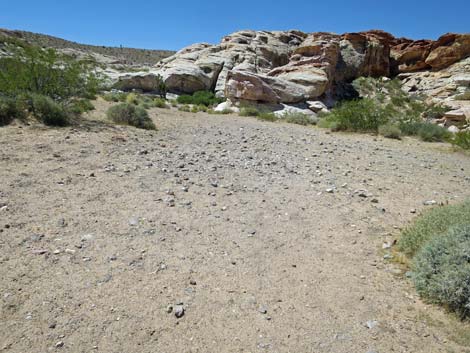 Scattered limestone cobbles from destroyed agave roasting pit |
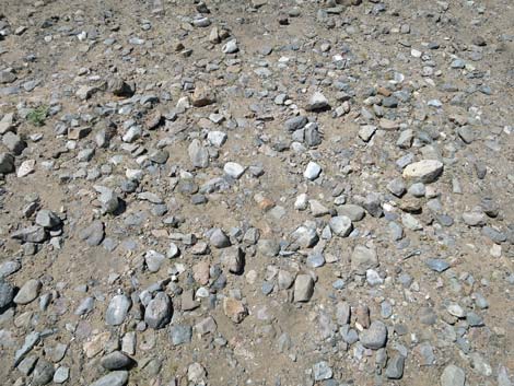 Scattered limestone cobbles from destroyed agave roasting pit |
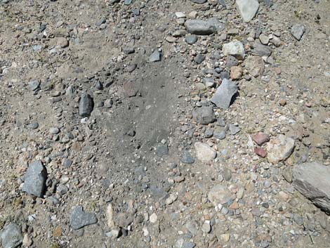 Scuffed dirt reveals ancient ash from agave roasting pit |
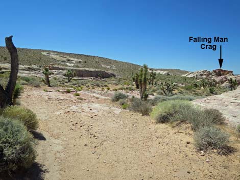
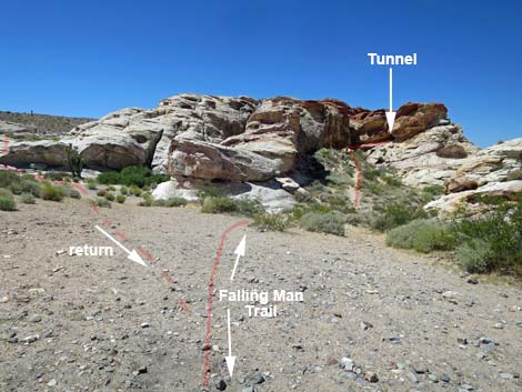 Trail junction; right to Falling Man (view SW) |
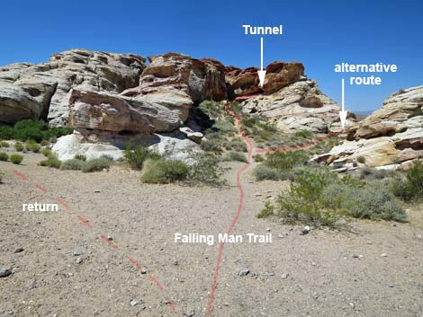 The Tunnel and Alternative routes (view SW from trail junction) |
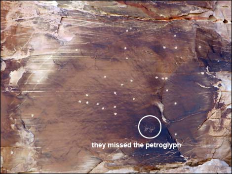 Bullet holes, but they missed the petroglyph |
 Hikers approaching the Tunnel (view SW) |
 Hikers below the Tunnel (view SW) |
 Hiker in the Tunnel (view W) |
 Hikers back through the Tunnel (view W) |
 Looking back at hiker emerging from the tunnel (view E) |
 Hikers coming out the other side of the tunnel (view NE) |
 West side of the Tunnel (view SW towards Falling Man) |
 Hikers traversing narrow ledges (view SW towards Falling Man) |
 Hiker traversing narrow ledges |
 Raven nest on cliff returns after several years missing |
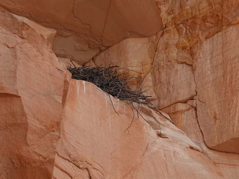 Raven nest built using sticks |
 Falling Man (view W) |
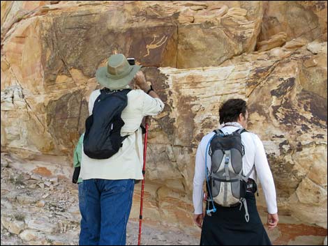 Hikers looking at the Falling Man panel (view SW) |
 Route continues around the corner (view W) |
 Continuing round the corner past the Falling Man (view W) |
 Route stays high around the corner (view SW) |
 Route continues across ledges (view SW) |
 Alcove along the ledge (view S) |
 Hiker at alcove along the ledge (view SE) |
 Pictograph inside alcove (view E) |
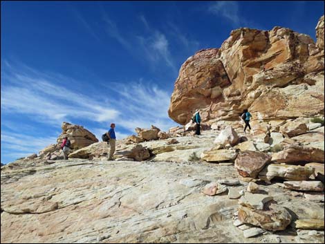
 Route climbs onto bench (hardest part of the trail; view SW) ... |
 ... then curves around to the left (view E) |
 Atop bench, route turns left towards amphitheater area (view SE) |
 Hikers entering the Amphitheater area (view E) |
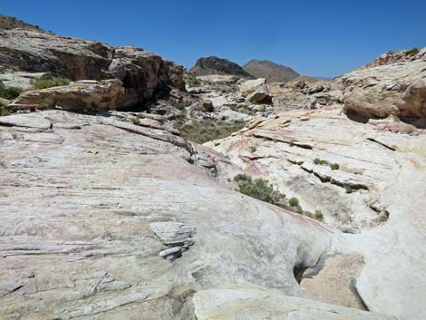
 Amphitheater area (view SE) |
 Amphitheater area (view SE) |
 Amphitheater area (view SE) |
 Route continues across slickrock to depart amphitheater (view SE) |
 Route drops into broad, sandy area (view S) |
 Departing the Amphitheater; down and right (view SE) |
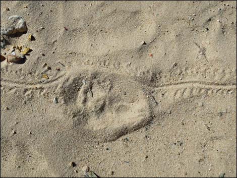 Kit fox and beetle tracks in the sandy area |
 Hikers look at cliffs above the sandy area (view NW) |
 Trail crosses the sandy area (view SW) |
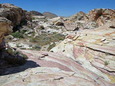
 Upper tinaja area (view W) |
 Tinajas would have had water when Native people lived here |
 Lower tinaja area (view W) |
 Lower tinaja area (view W) |
 Trail angles left past Lowest Tinaja, then down the wash (view NW) |
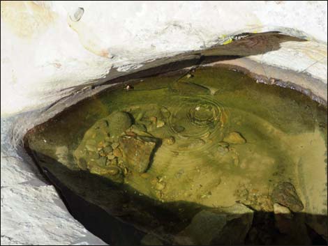 Red-spotted Toads in the water! |
 Trail runs down wash past Lowest Tinaja (view N) |
 Wash below tinajas (view N) |
 Hikers can use trail or wash (view N) |
 Trail runs above the wash (view N) |
 Petroglyphs on west side of the wash (view SW) |
 Petroglyphs tucked around the corner (view SW) |
 Petroglyphs on west side of the wash (view NW) |
 Hikers at small petroglyph panel (view N) |
 A long rock story (reads right to left; view NW) |
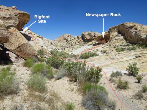 Approaching Bigfoot Site and Newspaper Rock (view N) |
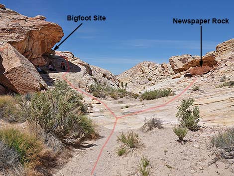 Route forks: left to Bigfoot, right to Newspaper Rock (view N) Route forks: left to Bigfoot, right to Newspaper Rock (view N) |
 Approaching Newspaper Rock (view N) |
 Hiker at Newspaper Rock (view N) |
 Newspaper Rock (view N) |
 Bigfoot and other sites (view SW from Newspaper Rock) |
 Route follows ramp to Bigfoot and other sites (view W) |
 Bigfoot Site (view SW from Newspaper Rock) |
 Bigfoot site (view S) |
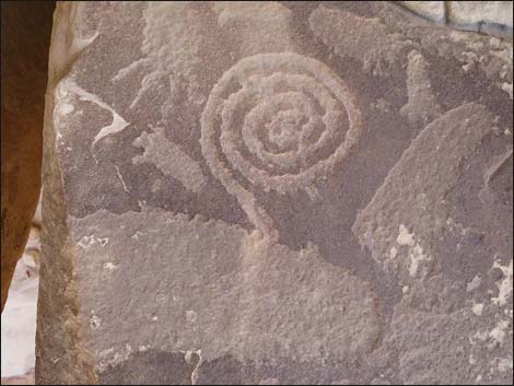 Spiral and the Big Foot (view S) |
 Route continues up ramp past Bigfoot site (view W) |
 Route continues up ramp past Bigfoot site (view W) |
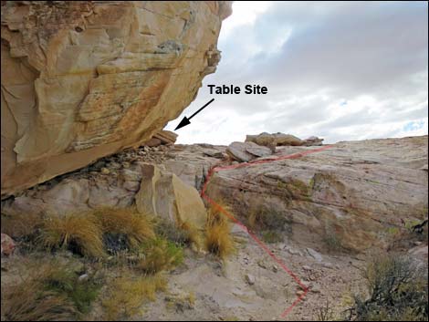 Route climbs onto flat ledge and Table Site (view W) |
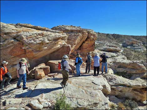 Hikers on the Ledge (view S) |
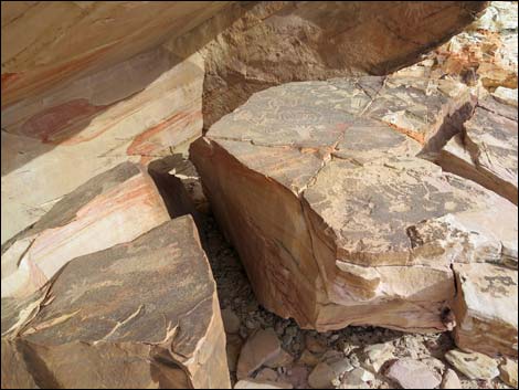 Rock art on "table tops" at the Ledge (view SE) |
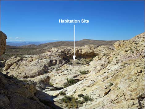 Habitation site (vandalized; view NW from Ledge) |
 Route continues south towards Upper Wall Panel |
 Upper Wall Site (view S) |
 Hikers on route to the Upper Wall Site (view SE) |
 Upper Wall Site and Lower Wall Site (view SE) |
 Upper Wall Site (view SE) |
 Upper Wall Site (view SE) |
 Departing Upper Wall Site (view N to broad, flat ledge) |
 Hiker arriving at at the broad ledge (view N from Upper Wall) |
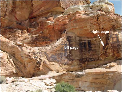 Lower Wall Site: left and right pages in an open book (view E) |
 Lower Wall Site, left page (view E) |
Table 2. Hiking Coordinates Based on GPS Data (NAD27, UTM Zone 11S). Download Hiking GPS Waypoints (*.gpx) file.
| Wpt. | Location | UTM Easting | UTM Northing | Elevation (ft) | Point-to-Point Distance (mi) | Cumulative Distance (mi) |
|---|---|---|---|---|---|---|
| 01 | Falling Man Trailhead | 752138 | 4044187 | 2,393 | 0.00 | 0.00 |
| 02 | Rabbit Ears Viewpoint | 752121 | 4044052 | 2,421 | 0.09 | 0.09 |
| 03 | Calvin's Rock | 752010 | 4043972 | 2,382 | 0.11 | 0.20 |
| 04 | Agave Roasting Pit | 752051 | 4043845 | 2,286 | 0.14 | 0.34 |
| 05 | Tunnel | 751983 | 4043774 | 2,443 | 0.08 | 0.42 |
| 06 | Falling Man Glyph | 751967 | 4043756 | 2,427 | 0.02 | 0.44 |
| 07 | Amphitheater | 751979 | 4043722 | 2,443 | 0.04 | 0.48 |
| 08 | Sandy Area | 752026 | 4043710 | 2,273 | 0.04 | 0.52 |
| 09 | Tinajas | 752000 | 4043649 | 2,405 | 0.05 | 0.57 |
| 10 | Newspaper Rock | 751928 | 4043715 | 2,397 | 0.07 | 0.64 |
| 11 | Bigfoot | 751924 | 4043692 | 2,408 | 0.02 | 0.66 |
| 12 | Ledge | 751899 | 4043680 | 2,431 | 0.02 | 0.68 |
| 13 | Wall Upper | 751920 | 4043661 | 2,426 | 0.02 | 0.70 |
| 11 | Bigfoot | 751924 | 4043692 | 2,408 | 0.05 | 0.75 |
| 14 | Saddle | 751970 | 4043618 | 2,426 | 0.06 | 0.81 |
| 15 | Wall Lower | 751919 | 4043654 | 2,390 | 0.07 | 0.88 |
| 14 | Saddle | 751970 | 4043618 | 2,426 | 0.07 | 0.95 |
| 09 | Tinajas | 752000 | 4043649 | 2,405 | 0.06 | 1.01 |
| 08 | Sandy Area | 752026 | 4043710 | 2,273 | 0.05 | 1.06 |
| 16 | Pictographs | 752027 | 4043732 | 2,276 | 0.02 | 1.08 |
| 17 | Alcove | 752046 | 4043797 | 2,265 | 0.07 | 1.15 |
| 04 | Agave Roasting Pit | 752051 | 4043845 | 2,286 | 0.04 | 1.19 |
| 02 | Rabbit Ears Viewpoint | 752121 | 4044052 | 2,421 | 0.14 | 1.33 |
| 01 | Falling Man Trailhead | 752138 | 4044187 | 2,393 | 0.09 | 1.42 |
Happy Hiking! All distances, elevations, and other facts are approximate.
![]() ; Last updated 240325
; Last updated 240325
| Gold Butte | Rock Art | Hiking Around Las Vegas | Glossary | Copyright, Conditions, Disclaimer | Home |