Hiking Around Las Vegas, Lake Mead National Recreation Area,
Pinto Valley Wilderness Area
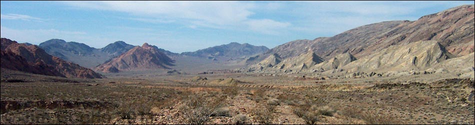
 The route starts behind the guardrail (view W) |
Overview This is a long (10.8 mile, one-way), but very pleasant and easy walk that runs over colorful mud hills and through a broad, scenic desert valley bordered by volcanic, sandstone, conglomerate, and carbonate mountains. Pinto Valley has two arms with low-point in the middle, and the route runs down one arm and back up the other. There are two springs along the route, but neither is reliable for drinking. The mud hills provide habitat for a number of unusual plant species, including two species of concern: California (Las Vegas) Bearpoppy and Silverleaf Sunray. This route traverses Pinto Valley, the namesake for the Pinto Valley Wilderness Area. Link to map. |
 Old road runs out to saddle (view S) |
The route starts on Northshore Road, runs south on an old road over a ridge and into the east end of Pinto Valley, follows washes to traverse the entire length of the valley, follows the old road back over the ridges and out of the west end of the valley, and then winds back over the mountains back to Northshore Road. Where the route runs over the ridges, it follows an old road, and the grades generally are easy. Where the route runs in washes, the surface is a mix of small gravel and dirt that makes for a firm walking surface; the grades are gentle. In most places, the road and washes are smooth enough that hikers don't need to watch their feet while walking. The entry and exit points on Northshore Road are about 8 miles apart, so this hike requires two vehicles or coordination with a third-party. I've hiked the route twice from east to west, so the description follows that direction, but it can be hiked in either direction. |
 Old road in white mudhills (view S) |
Watch Out Other than the standard warnings about hiking in the desert, ...this is a safe, but long hike without any unusual dangers. There is a short, 3rd-class scramble-down at Cottonwood Spring, but hikers who make it that far shouldn't have any trouble (it can be bypassed to the west). For backpackers doing the route without going down to the lake (6 extra miles round trip), be sure to bring enough water. While hiking, please respect the land and the other people out there, and try to Leave No Trace of your passage. This route runs into the Pinto Valley Wilderness Area, so pay particular attention to respecting the land. Also, this is a fairly long hike in a remote area, so be sure to bring the 10 Essentials. |
 Where there is a road, it is easy to follow (view SW) |
Getting to the Trailhead and Trail-End This hike is located along Northshore Road in Lake Mead National Recreation Area, about 1 hour northeast of Las Vegas. From town, drive out to Lake Mead, then drive out north on Northshore Road. Drive about 18.2 miles to the western trailhead: Mile 18.2 Trailhead. Continue a total of 25.8 miles to the eastern trailhead: Mile 25.8 Trailhead. Both trailheads are on the north side of the road. |
 Hikers on old road (view SW) |
The Hike From the eastern trailhead (Table 1, Waypoint 01), the route runs west 150 yards along the roadway (be sure to look and listen for approaching vehicles) to the guardrail (Wpt. 02) on the left. Step behind the guardrail and walk a about 50 yards to a low ridgeline. From this point, still against the guardrail, it becomes apparent that hikers are following the remnants of an old road, which now bends left to run southwest. Looking southwest, hikers can see two berms of dirt against a low hillside about 100 yards out. These berms block the old Pinto Valley Road (the Park Service has done a nice job of obscuring the old road). From here along the guardrail, hikers can also look south and see a low saddle, which will be the first overlook into Pinto Valley. The trail runs entirely in the Upper Sonoran (Mojave Desert Scrub) life zone, where the common shrubs on the hillsides are Creosote Bush, White Bursage, and Nevada Jointfir. In the washes, common shrubs include Catclaw Acacia and Burrobrush. |
 |
The route runs over to the two dirt berms, then follows the obvious old dirt road up and over the low ridges and down into a wash (Wpt. 03). The route follows the old road up the wash until exiting the wash to the right and climbing onto the crest of low, white, gypsum mud hills (Wpt. 04). In the mud hills, look for California Bearpoppies and Silverleaf Sunray, both of which are species of concern. Palmer's Phacelia, another rare plant that only grows on gypsum soils, is also common here. Although not restricted to gypsum soils, Schott's Pygmycedar, Fremont's Dalea, Desert Holly, and a species of desert-trumpet-like buckwheat with very frilly flower stalks are also found here. |
 Pinto Valley: the route runs out to the base of Hamblin Mountain before turning north (view W) |
The old road continues south from the low saddle and drops steeply down ravines through the gypsum mud hills. There is an amazing amount of cryptobiotic crust growing on the north-facing slopes of these mud hills. The crust stabilizes the mud and reduces erosion, producing little bits of cryptobiotic crust atop tiny pillars of mud. Below the gypsum mud hills, the road emerges onto the floor of Pinto Valley. Breaking out onto the flats, hikers can see that red sandstone cliffs block the east end of the valley. The north side is formed by the upper surfaces of tilted limestone layers of rock. The south side of the valley is formed by more limestone mountains with some red sandstone outcrops. There are also red sandstone outcrops, red spires, and tilted layers of limestone rock sticking up out of the valley floor. At this point, the west end of the valley is not visible. Between the old road and the mountains to the north, there are interesting beds of siltstone and mudstones that record ripple marks and fossils from some ancient lakeshore. |
 Sandstone Spring (view S) |
Continuing south across the valley, the road bends to the west. After about 1.3 miles, the road forks (Wpt. 05), but then rejoins on the other side of a little hill. The road eventually drops into a wash with many little ridges of hard sedimentary rock that cut across the wash. If water were flowing, these would form pretty little riffles in the stream. Through here, the sides of the canyon are an interesting mix of colors: light yellows, deep reds, greens, tans, and browns, with veins of gypsum crystals running throughout. At about 2.4 miles out, hikers get the first good view down Pinto Valley to the west. In general, the route runs to the other end of the valley, then turns right under Hamblin Mountain. It looks like a long way from here. |
 Boulder Wash (view S towards Lake Mead) |
At about 2.5 miles out (Wpt. 09), hikers can detour south on intermittent game trails that run southeast to Sandstone Spring (Wpt. 12). The spring emerges from below ground level at the base of the cliffs. Watch for a thicket of Catclaw Acacia, Honey Mesquite, Four-wing Saltbush, Saltgrass, and an old watering trough. Although interesting and scenic, Sandstone Spring is not a reliable place for drinking water because Bighorn Sheep sometimes leave piles of scat in and around the water. From the spring, follow washes west-southwest along the base of the cliffs to rejoin the main wash (Wpt. 15) without backtracking. The route follows the main wash downhill and southwest to the head of Boulder Wash (Wpt. 17). This spot, about 4.4 miles out, is the low point on the Pinto Valley route. Be sure to hike up the West Fork of Pinto Wash from here. |
 West Fork of Pinto Valley Wash (view NW from Boulder Wash) |
Through much of this section, the route runs down a wash that is broad (15-30 ft wide) and flat with a firm tread, and the walls are high enough to block much of the view. Where you get a view, you can see interesting layers of highly eroded mudstone laid up against the carbonate mountains to the north. Outside the wash, the dominant vegetation is Creosote Bush and White Bursage, but in and along the wash there are many other species including Fremont's Dalea, Catclaw Acacia with mistletoe, Rabbitbrush, Nevada Jointfir, Arrowweed, Honey Mesquite, and several species of composite shrub, plus Saltcedar in damp places. |
 Rock art in Pinto Valley |
From the head of Boulder Wash (Wpt. 17), the route continues westward and up the wash heading into the West Fork of Pinto Wash. In this side of the valley, the wash runs in the bottom of broad flat valley where the braided streambed is a firm substrate (small gravel and dirt) and easy to walk on. Here, the wash does not run in a canyon as it does in East Fork, providing better views but no shade. The vegetation here is similar to that in the East Fork. When passing the first red sandstone mountain on the south side of the valley (5.2 miles out), look for the rock shelter where someone etched the letter J above an overhang (Wpt. 18). It looks like someone spent a bit of time here long ago. There are some old pieces of wood, including native vegetation, and a few rusty (historic) old cans. |
 West Fork of Pinto Valley Wash (view W) |
From the rock shelter (Wpt. 18), the route continues west for about 1.1 miles to Signature Rock (Wpt. 20), a pile of large sandstone boulders on the north edge of the wash with an overhang that provides a shady place to stop and rest (the valley is broad and flat here, so this is an unusual feature). The west face of the highest boulder is smooth and desert varnished, seemingly a perfect sign-board for petroglyphs. Surprisingly, it seems only to have been marked by historic humans (mostly between 1922 and 1973). There are, however, a couple of small petroglyphs atop the highest boulder where passersby would never see them. Interestingly, the sandstone that makes up Signature Rock seems to be beach sand rather than wind-blown sand-dune sand (atop the rock pile, look for layers of coarse sand and pebbles mixed with finer sands. |
 Signature Rock |
From Signature Rock (Wpt. 20), start to get your bearings for leaving the valley. There is no road here, so hikers have to follow the correct washes as they start to branch apart. In general, stay to the north side of the valley bottom. Looking up the valley to the west, hikers can see three small ridges of sedimentary rocks sticking up out of the flat valley floor. There are two dark brownish ridges that lie in-line on the left (south) and a single bright yellow-and-red ridge on the right (north). The route goes along the north (right) side of the yellow-and-red ridge. Hikers can start up other washes, but they need to end up in the wash immediately on the north edge of the yellow-and-red ridge. The route passes one major side wash on the left (with darker sand) and continues to the next wash (Wpt. 21) on the right. At this point, what seems to be the main wash (right) clearly is starting up a canyon to the north. This is not the correct wash; stay left in the valley bottom. |
 |
Staying to the west (Wpt. 21), the route passes along the north edge of the yellow-and-red ridge. The canyon deepens and narrows until vehicle travel would be difficult, and hikers pass a pretty layer of green mudstone with some amazing water ripples on the surface. The canyon continues to narrow, and at one point, there is a little wall of sedimentary rock that sticks up vertically out of the wash and pinches the wash down to where it is too narrow for truck to drive through, but there is a bit of a road along the north edge of the wash next to the wall. This is the first evidence of a road since dropping into the wash back in the eastern end of Pinto Valley. |
 Looking back, better lighting shows color of the yellow-and-red ridge |
Eventually the wash narrows, runs around a sharp bend to the south, and suddenly a road cuts up and out of the wash on the north side of the canyon (Wpt. 24). Following the road, the route avoids several little pour-overs as it bends to the north. Out of the wash, the vegetation includes a nice stand of Desert Holly, but overall the vegetation is stunted and sparse in contrast to the relatively lush vegetation back along the washes. |
 Heading into mud hills on the west end of Pinto Valley (view N) |
The old road runs up the wash among eroded red mudhills that are capped with a layer of yellow mudhills. Eventually the old road runs up a canyon and bends to the east. In the soft mud stones, the old road seems to be intermittent, but it is not hard to follow. The old road eventually passes above the red hills, gets onto white mud hills, and arrives at a saddle (Wpt. 29). This is the highest point on the route; from here, it is all downhill to the pavement. The high point is in white mudhills with some reds and yellows and amazing colors all around. The small mountain to the north is red sandstone capped by dark conglomerate rock that looks like a basalt flow. |
 High point on the trail (view N) |
Following the old road, the route drops down and north towards the bottom of a canyon in the white hills. In the bottom of the canyon (Wpt. 30), the road cuts sharply back to the west and runs down a narrow wash. It would be easy to miss this turn and start going up the canyon, but remember, from the high point, it is all downhill to the pavement. The route continues to follow the old road and washes downhill. The old road seems to disappear at times, but then it appears again continuing downhill. Down the canyon, watch for red mudstone and shale with ripple marks. The route follows the wash down into red mud hills until it takes a sharp turn to the right to run north at a point where another wash comes in from the southwest (Wpt. 32). From there, the route runs north and downhill. A minute or two below the turn, the route runs through a short, but narrow gap through a ridge where, curiously, the rock is blue-gray conglomerate on one side and red sandstone on the other. |
 Old road takes a sharp bend back to the west (view W) |
Continuing north and downhill, the route runs down another broad, flat, gently sloping wash to Cottonwood Spring (Wpt. 39). The trail emerges through a gap to the top of a pour-over overlooking two Cottonwood Trees at the spring. Scramble down the easy 3rd-class pour-over (from above, it looks higher and harder than it is -- the trees aren't that tall, and only the lowest 4 to 5 ft are water-polished and slippery). For people who don't want to scramble down, backtrack up the wash 150 yards where an old road turns out of the wash to the right (to the right when backtracking) and bypasses the pour-over. The spring is a good place to sit and rest in the shade of the trees, the only real trees on the route. Vegetation around the spring includes two Cottonwood Trees, Desert Willow, one small Fan Palm, Arrowweed, Four-wing Saltbush, and lots of Honey Mesquite; Saltcedar has been removed. If water is not present on the surface, check around the wash for holes in the gravel, as animals dig holes to get to the water. |
 Approaching the top end of Cottonwood Wash (view W) |
From Cottonwood Spring, the route continues northwest down the wash for about 1.2 miles (for details on this section, see the Cottonwood Spring Hike). When the canyon open and the paved road becomes visible, watch for a use-trail that cuts up the east bank of the wash. Follow the use-trail for about 5 minutes as it runs directly to the Mile 18.2 trailhead (Wpt. 46). |
 Looking back up Cottonwood Wash (view S) |
For hikers going in the opposite direction (west to east) If hiking into Pinto Valley from the west, the only place where the route is confusing is on the west (right) toe of the red sandstone mountain with the dark conglomerate cap (see photo at left). The route follows this wash around the west (right) edge of the mountain, then cuts back to the east (left) behind the mountain running up this same wash (view S). |
Table 1. Hiking Coordinates Based on GPS Data (NAD27; UTM Zone 11S). Download Hiking GPS Waypoints (*.gpx) file.
| Wpt. | Location | UTM Easting | UTM Northing | Elevation (ft) | Point-to-Point Distance (mi) | Cumulative Distance (mi) | Verified |
|---|---|---|---|---|---|---|---|
| 01 | Trailhead East (Mile 25.8) | 721296 | 4013545 | 1,975 | 0.00 | 0.00 | GPS |
| 02 | Guardrail | 721149 | 4013488 | 2,089 | 0.10 | 0.10 | GPS |
| 03 | Road Drops into Main Wash | 720896 | 4013109 | 2,108 | 0.30 | 0.40 | GPS |
| 04 | Saddle | 720806 | 4012453 | 2,186 | 0.46 | 0.86 | GPS |
| 05 | Fork in Old Road | 720748 | 4011898 | 2,076 | 0.44 | 1.30 | GPS |
| 07 | Side canyon and Cairn | 720086 | 4011045 | 1,957 | 0.80 | 2.10 | GPS |
| 09 | Start to Sandstone Spring | 719681 | 4010529 | 1,903 | 0.43 | 2.53 | GPS |
| 12 | Sandstone Spring | 719773 | 4009927 | 1,897 | . | . | GPS |
| 15 | Back Main Wash | 719044 | 4009820 | 1,803 | 0.63 | 3.16 | GPS |
| 17 | Boulder Wash | 717852 | 4008436 | 1,647 | 1.25 | 4.41 | GPS |
| 18 | Rock Shelter J | 716744 | 4008158 | 1,761 | 0.72 | 5.13 | GPS |
| 20 | Signature Rock | 715168 | 4007645 | 1,958 | 1.10 | 6.23 | GPS |
| 21 | Fork in Wash | 714643 | 4007545 | 2,111 | 0.37 | 6.60 | GPS |
| 24 | Road Out of Wash | 713760 | 4007185 | 2,156 | 0.63 | 7.23 | GPS |
| 27 | Wooden 4x4 Post | 713070 | 4007538 | 2,306 | 0.54 | 7.77 | GPS |
| 29 | High Point | 713360 | 4007965 | 2,432 | 0.40 | 8.17 | GPS |
| 30 | Bottom of Wash | 713408 | 4008129 | 2,377 | 0.12 | 8.29 | GPS |
| 32 | Confluence of Washes | 712763 | 4007939 | 2,258 | 0.54 | 8.83 | GPS |
| 35 | Fork in Wash | 712418 | 4008326 | 2,167 | 0.37 | 9.20 | GPS |
| 37 | Old Road Leaves Wash | 712072 | 4008748 | 2,107 | 0.40 | 9.60 | GPS |
| 38 | Avoid Pour-Over | 711993 | 4008685 | 2,097 | . | . | GPS |
| 39 | Cottonwood Spring | 711950 | 4008807 | 2,066 | 0.10 | 9.70 | GPS |
| 40 | Washes Merge below Cottonwood Spring | 711846 | 4008853 | 2,050 | 0.07 | 9.77 | GPS |
| 45 | Canyon Opens | 710786 | 4009431 | 1,921 | 0.82 | 10.59 | GPS |
| 46 | Trailhead West (Mile 18.2) | 710744 | 4009682 | 1,920 | 0.16 | 10.75 | GPS |
Happy Hiking! All distances, elevations, and other facts are approximate.
![]() ; Last updated 240326
; Last updated 240326
| Hiking Around Lake Mead | Hiking Around Las Vegas | Glossary | Copyright, Conditions, Disclaimer | Home |