Birding Around Las Vegas, Gold Butte National Monument
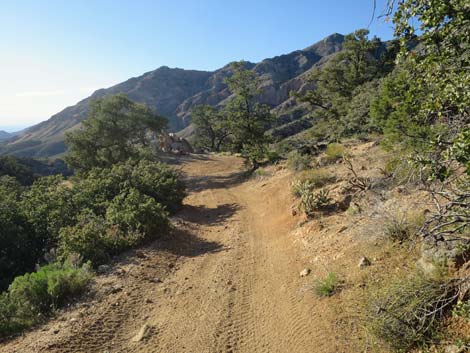
 Start of Whitney Pass Road at Whitney Pocket (view E) |
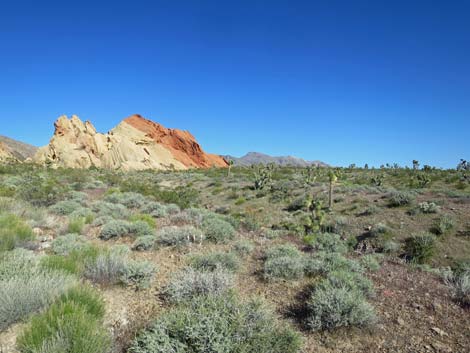
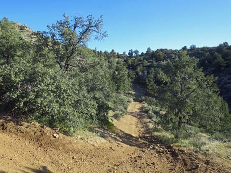
Description Whitney Pass Road, also called Arizona Road and Ney Ranch Road, runs from Whitney Pocket east over the mountains and down into Arizona, climbing some 2,000 feet in 4.5 miles to Whitney Pass. Along the way, the road passes through vegetative elevation zones where different species of desert and montane plants can be found, and therefore different species of birds can be found too. Whitney Pocket has an informal BLM campground nestled among scenic red and white sandstone cliffs at about 3,000 feet elevation. The area is quite dry, and the vegetation is widely spaced creosote bush (Mojave Desert Scrub Zone) with a few other species mixed in. From this dry desert area, the road ascends through several vegetation communities (zones of increasing precipitation and changing vegetation) to Whitney Pass at about 5,000 feet in the Pinon-Juniper Woodland Zone. The Whitney Pass area is vegetated with a thick and diverse assemblage of shrubs, buckhorn cholla, and pinyon pine, but 230 acres burned in 2006, killing many trees. Link to map. |
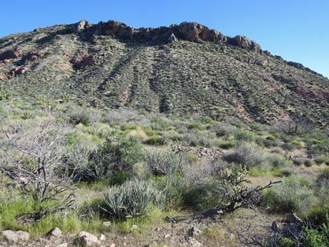
 Middle of Whitney Pass Road, vegetation is diverse (view NE) |
Watch Out Other than the standard warnings about hiking in the desert, ... this road is fairly safe, but be careful on blind curves and watch for off-highway vehicles careening down the road. The road is suitable for sedans under benign weather conditions, but it is steep and narrow, it gets a bit washboarded, and sometimes the road grader leaves behind too many big rocks. This is wild and remote country without services of any kind (no restrooms, no water, no gas, no food). Bring what you need to survive. Be prepared and be self-reliant. It is a big place, and someone will find you eventually if you stay on a main road, but be prepared to survive alone for a day or two, or even longer on side roads. Cell phones work from a place or two higher up. While out, please respect the land and the other people out there, and try to Leave No Trace of your passage. Also, even though this hike is short, the area is remote, so be sure to bring what you need of the 10 Essentials. |
 Top of Whitney Pass Road (view E into Arizona) |
Location Whitney Pass Road is located about 2 hours east of Las Vegas, in the wild, remote, and scenic Gold Butte National Monument south of the town of Mesquite. From Las Vegas, drive east on Highway I-15 to Highway 170 (Exit 112 towards Bunkerville). Exit the Interstate and drive south on Highway 170 for 3 miles to the Virgin River bridge. Cross the bridge and immediately turn right onto Gold Butte Road. The slope of the road makes the turn look like a pullout rather than an intersection. Follow the rough paved road southwest along the river and then up onto the desert for 21 miles to the end of the pavement at Whitney Pocket (Table 1, Site 0462). At Whitney Pocket, the pavement ends, but Gold Butte Road continues straight ahead as a broad, graded dirt road. Fifty yards past the end of the pavement, Whitney Pass Road forks off to the left and runs east and up along the sandstone cliffs. A road sign says that Arizona is 6 miles to the east. |
BIRDING HABITATS ALONG WHITNEY PASS ROAD
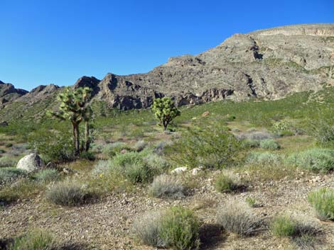
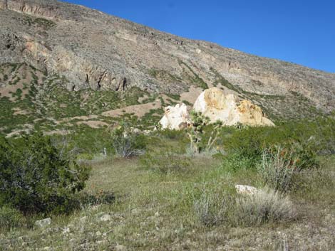
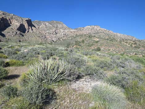
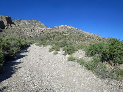
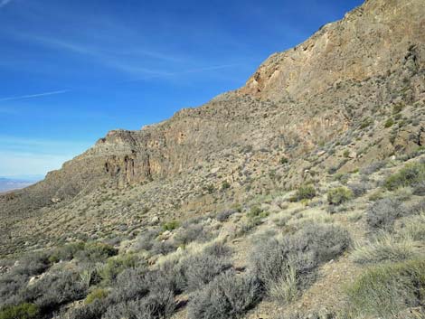
Lower Elevation Sandstone Crags and Sparse Shrubs
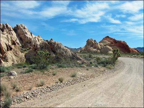
Whitney Pass Road (Table 1, Site 0462) runs east along the base of towering sandstone crags passing campsites on the left and right, and also an historic stone dam built by the CCC in the 1930s. During wet seasons, the dam holds water, and this can be a good place to watch for birds coming in for water. Vegetation here is creosote bushes and a few other species including Eastern Joshua trees, buckhorn cholla, and Mojave yucca, but the sense is widely spaced bushes with few other species and lots of visible ground surface. In this sparsely vegetated area, watch for desert species, especially sparrows, Rock Wrens, and House Finches. Say's Phoebe, Loggerhead Shrike, Western Meadowlark, and Western Kingbird can be seen, and wide-ranging Common Ravens often come in looking for camper scraps. In the rocky cliffs, keep a keen eye and ear out for nesting Western Screech Owls, Violet-green Swallows, and White-throated Swifts. |
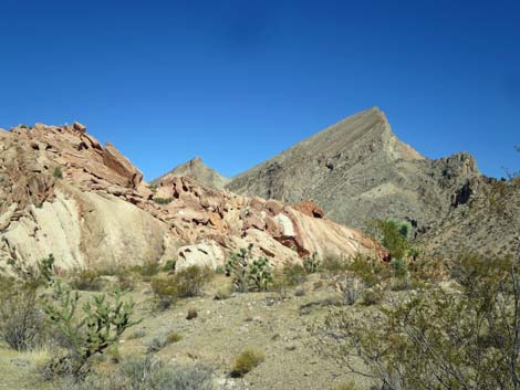 Lower Elevation Sandstone Crags and Sparse Shrubs (view N) |
 |
 |
 |
 |
 Scattered buckhorn cholla and a few Joshua trees |
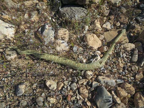 Watch for Mojave and other rattlesnake species |
 |
 |
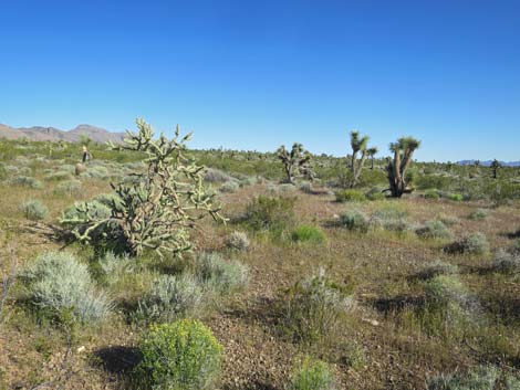
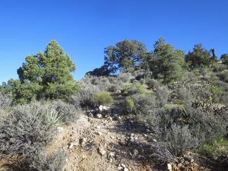
Lower Elevation Shrubland
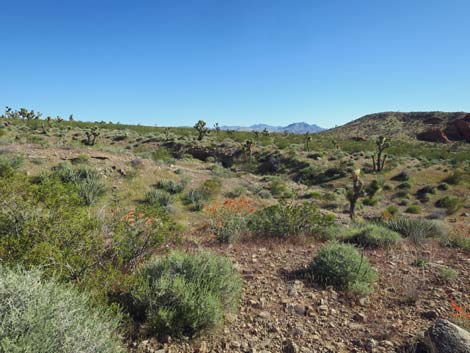
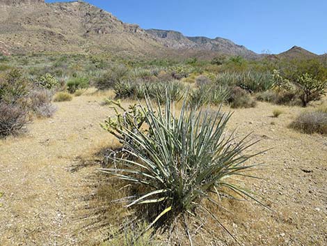
Up the road a mile or so, the vegetation starts to become more diverse because as the elevation increases, rainfall increases and supports more species. Eastern Joshua trees, buckhorn cholla, catclaw acacia, and banana yuccas become common, and less of the ground surface is visible as birders look off across the landscape. A side road to the left, about 2.4 miles out, makes a place to park off the main road and listen for birds. Watch for Scott's Oriole, Sagebrush Sparrow, House Finch, and Mourning Doves. Also look for Black-tailed Gnatcatcher, Blue-gray Gnatcatcher, Red-tailed Hawk, Black-throated Sparrow, White-crowned Sparrow, Northern Mockingbird, Common Poorwill, Common Raven, Verdin, Ladder-backed Woodpecker, Cactus Wren, and Loggerhead Shrike. |
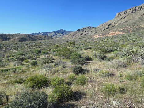 Lower Elevation Shrubland (view N) |
 |
 |
 |
 |
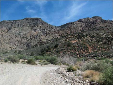
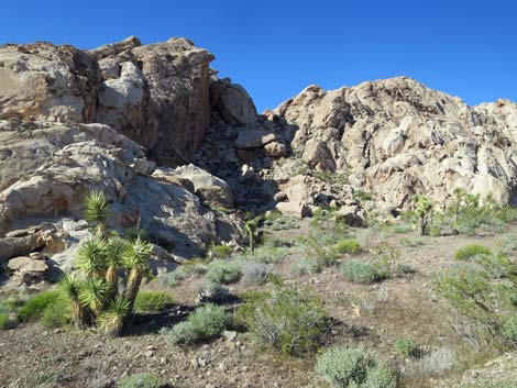
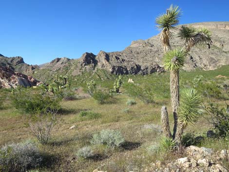
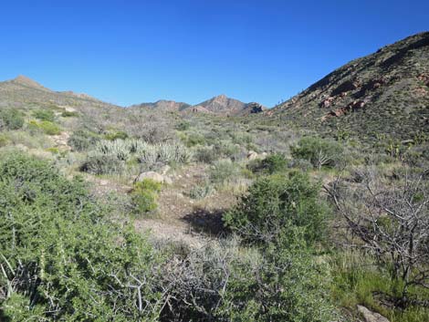
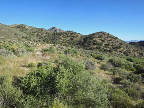
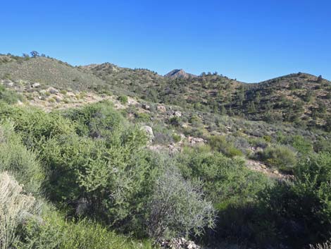
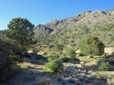
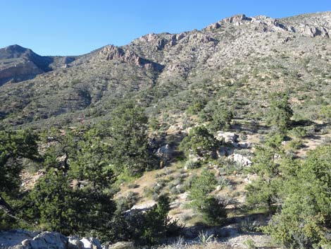
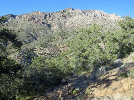
Higher Elevation Shrubland
Higher up, the shrubs become lush by desert standards. Desert almond is common in the washes, blackbrush dominates the hillsides, and shrub live oak trees enter the species mix. Scattered conifer trees can be seen, and the slopes ahead are forested. A side road to the left, about 3.4 miles out, makes a place to park off the main road and listen for birds. Watch for Woodhouse's Scrub-jay, Spotted Towhee, Gambel's Quail, and Crissal Thrasher, Rock Wren, Red-tailed Hawk, Sharp-shinned Hawk, Coopers Hawk, American Kestrel, Northern Mockingbird, Common Raven, Bewick's Wren. Also watch for mule deer. |
 Higher Elevation Shrubland (view W) |
 |
 |
 |
 |
 |
 |
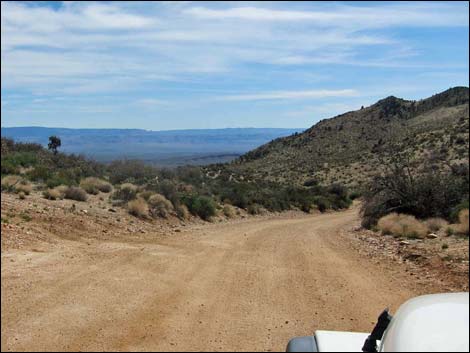
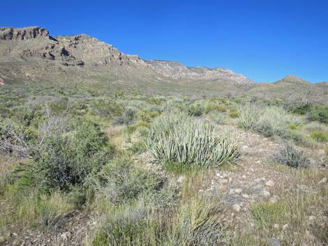
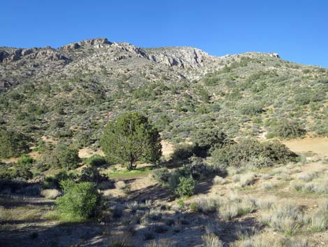
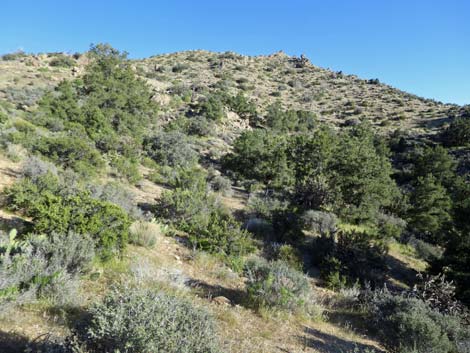
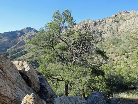
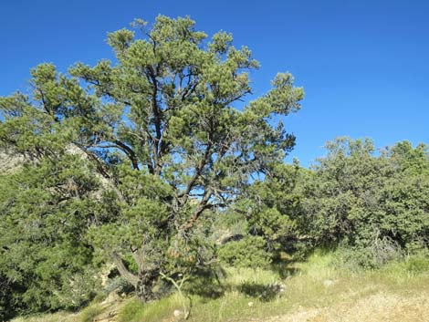
Higher Elevation Pinyon-Juniper Forest
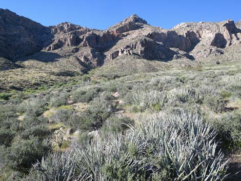
Up here, the temperatures are noticeably cooler than at Whitney Pocket, even during summer, and the area receives 3-4 times as much precipitation as the desert flats below, including snow during winter. Single-leaf pinyon pine trees are so thick it almost feels like a forest, although Utah Juniper (which usually grows with pinyon here) are curiously few. A side road to the right, about 4.2 miles out, makes a place to park off the main road and listen for birds. At these higher elevations, expect to see montane species such as Pinyon Jay, Mountain Chickadee, Ruby-crowned Kinglet, and Western Bluebird. Golden Eagle, Woodhouse's Scrub-Jay, Juniper Titmouse, Sharp-shinned Hawk, Coopers Hawk, and Common Raven can also be seen. |
 Higher Elevation Pinyon-Juniper Forest (view W) Higher Elevation Pinyon-Juniper Forest (view W) |
 |
 |
 |
 |
 |
 |
 |
 |
 |
 |
Whitney Pass plus Mammals and Reptiles Seen on Whitney Pass Road
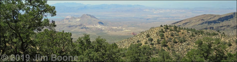
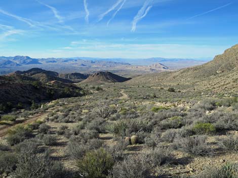
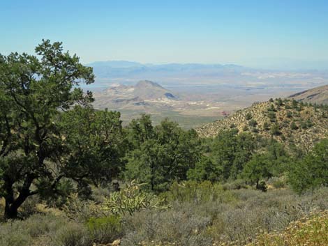
Atop Whitney Pass (Site 0688), the trees disappear, and birders get great views east to the Grand Wash Cliffs in Arizona and west to Lake Mead. Fires here in 2006 removed the trees, and a lush shrub community heavily mixed with buckhorn cholla has replaced the forest. This area supports a dense population of Crissal Thrashers. Watch for these plus Cactus Wren, Ruby-crowned Kinglet, Verdin, and White-throated Swift. Mammals Black-tailed Jackrabbit, desert cottontail, cliff chipmunk, rock squirrel, valley pocket gopher, white-tailed antelope squirrel, mule deer, and feral burro. I've seen bighorn scat. Reptiles Lyre Snake, Patchnose Snake, Speckled Rattlesnake, Mojave Rattlesnake, Common Chuckwalla, Yellow-backed Spiny Lizard, and Side-blotched Lizard. |
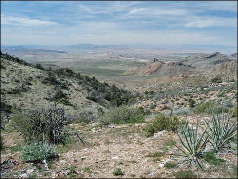 Whitney Pass (view SW across Gold Butte to Lake Mead) |
Table 1. GPS Coordinates for Highway Locations (NAD27; UTM Zone 11S). Download Highway GPS Waypoints (*.gpx) file.
| Site # | Location | Latitude (°N) | Longitude (°W) | UTM Easting | UTM Northing | Elevation (feet) |
|---|---|---|---|---|---|---|
| 0462 | Whitney Pocket | 36.5231 | 114.139 | 756178 | 4045577 | 3,013 |
| 0688 | Whitney Pass | 36.5314 | 114.069 | 762417 | 4046683 | 4,875 |
Happy birding! All distances, elevations, and other facts are approximate.
![]() ; Last updated 240322
; Last updated 240322
| Birds Around Las Vegas | Birding Around Las Vegas | Glossary | Copyright, Conditions, Disclaimer | Home |