
Sloan Canyon Loop
Hiking Around Las Vegas, Sloan Canyon NCA

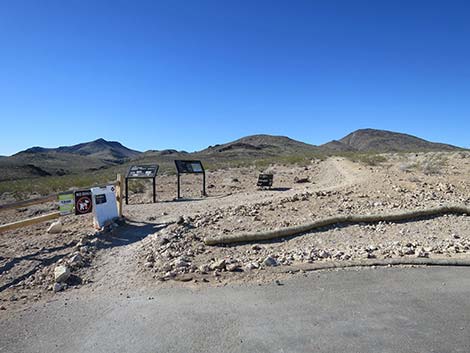 Hiker starting on Petroglyph Trail (view S) |
Note: Nawghaw Poa Road is closed during construction. Walk in from Democracy Drive. See Closure Notice (PDF). Overview Sloan Canyon Loop is a nice 7-mile route in the North McCullough Wilderness Area, which is located inside Sloan Canyon National Conservation Area. The route starts at the Sloan Canyon Trailhead and winds up washes past scramble-ups, pour-overs, and an amazing petroglyph gallery (Petroglyph Canyon) to a saddle on the crest of the range. From the saddle, the route traverses east under the north face of volcanic cliffs to the next saddle, then turns back to the north and follows an old road and washes downhill until reconnecting with the original route and closing the loop near the petroglyph gallery. From there, the original wash is followed downhill to the trailhead. Just hiking to Petroglyph Canyon is about 3.7 miles, round-trip. Link to map. |
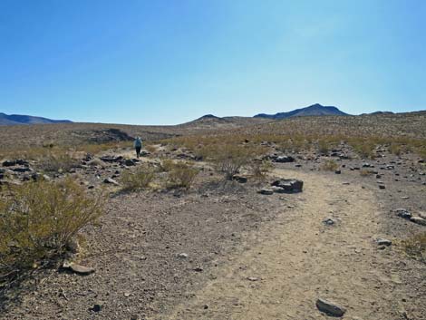 Hiker on Petroglyph Trail (view S) |
Watch Out Other than the standard warnings about hiking in the desert, there are no particular dangers on this route. There is one, non-trivial (3rd-class) water-polished 10-foot pour-over to climb (about 1.8 miles out), but it isn't bad if you are willing to climb on the most exposed part. If you slip, you land in the sandy wash. Getting to the Trailhead This hike is located in the Sloan Canyon National Conservation Area, on the north side of the North McCullough Wilderness Area. From town, drive south about 45 minutes to the Sloan Canyon Trailhead. |
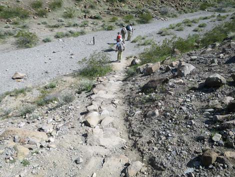 Hikers on Petroglyph Trail entering Sloan Wash (view SE) |
The Hike From the trailhead sign (Table 1, Waypoint 01), Sloan Canyon Loop begins on the Petroglyph Trail (BLM 100), which runs south around the left edge of the Visitor Center and winds gently up the hillside (Wpt. 02) into an area with a number of large, dark-colored boulders and begins a moderate descent towards Sloan Wash. The trail makes two long switchbacks ending on a bench above the wash. Heading up-canyon on the bench, the trail eventually descends steeply into the gravel of Sloan Wash (Wpt. 03). For details of this section of the hike, see Petroglyph Trail. Sloan Canyon Loop runs up Sloan Wash (Wpt. 04) (Wpt. 05) to an intersection (Wpt. 06) where the Cowboy Trail turns right into a side canyon. Again, the trail runs up Sloan Wash (Wpt. 07), but getting into Petroglyph Canyon requires climbing a 10-foot pour-over where the canyon is blocked by a large chockstone (Wpt. 08). In all cases, the rock is smooth and slippery. The pour-over is fairly easy to climb, but hikers could use the Cowboy Trail (BLM 200) as an alternative that reconnects with Sloan Wash (Wpt. 11) above the petroglyph gallery. |
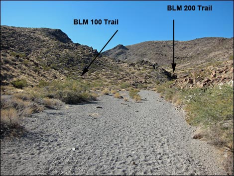 Approaching BLM100-BLM200 trail junction (view SW) |
In the petroglyph gallery (Wpt. 09), there are amazing petroglyphs on both sides of the canyon, and in places, almost every boulder is marked. Petroglyph Canyon is a special place. For the ancient people who created the petroglyphs, this probably was a spiritual place as there are no signs of habitation in the area. For the rest of us, this is a glimpse into the lives of those who lived on this land before we got here. Please respect the spirituality and history of this place. Take only photographs, leave only footprints, and don't touch the petroglyphs. Continuing on the Sloan Canyon Loop, the route runs up the wide, sandy wash past the petroglyph gallery. Sloan Wash bends to the southwest at a point where another fairly large wash comes in from the south (Wpt. 10). This fork in the canyon is where the loop route comes back to close the loop. About 10 minutes past the side wash, a trail marker in the middle of the wash (Wpt. 11) announces the end of the (Petroglyph Trail (BLM 100) at a junction with the Cowboy Trail (BLM 200) and the Hidden Valley Trail (BLM 300). Watch for petroglyphs along the sides of the wash in this area. |
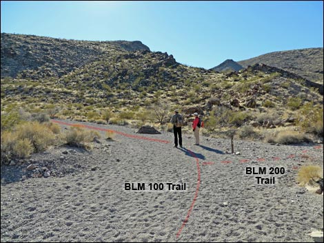 Hikers at BLM100-BLM200 trail junction (view SW) |
At this point (Wpt. 11), the canyon is quite open, seeming more like a shallow valley with mountains rather than a canyon, with a towering rock spire just ahead on the right. From the trail junction (Wpt. 11), the route continues up the main wash (staying left-ish) following the Hidden Valley Trail. In about 50 yards, the wash forks and the Hidden Valley Trail is followed up the main left fork. The wash bends right, then bends left, and again the wash forks (Wpt. 12). Here the route stays right on the Hidden Valley Trail following the main wash. As an alternative, hikers can turn left into the narrower wash and rejoin the regular route in about 0.5 miles. Continuing southwest, the wash winds through a rocky canyon as it threads between two isolated peaks. Emerging from the canyon, the wash opens into a broad flat basin sprinkled with eroded rock outcrops. The peaks on the north side generally are low and rounded, but the peaks to the south are steep, craggy, volcanic peaks. |
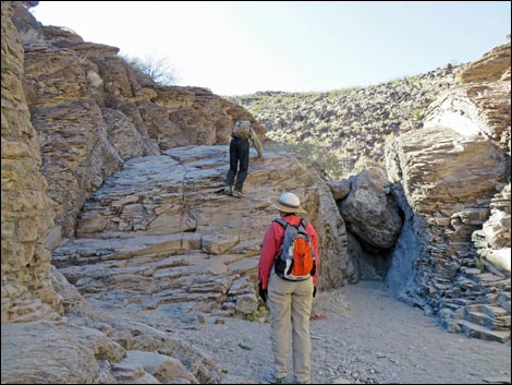 Hikers at 10-ft pour-over (view W) |
As the wash enters the open basin, it bends hard to the left to run almost due south. Shortly, a side wash merges from the left that can be seen to stay against the base of the mountain on the left. At this point, a cairn (Wpt. 13) marks the point where the Hidden Valley Trail exits the wash and begins heading south towards the high peaks in the distance. Here (Wpt. 13), the route departs the Hidden Valley Trail and stays left into the wash and follows along the base of the mountain heading generally south-southeast. The wash runs up between the mountain on the left and a rocky ridge on the left. Past the first rocky ridge, and before another rocky crag (separate, but a continuation of the rocky ridge), notice ahead on the left an old road that leaves the wash and cuts up across the hillside, eventually going over a low saddle just left of the rocky crag. The route follows the old road onto the low saddle (Wpt. 14). From the saddle, the old road continues southeast across the hillside, crosses the wash below, and climbs up over the next low saddle heading east. For hikers who don't want to do the entire route, the old road can be followed over that next saddle and down into the next drainage to the east. |
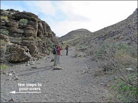 Hikers entering Petroglyph Canyon (view S) |
Continuing the Sloan Canyon Loop route, the old road is followed over the saddle, down into the wash below (Wpt. 15). The wash is then followed upstream all the way to a saddle on the crest of the mountain range (Wpt. 16). Along the way, hikers need to scramble under boulders and find an easy way to head uphill. The crest of the range is broad and open, with some well-used bighorn sheep trails. Rocky peaks flank the saddle, especially to the west. After enjoying the view south towards Primm and the New York Mountains, the route heads east on sheep trails cutting across the north-facing slope while staying fairly high under the cliffs. It takes about 10 minutes to cross the slope and drop into the next saddle on the main ridge (Wpt. 17). The old road, seen before, crosses this saddle and continues downhill to the south. In contrast to the lower hillsides, the hillsides at this elevation are covered with fairly dense and diverse, if low-growing, vegetation. There are lots of shrubs, plus a few silver cholla, pencil cholla, California barrel cactus, and Mojave yucca. These higher slopes catch and retain more precipitation than the lower slopes, which allows more species to survive here. |
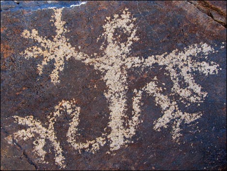 Petroglyph Canyon (view S) |
From the saddle (Wpt. 17), the route turns north and runs down the slope and wash following the old road. After about 15 minutes on the old road, hikers will have passed around the east side of a small peak and arrived in a broad, open area (Wpt. 18). The old road turns and runs northwest back towards the saddle hikers crossed previously (Wpt. 14). Here (Wpt. 18), the route leaves the old road, angles northeast, drops into the wash, and follows the wash northward. The wash runs along the east edge of Peak 3623. The top of the canyon is fairly broad, but soon the wash runs in a fairly narrow channel. The canyon gradually narrows and gets rocky. The hiking is easy, but there is one pour-over to scramble around (Wpt. 19) and there are several easy scramble-downs in the narrow part. The canyon finally begins to widen as hikers pass Peak 3623 and the wash merges with a large wash coming down from the left (Wpt. 10). This larger wash is Sloan Wash, and the loop is closed. From here, the route descends through Petroglyph Canyon, drops over the four pour-overs, and continues down the Sloan Wash and back to the trailhead (Wpt. 01). |
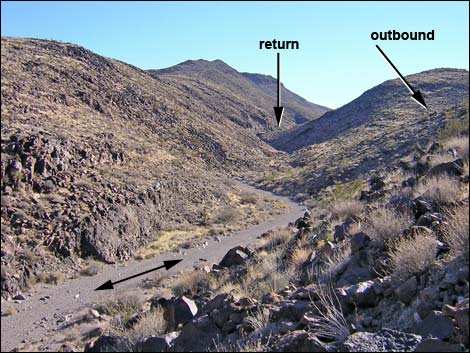 From Petroglyph Canyon, the loop follows the arrows (view S) |
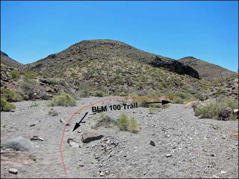 At first fork in the canyon, outbound route stays right (view SW) |
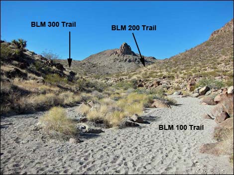 Route continues up Sloan Wash (view W) |
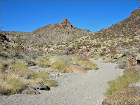 Approaching the broad, flat basin (view SW) |
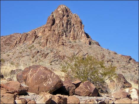 Petroglyphs at edge of wash (view SW) |
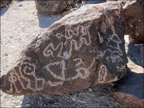 Petroglyphs |
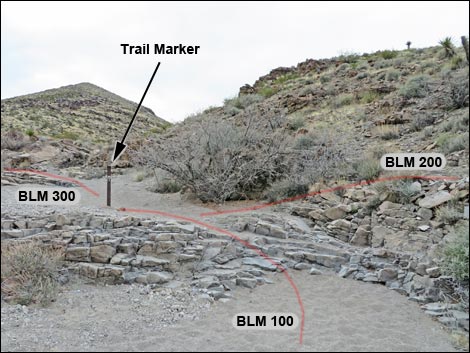 BLM100-BLM200-BLM300 Trail Junction (view SW) |
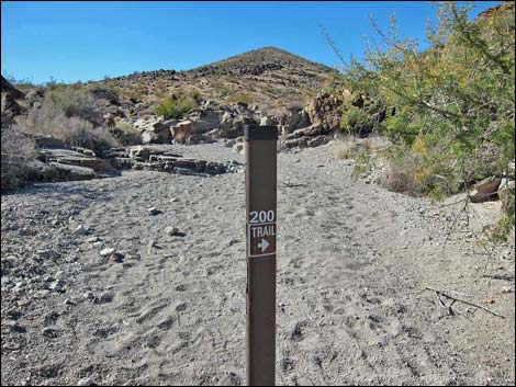 Trail sign at BLM100-BLM200-BLM300 Trail Junction (view SW) |
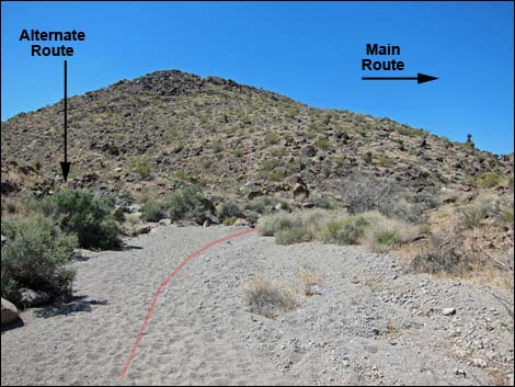 Route follows Sloan Wash (view SW) |
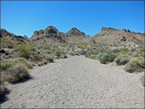 Canyon opens into broad valley (view SW) |
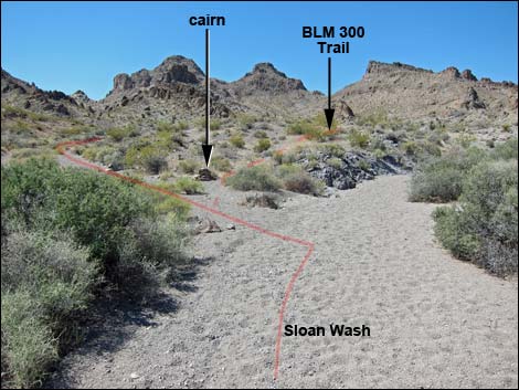 BLM 300 and route exit Sloan Wash (view S) |
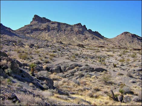 Broad flat valley with eroded rocky outcrops (view SW) |
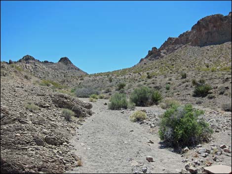 Route runs up wash (view S) |
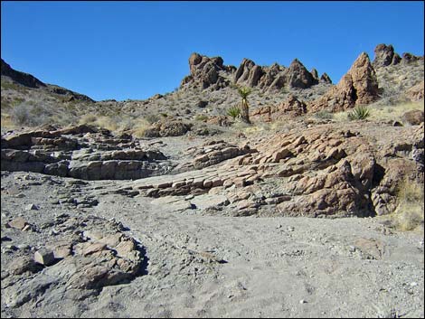 Rocky outcrops near the first saddle (view W) |
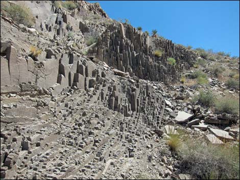 Interesting geology (view S) |
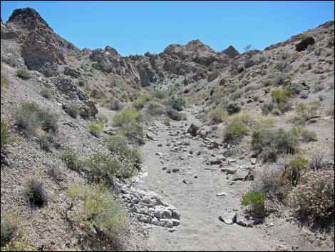 Route runs up wash (view S) |
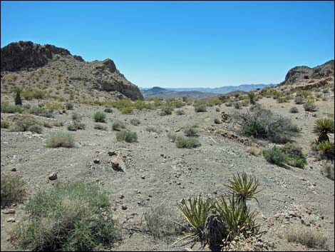 High saddle on the crest of the range (view S) |
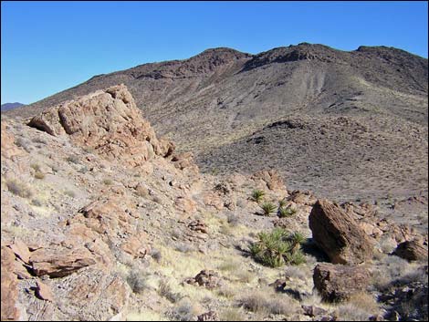 Traversing hillsides and dropping towards low saddle (view NE) |
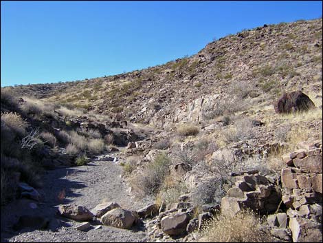 Wash beyond the old road (view N) |
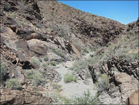 Atop pour-over (view N down the canyon) |
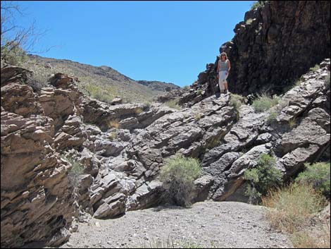 Looking back, hiker atop pour-over (view S up the canyon) |
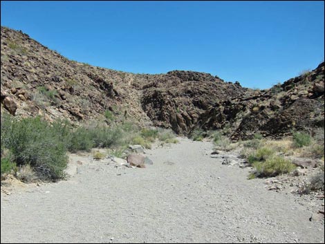 Returning to Petroglyph Canyon (view N) |
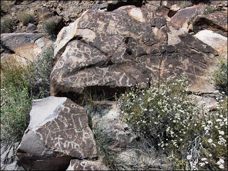 Petroglyph Canyon (view W) |
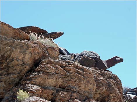 Stone tortoises: guardians of Petroglyph Canyon (view SE) |
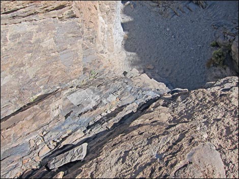 Top of 10-ft pour-over (view down from atop stone ladder) |
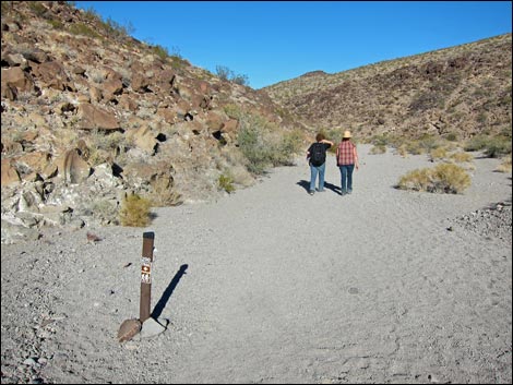 Passing BLM100-BLM200 Trail junction (view N) |
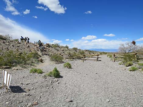 Petroglyph Canyon exits Sloan Wash (view N) |
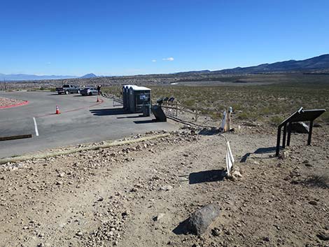 Hiker on trail returning to the Sloan Canyon Trailhead (view N) |
Table 1. Hiking Coordinates Based on GPS Data (NAD27; UTM Zone 11S). Download Hiking GPS Waypoints (*.gpx) file.
| Wpt. | Location | UTM Easting | UTM Northing | Elevation (ft) | Point-to-Point Distance (mi) | Cumulative Distance (mi) |
|---|---|---|---|---|---|---|
| 01 | Petroglyph Trailhead | 669171 | 3976082 | 2,954 | 0.00 | 0.00 |
| 02 | Trail Joins Old Road | 669046 | 3975793 | 2,934 | 0.21 | 0.21 |
| 03 | Trail Enters Sloan Wash | 669355 | 3975480 | 2,897 | 0.37 | 0.58 |
| 04 | Sloan Canyon First Narrows | 669331 | 3975256 | 2,921 | 0.15 | 0.73 |
| 05 | Canyon Narrows | 669327 | 3974673 | 2,995 | 0.42 | 1.15 |
| 06 | Petroglyph Trail at Cowboy Trail | 669282 | 3974452 | 2,990 | 0.18 | 1.33 |
| 07 | First Pour-Overs | 669437 | 3974282 | 3,043 | 0.16 | 1.49 |
| 08 | Canyon Narrows | 669457 | 3974023 | 3,086 | 0.24 | 1.73 |
| 09 | Petroglyph Gallery | 669398 | 3973973 | 3,162 | 0.06 | 1.79 |
| 10 | Washes Fork | 669389 | 3973770 | 3,169 | 0.14 | 1.93 |
| 11 | BLM100-BLM200-BLM300 Trail Junction | 669059 | 3973636 | 3,225 | 0.27 | 2.20 |
| 12 | Washes Merge | 668846 | 3973453 | 3,284 | 0.22 | 2.42 |
| 13 | Depart Hidden Valley Trail | 668578 | 3973265 | 3,362 | 0.28 | 2.70 |
| 14 | Low Saddle | 668669 | 3972972 | 3,481 | 0.22 | 2.92 |
| 15 | Wash | 668845 | 3972909 | 3,484 | 0.12 | 3.04 |
| 16 | Saddle on Crest of Ridge | 668695 | 3972306 | 3,665 | 0.51 | 3.55 |
| 17 | Next Saddle | 669036 | 3972267 | 3,609 | 0.24 | 3.79 |
| 18 | Leave Illegal Road | 669176 | 3972820 | 3,483 | 0.42 | 4.21 |
| 19 | Pour-Over | 669366 | 3973116 | 3,407 | 0.28 | 4.49 |
| 10 | Washes Fork | 669389 | 3973770 | 3,169 | 0.52 | 5.01 |
| 09 | Petroglyph Gallery | 669398 | 3973973 | 3,162 | 0.14 | 5.15 |
| 06 | Petroglyph Trail at Cowboy Trail | 669282 | 3974452 | 2,990 | 0.46 | 5.61 |
| 03 | Trail Enters Sloan Wash | 669355 | 3975480 | 2,897 | 0.75 | 6.36 |
| 01 | Petroglyph Trailhead | 669171 | 3976082 | 2,954 | 0.58 | 6.94 |
Happy Hiking! All distances, elevations, and other facts are approximate.
![]() ; Last updated 240330
; Last updated 240330
| Hiking Around Las Vegas | Hiking Around Wilderness Areas | Glossary | Copyright, Conditions, Disclaimer | Home |