Hiking Around Las Vegas, Red Rock Canyon National Conservation Area

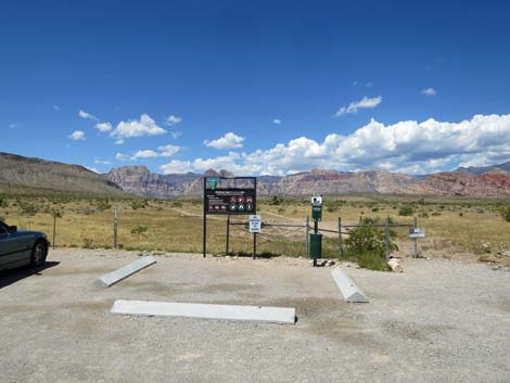 Trailhead (gate through fence; view W) |
Overview A number of nice use-trails have become established in the Red Rock Canyon Campground Area. The Fire Station Hill Loop (3.01 miles round trip) runs west from the public trailhead, then makes a big loop out behind the fire station, climbing onto a peak with grand views. This is the hardest of the Campground Area Loops, but the expansive views make it worth it, and there is a nice cactus garden atop Fire Station Hill. The trail continues down the other side of the mountain and returns to the paved road. Hikers can return over the pavement or continue across the road and use other trails to return to the trailhead. After hiking this loop, consider hiking one of the other short or long loops in the campground area. This hike is nice because it is close to town and not on the Scenic Loop Drive. This makes it free, a quick little get away from town, and it minimizes time driving to and from the trailhead. Link to map or elevation profile. |
 Hiker departing the trailhead (view W) |
Watch Out Other than the standard warnings about hiking in the desert, ...this hike is about as safe as hiking in the desert can be, but watch out for dog poop near the trailhead. While hiking, please respect the land and the other people out there, and please try to Leave No Trace of your passage. Also, even though this hike is short and close to civilization, be sure to bring what you need of the 10 Essentials. Please pick up after your pet too. |
 Hiker staying right on the longer, less steep trail (view W) |
Getting to the Trailhead This hike is located in Red Rock Canyon National Conservation Area, about 30 minutes from town, but not on the Scenic Loop Road. Drive out West Charleston Blvd to Moenkopi Road and turn left towards Red Rock Campground. For non-campers, drive south on Moenkopi Road about 0.3 miles to Moenkopi Road Trailhead (Moenkopi Road Recreation Site parking area). Park here; this is the trailhead. For campers, continue south into the campground, park at your campsite, then walk out into the desert and pick up the trails. |
 The trail crosses an old road staying left (view NW) |
The Hike Fire Station Hill Loop Trail is a loop, so hikers can walk it in either direction, but as described here, the trail departs the trailhead heading west into the open desert. Alternatively, hikers could walk farther up Moenkopi Road and do the loop in the other direction. From the trailhead (Table 1, Waypoint 01), two trails runs west across a flat, sparsely vegetated area. The Fire Station Hill Loop Trail can start on either trail, but as described here, this hike takes the right trail. Starting to the right makes for a slightly longer, less steep route, while the left trail is a bit shorter and steeper. Continuing on the right trail, hikers soon arrive at an old road (Wpt. 02) that cuts diagonally (SE-NW) across the area. The Fire Station Hill Loop Trail cuts across the old road and continues west on the bluff overlooking Red Rock Wash. |
 Traversing a lightly vegetated area (view W) |
Staying atop the cliffs, the Fire Station Hill Trail continues west and shortly becomes well defined as it follows an old two-track road with some nice views to the north and west. Through here, the vegetation is typical Mojave Desert Scrub habitat type with lots of creosote bush and white bursage, plus Mojave yucca, Eastern Joshua trees, Nevada ephedra, spiny menodora, and galleta grass. Also watch for beavertail cactus and cottontop cactus. The old road eventually bends left to head more due south. Shortly after the bend, the old road ends and a regular trail continues. The trail passes a junction (Wpt. 05) with the Campground Wash Loop Trail (on the right) and continues heading uphill to the south. At about 0.79 miles out, the trail reaches a junction (Wpt. 06) with the other trail that departed the trailhead westbound. Using that trail would have saved hikers about 0.1 miles. |
 There are a few Eastern Joshua Trees in this area (view W) |
At about 0.93 miles out, the trail intersects an old road (Wpt. 07) coming up from the Fire Station. The route bends right and heads southwest up the road. A minute or two farther along, the trail merges with another old road (0.96 miles out; Wpt. 08), also coming up from the Fire Station, and the trail continues southwest and uphill. The old road ends (0.98 miles out; Wpt. 09), but a constructed trail edged with white rock starts up the ridge and heads south towards the summit of Fire Station Hill. About 1.15 miles out, the trail passes an enormous cairn (Wpt. 10). There is a bit of a hilltop here, but the meaning of the cairn remains mysterious. In this area, there are lots of California barrel cactus, cottontop cactus, and Engelmann's Hedgehog Cactus. Beyond the cairn, the trail continues up the ridge, climbing somewhat steeply now. The trail passes some interesting Paleozoic fossil outcrops and arrives at the summit (1.38 miles out; Wpt. 11), which is on a short spur trail to the right. |
 The trail runs atop cliffs overlooking Red Rock Wash (view W) |
The peak is craggy limestone with lots of fossiliferous material. The vegetation is sparse, but diverse, and there are lots of cactus in the summit area, including California barrel cactus, cottontop cactus, Desert Spinystar Cactus, and Engelmann's Hedgehog Cactus. Interesting shrubs around the summit include Heermann's buckwheat, butterfly bush, and even Parry's Lipfern growing in cracks in the rocks. From the summit, hikers can return over the spur trail to the main trail, which continues southeast across the summit areas. Hikers might want to hike off-trail to the left to a rocky sub-summit that overlooks the campground. From there, the route to the main trail continues southeast down the steep hillside. The trail then bends northeast as it runs down across the hillside, somewhat steeply at times, to connect with the end of another old road (Wpt. 13). |
 Grand view north across Red Rock Wash (view N) |
The trail follows the road northeast, staying to the right at a fork (Wpt. 14), until the old road reaches a barbed wire fence (Wpt. 15), which is to keep burros out of the campground. The trail passes through a gate in the fence and continues down the dirt road, which shortly intersects the paved Moenkopi Road (2.42 miles out; Wpt. 16). On the paved road, hikers can return directly to the trailhead (Wpt. 01). Watch for cars, but hiking on the pavement is actually enjoyable after hiking down the steep hillsides. Be sure to wave at the Fire Boys as you pass the Station. Otherwise, hikers can walk a few yards north on the pavement, then duck under the fence on the east side of the road and pick up other Campground Area trails. By staying left at trail junctions, hikers can loop out into the desert before bending back west and retuning to the trailhead (Wpt. 01). |
 Cliffs overlooking Red Rock Wash (view W) |
 The trail follows an old two-track road (view W) |
 |
 |
 Fall colors: dried rusty-red buckwheat along the trail (view W) |
 Approaching a bend to the left (view W) |
 Trail bends left towards Fire Station Hill (view S) |
 Fire Station Hill Trail climbs at gentle grades (view S) |
 Fire Station Hill Trail approaching a junction (view S) |
 Campground Wash Loop Trail descends into the canyon (view SW) |
 Fire Station Hill Trail climbs at gentle grades (view S) |
 Fire Station Hill Trail climbs at gentle grades (view S) |
 Fire Station Hill Trail approaching another trail junction (view S) |
 Fire Station Hill Trail continues past the trail junction (view S) |
 Fire Station Hill Trail traversing gentle slopes (view S) |
 Trail merges onto another old road (view S) |
 Trail heads west for a short distance (view W) |
 Interesting lighting on a stormy day (view NW) |
 Trail resumes heading south (view S) |
 |
 |
 Approaching the large cairn (view SW) |
 Large cairn on ridge (view NW) |
 Looking back at the large cairn (view NW) |
 Easy walking for a bit (view S) |
 Trail gets a bit steeper (view S) |
 Trail gets a bit steeper (view S) |
 Trail gets a bit steeper (view S) |
 Hiker coming up the ridge (view NW) |
 Hiker at junction of spur trail to the summit (view S) |
 Fossils in the rocks near the summit (view W) |
 Fossils in the rocks near the summit (view W) |
 Hiker among summit blocks (view NW) |
 Hiker arriving on the summit (view N) |
 Hiker and cactus atop summit block (view NW) |
 Hiker atop summit block (view W) |
 Summit scenery (view N) |
 Summit scenery (view NE) |
 Summit scenery (view E) |
 Summit scenery (view SE) |
 Summit scenery (view S) |
 Trail and false summit (view SE) |
 Off-trail route to false summit (view E) |
 Red Rock Campground as seen from the false summit (view E) |
 Red Rock BLM Fire Station from above (view NE) |
 Trail continues onto south face of Fire Station Hill (view SE) |
 Trail runs down and across the hillside (view E) |
 Trail runs down and across the hillside (view NE) |
 Hikers arriving at the end of another old road (view NE) |
 Easy walking back on the desert flats (view E) |
 Easy walking back on the desert flats (view NE) |
 Hiker approaching the Fire Station (view NE) |
 Route stays left at faint old road intersection (view E) |
 Hiker near the Fire Station (view NE) |
 More easy walking past the Fire Station (view NE) |
 Trail passes through gate in the barbed wire fence (view E) |
 Trail continues along outside of the fence (view NE) |
 Hikers approaching the pavement (view NE) |
 Looking back, the trail ends at the pavement (view SW) |
 More to come ... |
Alternate End: Hike in the desert rather than back down the pavement.
 Ducking under the east-side fence (view NE) |
 Hikers walking parallel to the fence (view N) |
 Old road makes for a nice trail (view NE) |
 Old road continues (view NE) |
 Old road continues (view NE) |
 Old road continues (view NE) |
 Another old road turns left (view N) |
 Continuing on the old road (view N) |
 Old road becomes a trail (view NW) |
 Continuing on the trail (view NW) |
 Trail merges with another trail from the right (view NW) |
 Crossing final desert flats heading towards the trailhead (view W) |
 Hiker returning to the trailhead (view W) |
More to come ... |
Table 1. Hiking Coordinates Based on GPS Data (NAD27; UTM Zone 11S). Download Hiking GPS Waypoints (*.gpx) file.
| Wpt. | Location | Easting | Northing | Elevation | Point-to-Point Distance (mi) | Cumulative Distance (mi) |
|---|---|---|---|---|---|---|
| 01 | Trailhead Parking | 644631 | 4000635 | 3,455 | 0.00 | 0.00 |
| 02 | Trail Junction | 644374 | 4000552 | 3,470 | 0.17 | 0.17 |
| 05 | Trail Junction | 643890 | 3999941 | 3,563 | 0.51 | 0.68 |
| 06 | Trail Junction | 643966 | 3999786 | 3,655 | 0.11 | 0.79 |
| 07 | Old Road | 643978 | 3999563 | 3,638 | 0.14 | 0.93 |
| 08 | Fork in Old Road | 643950 | 3999532 | 3,650 | 0.03 | 0.96 |
| 09 | Trail Leaves Old Road | 643926 | 3999510 | 3,658 | 0.02 | 0.98 |
| 10 | Large Cairn | 644020 | 3999256 | 3,750 | 0.17 | 1.15 |
| 11 | Summit | 644253 | 3999022 | 3,892 | 0.23 | 1.38 |
| 12 | Subsummit | 644379 | 3999017 | 3,882 | 0.09 | 1.47 |
| 13 | Old Road | 644516 | 3999186 | 3,710 | 0.25 | 1.72 |
| 14 | Fork in Old Road | 644689 | 3999486 | 3,560 | 0.24 | 1.96 |
| 15 | Barbed-Wire Fence | 645021 | 3999708 | 3,507 | 0.25 | 2.21 |
| 16 | Paved Road | 645166 | 3999969 | 3,470 | 0.21 | 2.42 |
| 01 | Trailhead Parking | 644631 | 4000635 | 3,455 | 0.59 | 3.01 |
Happy Hiking! All distances, elevations, and other facts are approximate.
![]() ; Last updated 250122
; Last updated 250122
| Hiking Around Red Rocks | Hiking Around Las Vegas | Glossary | Copyright, Conditions, Disclaimer | Home |