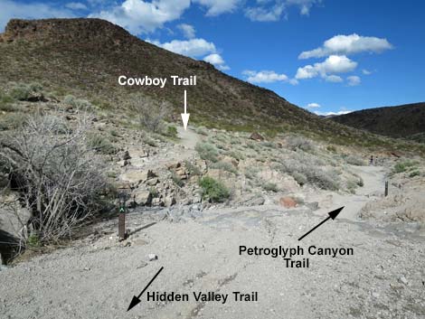
Cowboy Trail (BLM 200 Trail)
Hiking Around Las Vegas, Sloan Canyon NCA
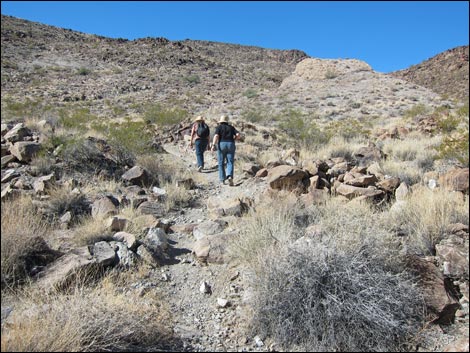
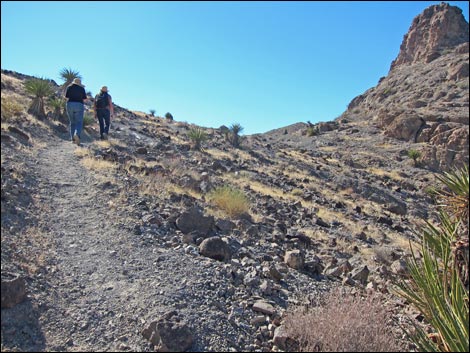
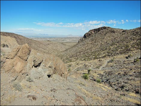
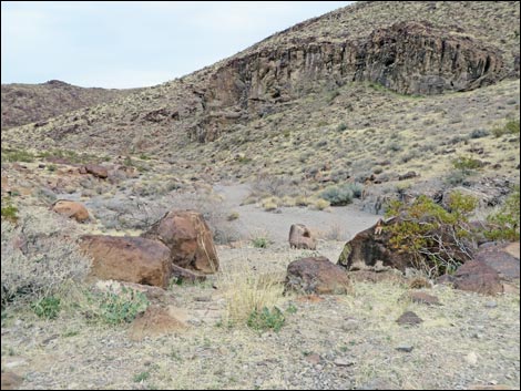
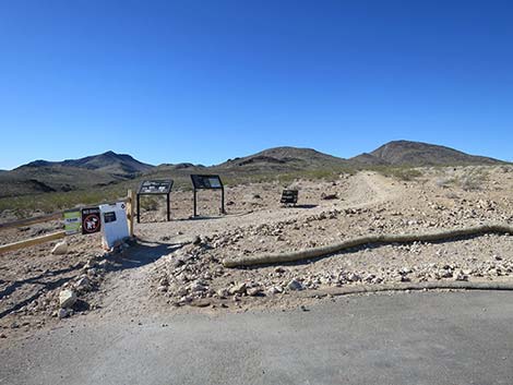 Start of Petroglyph Canyon Trail (view S) |
Note: Nawghaw Poa Road is closed during construction. Walk in from Democracy Drive. See Closure Notice (PDF). Overview The Cowboy Trail, also known as the BLM 200 Trail, is a 0.75-mile-long trail segment that neither starts nor ends at a trailhead. Rather, this trail is an alternative route that provides visitors on horseback, and others, a way to get to Petroglyph Canyon without the 3rd class rock scrambling required on the regular route. Hikers can also use the Cowboy Trail to make a partial loop for the Petroglyph Canyon hike or use it to access other areas deep inside the North McCullough Wilderness Area. Using the Cowboy Trail, hikers start at the Sloan Canyon Trailhead and walk 1.4 miles up Sloan Canyon Wash on the Petroglyph Trail. The Cowboy Trail then runs up a side canyon, climbs over a saddle, and drops back into Sloan Canyon at the upper end of the Petroglyph Trail, which is followed down into Petroglyph Canyon for a total of 2.5 miles (one way). Link to map. |
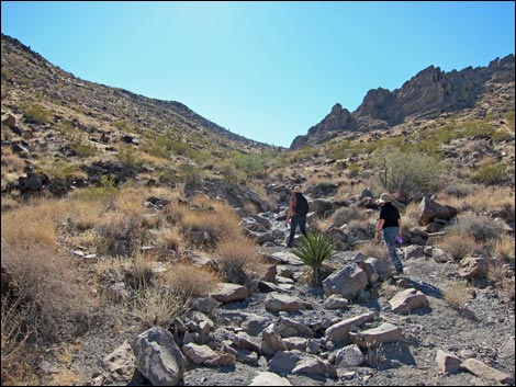
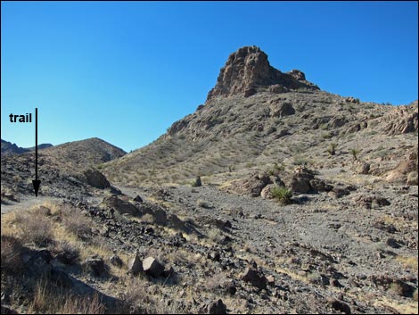
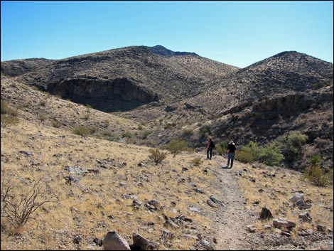
 Trail eventually runs up Sloan Wash (view S) |
Watch Out Other than the standard warnings about hiking in the desert, there are no particular dangers on this route, but climbing over the saddle is steeper than it looks, so take it easy and bring plenty of water. While hiking, please respect the land and the other people out there, and try to Leave No Trace of your passage. Also, this hike is fairly remote, so be sure to bring the 10 Essentials. Cell phones don't work back in the canyons. Bicycles are prohibited on this trail. This trail leads into a Wilderness area and to a site sacred to Native Americans, so pay particular attention to respecting the land. Don't touch petroglyphs because oils on your hands slowly damage the artwork. |
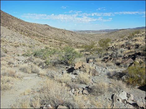
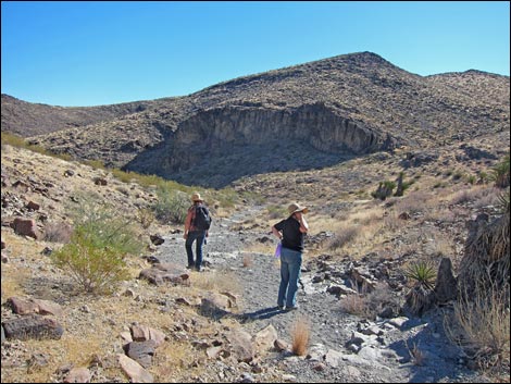
 Cowboy Trail departs Sloan Canyon Wash |
Getting to the Trailhead This hike is located in Sloan Canyon National Conservation Area on the north side of the North McCullough Wilderness Area. From town, drive south about 45 minutes to the Sloan Canyon Trailhead. Note that from the trailhead, it takes 1.4 miles of walking up Sloan Canyon Wash to get to the start of the Cowboy Trail. |
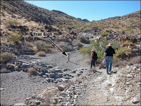
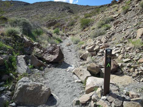 Cowboy Trail junction sign (view W) |
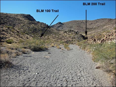
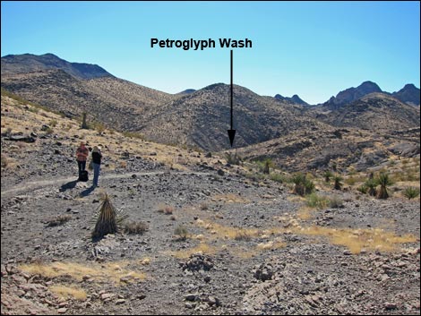
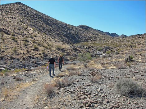
The Hike From the trailhead (Table 1, Waypoint 01), the Petroglyph Trail runs south out the end of the parking area. Climbing the gentle ridgeline, the trail eventually turns and switchbacks down into Sloan Canyon Wash. After about 1.3 miles, the Petroglyph Trail arrives at a trail intersection and the start of the Cowboy Trail (Wpt. 06), on the right. For details of this part of the hike, see the Petroglyph Trail. At this point (Wpt. 06), a side wash on the right merges with Sloan Canyon Wash. The confluence is marked with a trail sign indicating that the Cowboy Trail (BLM 200) turns right, out of Sloan Canyon Wash, and runs up the side canyon. |
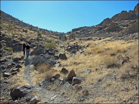
 Trail follows this side wash to the saddle (view SW) |
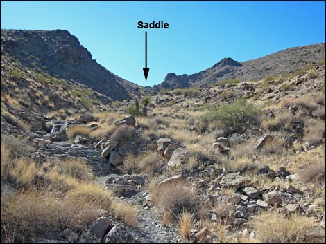
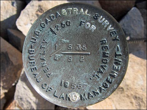
The Cowboy Trail follows the bottom of the rocky wash for about 0.24 miles until a built trail (Wpt. 11). Following the built trail, hikers climb onto the east-facing (right) hillside above the wash, but eventually return to and cross the wash to switchback up the northwest-facing (left) slope. The trail eventually climbs onto a saddle (Wpt. 12) with nice views north across the Las Vegas Valley and south to the higher peaks in the Wilderness area. There is also a USGS Benchmark on the saddle that dates from 1956. Crossing over the saddle, the trail runs down the south-facing hillside, then follows a minor wash. Eventually, this minor wash runs downhill into a major wash (Wpt. 08), which is Sloan Canyon Wash. |
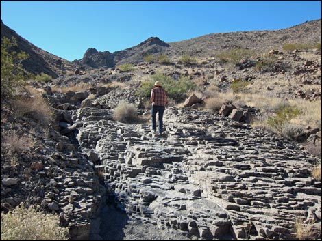 Trail runs over interesting geology (view SW) |
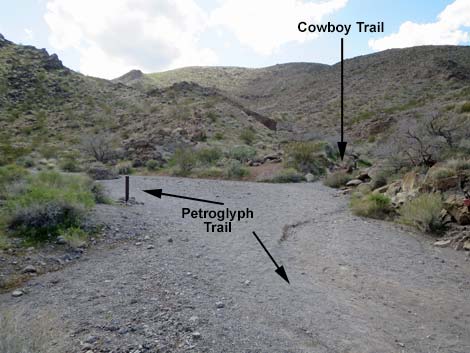
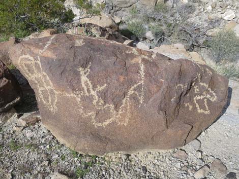
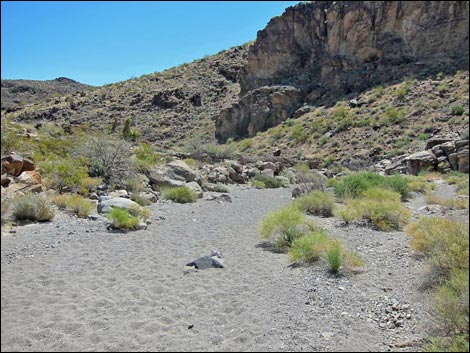
The Cowboy Trail ends here. However, this is no place to stop, so following the Petroglyph Trail down Sloan Canyon Wash, keep an eye out for petroglyphs along the wash. The route passes a confluence (Wpt. 09) with a major wash on the right and continues downstream. Shortly beyond the confluence, Sloan Canyon Wash bends to the left and opens into the long, straight canyon. The middle and north ends of this canyon are Petroglyph Canyon. Here, petroglyphs cover the cliffs and boulders along the wash and on the hillsides. Enjoy the petroglyphs, but please help protect the area and report vandalism. [more petroglyph photos]. Return to the trailhead by retracing your footprints in the wash [photos] or slide down the pour-overs following the Petroglyph Trail (the Regular Route. |
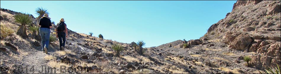
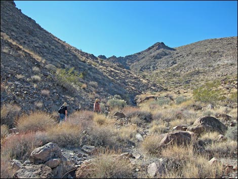 Hikers on Cowboy Trail (view SW) |
 Built trail departs the wash (view SW) |
 Climbing towards the saddle |
 Pausing to look back over Henderson (view NE) |
 Crossing the wash to the NW-facing slope (view S) |
 Hikers nearing the saddle, the highpoint on the trail (view SW) |
 Arriving on the saddle (view SW) |
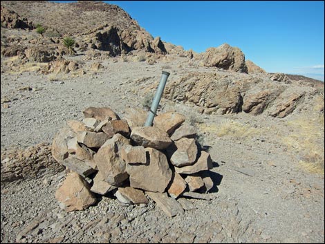 USGS Benchmark on saddle (now missing) |
 USGS Benchmark on saddle (now missing) |
 Saddle (looking back towards Las Vegas; notice switchbacks) |
 Starting over the saddle |
 Trail descends over the saddle (view S) |
 Trail follows wash (view S) |
 On trail, looking left down Sloan Canyon from hillside (view SE) |
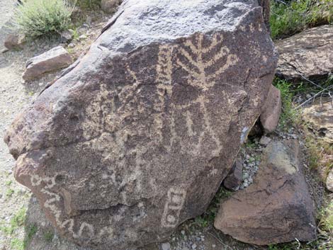 Petroglyphs |
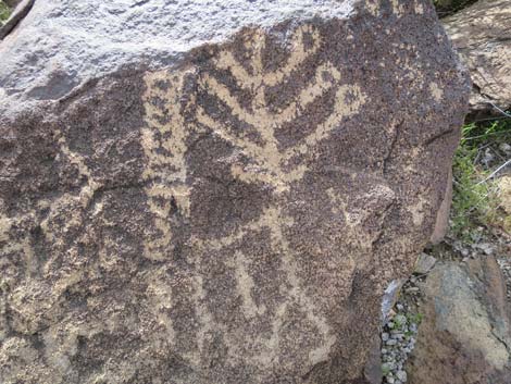 Petroglyphs |
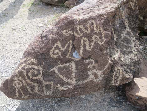 Petroglyphs |
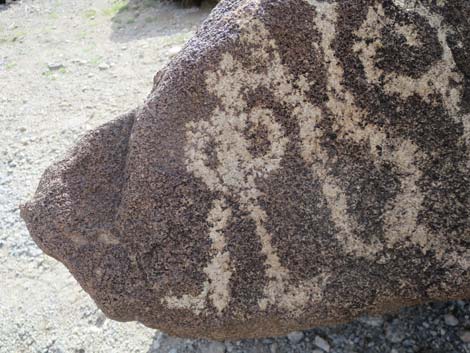 Petroglyphs |
 Petroglyphs |
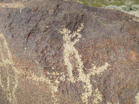 Petroglyphs |
 Trail approaching Sloan Wash (view SW) |
 Arriving back in Sloan Wash (view SW) |
 Trail sign in Sloan Wash (view N) |
 Scattered petroglyphs along wash [more petroglyph photos] |
 Petroglyph Trail runs down Sloan Wash (view E) |
 Petroglyph Trail (view N into petroglyph gallery) |
Table 1. Hiking Coordinates and Distances based on GPS Data (NAD27; UTM Zone 11S). Download Hiking GPS Waypoints (*.gpx) file.
| Wpt. | Location | UTM Easting | UTM Northing | Elevation (ft) | Point-to-Point Distance (mi) | Cumulative Distance (mi) |
|---|---|---|---|---|---|---|
| 01 | Petroglyph Trailhead | 669171 | 3976082 | 2,954 | 0.00 | 0.00 |
| 06 | BLM100 Trail at BLM200 Trail | 669282 | 3974452 | 2,990 | 1.14 | 1.37 |
| 13 | Built Trail Leaves Wash | 669066 | 3974245 | 3,105 | 0.24 | 1.61 |
| 12 | Saddle | 669019 | 3973890 | 3,306 | 0.31 | 1.92 |
| 11 | BLM100-BLM200-BLM300 Trail Junction | 669059 | 3973636 | 3,225 | 0.20 | 2.12 |
| 10 | Washes Merge | 669401 | 3973765 | 3,169 | 0.28 | 2.40 |
| 09 | Petroglyph Gallery | 669398 | 3973973 | 3,162 | 0.06 | 2.46 |
Happy Hiking! All distances, elevations, and other facts are approximate.
![]() ; Last updated 240330
; Last updated 240330
| Hiking Around Las Vegas | Hiking Around Wilderness Areas | Glossary | Copyright, Conditions, Disclaimer | Home |