Petroglyph Canyon Trail (BLM 100 Trail)
Hiking Around Las Vegas, Sloan Canyon NCA
Note: Nawghaw Poa Road is closed during construction of the new Visitor Center. The new trailhead is Democracy Drive. See Closure Notice (PDF).
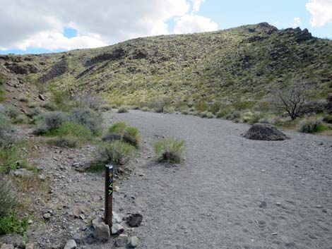
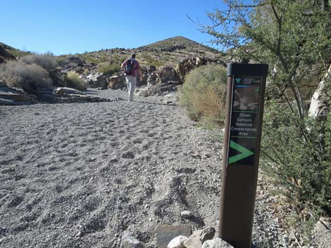
 Petroglyph Canyon Trailhead at Democracy Drive (view S) |
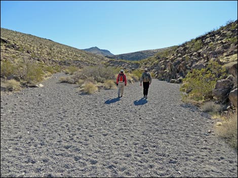
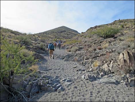
Overview Petroglyph Canyon Trail (BLM 100) starts at the Sloan Canyon Trailhead (which is now along Democracy Drive) and runs south into the North McCullough Wilderness Area. The trail follows Sloan Canyon Wash for about 2.3 miles to Petroglyph Canyon. The in-and-out hiking distance is 4.7 miles, but hikers might want to do a 5.3-mile variation that makes a partial loop. Most of the hike is easy walking, but there are scramble-ups at pour-overs just below Petroglyph Canyon, one of which is minimal 3rd-class. However, the Cowboy Trail (BLM 200) can be used to bypass the pour-overs, and it can be used to make the hike into a partial loop. Petroglyph Canyon is a special place. For the ancient people who wrote on the stones, this probably was a spiritual site as there are no signs of habitation. For the rest of us, this is a glimpse into the lives of those who once lived here. Please respect the spirituality and history here. Take photographs, leave footprints, don't touch the petroglyphs, and please stay in the wash rather than climbing onto the hillside in the petroglyph gallery. Petroglyph Canyon is closed to pets and bicycles. Link to map. |
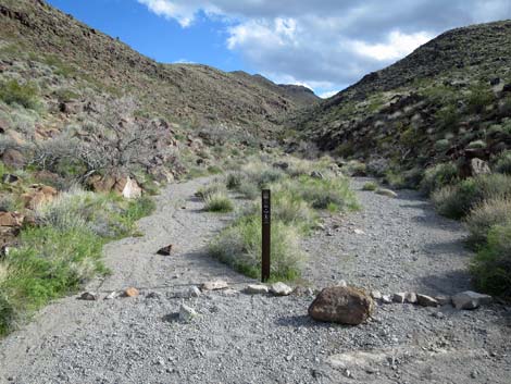
 Start of Petroglyph Canyon Trail (view S) |
Watch Out Other than the standard warnings about hiking in the desert, there are no particular dangers on this route. There are several pour-overs, one of which is a non-trivial (3rd-class) water-polished 10-footer. It isn't hard if you are willing to climb on the exposed corner, and if you slip from there, you'll land in the sandy wash. While hiking, please respect the land and the other people out there, and try to Leave No Trace of your passage. This hike is fairly remote, so be sure to bring the 10 Essentials. Cell phones don't work back in the canyons. Bicycles and dogs are prohibited on this trail. This trail leads into the North McCullough Wilderness Area to a site sacred to Native Americans, so pay particular attention to respecting the land. Don't touch petroglyphs because oils on your hands slowly damage the artwork, and please stay in the bottom of the sandy wash because hikers scrambling around on the hillside are causing serious erosion. We don't want to see fencing keeping us in the bottom of the wash, so please show some self-restraint in the petroglyph gallery. |
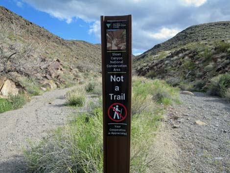
 Lots of signs in this area (view S) |
Getting to the Trailhead This hike is located in the Sloan Canyon National Conservation Area, on the north side of the North McCullough Wilderness Area. From town, drive south about 30 minutes to the Sloan Canyon Trailhead. The access roads (Via Firenze, Democracy, and Nawghaw Poa) are all paved. Democracy is now paved and connects to Las Vegas Blvd, which provides the easiest access to Sloan Canyon Trailhead.
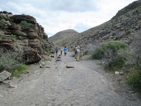
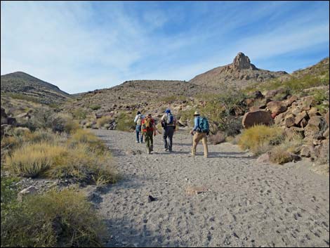
The Hike From the trailhead along the south side of Democracy Drive (Table 1, Waypoint 01), the trail runs south on the paved bike-trail that parallels Nawghaw Poa Road, which is open only to construction traffic. |
 Sign: Petroglyph Trail and Sloan 101 Trail this way (view S) |
Climbing at a gentle grade, the trail runs up the open bajada where Creosote Bush and White Bursage dominate the landscape, and dried Devil's Spineflower are scattered among the shrubs. This is a classic example of Creosote-Bursage Flats habitat type that covers vast areas of low-desert lands in southern Nevada. During spring, this area can be covered with desert wildflowers. After 0.45 miles on the paved bike-trail, the Petroglyph Trail hits a barricade (Wpt. 02) and bends left into the desert on a wide, dusty trail. In this area, hikers can enjoy grand views north across the Las Vegas Valley and south into the North McCullough Wilderness Area. Before long, hikers reach a trail junction (Wpt. 02b) where the BLM 101 Trail forks left to head east. To the right, the trail that used to run up the hillside to the Visitor Center is closed. At this point, the trail officially enters Sloan Canyon National Conservation Area, although there are no signs. |
 Signs |
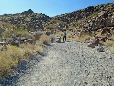
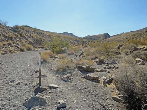
Just ahead, the Petroglyph Trail runs onto a fenced gravel pad where a shipping container sits on the right. The Petroglyph Trail runs across the gravel and back onto the dirt, continues southeast, and drops into Sloan Wash. Here, the trail turns right to head upstream. Hiking up the wash, the trail eventually encounters a wooden fence (Wpt. 03) with a gap that allows hikers to pass through. On the right, hikers will see a area-closed sign blocking a trail with stone stairs that run up the side of the wash. This trail runs back to the Visitor Center, which is closed. Continuing up Sloan Wash, the canyon narrows as the trail winds through a jumble of boulders that partially block the wash. At the far end of the narrow section (more info signs), the trail enters the North McCullough Wilderness Area, which is marked with a sign. The dark cliffs on the sides of the canyon in this area are good places to look for Common Chuckwalla. Watch for a triangular head sticking up from behind the rocks. Keep an eye out for Great Basin Collared Lizards and Side-blotched Lizards along the wash too. |
 Signs |
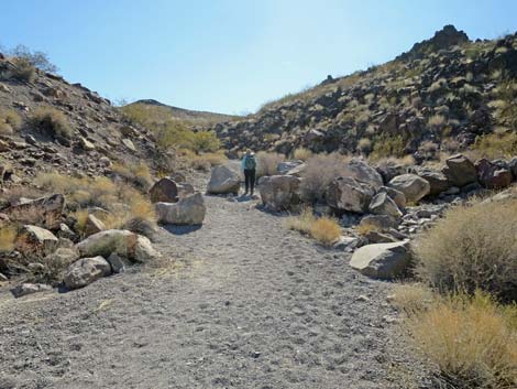
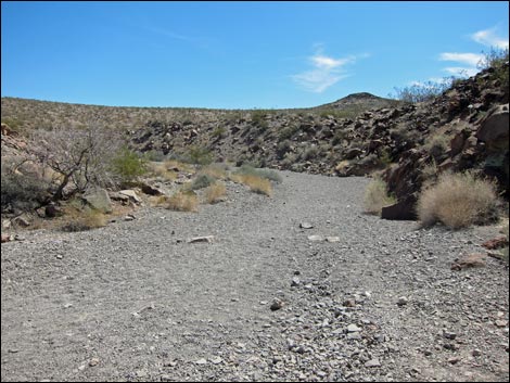
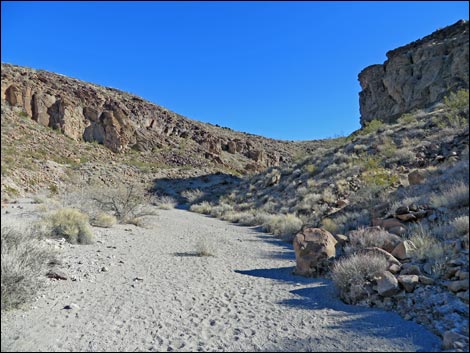
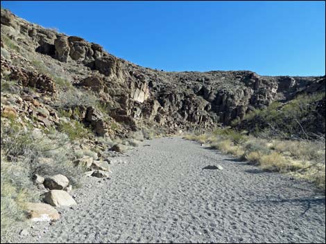
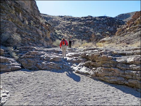
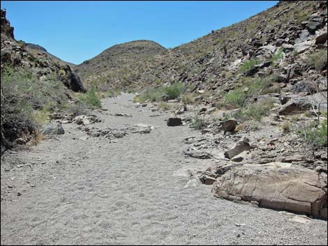
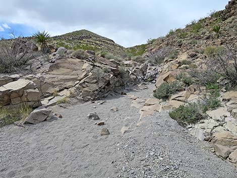
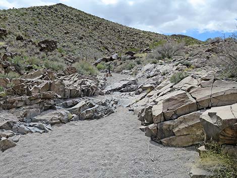
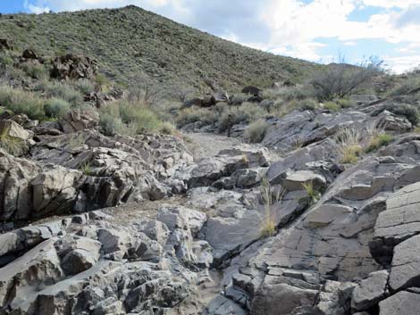
Beyond the wilderness sign, the canyon widens, the sides lay back, and the trail continues south in Sloan Wash. Because of differences in soils and moisture availability, the vegetation on the hillsides contrasts strongly with that in the wash. On the hillsides, which are dry and rocky, the shrubby vegetation is dominated by creosote bush, white bursage, a few Mojave yucca, and little else. In the wash, the shrubby vegetation is fairly robust and diverse, with lots of creosote bush, desert almond, white bursage, and a fair amount of matchweed, bladder sage, Mormon tea, catclaw acacia, various buckwheats, desert globemallow, and bunchgrasses. This more diverse vegetation is typical of the Mojave Desert Scrub habitat type, which becomes more obvious at slightly higher elevations up the canyon. Eventually the canyon begins to narrow (Wpt. 05), giving the feeling of hiking in a canyon rather than in an open wash. Below here, the sides of the wash are gentle and rock strewn; above here, the hillsides are steeper with rocky outcrops. |
 Petroglyph Trail follows bike-trail parallel to Nawghaw Poa Rd (view S) |
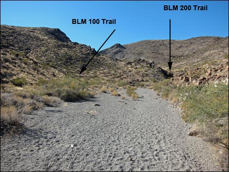
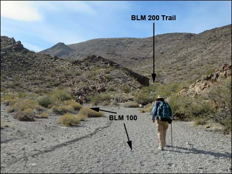
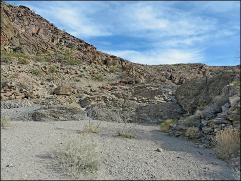
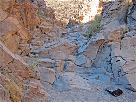
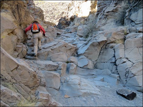
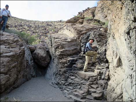
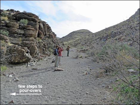
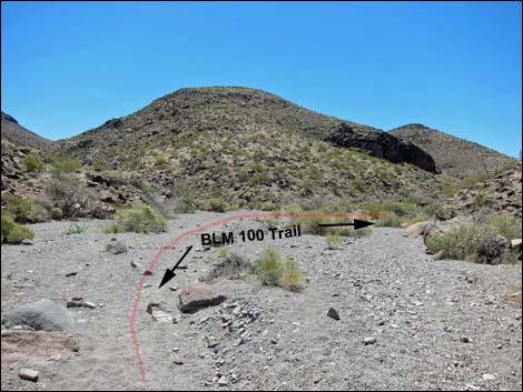
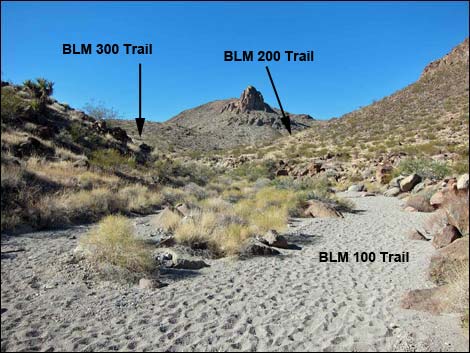
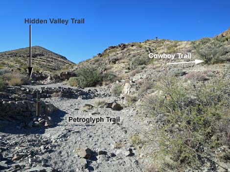
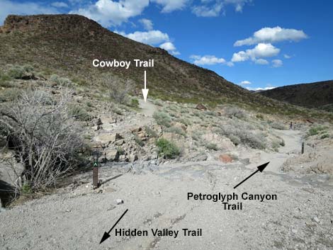
In this area, watch the edges of the wash for good examples of volcanic landslide materials. These are now conglomerate rocks that look like rocks and boulders of various sizes mixed in a reddish-brown matrix. These cliffs formed when volcanic ash and boulders rolled down the hillside as lava was pushing to the surface. As the rocks cooled, the material solidified, creating the rock that we see today. At a sharp bend to the left in Sloan Wash, a trail sign marks the BLM 100-BLM 200 trail junction (Wpt. 06). The Petroglyph Canyon Trail (BLM 100) continues left following the broad, sandy Sloan Wash to the south, while the Cowboy Trail (BLM 200) turns right and heads up the narrow side canyon to the west. The Cowboy Trail does not require any scrambling and is suitable for horses, but it is about 3/4-miles farther to the petroglyph gallery. Continuing up Sloan Wash, hikers soon encounter the first pour-over (Wpt. 07). This pour-over is easily passed using a use-trail on the east edge of the wash or by just clambering up the rocks (be careful on the slick, sand-covered rocks). |
 Petroglyph Trail passed water storage tanks (view S) |
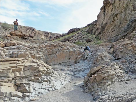
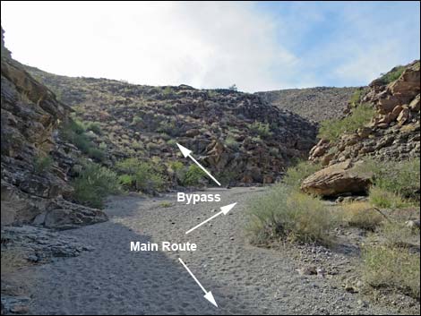
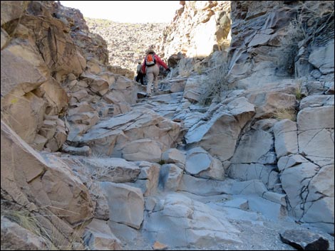
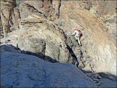
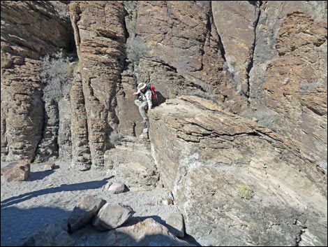
The rocks of this pour-over are interesting; they are the outer edge of the core of a small, extinct volcano. Note that the rocks appear to be layered, and that the layers are inclined nearly vertically. This layering occurs when magma is moving, and the inclined layers indicate vertical movement. Above here, the canyon walls get vertical, but not too high. Watch for bird nests in the Catclaw Acacia in the wash and petroglyphs on the rock walls, but also notice that the rock layers are now horizontal. Horizontal layering indicates horizontal movement of magma -- evidence that this was the top of the volcano, and that the magma was spreading sideways. In fact, at this point, hikers are standing inside the core of the old volcano. About 0.2 miles above the first pour-over, the canyon jogs to the right (west) and narrows abruptly. The narrows contain more pour-overs, and hikers wishing to avoid them can do so by exiting the canyon to the left (south) at the last possible moment and hiking up and over the ridge. Be sure to angle southwest and back into Sloan Wash. |
 Petroglyph Trail runs parallel to Nawghaw Poa Rd (view S) |
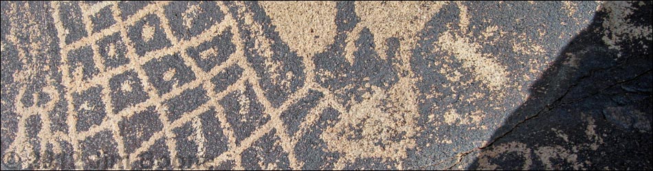
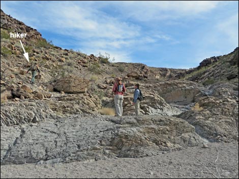
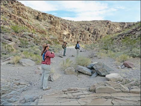
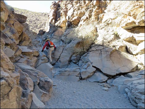
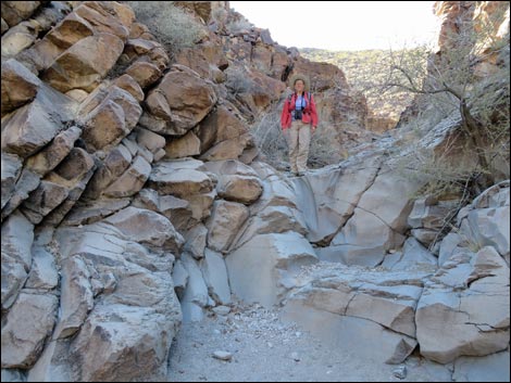
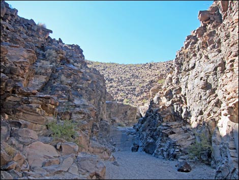
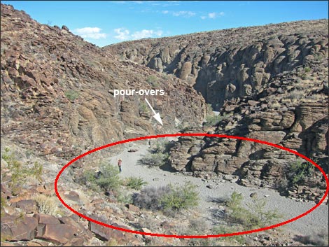
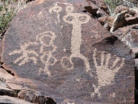
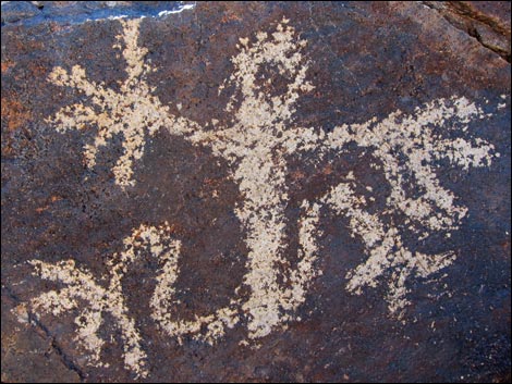
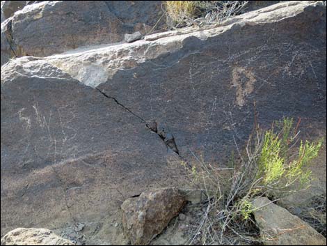
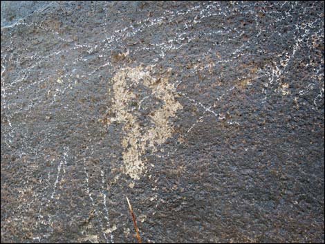
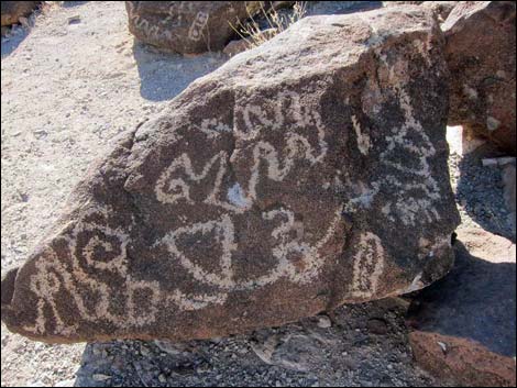
In the narrows (Wpt. 08), there are three short, water-polished scramble-ups followed by a 10-foot pour-over where the canyon is blocked by a large boulder. In all cases, the rock is smooth and slippery. The last pour-over is fairly easy to climb on the left side of the wash (minimal 3rd-class) or on the right side of the wash with a bit more exposure (still minimal 3rd-class). It is hard for the untrained eye to see, but in the narrows, hikers exit the core of one extinct volcano and enter another! Just above the 10-foot pour-over, the canyon jogs left (south) and widens considerably. This straight section of wash is Petroglyph Canyon (Wpt. 09). Amazing petroglyphs decorate both sides of the canyon here, and in some places, almost every boulder is marked. See many photos posted here. Please respect the history of this area and don't touch, mark, or otherwise mess with the petroglyphs. Report vandalism to the BLM or just call 911. |
 Petroglyph Trail approaching fencing (view S) |
For the return, hikers can either hike back down Sloan Wash or make a partial loop by continuing up Sloan Wash and using the Cowboy Trail (BLM 200) to loop back to the trailhead. For hikers intending to use the Cowboy Trail to make a partial loop, the Petroglyph Trail continues past the petroglyph gallery (Table 2, Wpt 09) following Sloan Wash south. Shortly, Sloan Wash arrives at a large side wash coming in from the left (Wpt 10). This side wash makes for an interesting hike, but the Petroglyph Trail stays right following the main wash. Staying in Sloan Wash, notice boulders along both sides with interesting petroglyphs. In addition, notice the cliffs that tower above the wash on the south side. Trace the layering in the cliffs and figure out what was going on here (yes, another extinct volcano). |
 Petroglyph Trail at fencing barricade (view S) |
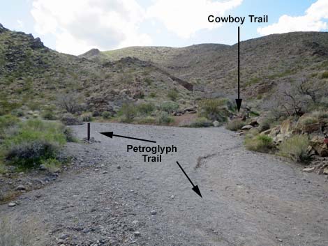
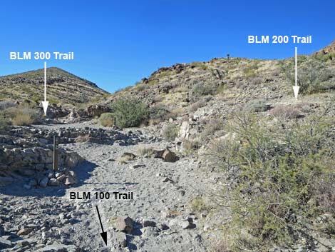
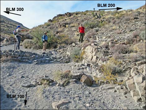
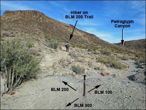
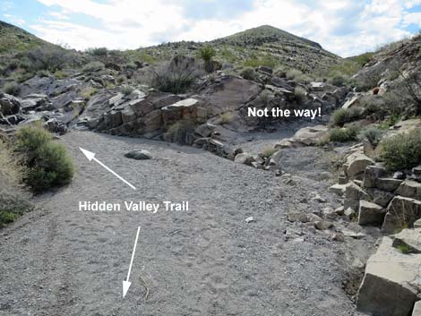
In about 0.3 miles past the main petroglyph gallery, hikers encounter another trail sign in the middle of the wash (Wpt. 11). At this point, the Petroglyph Trail (BLM 100) ends. The Hidden Valley Trail (BLM 300) continues southwest and up the main wash, and the Cowboy Trail (BLM 200) makes a hard right turn, exits the wash, and starts up across the hillside angling back down the canyon. It is important to pay attention here because this trail junction has been the source of confusion for several hiking parties, some of whom barely made it out alive. When hiking up Sloan Canyon, if you intend to hike back on the Cowboy Trail, DO NOT PASS THE TRAIL SIGN. Instead, from the trail sign, immediately turn right and climb out of the wash heading northeast. The trail is plainly visible when looking in this direction. For details of the Cowboy Trail (BLM 200), see the description of the hike heading southbound, but for hikers returning over this trail, see the photos and brief description of hiking northbound back towards the trailhead. Heading back, the next Waypoint is #12, which sits atop a saddle to the north of the trail junction. |
 Fencing barricade with more signs (view S) |
 Sign: trail go left |
 Trail departs the bike trail onto dirt (view SE) |
 Trail starting onto dirt (view SE) |
 Trail passes through gap in the roadside fencing (view SE) |
 Lots of trail signs (view S) |
 Petroglyph Trail continues across gentle terrain (view S) |
 Petroglyph Trail approaching trail junctions (view S) |
Intersection: Sloan 101 Trail Departs Petroglyph Canyon Trail. People with dogs must turn left onto the BLM 101 Trail or turn back.
 Trail up to the visitor center is closed (view W) |
 Trash can adjacent to closed Visitor Center trail (view W) |
 Sloan 101 Trail departs Petroglyph Trail (view SE) |
 Sloan 101 Trail departs Petroglyph Trail (view SE) |
 Sign: Sloan 101 Trail turns left (view S) |
 Sloan 101 Trail departs Petroglyph Trail (view SE) |
Continuing on Temporary Petroglyph Trail (BLM 100 Trail)
 Petroglyph Trail continues past Sloan 101 Trail (view SE) |
 Petroglyph Trail continues past construction shed (view SE) |
 Petroglyph Trail with more signs (view SE) |
 Petroglyph Trail with another signs (view SE) |
 Petroglyph Trail approaching Sloan Wash (view SE) |
 Petroglyph Trail turns up Sloan Wash (view S) |
 Petroglyph Trail follows Sloan Wash all the way (view S) |
 Petroglyph Trail approaching a trail-use counter (view S) |
 Trail-use counter on backside of fence post (view SE) |
 Petroglyph Trail follows Sloan Wash (view S) |
 Petroglyph Trail follows Sloan Wash (view S) |
 Petroglyph Trail follows Sloan Wash (view S) |
 Petroglyph Trail follows Sloan Wash (view S) |
 Petroglyph Trail follows Sloan Wash (view S) |
 Petroglyph Trail approaching a fence across the wash (view S) |
 Petroglyph Trail runs through a gap in the fence (view S) |
 Past the fence to the right, the original trail is closed (view NW) |
 Temporary trail joins with original Petroglyph trail (view S) |
Continuing on the Original Petroglyph Trail
 Hiker heading up Sloan Wash (view S) |
 A narrow section of Sloan Wash (former end of old road; view S) |
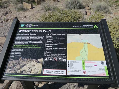 Information sign: Wilderness is Wild |
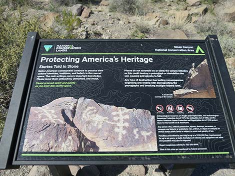 Information sign: Protecting America's Heritage |
 Trail continues up the Sloan Wash (view S) |
 Trail approaching wilderness area boundary sign (view SE) |
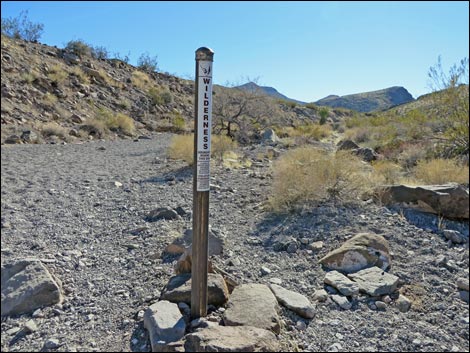 Entering North McCullough Wilderness Area (view S) |
 Trail follows the wash (view SW) |
 Approaching the BLM 100 -- BLM 200 trail junction (view SW) |
 Approaching the BLM 100 -- BLM 200 trail junction (view SW) |
 Approaching Petroglyph-Cowboy trail junction (view SW) |
 Petroglyph Trail stays left at the junction (view SW) |
 Continuing past trail junction (view S) |
 Nearing the first pour-over (view S) |
 First pour-over (note hiker on bypass; view S) |
 First pour-over (note hiker climbing pour-over; view S) |
 Hikers just above first pour-over (view S) |
 Continuing up the wash (view S) |
 Petroglyphs high on the canyon wall (view SE) |
 Hiker on low pour-over (just a step-up; view SW) |
 Last possible exit before the narrows with pour-overs (view S) |
 Narrow canyon with pour-overs can be bypassed left (view SW) |
 Approaching the pour-overs (view W) |
 Hiker on first pour-over in the narrows (view W) |
 Hiker atop first pour-over in the narrows (view W) |
 Second pour-over in the narrows (view W) |
 Hiker halfway up second pour-over in the narrows (view W) |
 Hiker atop second pour-over in the narrows (view W) |
 Narrow canyon (view W) |
 Third pour-over in the narrows (view W) |
 Hiker on third pour-over in the narrows (view W) |
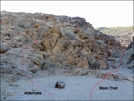
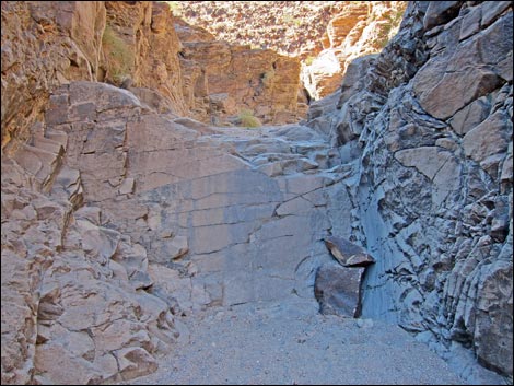
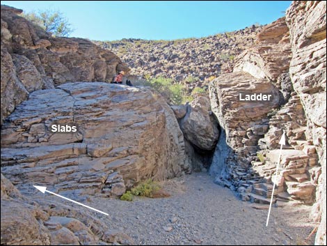 The big one: the 10-foot-high, fourth pour-over (view W) |
 Hiker on left edge (harder side) of slabs bypass (view W) |
 Hiker on right edge (easier side) of slabs bypass (view W) |
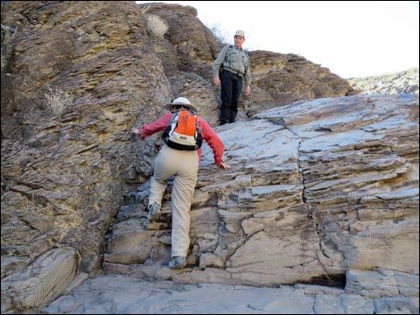
 Hiker on stone ladder bypass (view NW) |
 Hiker on stone ladder bypass (view NW) |
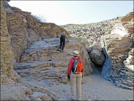
 Hiker dropping off the stone ladder bypass (view NW) |
 Hikers arriving in the petroglyph gallery (view S) Hikers arriving in the petroglyph gallery (view S) |
 Hikers in the petroglyph gallery (view S) |
 Sloan Canyon Petroglyph Gallery: both sides of the wash are marked |
 One of many petroglyph-marked boulders [more photos] |
 One of many wild petroglyphs [more photos] |
 Don't be the idiot that vandalizes petroglyphs |
 Defacing petroglyphs is a crime - don't do this! |
Petroglyph Trail (BLM 100) Trail continues up Sloan Wash past the Petroglyph gallery
 Upper Petroglyph Trail continues through Petroglyph gallery |
 Main wash bends to the right (view SW) |
 This side canyon is not the Petroglyph Trail (view S) |
 This side canyon is not the Petroglyph Trail (view S) |
 Hikers in Upper Sloan Wash (view W) |
 Upper BLM 100 Trail continues up Sloan Wash (view W) |
 Hikers in Upper Sloan Wash (view W) |
 Petroglyphs in Upper Sloan Wash |
 Approaching 3-way trail junction (view SW) |
 Petroglyph Trail ends at trail junction (view SW) |
 Trail marker in Sloan Wash (view W) |
 Intersection of three trails (view N) |
 Hikers turning onto Cowboy Trail |
 Hikers on Cowboy Trail |
 Beyond the trail junction, Hidden Valley Trail stays left (view W) |
 Lots of footprints, but not the way! |
 Beyond the trail junction, Hidden Valley Trail stays left (view W) |
 Beyond the trail junction, Hidden Valley Trail stays left (view W) |
Table 1. Hiking Coordinates and Distances based on GPS Data (NAD27; UTM Zone 11S). Download Hiking GPS Waypoints (gpx) file.
| Wpt. | Location | UTM Easting | UTM Northing | Elevation (ft) | Point-to-Point Distance (mi) | Cumulative Distance (mi) |
|---|---|---|---|---|---|---|
| 01 | Petroglyph Canyon Trailhead | 669362 | 3977149 | 2,954 | 0.00 | 0.00 |
| 02 | Trail Joins Old Road | 669290 | 3976449 | 2,934 | 0.45 | 0.45 |
| 02b | Trail Junction | 669335 | 3976147 | 2,829 | 0.20 | 0.65 |
| 03 | Trail Enters Sloan Wash | 669355 | 3975480 | 2,897 | 0.47 | 1.12 |
| 04 | Sloan Canyon First Narrows | 669331 | 3975256 | 2,921 | 0.16 | 1.28 |
| 05 | Canyon Narrows | 669327 | 3974673 | 2,995 | 0.42 | 1.70 |
| 06 | BLM100 at BLM200 | 669282 | 3974452 | 2,990 | 0.18 | 1.88 |
| 07 | First Pour-Overs | 669437 | 3974282 | 3,043 | 0.15 | 2.03 |
| 08 | Canyon Narrows | 669457 | 3974023 | 3,086 | 0.24 | 2.27 |
| 09 | Petroglyph Gallery | 669398 | 3973973 | 3,162 | 0.06 | 2.33 |
| 01 | Petroglyph Canyon Trailhead | 669362 | 3977149 | 2,954 | 2.33 | 4.66 |
Table 2. Hiking Coordinates and Distances based on GPS Data (NAD27; UTM Zone 11S) for continuing up Sloan Wash and making a partial loop back to the trailhead using the Cowboy Trail. Download Hiking GPS Waypoints (gpx) file.
| Wpt. | Location | UTM Easting | UTM Northing | Elevation (ft) | Point-to-Point Distance (mi) | Cumulative Distance (mi) |
|---|---|---|---|---|---|---|
| 09 | Petroglyph Gallery | 669398 | 3973973 | 3,162 | 0.00 | 2.33 |
| 10 | Washes Merge | 669401 | 3973765 | 3,169 | 0.14 | 2.47 |
| 11 | BLM100-BLM200-BLM300 Trail Junction | 669059 | 3973636 | 3,225 | 0.28 | 2.75 |
| 12 | Saddle | 669019 | 3973890 | 3,306 | 0.19 | 2.94 |
| 13 | Built Trail Leaves Wash | 669066 | 3974245 | 3,105 | 0.30 | 3.24 |
| 06 | BLM100 at BLM200 | 669282 | 3974452 | 2,990 | 0.23 | 3.47 |
| 05 | Canyon Narrows | 669327 | 3974673 | 2,995 | 0.18 | 3.65 |
| 04 | Sloan Canyon First Narrows | 669331 | 3975256 | 2,921 | 0.42 | 4.07 |
| 03 | Fence | 669355 | 3975480 | 2,897 | 0.15 | 4.22 |
| 02b | Trail Junction | 669335 | 3976147 | 2,829 | 0.47 | 4.69 |
| 02 | Trail Joins Old Road | 669290 | 3976449 | 2,934 | 0.20 | 4.89 |
| 01 | Petroglyph Canyon TH | 669362 | 3977149 | 2,954 | 0.45 | 5.34 |
Happy Hiking! All distances, elevations, and other facts are approximate.
![]() ; Last updated 250108
; Last updated 250108
| Hiking Around Las Vegas | Hiking Around Wilderness Areas | Glossary | Copyright, Conditions, Disclaimer | Home |