Backroads Around Las Vegas, Basin and Range
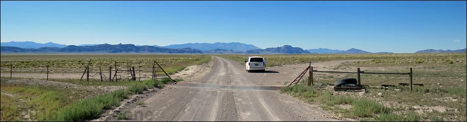
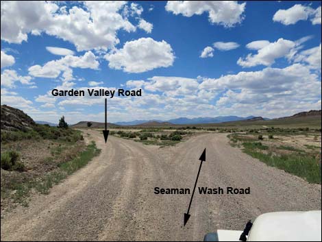
 Highway 318 at Seaman Wash Road (view NW) |
Overview For visitors from Las Vegas, a nice full-day driving tour of Basin and Range National Monument links three major roads, normally suitable for 2WD vehicles, to make an 81-mile dirt road loop. The tour route runs through grand scenery and wide-open spaces, passes working ranch operations, and provides a glimpse into Michael Heizer's City, which is not yet open to the public. In total, this makes for a long, 320-mile day from town. After driving north through Hiko, Seaman Wash Road departs Highway 318 running northwest over the Seaman Range and down into Coal Valley. Running northwest, the road cuts through a gap in the Golden Gate Range (Water Gap) into Garden Valley. Beginning to loop back south, Garden Valley Road runs out to connect with Mail Summit Road. Turning left, the road runs south across Garden Valley and Wild Horse Valley, through Murphy Gap back into Coal Valley, over the Seaman Range again, and back to Highway 318. Link to Area Map (use back-button to return here). |
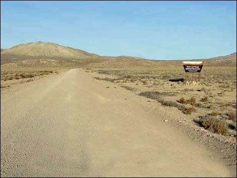 Basin and Range National Monument sign (view NW) |
Watch Out Other than the standard warnings about driving in the desert, ...this loop is pretty safe, but be sure that your vehicle is in good working condition, carry plenty of water (radiator and drinking), and pack a lunch. Always drive carefully; even though the road is well maintained, there are occasional hazards such as errant boulders and cows in the road. The roads here are good and empty, and nobody is expecting another vehicle on the road, so be careful to keep the speed down on corners and hilltops in case someone else is careening up the road -- you don't want to meet by accident on a blind corner. While out, please respect the land and the other people out there, and try to Leave No Trace of your passage. This road goes into remote areas, so be sure to bring the 10 Essentials. Cell phones don't work in most of the monument. |
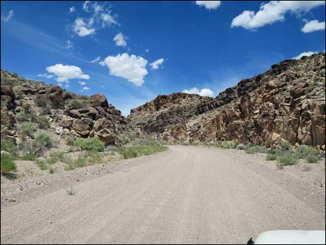 Entering Seaman Wash Narrows (view NW) |
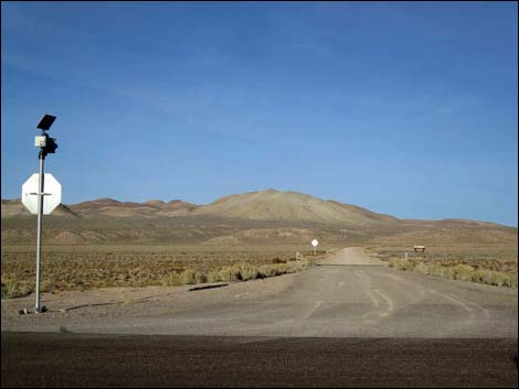
Getting to the Driving Tour This dirt-road portion of this loop starts on the southeast side of Basin and Range National Monument, about 2 hours (124 miles) northeast of Las Vegas driving directly, or about 15 minutes (17.4 miles) north of the intersection of Highway 93 and Highway 318. From Las Vegas, drive north on Interstate-15 21 miles to Highway 93. Turn left onto Great Basin Highway (Hwy 93) and top off the gas tank if necessary. Drive north past the towns of Alamo (95 miles from Las Vegas) and Ash Springs (102 miles) to the intersection of Highway 93 and Highway 318 (107 miles). Gasoline is available in Alamo and Ash Springs. Sandwiches, drinks, and snacks are also available in these towns. Turn left onto Highway 318 and drive west then north for 17.4 miles to Seaman Wash Road on the left. The intersection is marked by a stop sign with a solar-powered flashing red light, but no road signs. |
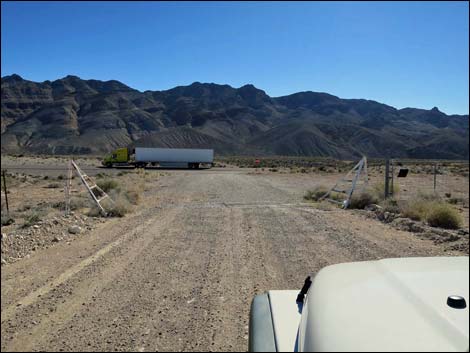
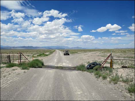 Cattle guard in the bottom of Coal Valley (view NW) |
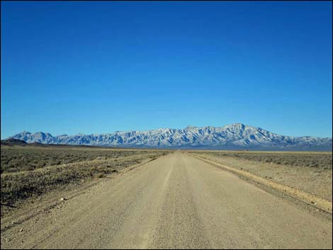
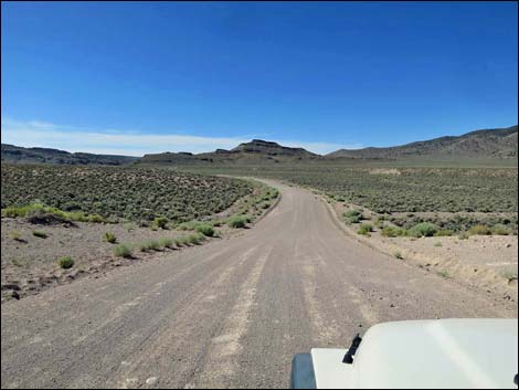
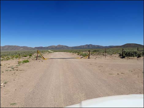
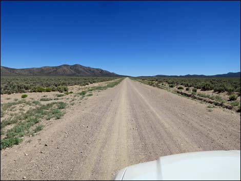
The Tour From the pavement, Seaman Wash Road passes the new National Monument sign and runs northwest across desert flats towards the Seaman Range. The road runs up along Seaman Wash, and at about 4 miles out, enters the sinuous Seaman Narrows. Beyond the narrows, the road continues to wind up the canyon. At about 7.7 miles out, the road crosses a broad ridge that seems like the highpoint. This area provides nice views, but the road continues across rolling country. At about 8.4 miles out, the road finally crosses a highpoint where it begins a gradual descent into Coal Valley, a grand, wide-open basin bordered by mountain ranges. The road runs more or less straight north-northwest into the endless distance. At about 15.5 miles out, in the bottom of Coal Valley, the road crosses a cattle guard where fencing stretches east and west as far as the eye can see. This is a good place to stop, get out of the car, stretch the legs, and bask in the full glory of the basin and range environment. |
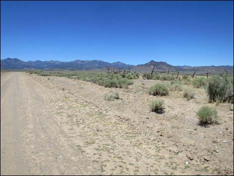
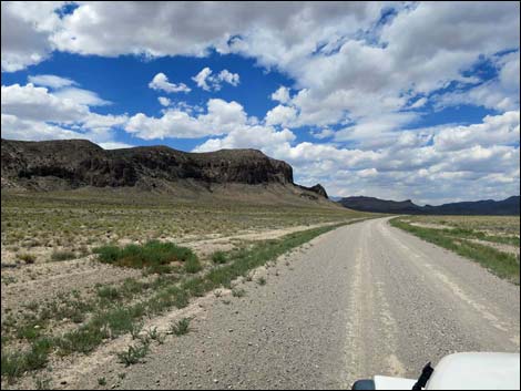 Running along the base of the Golden Gate Range (view NW) |
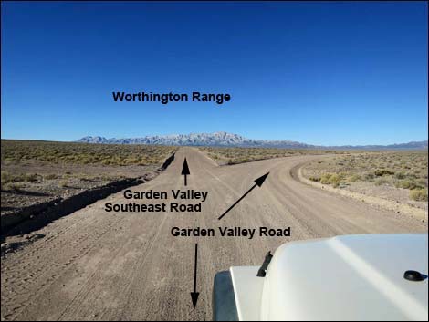
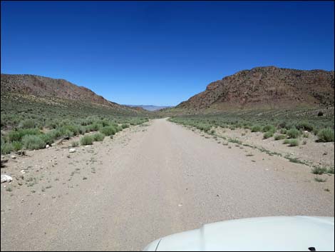
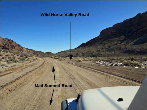
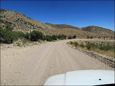
About 3 miles beyond the cattle guard, Seaman Wash Road passes Coal Valley Reservoir and Sheep Reservoir. When water is present, this is a good place to look for cows and wildlife coming in for water. The road slowly gets closer and closer to the Golden Gate Range, which borders the west side of Coal Valley. When the dark gray cliffs are close enough to touch, Seaman Wash Road rounds a corner and turns west into Water Gap (25.5 miles out). Water Gap is a break in the Golden Gate Range where storm waters flow from Garden Valley eastward into Coal Valley. Passing through Water Gap, Seaman Wash Road runs west for another mile to a fork. This fork presents a decision point for visitors. The tour route stays left at the fork, but some visitors may wish to stay right, then left, and hike up "lovers leap" where they can look down from the cliffs onto the lights of the city (well, at least look down on Michael Heizer's City). Other visitors may wish to stay right, then right again, and drive east on Timber Mountain Pass Road to exit the area back to Highway 318. |
 Turning into Water Gap (view NW) |
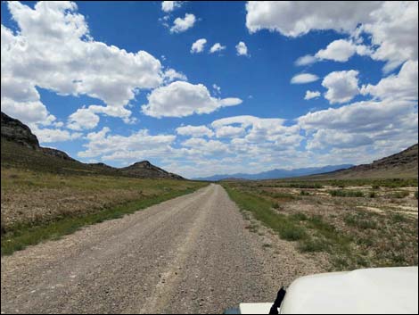
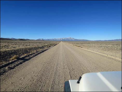
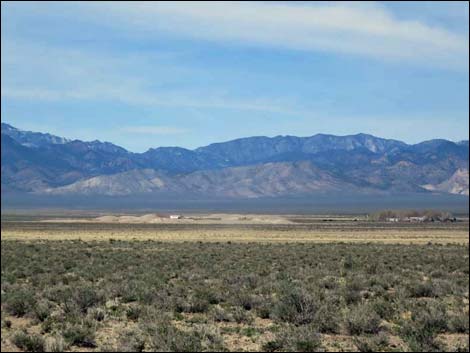
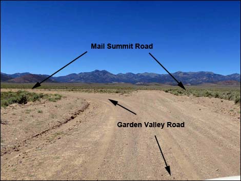
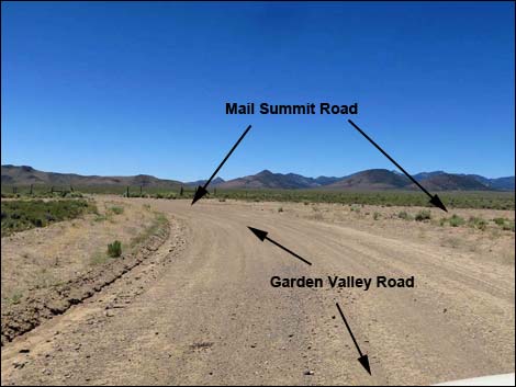
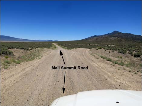
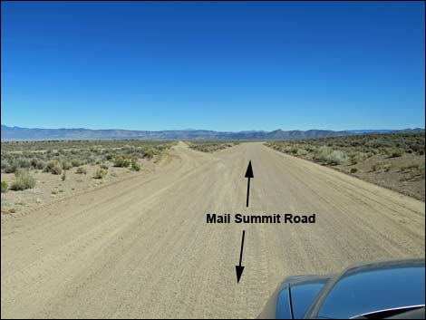
The route departs Seaman Wash Road at this point; reset the odometer to zero. Staying left at the fork to continue the tour route, Garden Valley Road runs southwest into Garden Valley. At about 3.0 miles out, a low ridge along the road provides a bit of a viewpoint from which visitors can look across some 1.7 miles of Great Basin Desert and see City in the distance. Be sure to bring binoculars. Continuing across Garden Valley, the road forks (4.7 miles out). Staying right, Garden Valley Road drops into the bottom of the valley, passes more reservoirs, and climbs gradual slopes westward towards the Quinn Canyon Range in the distance. At 13.5 miles out, the road forks at what is actually a triangular intersection with Mail Summit Road. The route departs Garden Valley Road at this point; reset the odometer to zero for the final time. |
 Water Gap (view W) |
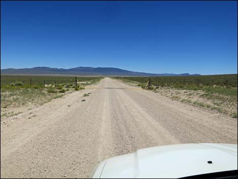
Staying left onto Mail Summit Road the tour route begins to head for home. Driving south on Mail Summit Road, there are many side roads, but Mail Summit Road is a main road and always is the "straight" choice. At 3.1 miles out, Garden Valley Road passes a major side road to the right. This road crosses the low pass between the Quinn Canyon Range and the Worthington Range, and it can be used to exit the area to the pavement (Highway 375) near the town of Rachel. Beyond that intersection, Mail Summit Road bends left to run southeast as it descends towards the bottom of Garden Valley. At 5.3 miles out, Mail Summit Road passes a side road to the left. This road connects with roads that can be used to drive back to Water Gap. A few yards farther, a minor road branches right. This old road climbs to an old mining area on the northeast flanks of Worthington Peak. |
 Fork in the road, tour stays left |
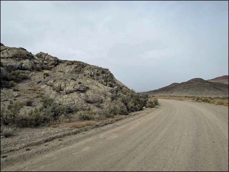
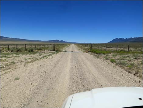
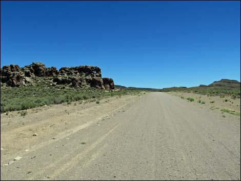
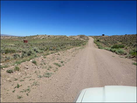
Continuing, Mail Summit Road runs straight, bends a bit to the right, bends a bit to the left, and eventually arrives at another road intersection (9.7 miles out). Here, the road left, Garden Valley Southeast Road, runs back to Water Gap, while the road right, Garden Valley West Road, runs southwest along the base of the Worthington Range and provides access to Leviathan Cave. Continuing southeast, the road begins a long, gradual climb out of the bottom of Garden Valley. At 13.7 miles out, the main road crosses a minor road. Here, to the right, Garden Valley South Road runs west to connect with Garden Valley West Road at the base of the Worthington Range. The left runs up into the mountains and ends at a spring in the Golden Gate Range. Farther along, the road passes a rocky outcrop of volcanic ash on the left, and just beyond, a parking area at 14.0 miles out. This is a nice place to stop, clamber around on the rocks, stretch the legs, and exercise the camera. |
Garden Valley Road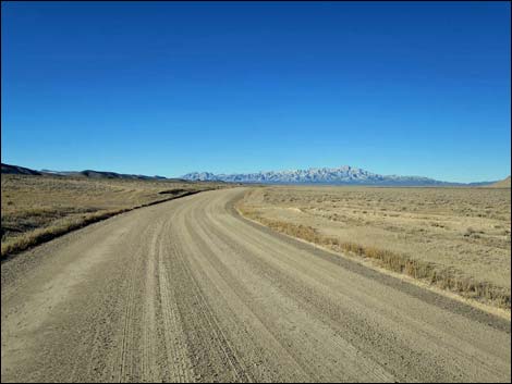 |
Continuing south, Mail Summit Road winds a bit among the hills as it climbs towards a low saddle. The road passes a Garden Valley sign (14.4 miles out), making a nice landmark, but unfortunately it isn't positioned well for a photo of Garden Valley. At about 17.3 miles out, the road runs over a low saddle, leaving Garden Valley and beginning the descent into Wild Horse Valley. As the road descends, it winds a bit, but it remains fast and wide until about 19.8 miles out where a bend to the left is sharper than one might expect. Now running northeast towards Murphy Gap, Mail Summit Road reaches a major side road to the right (20.5 miles out). Here, Wild Horse Valley Road runs south between the Mt. Irish Range on the left and the Timpahute Range on the right, eventually reaching the pavement at Highway 375. |
 |
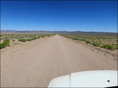
Mail Summit Road runs down through Murphy Gap (about 21 miles out), a gap between the Golden Gate Range on the left and the Mt. Irish Range on the right. Here, all water falling into the Wild Horse Valley drainage system eventually flows east into Coal Valley. The road passes a side road to the left that runs down to a well and water tanks on the left, then climbs steeply out of the wash and onto bench that is the edge of Coal Valley. At 21.8 miles out, the road forks. Mail Summit Road continues straight, while the left, Coal Valley West Road, runs north through Coal Valley, mostly staying along the base of the Golden Gate Range, until joining Seaman Wash Road near Water Gap. Mail Summit Road runs southeast, nearly straight, across the south end of Coal Valley. At 25.1 miles out, the road crosses a cattle guard and continues straight until making a big bend to the right at 27.9 miles out. Here, the main road bends right, while a lesser road makes a hard left to run back down into the bottom of Coal Valley. |
 |
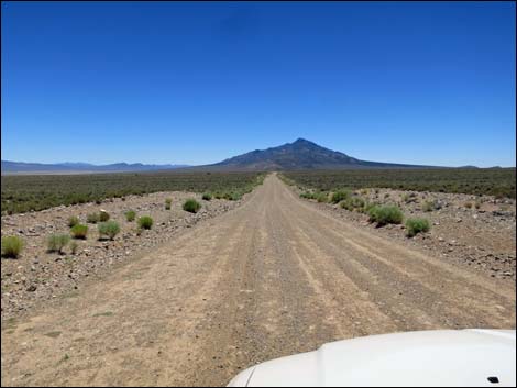
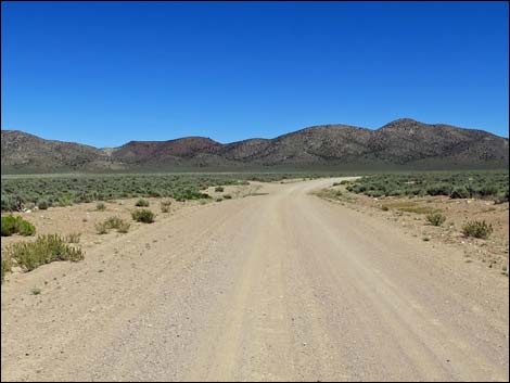
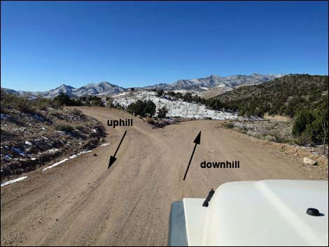
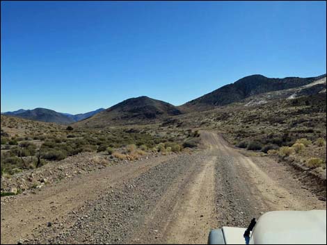
Now running south-southeast, Mail Summit Road begins to climb towards the Seaman Range. The road runs nearly straight, passing a Coal Valley sign (29.2 miles out) that makes for a nice photo opportunity. Continuing straight, a side road branches left (about 30.0 miles). Mail Summit Road begins to wind a bit and passes a side road right at 30.7 miles out. The trees thicken on the hillsides, and at 31.5 miles out, another side road branches left. At the top of the pass, the road makes a big horse-shoe bend to the right and forks (32.7 miles out). Here, both forks later rejoin, but drivers should stay to the right. The road becomes steep, narrow, and a bit bumpy, but hopefully everyone will stay right making this a one-way section of road. At 33.5 miles out, the uphill and downhill forks rejoin. The road remains narrow and bumpy for a bit farther, but eventually widens and smooths out. Descending out of the trees, through an old burn zone, and down into the desert, Mail Summit Road finally returns to Highway 318 (39.2 miles out) a few miles north of Hiko. |
Garden Valley Road
 Worthington Range in the distance (view SW) |
 Garden Valley Road stays right (view SW) |
 Crossing Garden Valley (view W towards Quinn Canyon Range) |
 Water for cows on the right (view W) |
 Approaching corral on the left |
 Approaching old corral on the right |
 Tour route stays left approaching Mail Summit Road (view W) |
 Garden Valley Road at Mail Summit Road (view W) |
Mail Summit Road
 Mail Summit Road (view S towards Worthington Range) |
 Mail Summit Road stays left (view S) |
 Approaching a cattle guard (view S) |
 Approaching another cattle guard (view S) |
 Approaching Garden Valley Crags (view S) |
 Climbing out of southern Garden Valley (view S) |
 Descending towards Murphy Gap (view E) |
 Approaching Murphy Gap (view E) |
 Passing a water well (view E) |
 First views out across southern Coal Valley (view E) |
 Mail Summit Road runs across southern Coal Valley (view E) |
 Cattle guard (view E) |
 Mail Summit Road bends right (view E) ... |
 ... then runs south |
 Mail Summit Road crossing Mail Summit Pass (view SE) |
 Mail Summit Road forks, downhill traffic stays right (view E) |
 Mail Summit Road dropping out of the mountains (view SE) |
 Mail Summit Road approaching Highway 318 (view E) |
Happy Hiking! All distances, elevations, and other facts are approximate.
![]() ; Last updated 20324
; Last updated 20324
| Basin and Range | Backroads | Hiking Around Las Vegas | Glossary | Copyright, Conditions, Disclaimer | Home |